🌍 Capture the world at 100% OFF! Use code ongeo100on 10 meters satellite image resolutions – limited time only! Higher resolution satellite images remain subject to payment.
🌍 Capture the world at 100% OFF! Use code ongeo100on 10 meters satellite image resolutions – limited time only! Higher resolution satellite images remain subject to payment.
Maxar's Satellite Images Reveal Devastation in Myanmar After Earthquake
2025-03-31
(Article updated:
2025-03-31
)
~ 4 min
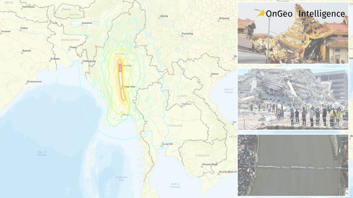
Following the devastating 7.7-magnitude earthquake in Myanmar on March 28, 2025, Maxar Technologies has released critical satellite imagery through its Open Data Program. This imagery, showing before-and-after views of the destruction, is now freely available for humanitarian and emergency response efforts.
High-Quality Satellite Imagery, Hassle-Free
Explore any location on Earth with precision. Order a detailed Satellite Imagery Report—no sign-ups, no contracts. Delivered in a clear PDF for instant insights.
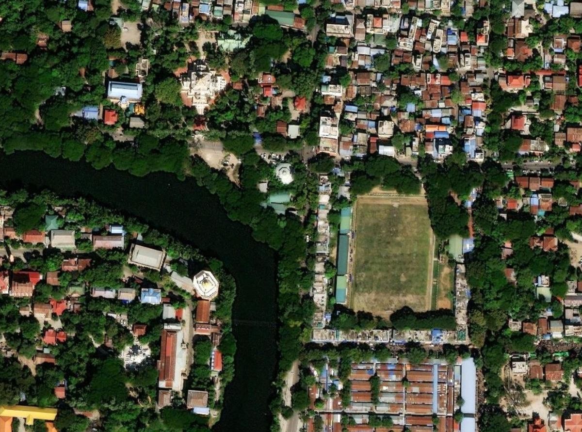
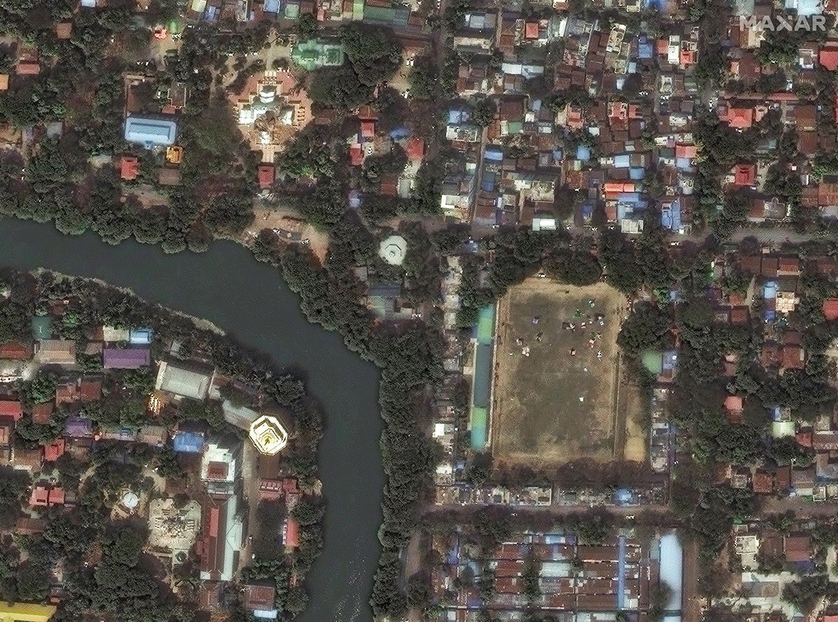
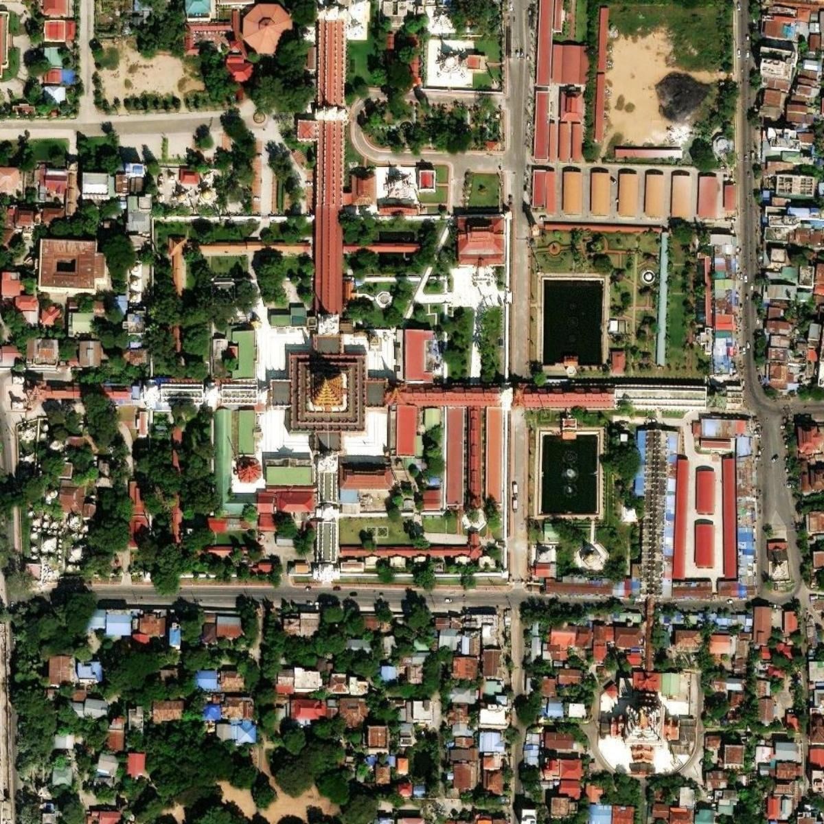
Maxar Technologies has published high-resolution satellite imagery of areas in Myanmar affected by the devastating 7.7-magnitude earthquake that struck on March 28, 2025. The imagery, accessible through Maxar's Open Data Program, provides critical before-and-after views of the destruction caused by the disaster. The images are available to the public for humanitarian and emergency response purposes via the program's platform at Maxar Open Data.
Before-and-After Satellite Images Crucial for Myanmar Relief Efforts
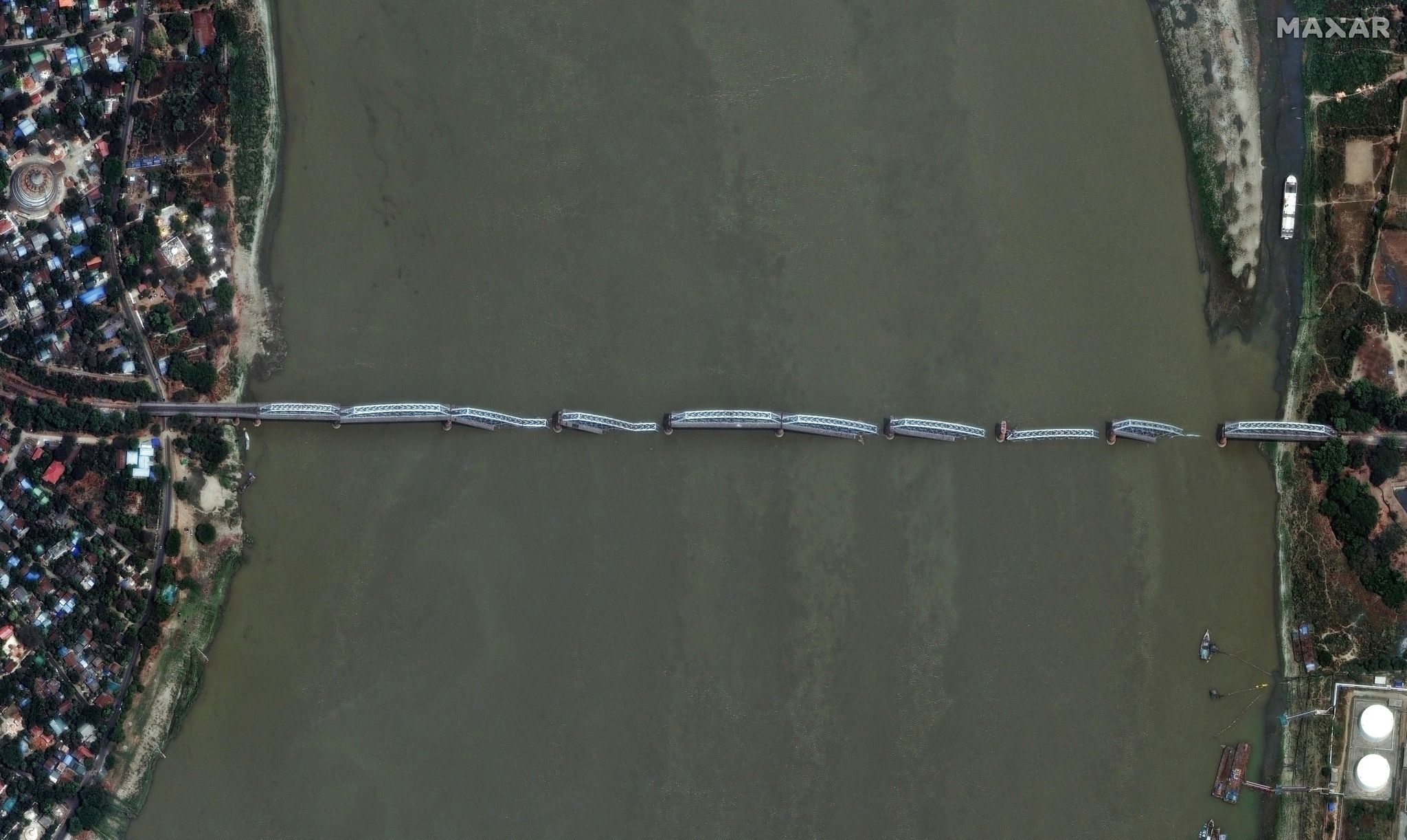
The earthquake, centered near Mandalay, Myanmar's second-largest city, resulted in widespread destruction, with over 1,600 fatalities and more than 3,400 injuries reported so far. The disaster caused significant damage to infrastructure, including collapsed bridges, destroyed homes, and ruined religious sites. Tremors were felt as far as Bangkok, Thailand, where a high-rise building under construction collapsed, adding to the casualties.
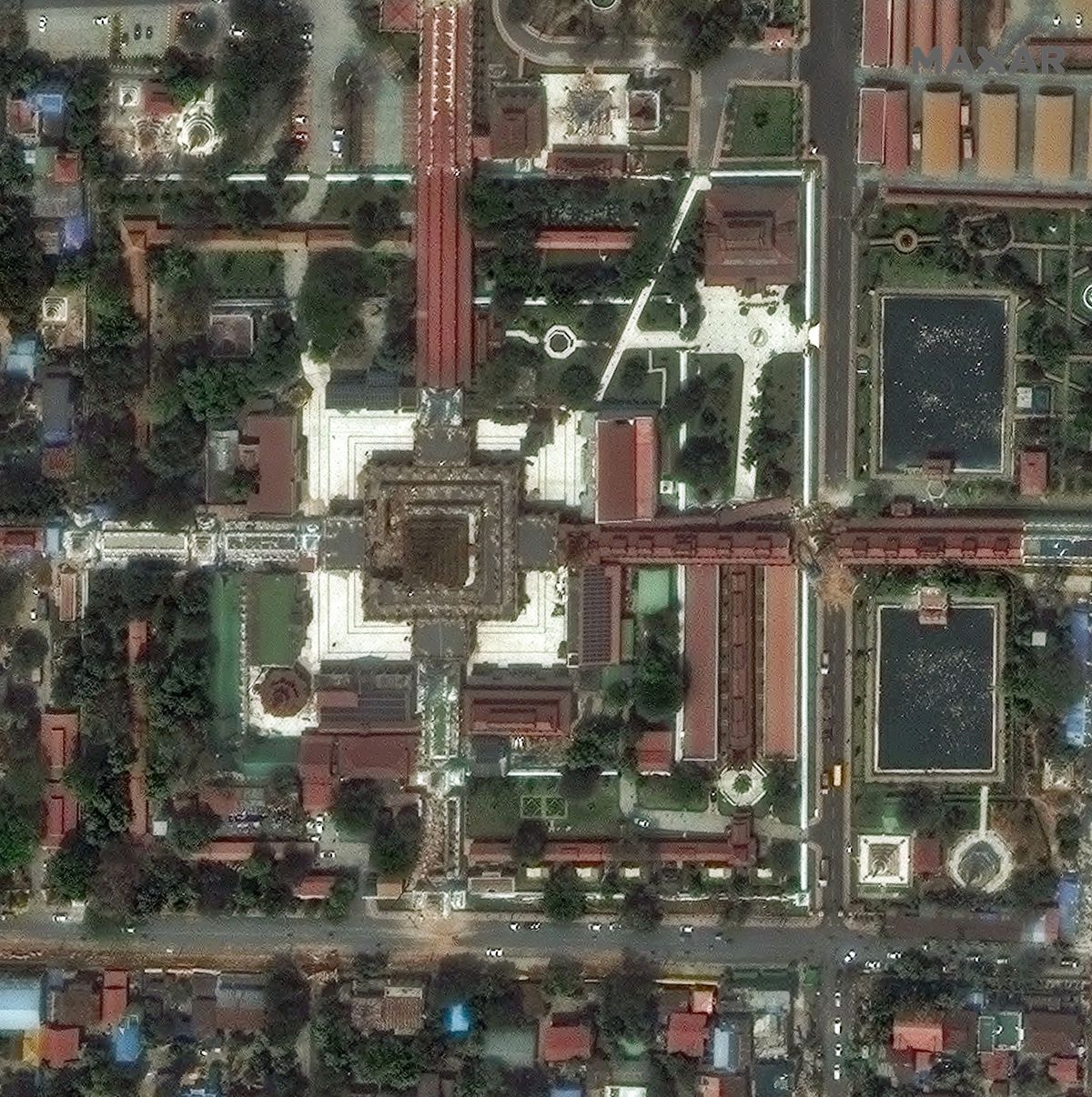
Myanmar earthquak: Damaged pagodas and relief area in Mandalay, Myanmar, 29 March 2025
Maxar Images
Myanmar earthquak: Damaged Mahamuni pagoda in Mandalay, Myanmar, 29 March 2025
Maxar Images
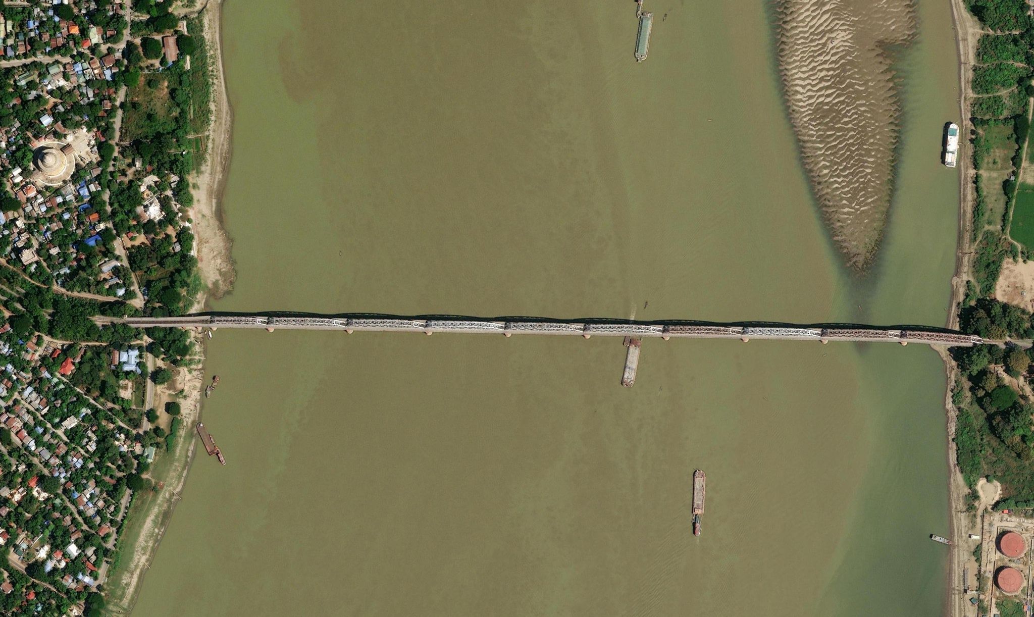
Myanmar earthquak: Collapsed Inwa bridge in Mandalay, Myanmar, 29 March 2025
Maxar Images
Maxar's Open Data Program aims to support humanitarian efforts by providing freely accessible satellite imagery during major crises. This initiative enables organizations on the ground to assess damage, coordinate rescue operations, and plan recovery efforts effectively. The program has been instrumental in past disasters and continues to play a vital role in global emergency response.
Myanmar Needs You: How to Help After the Earthquake
The earthquake in Myanmar has created a dire situation, but with the rapid dissemination of critical information like the satellite imagery provided by Maxar's Open Data Program, aid organizations can better understand the scope of the devastation and deploy resources effectively. To support the relief efforts, we encourage you to share this information widely and consider donating to reputable humanitarian organizations working on the ground. Access to accurate data is crucial during crises, and the Maxar Open Data Program is a powerful example of how technology can be leveraged to assist those in need.
We use cookies to run our website, analyze your use of our services, manage your online preferences & personalize ad content. By accepting our cookies, you'll get relevant content and social media features, personalized ads, and an enhanced browsing experience. To manage your choices, click "Cookie Settings." Necessary cookies are required for the core website functionality and cannot be rejected. For more information, see our Cookie Policy.
About cookies on this site
Cookies used on the site are categorized. Below you can allow or deny some or all of them, except for Necessary Cookies which are required to provide core website functionality. When categories that have been previously allowed are disabled, all cookies assigned to that category will be removed from your browser.
Some cookies are required to provide core functionality. The website won't function properly without these cookies and they are enabled by default and cannot be disabled.
Preference cookies enables the web site to remember information to customize how the web site looks or behaves for each user. This may include storing selected currency, region, language or color theme.
Analytical cookies help us improve our website by collecting and reporting information on its usage.
Marketing cookies are used to track visitors across websites to allow publishers to display relevant and engaging advertisements. By enabling marketing cookies, you grant permission for personalized advertising across various platforms.
The cookies in this category have not yet been categorized and the purpose may be unknown at this time.