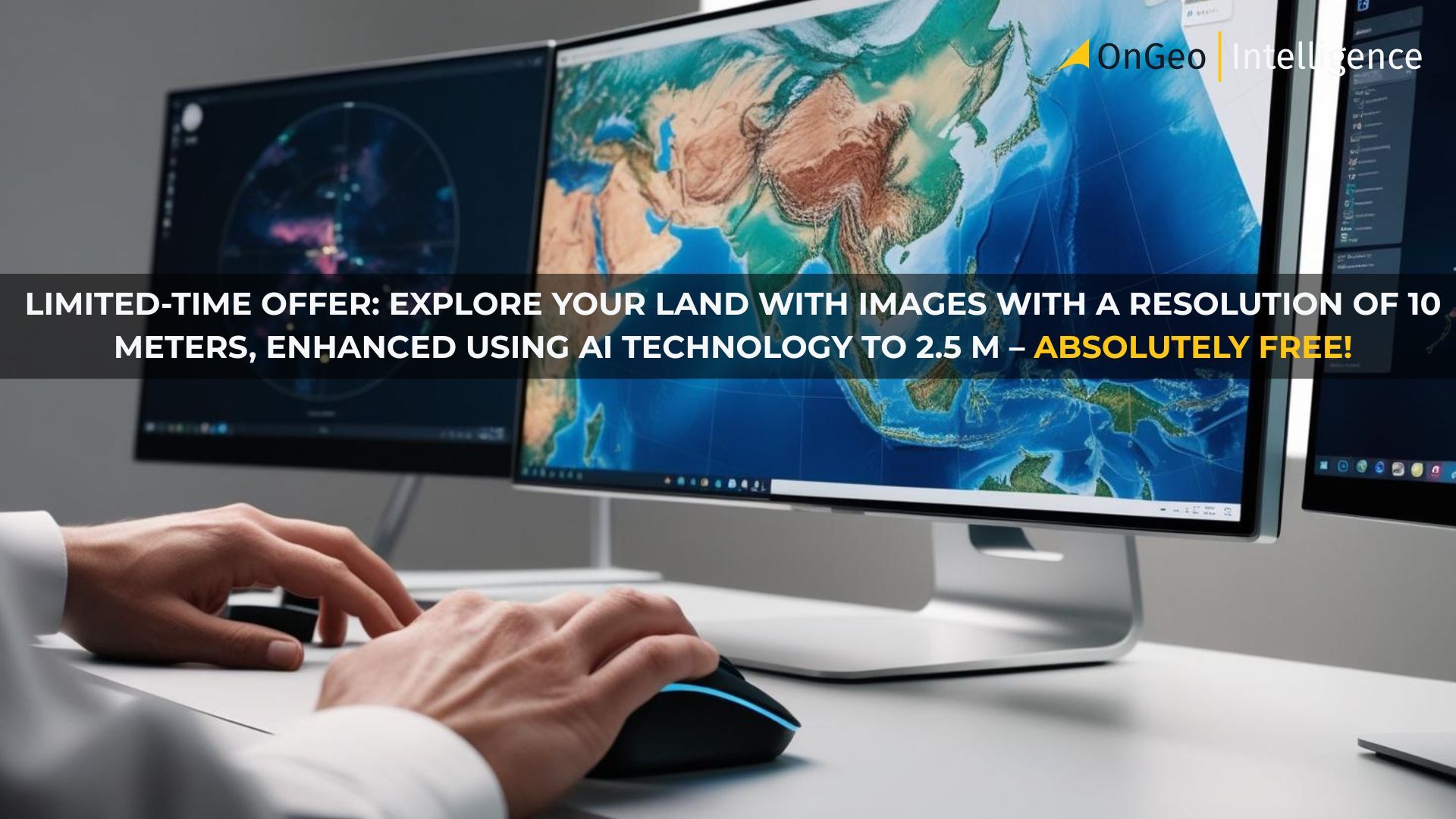
🌍 Capture the world at 100% OFF! Use code ongeo100on 10 meters satellite image resolutions – limited time only! Higher resolution satellite images remain subject to payment.
🌍 Capture the world at 100% OFF! Use code ongeo100on 10 meters satellite image resolutions – limited time only! Higher resolution satellite images remain subject to payment.
Unlock the Power of Satellite Data – Get Your Free Satellite Imagery Report from OnGeo Intelligence Today
2025-04-23
(Article updated:
2025-04-23
)
~ 5 min
In today’s fast-paced digital world, satellite technology is transforming how individuals and organizations access and use spatial information. With OnGeo Intelligence, this cutting-edge technology is now accessible to everyone—whether you're a tech enthusiast curious about satellite data or someone looking to explore its practical applications via a detailed Satellite Imagery Report.
Thanks to the promotional code ongeo100, you can generate a free Satellite Imagery Report featuring 10-meter resolution images (enhanced to 2.5 meters) and experience the possibilities of satellite data firsthand.
High-Quality Satellite Imagery, Hassle-Free
Explore any location on Earth with precision. Order a detailed Satellite Imagery Report—no sign-ups, no contracts. Delivered in a clear PDF for instant insights.
Unlocking the power of satellite data for everyone
In the era of digital transformation, satellite imagery has become an essential tool for addressing complex legal, environmental, and property challenges. OnGeo Intelligence makes accessing this data simple through our Satellite Imagery Report.
This service highlights how groundbreaking satellite technology has shifted from an exclusive industry asset to a widely accessible resource. With just a few clicks, everyday users can now examine their surroundings, monitor property changes, and verify environmental conditions with historical imagery contained within their Satellite Imagery Report.
Whether it’s simple curiosity - like comparing a town's landscape using historical satellite images - or a critical analysis for a legal case, our Satellite Imagery Report service is built to serve your needs.
What is the Satellite Imagery Report by OnGeo Intelligence?
The Satellite Imagery Report is an innovative service designed to democratize access to high-quality satellite data. It simplifies the process of obtaining actionable geospatial insights from satellite imagery, making it ideal for tech enthusiasts, property owners, researchers, and anyone interested in exploring Earth from above through an easy-to-understand report format.
How the Satellite Imagery Report service works?
The Satellite Imagery Report from OnGeo Intelligence is designed with simplicity and accessibility in mind:
Simple access: Order your Satellite Imagery Report via an intuitive online form—no account registration or subscriptions required.
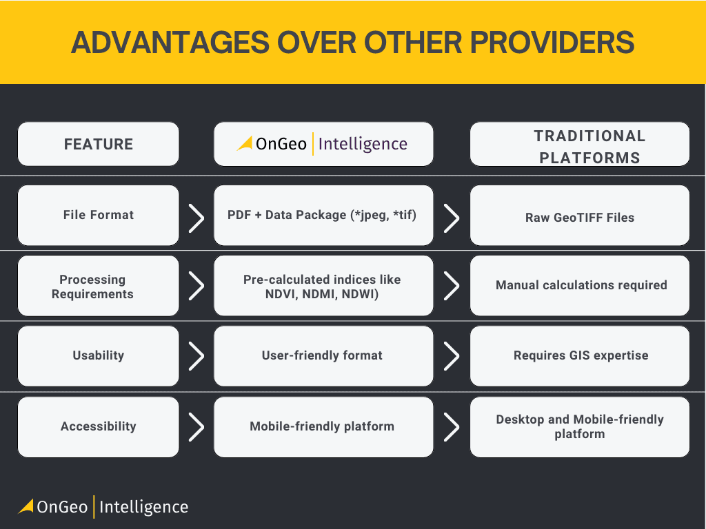
High-quality images: Free reports feature 10-meter resolution images enhanced using AI technology within the Satellite Imagery Report, while high-resolution images (up to 0.3 meters) are available as paid options.
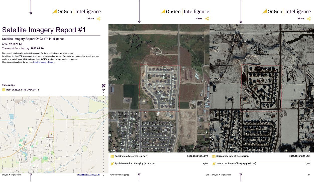
Clear reports: Receive easy-to-read PDF Satellite Imagery Reports with chronological scenes for effortless analysis.
Source data package: Each Satellite Imagery Report includes visible bands as well as near-infrared (NIR) and short-wave infrared (SWIR) channels for advanced GIS analysis.
Mobile-friendly: Order and view your Satellite Imagery Report directly from your smartphone.
Global coverage: Generate a Satellite Imagery Report for any location on Earth.
Satellite imagery isn’t just a fascinating technology - it’s also a powerful tool for solving real - world challenges. Consider this user story.
A shared home and satellite evidence in a divorce dispute
Anna and Thomas, a couple with many years of shared history, found themselves in court facing a divorce. The major point of disagreement was the ownership of the house they had constructed together. Thomas had received the land as a pre-marital gift from his parents and insisted the house was solely his since it was built on his property. Anna, however, argued that the house was constructed during their marriage, with both contributing financially and physically, and she deserved a rightful share.
The case was complex. Concrete proof was needed to establish when the house was actually built - recollections and receipts weren’t enough. That’s when Anna’s lawyer had an idea: to use the OnGeo Intelligence Satellite Imagery Report.
“We requested a report for that specific property,” Anna recalls. “What did we discover? Historical satellite images clearly revealed that at the time of our wedding, the plot only had a small, incomplete outbuilding. The main house wasn’t constructed until after we were already married.”
Anna
The satellite photos made all the difference! Once the court saw this evidence, it ruled that the house was part of our joint marital assets. I received my fair share. It was a challenging experience, but the report from OnGeo Intelligence helped me reclaim what I had invested so much into.
Explore, Compare, and Discover
Whether you’re a tech geek eager to experiment with the latest technology or simply curious about your neighborhood’s historical landscape, the Satellite Imagery Report is your go-to tool. In just a few simple steps, you can compare images from days, months, or even years apart—unlocking new perspectives on familiar places.
How to Generate Your Free Satellite Imagery Report
Go to theorder form and select your area of interest using an interactive map.
Specify your desired time range.
Apply code ongeo100 during checkout to unlock free access.
Receive your report via email within minutes!
Try it for free today!
Ready to experience the power of satellite data for yourself? We’re inviting you to test the waters with a free Satellite Imagery Report featuring 10-meter resolution imagery. Simply use the discount code ongeo100 at checkout. Please note that while this introductory offer lets you explore satellite data at no cost, high-resolution images (up to 0.3 m) remain part of our premium offering.
We value your feedback
After you’ve explored our service, we’d love to hear about your experience and any suggestions you may have. Drop us a line at contact@ongeo-intelligence.com to share your thoughts and help us further improve our offering.
OnGeo Intelligence is committed to making satellite data accessible, affordable, and incredibly powerful for everyone. Join the movement—experience the simplicity of satellite data reporting and unlock a new way to see the world around you.
We use cookies to run our website, analyze your use of our services, manage your online preferences & personalize ad content. By accepting our cookies, you'll get relevant content and social media features, personalized ads, and an enhanced browsing experience. To manage your choices, click "Cookie Settings." Necessary cookies are required for the core website functionality and cannot be rejected. For more information, see our Cookie Policy.
About cookies on this site
Cookies used on the site are categorized. Below you can allow or deny some or all of them, except for Necessary Cookies which are required to provide core website functionality. When categories that have been previously allowed are disabled, all cookies assigned to that category will be removed from your browser.
Some cookies are required to provide core functionality. The website won't function properly without these cookies and they are enabled by default and cannot be disabled.
Preference cookies enables the web site to remember information to customize how the web site looks or behaves for each user. This may include storing selected currency, region, language or color theme.
Analytical cookies help us improve our website by collecting and reporting information on its usage.
Marketing cookies are used to track visitors across websites to allow publishers to display relevant and engaging advertisements. By enabling marketing cookies, you grant permission for personalized advertising across various platforms.
The cookies in this category have not yet been categorized and the purpose may be unknown at this time.