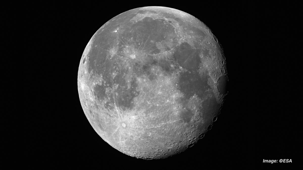
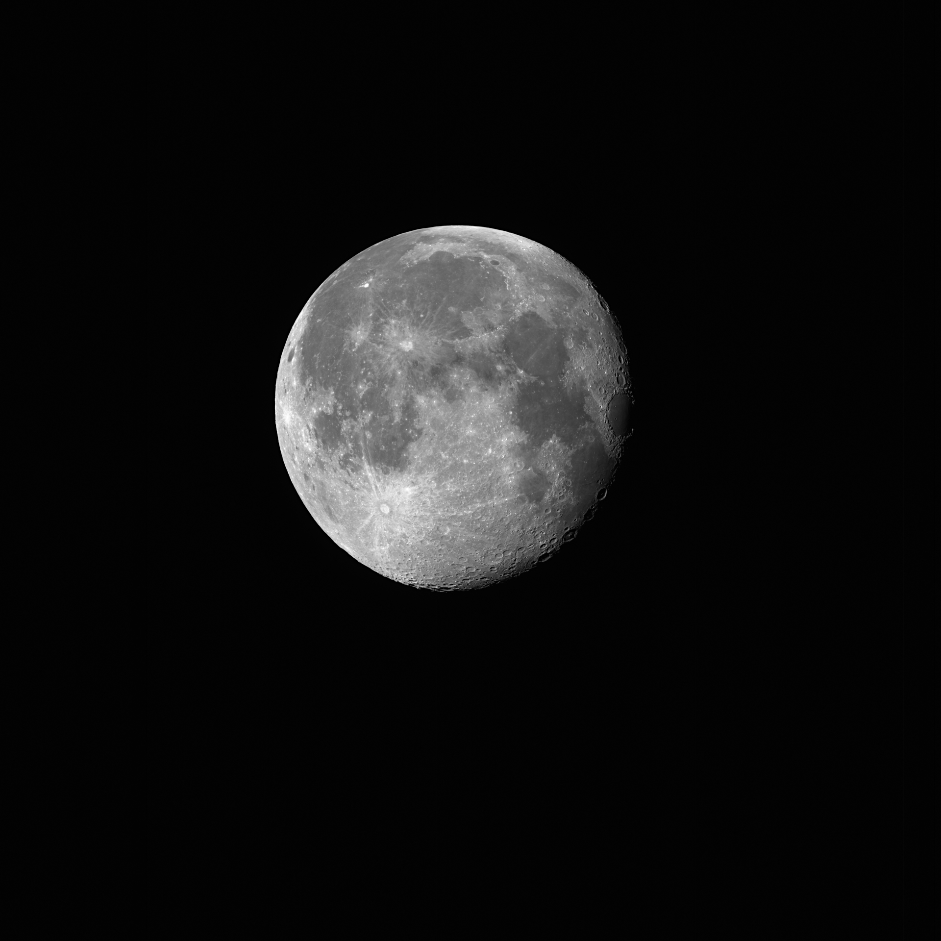
On September 20th, 2024, the Copernicus Sentinel-2C satellite captured an extraordinary image of the Moon as part of its calibration process. Although Sentinel-2C primarily focuses on Earth observation, this rare lunar snapshot highlights the satellite’s impressive imaging capabilities. Initially distorted, the image underwent correction, revealing the Moon's distinctive features in stunning detail.
High-Quality Satellite Imagery, Hassle-Free
Explore any location on Earth with precision. Order a detailed Satellite Imagery Report—no sign-ups, no contracts. Delivered in a clear PDF for instant insights.
Sentinel-2C mission overview
Launched on September 5th, 2024, Sentinel-2C is part of the European Union's Copernicus Programme - an extensive network of Earth-observing satellites designed to monitor the environment, land use, and coastal waters. However, once a month, Sentinel-2C shifts its focus from Earth to the Moon for a "Moon calibration" procedure. This routine calibration is critical for ensuring the radiometric accuracy of the satellite's instruments. The Moon’s stable and predictable light serves as an excellent reference target, helping the satellite detect and correct any slight performance variations, such as sensor shifts due to aging components or optical changes.
How the image was captured
To acquire the lunar image on September 20th, 2024, the satellite performed a sideways roll, bringing the Moon into view. Initially, the photograph appeared distorted, showing an elongated shape caused by the relative motion between the Moon and Sentinel-2C. After applying a correction process, the distortion was resolved, revealing a high-resolution image with a clarity of approximately 5 km. The corrected photo distinctly shows prominent lunar features, including the Copernicus and Tycho craters, along with several lunar seas: the Sea of Tranquillity, Sea of Moisture, and Sea of Clouds.
Download high resolution image of the Moon JPEG
Download high resolution image of the Moon TIF
Images source: ESA
Importance of moon calibration
Orbiting Earth at an altitude of 786 km, Sentinel-2C primarily uses its advanced multispectral imager to capture high-resolution images of landscapes, forests, agriculture, and coastal waters. However, these monthly Moon calibration images play a crucial role in ensuring the long-term reliability of the satellite's data. By using the Moon’s stable light as a reference, even the smallest changes in sensor performance can be detected and corrected, safeguarding the accuracy of Earth observation data.
Enhancing the copernicus mission
As the latest addition to the Copernicus fleet, Sentinel-2C continues to strengthen the mission’s ability to provide valuable data for scientific research, environmental policy-making, and resource management. This successful calibration not only showcases the satellite’s advanced capabilities but also ensures the ongoing quality of the critical data that supports a wide range of Earth observation applications.
