The role of satellite imagery in conflict zones
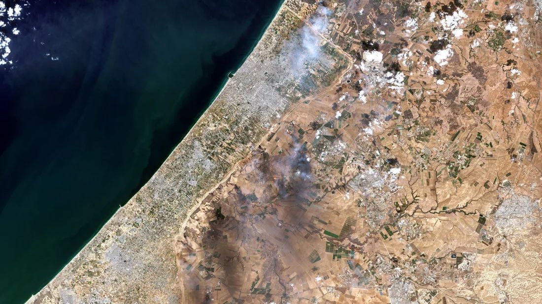
Satellite imagery has proven crucial in assessing the scope of destruction in Gaza. Through the use of high-resolution Earth Observation technology, experts have been able to track and analyze damage across large areas, providing an accurate and unbiased perspective. Organizations such as the United Nations, human rights groups, and companies like Maxar Technologies and Planet Labs have used satellite data to document the destruction of homes, businesses, schools, and essential utilities like electricity and water systems.
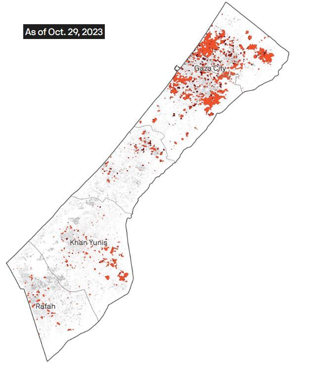
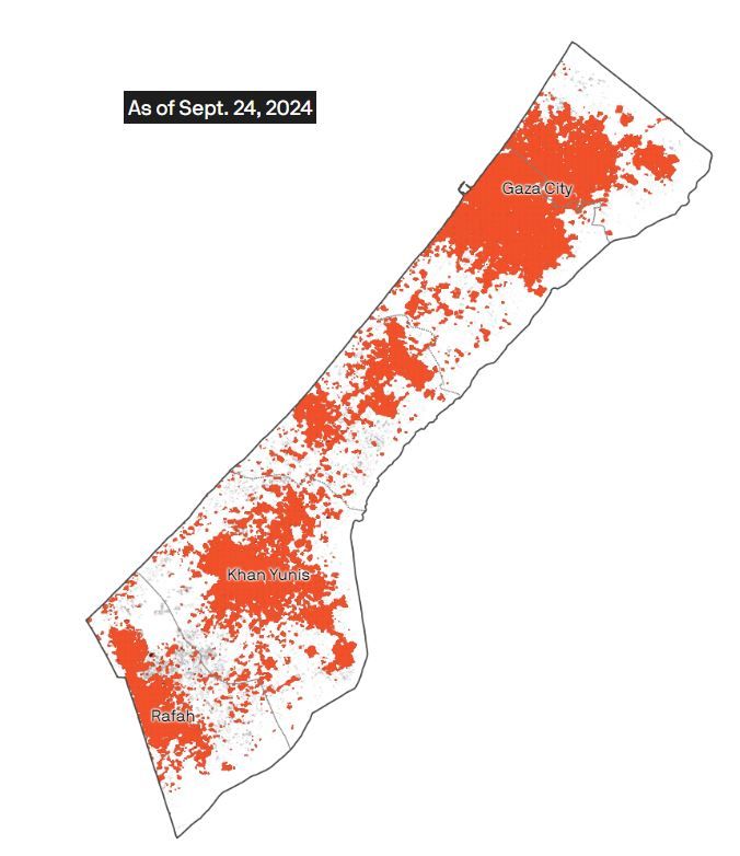
Key findings: 60% of Gaza’s infrastructure damaged
The data collected indicates that nearly 60% of buildings in Gaza have been partially or entirely destroyed, including vital public infrastructure. Hospitals, schools, and power plants have suffered significant damage, compounding the crisis for an already vulnerable population. With access to basic necessities like electricity, clean water, and healthcare severely compromised, the long-term recovery of Gaza’s infrastructure poses immense challenges.
Buildings damaged or destroyed in Gaza
Data source: Damage analysis of Copernicus Sentinel-1 satellite data by Corey Scher of CUNY Graduate Center and Jamon Van Den Hoek of Oregon State University; Map: Erin Davis/Axios Visuals
https://www.axios.com/2024/10/05/gaza-destruction-map-israel-hamas
Satellite imagery supports the Guardian's map of Gaza destruction
The Guardian has created a detailed map of the destruction in Gaza based on available satellite imagery. This map highlights the damage to critical infrastructure in three districts: Beit Hanoun, al-Zahra, and Khan Younis. On the map, destroyed buildings are marked in red, including schools, mosques, hospitals, and residential homes, illustrating the widespread devastation. Story Maps complement this visual evidence, using satellite images and videos to provide further proof of the attacks.
The humanitarian and diplomatic implications
The use of satellite data is not only important for informing humanitarian aid efforts but also plays a key role in international discussions regarding reconstruction and peace negotiations. These satellite reports offer clear, reliable data to support diplomatic efforts in addressing the ongoing crisis.
Conclusion
Satellite imagery of Gaza has been instrumental in highlighting the true scale of destruction. This technology continues to provide essential insights for rebuilding and restoring affected areas, while also offering a transparent view into the ongoing challenges faced by the region.