Get Your Satellite Imagery Report with OnGeo
The Satellite Imagery Report by OnGeo™ Intelligence brings the power of high-resolution satellite data to everyone, transforming the way we see and understand the world.
Designed for a diverse range of users-from individuals exploring personal interests to professionals across countless industries-this service delivers clear, reliable, and up-to-date imagery straight to you.
No matter your field or focus, the report offers a flexible tool to uncover insights, solve problems, and make smarter decisions. Whether you're tracking changes over time, planning ahead, or simply curious about what’s happening beyond your doorstep, OnGeo™ Intelligence makes satellite technology accessible and practical for all.
Forget the days when such data was exclusive to big organizations-today, it’s in your hands, ready to empower your ideas and actions, whatever they may be.
What is the Satellite Imagery Report OnGeo™ Intelligence?
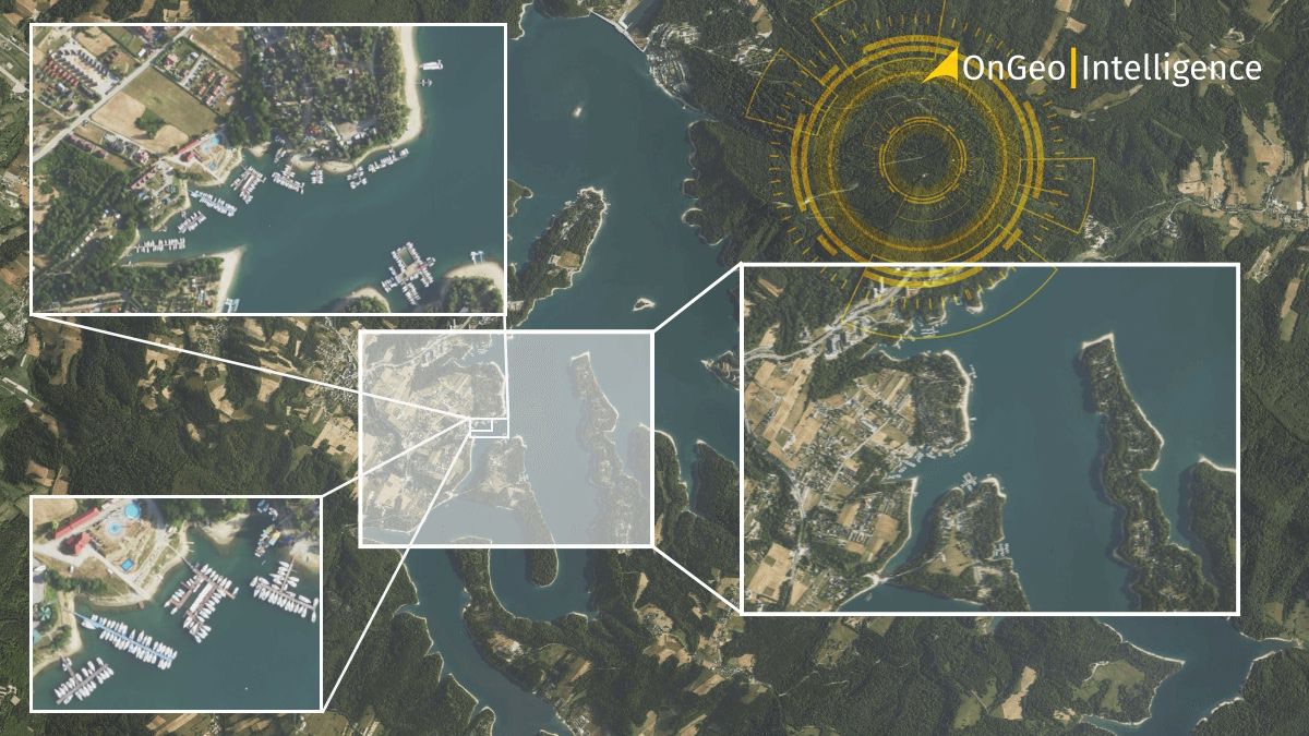
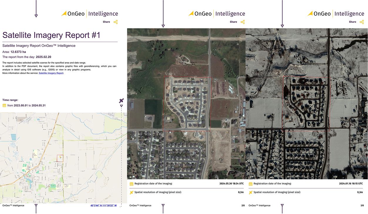
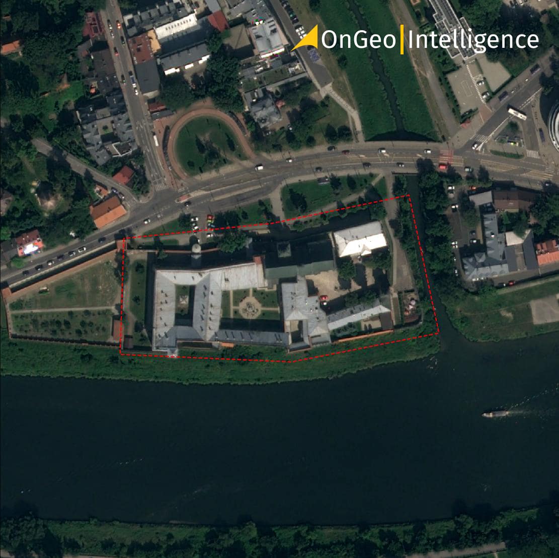
The report features a curated selection of high-resolution satellite images that comprehensively depict your property or chosen area. This systematic organization allows you to easily track changes over time and gain valuable insights into events that occurred during the report period.
Download Sample Satellite Imagery Report OnGeo Intelligence
Accessing high-resolution satellite imagery
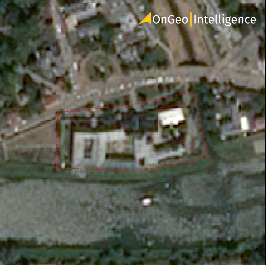
- The report features satellite imagery in natural colors (RGB) derived from high-resolution images captured regularly by Earth-orbiting satellites.
- We offer a variety of pixel sizes to suit your needs, ranging from 10 meters to sub-meter resolution (from 0,3 meter).
- Additionally, our advanced AI technology can enhance 10-meter resolution images to a sharper 2.5-meter resolution, allowing you to see finer details and identify specific objects, phenomena, or changes within the imagery.
Enhancing data analysis with advanced features
The OnGeo™ Intelligence Report goes beyond just high-resolution imagery. Your report also includes:
- Sentinel-2 data package: This comprehensive Sentinel-2 data package delivers not only visible band channels but also near-infrared (NIR) and short-wave infrared (SWIR) channels for each image. These additional bands unlock advanced analysis possibilities in GIS software, allowing you to perform detailed spatial analyses.
- Remote sensing index: A dedicated PDF report provides insightful graphs. These graphs illustrate the variability of the average value of key remote sensing index (NDVI, NDWI, NDMI) within the selected area over the specified time period. This allows you to monitor changes in vegetation health, water content, and soil moisture.
With the exclusive code: ongeo100
you can generate professional free satellite imagery reports
Find out more about the promotion: Generate Satellite Imagery Reports for Free – Limited Time Offer!
Frequency and global coverage
- Satellite image capture: While satellites capture imagery approximately every 5 days, the report prioritizes cloud-free images. This results in a real-time interval between images typically ranging from 7 to 30 days.
- Global availability: Access valuable insights from anywhere on Earth. Our service provides data for any location with the oldest available imagery dating back to 2008.
Ordering your satellite imagery report: a simple process
Ordering and receiving your OnGeo™ Intelligence report takes just a few minutes for low-resolution scenes and up to a maximum of 48 hours for high-resolution data. The ordering process is straightforward and easy to understand for everyone. Your requested data will be delivered in a PDF document to your specified email address. The report will include all the satellite images you ordered, organized from newest to oldest for quick and efficient review.
Enjoy exceptional convenience and accessibility with the OnGeo™ Intelligence Satellite Imagery Report service – no account registration, contracts, or subscription fees required.
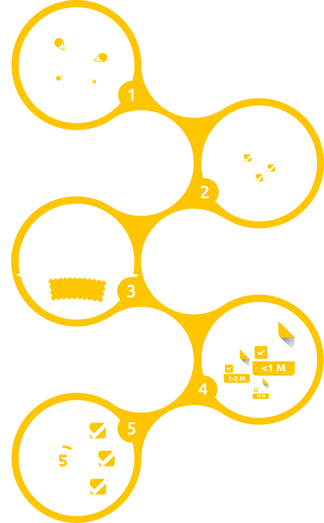
Creating a Report with satellite images on OnGeo™ Intelligence is straightforward and involves just a few steps.
Improved practical applications of the OnGeo™ Intelligence Report
- Remote property evaluation:
The OnGeo™ Intelligence Report empowers investors and property owners to remotely assess a plot's development status. Precisely dated satellite images provide a detailed history of the property, enabling informed investment decisions without the need for constant site visits. - Strengthening evidence documentation:
OnGeo™ Intelligence Satellite Imagery Reports can be a critical element in legal or administrative evidence documentation. Satellite images offer invaluable proof in land-use cases, boundary disputes, property violations, and even insurance claims. - Monitoring land use changes:
The OnGeo™ Intelligence Report provides a powerful tool for monitoring landscape changes, crucial for spatial planning and agriculture. Regular satellite imagery allows users to track shifts in agricultural land use and assess environmental impacts. In construction projects, the report serves as a valuable tool for documenting progress and can be used as evidence during administrative procedures. - Identifying environmental threats:
Satellite images enable rapid assessment of environmental threats like droughts or floods, vital for crisis management and preventative planning. The OnGeo™ Intelligence Report delivers data to identify areas susceptible to erosion and monitor groundwater and surface water levels, essential for effective water resource management.
Client Story: How Satellite Imagery Helped Resolve a Property Dispute in Divorce
During a challenging divorce, Anna and Tomas found themselves locked in a dispute over their family home. The house sat on land Tomas had inherited from his parents before the marriage, and he claimed full ownership, arguing that the property was his alone due to the land’s origin. Anna, however, maintained that the house itself was built after they tied the knot, with both of them pooling their money and efforts into its construction, making it a shared asset.
The court faced a tough decision. Determining the exact timeline of the house’s construction required solid proof-memories and paperwork alone wouldn’t suffice. That’s when Anna's legal team turned to an innovative solution: the OnGeo Intelligence Satellite Imagery Report.
“We requested a detailed report for the property,” Anna recounted. “The archival satellite images were eye-opening. They showed that at the time of our wedding, the land held only a small, unfinished structure. The home we lived in was clearly built later, during our marriage.”
Those images proved to be a game-changer. Presented with this clear evidence, the court ruled that the house qualified as marital property. Anna received her fair share. “It was a stressful ordeal, but the OnGeo Intelligence report made all the difference-I got what I rightfully deserved,” she said, relieved. In this case, cutting-edge technology paved the way for a just resolution.
Unlock the power of satellite insights with OnGeo™ Intelligence
OnGeo™ Intelligence Satellite Imagery Reports showcase how cutting-edge satellite technology empowers diverse industries, from agriculture and urban planning to everyday citizens.
This powerful tool delivers precise data about specific locations, unlocking new possibilities for monitoring, planning, and managing land use. Our commitment to constantly improving satellite data acquisition, analysis, and interpretation ensures we meet the ever-evolving needs of our users.

Unprecedented speed and insights:
OnGeo™ Intelligence users gain access to detailed land documentation within minutes of placing an order. High-resolution images and spectral data provide an unparalleled level of convenience and efficiency. Track any land area's history in detail, from landscape evolution to land-use changes.
Empowering the Future of Remote Sensing:
These advantages highlight the importance of continuous research and development in remote sensing. By pushing boundaries, we unlock even greater potential applications for satellite imagery, delivering invaluable insights to a broad spectrum of users.