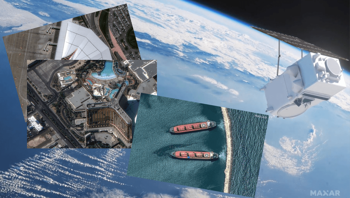
A new era of satellite imaging
Currently, four of the six planned WorldView Legion satellites are operational. The first pair, launched in May 2024, entered sun-synchronous orbits alongside Maxar’s existing satellites. These orbits ensure consistent daily imaging by circling Earth’s poles, a configuration ideal for capturing regular, detailed observations at fixed times each day.
The second pair, launched in August 2024, introduced a cutting-edge mid-inclination orbital strategy. These satellites focus on regions between 45° north and 45° south latitude, home to the majority of the global population. Their unique orbital design facilitates "dawn-to-dusk" imaging, providing continuous coverage of dynamic events and multiple revisits to key areas within a single day.
The final two satellites, WorldView Legion 5 and 6, are scheduled for launch in early 2025. Once fully deployed, the constellation will enable up to 15 revisits per day to specific locations, delivering unparalleled monitoring and analysis capabilities.
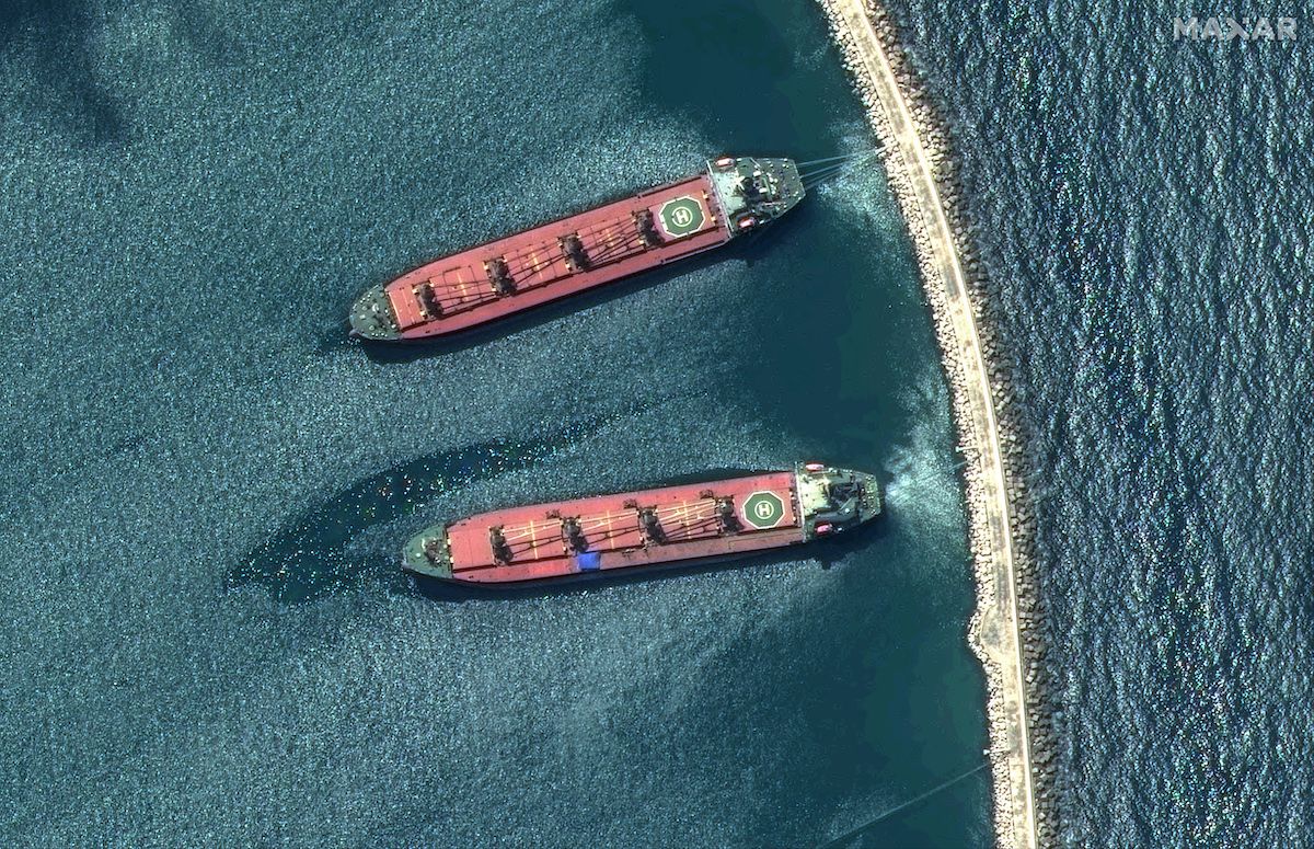
This WorldView Legion image of bulk carriers in Syria shows remarkable detail: the cranes for loading cargo, the navigational bridge on the stern, and the mooring lines attached to the jetty.
Source: maxar.com
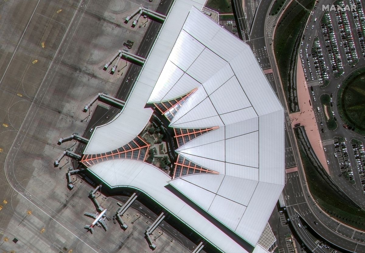
This WorldView Legion image of the Lhasa Gonggar Airport demonstrates the value of 30 cm-class imagery. In the parking lot and surrounding areas, individual cars and pedestrian access points can clearly be identified along with other fine details. The interior shows the trees, bridges and resting areas for passengers.
Source: maxar.com
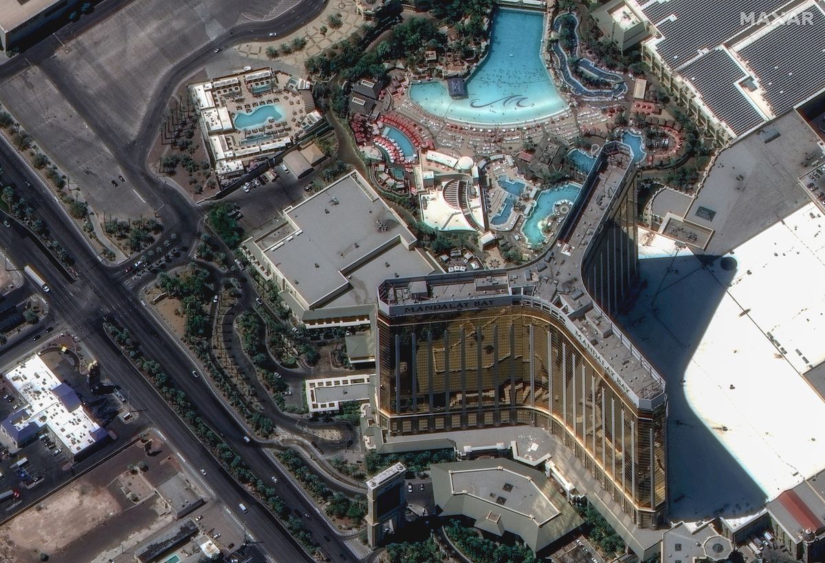
This WorldView Legion image shows the Mandalay Bay hotel in Las Vegas, Nevada where details such as people, pool chairs and umbrellas are clearly visible.
Source: maxar.com
Unmatched imaging precision
The WorldView Legion constellation redefines imaging clarity with its 30 cm-class resolution, the highest commercially available today. Maxar’s proprietary technology enhances this further to 15 cm HD, allowing detailed visualization of ground features such as lane markings, aircraft, and urban infrastructure.
This exceptional imaging capability supports a diverse range of applications, including:
- Defense and intelligence: High-frequency revisits enable real-time monitoring for time-sensitive decision-making.
- Disaster response: Rapid imaging of affected areas provides accurate data for rescue and recovery efforts.
- Urban planning: Detailed imagery aids in designing and optimizing infrastructure.
- Environmental monitoring: High-resolution images support studies of ecosystems and climate change impacts.
By tripling its 30 cm-class imaging capacity, Maxar meets the increasing demand from governments, businesses, and international organizations for precise, reliable satellite imagery.
Unlock the power of high-resolution satellite imagery with OnGeo-Intelligence. Our Satellite Imagery Reports provide precise, up-to-date insights for any location on Earth, delivered in an easy-to-use PDF format. Whether you're managing projects, monitoring assets, or analyzing critical events, OnGeo's reliable, high-quality data empowers you to make smarter, faster decisions without the hassle of subscriptions or contracts.
Read More Here: Satellite Imagery Report
Revolutionizing Industries with High-Frequency Imaging
The WorldView Legion satellites cater to both specialized and consumer needs:
- Mapping and navigation: Frequent updates ensure accurate, up-to-date tools for navigation and geospatial analysis.
- Oil and gas: Remote monitoring of pipelines and offshore facilities reduces operational costs and site visits.
- Population studies: Mid-inclination satellites provide new insights into human activity patterns in densely populated areas.
Additionally, during large-scale disasters, the constellation offers rapid, multi-angle perspectives, enabling fast, data-driven responses.
Empowering Insights Through AI and Analytics
Maxar is leveraging its vast archive of over 125 petabytes of Earth observation data with cutting-edge analytics and artificial intelligence. By integrating advanced tools with real-time imaging, Maxar empowers users to extract actionable insights quickly and precisely. This capability enhances decision-making across sectors, from environmental monitoring to national security.
Shaping the Future of Earth Observation
As the final launch of WorldView Legion approaches, Maxar is poised to redefine satellite imaging. With its revolutionary constellation nearing completion, the company is well-positioned to meet the evolving demands of its customers and provide innovative solutions for managing a rapidly changing world.
The WorldView Legion constellation is more than a technological marvel—it is a leap forward in our ability to understand and shape the world around us.


