🌍 Capture the world at 100% OFF! Use code ongeo100on 10 meters satellite image resolutions – limited time only! Higher resolution satellite images remain subject to payment.
🌍 Capture the world at 100% OFF! Use code ongeo100on 10 meters satellite image resolutions – limited time only! Higher resolution satellite images remain subject to payment.
Download the Satellite Map of New York City – Free Printable PDF
2025-05-09
(Article updated:
2025-05-09
)
~ 4 min
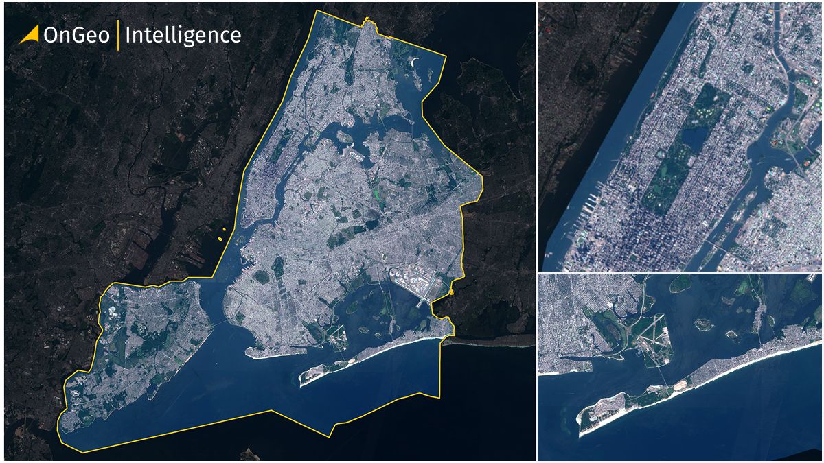
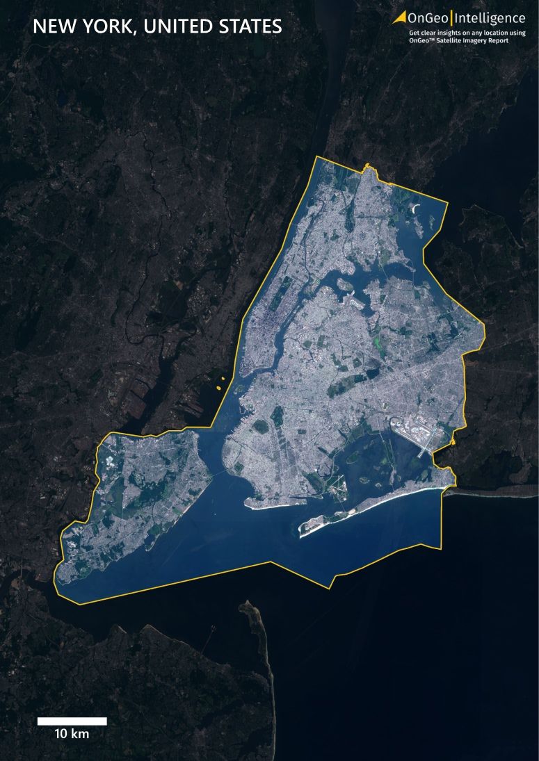
New York City is one of the most mapped and photographed places on Earth – but have you ever seen it like this? With satellite imagery from space, you can explore the city’s full structure, from dense urban zones to lush green parks and surrounding waterways. In this article, we invite you to download a print-ready satellite map of New York City, generated using high-resolution 2024 Sentinel-2 data.
High-Quality Satellite Imagery, Hassle-Free
Explore any location on Earth with precision. Order a detailed Satellite Imagery Report—no sign-ups, no contracts. Delivered in a clear PDF for instant insights.
This map was developed by the geospatial team at OnGeo Intelligence, composed of specialists in geoinformatics, remote sensing, and urban planning. We use official satellite imagery from the Sentinel-2 mission operated by the European Space Agency (ESA), processed using advanced cartographic methods.
Satellite maps like these are vital for environmental planning, infrastructure development, emergency response, and education. OnGeo Intelligence transforms raw data into clear, visual insight for everyone — no GIS skills needed.
How to Use the Satellite Map of New York City
Our goal is to make satellite data accessible to all — that’s why this satellite map of New York is free to download and reuse. You can use it for:
📖Educational presentations or materials
🌳Environmental studies and land analysis
🏤Urban development planning
🧳Tourism and promotional visuals
🗺️Personal research or private mapping
📰 Public media or creative projects
You may modify, annotate, or publish the map, provided that:
☝️You do not remove the OnGeo Intelligence watermark or logo
⚠️If published publicly, credit the source: OnGeo-Intelligence.com
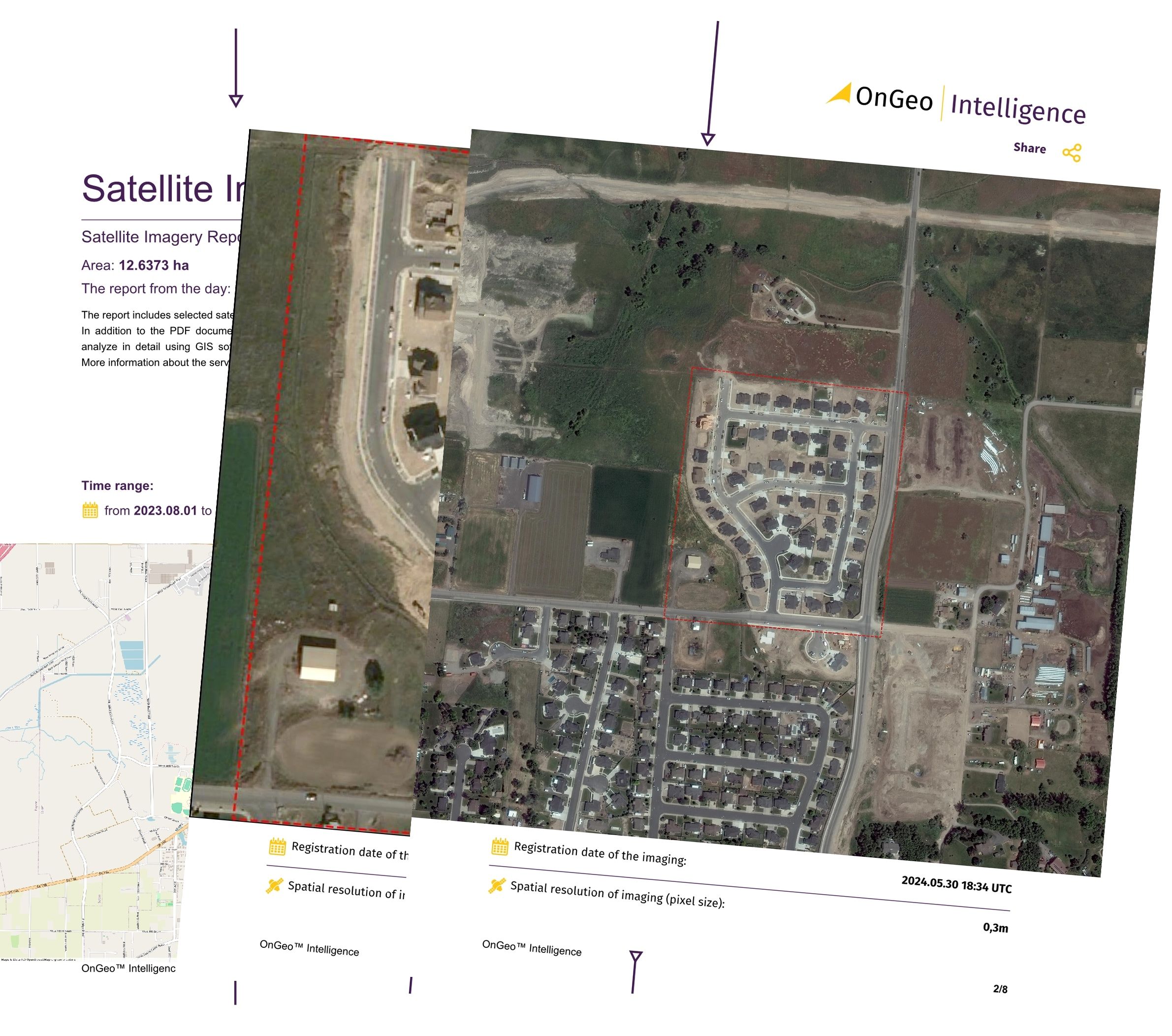
OnGeo Satellite Imagery Report – Instant Map of Your Property
Need high-resolution satellite imagery for a specific property, field, or parcel of land?
Try the OnGeo Satellite Imagery Report — a fast, mobile-friendly tool that generates a PDF satellite map of your location in seconds.
🛰 What you get:
Access to very high-resolution satellite images
No account or login required
Ready-to-download PDF format
Works on any phone or computer
Ideal for real estate, agriculture, land management, insurance, and more
This article is part of an expanding series. Coming soon: satellite maps of Los Angeles, Chicago, London, Paris, and many other cities around the world.
We use cookies to run our website, analyze your use of our services, manage your online preferences & personalize ad content. By accepting our cookies, you'll get relevant content and social media features, personalized ads, and an enhanced browsing experience. To manage your choices, click "Cookie Settings." Necessary cookies are required for the core website functionality and cannot be rejected. For more information, see our Cookie Policy.
About cookies on this site
Cookies used on the site are categorized. Below you can allow or deny some or all of them, except for Necessary Cookies which are required to provide core website functionality. When categories that have been previously allowed are disabled, all cookies assigned to that category will be removed from your browser.
Some cookies are required to provide core functionality. The website won't function properly without these cookies and they are enabled by default and cannot be disabled.
Preference cookies enables the web site to remember information to customize how the web site looks or behaves for each user. This may include storing selected currency, region, language or color theme.
Analytical cookies help us improve our website by collecting and reporting information on its usage.
Marketing cookies are used to track visitors across websites to allow publishers to display relevant and engaging advertisements. By enabling marketing cookies, you grant permission for personalized advertising across various platforms.
The cookies in this category have not yet been categorized and the purpose may be unknown at this time.