Download the Satellite Map of Los Angeles – Free Printable PDF
Los Angeles is a sprawling metropolis, stretching from the mountains to the Pacific Ocean. With its iconic neighborhoods, vast highway systems, and natural features, it offers one of the most complex urban landscapes in the world. Now, with this high-resolution satellite map, you can explore LA from a completely new perspective — free to download, print, and use.
Download High Quality Satellite Map of Los Angeles – PDF
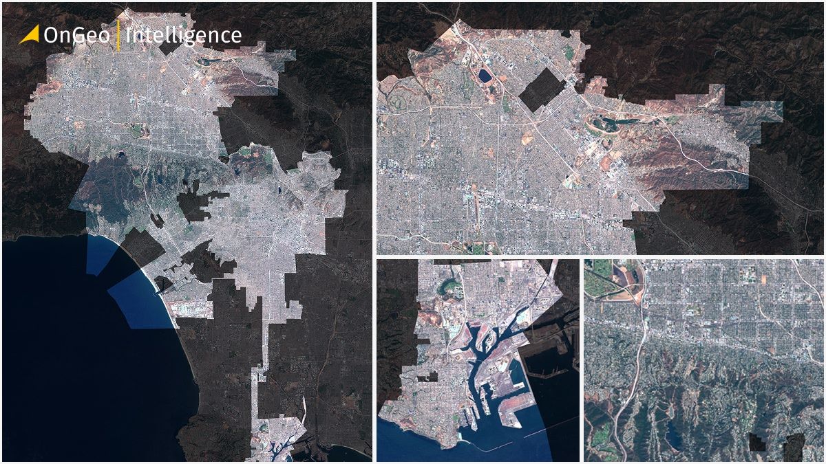
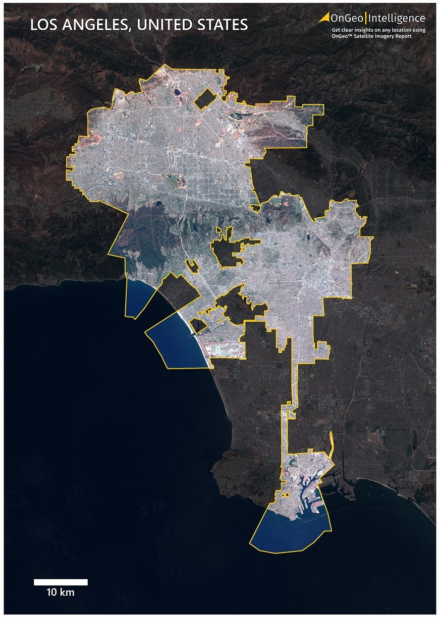
This satellite map of Los Angeles is based on 2024 imagery from Sentinel-2, presented in natural RGB color. It’s available in a printable A3 PDF format, showing the entire city and its surroundings in clear detail.
📥 [Download High Quality Satellite Map of Los Angeles – PDF, 26.2 MB]
Format: A3 PDF
File Size: 26.2 MB
Year: 2024
Los Angeles Satellite Map Thumbnail Low Quality
What the Satellite Map of Los Angeles Contains
This map displays the full urban extent of Los Angeles, including:
Downtown LA, Hollywood, Venice Beach, and industrial zones
The freeway network: I-5, I-10, I-405, and more
Griffith Park, the LA River, and mountain foothills
Santa Monica Bay coastline and surrounding residential areas
Clearly marked yellow city boundary
Darkened background outside the municipal area for visual emphasis
Title at the top: Los Angeles, United States
Scale bar in the lower-left corner
OnGeo Satellite Imagery Report – Instant Map of Your Property
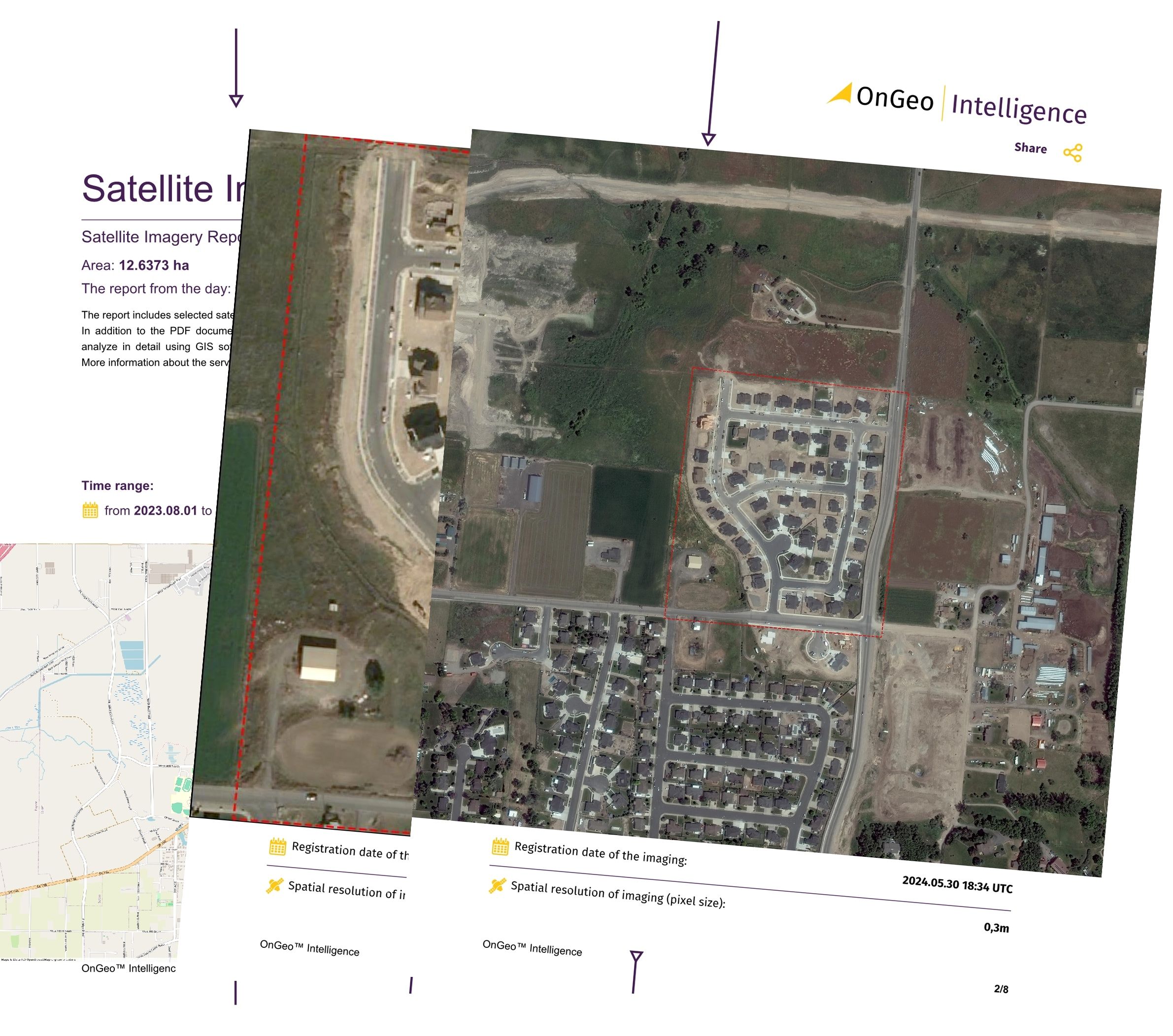
Looking for recent satellite imagery of a specific location or property?
With the OnGeo Satellite Imagery Report, you can instantly generate custom high-resolution satellite maps of any area in just a few clicks — no registration required.
🛰 Key Features:
Access very high-resolution imagery instantly
Delivered in PDF format — perfect for sharing and printing
No login or software needed — works on your phone or PC
Ideal for real estate, agriculture, insurance, environment, and more
Who Created the Map and How It Was Made
This map was prepared by the geospatial experts at OnGeo Intelligence using RGB satellite imagery captured by the Sentinel-2 satellite constellation.
Our team processed the data with advanced cartographic tools to enhance visual clarity and geographic accuracy. The final product is suitable for screen display or high-quality printing.
Satellite mapping is widely used in:
Urban planning and development
Infrastructure management
Environmental analysis
Academic and institutional research
Real estate and communication
Satellite Map of Los Angeles – Tailored to Your Needs
Need the map in another format, scale, or focus area (e.g., South LA, San Fernando Valley, Port of LA)?
📧 We provide custom satellite maps upon request. Just contact us at: contact@ongeo-intelligence.com
How to Use the Satellite Map of Mexico City
We believe in open access to spatial knowledge. That’s why this map is free for use in:
🎓Educational and academic work
🌳Environmental and urban studies
🏤Real estate and location analysis
📝Presentations and reports
📣Creative and promotional materials
🔎Personal research and exploration
You may modify and publish the map freely, with only two conditions:
⚠️Do not remove the OnGeo Intelligence logo or map branding
📝If shared publicly, include attribution: Source: OnGeo-Intelligence.com
Explore More City Maps Soon
Our map of Los Angeles is part of a global series of free downloadable city maps. Coming soon: San Diego, Las Vegas, Phoenix, and San Francisco.
📌 Follow OnGeo-Intelligence.com or subscribe for updates.