
How to Get a Current Satellite Map of My Property
Are you looking for a high-quality, up-to-date satellite map of your property? Whether for investment planning, monitoring land changes, or simply out of curiosity, OnGeo Intelligence provides an easy and reliable solution. This guide will walk you through the process step by step, explain the benefits of satellite imagery, and showcase why OnGeo Intelligence is the best platform for accessing this data.
The Power of Satellite Imagery
Satellite maps are more than just images from space - they are essential tools that provide an accurate representation of the Earth's surface. Unlike simple aerial photography, satellite maps use advanced geospatial data to display real-time land conditions, changes over time, and key geographic details. Whether you need a current satellite map of your property or want to analyze large-scale geographic patterns, these maps offer crucial insights.
Key benefits include:
- Access to High-Resolution Images: OnGeo Intelligence provides access to satellite imagery with greater detail than free services like Google Maps.
- Regular Updates: Satellite images on OnGeo Intelligence are updated frequently, ensuring you work with the most recent data available.
- Multiple Data Layers: Beyond just visuals, OnGeo Intelligence allows users to integrate terrain analysis, land use overlays, and historical imagery comparisons.
- Enhanced Precision for Analysis: With professional-grade satellite maps, users can make more informed decisions regarding their land, property, or research projects.
Practical Applications of Satellite Maps
People use satellite maps for various reasons, including tracking property changes, verifying land use, and assessing natural conditions. Unlike free online maps that may be outdated by months or even years, current satellite maps provide up-to-date information, allowing for better decision-making.
Satellite maps are widely used across various industries, but they also offer many practical uses for everyday people. Here are some real-world scenarios where they come in handy:
- Homeowners & Property Buyers: Want to see how a property has changed over time? A current satellite map helps track construction, vegetation growth, or unauthorized modifications.
- DIY Home Improvement Projects: Considering installing solar panels or a swimming pool? A high-resolution satellite map allows you to assess shading, space availability, and property layout.
- Gardeners & Farmers: Monitor soil conditions, irrigation areas, and plant health using detailed satellite maps.
- Small Business Owners: If you're expanding or relocating, use a satellite map of your property to analyze nearby infrastructure, accessibility, and neighboring land use.
- Boat Owners & Fishermen: Satellite maps help track water body conditions, shorelines, and seasonal changes for safer navigation.
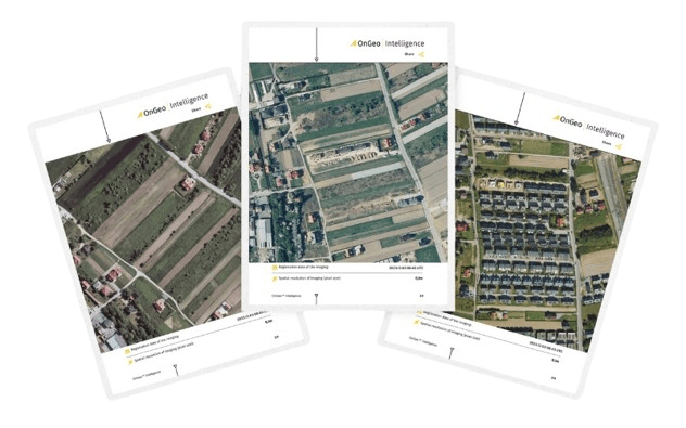
OnGeo™ Intelligence users gain access to detailed land documentation within minutes of placing an order. High-resolution images and spectral data provide an unparalleled level of convenience and efficiency. Track any land area's history in detail, from landscape evolution to land-use changes.
Read more about:
Why Not Just Use Google Maps?
Many people turn to Google Maps for satellite imagery, but it's important to note that these maps are often outdated, sometimes by several years. Google Maps does not prioritize frequent updates, especially in less urbanized areas, making it unreliable for users needing the most recent images.
In contrast, OnGeo Intelligence provides access to regularly updated high-resolution satellite images, making it the superior choice for professionals and individuals who need accurate data.
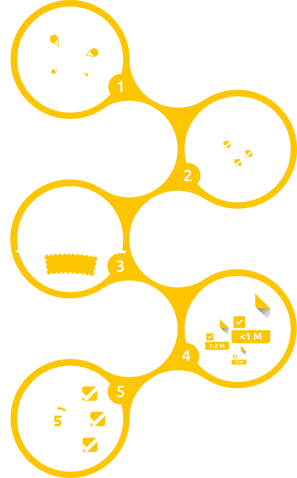
How to Get a Current Satellite Map of Your Property
Step 1: Visit OnGeo Intelligence Platform
Go to OnGeo Intelligence and navigate to the satellite imagery section.
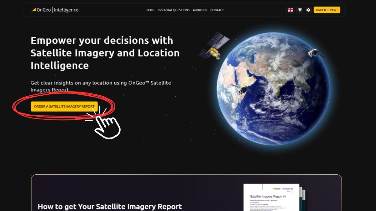
Click the button: "Order a satellite imagery report".
You can check our services by clicking on the free report on the website or by discovering a single photo.
Step 2: Enter Your Property’s Location
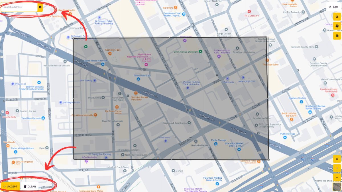
Use our interactive map and select the area that interests you.
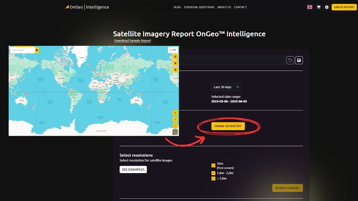
You can choose the address yourself or zoom manually to the area of interest.
Mark the area as shown in the image below. You will get a black border. If you are satisfied with your choice, click "Accept".
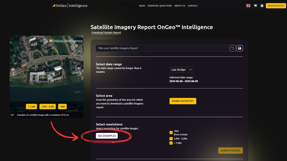
Step 3: Select the Satellite Imagery Option
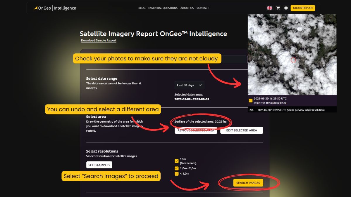
Choose from different satellite imagery options available on OnGeo Intelligence. The platform provides access to high-resolution images from various providers, allowing you to pick the best available data for your needs.
Step 4: Choose interesting photos
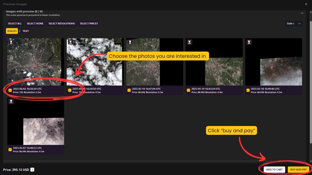
Choose the photos you are interested in. The platform allows you to preview available satellite images and select the ones that meet your requirements.
Click "Preview images and order." This option lets you proceed with your selection and ensures you're getting the right images before purchase.
Finalize the order by clicking "Buy and Pay." Once you've made your selection, you can proceed to payment and instantly gain access to high-resolution satellite imagery.
OnGeo Intelligence ensures a seamless experience, making the process of obtaining satellite maps quick and efficient.
Step 5: Download or Save Your Map
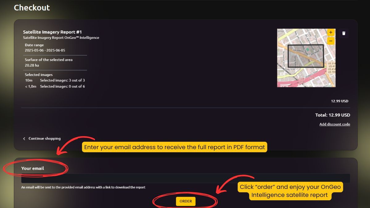
To receive your full satellite report in PDF format, simply enter your email address in the designated field. Then, click the Order button to complete your purchase. Your OnGeo Intelligence satellite report will be sent directly to your inbox, allowing you to download and use it instantly.
FAQ
How often are satellite maps updated?
Satellite maps from OnGeo Intelligence are regularly refreshed, ensuring you have access to the most up-to-date information available. The frequency depends on the location and satellite provider.
Do I need special software to view the images?
No, OnGeo Intelligence provides an intuitive online platform accessible through any web browser, eliminating the need for additional software installations.
Can I see my property in real-time?
No, satellite maps do not provide real-time imagery. However, our maps offer some of the most recent and high-resolution images available, updated at frequent intervals.
What is the difference between free maps and professional satellite maps?
Free maps, like those from Google, may be outdated by several months or years. Professional satellite maps from OnGeo Intelligence offer higher resolution, regular updates, and more data layers for better accuracy.