2026-07-21
~ 7 min
(Article updated: 2026-07-21)
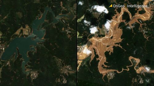
The two reservoirs are among the most important pieces of water infrastructure in Hengzhou, a county-level city administered by Nanning in the Guangxi Zhuang Autonomous Region. Built during China's large-scale water conservancy campaign of the late 1950s, both projects have supported agriculture, flood control and local economic development for decades.
Read more