How to Obtain Satellite Imagery of Your Plot? OnGeo Intelligence Guide
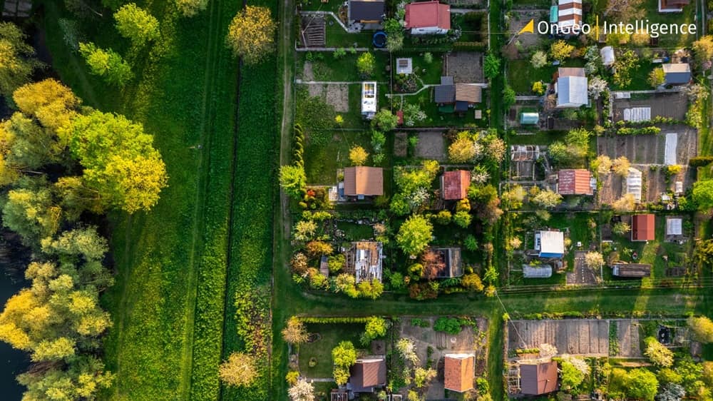
Need to see how your plot has changed over time, monitor construction, or check on your crops? Getting satellite imagery of your property is now simple. This guide will show you how, from finding free images and understanding resolution, to ordering a detailed Satellite Imagery Report from OnGeo Intelligence. Get the perfect aerial view of your land.
Why Do You Need Satellite Imagery of Your Plot?
Satellite imagery of your plot is a practical tool for analysis and documentation. It can be useful in many situations:
✅ Monitoring changes: You can track the development of buildings, changes in land use, or progress of construction work over the years using plot satellite imagery.
✅ Documentation: Use satellite images of your plot as evidence in legal disputes, for insurance purposes, or in spatial planning. For example, you can document illegal tree felling or land use changes on a neighboring plot that violate zoning plans with detailed satellite imagery of your plot.
✅ Agricultural analysis: Assess crop health, identify problematic areas in a field, and optimize resource management using satellite imagery of your plot.
✅ Planning: Get additional data about your property before making decisions, such as the location of a new building, thanks to plot satellite imagery.
What Satellite Imagery Resolutions Are Available for Your Plot, and How Much Do They Cost?
The choice of resolution affects the detail level when you want to obtain satellite imagery of your plot.
Low Resolution (e.g., 10m Sentinel-2)
🎯 Purpose: Good for analyzing large areas, such as farmlands, forests, or general land cover changes. You won't see small details of your plot with this resolution.
💰 Cost: 10-meter resolution satellite images of your plot are FREE when purchasing an OnGeo Intelligence Satellite Imagery Report, thanks to our special promotion. Use discount code ongeo100 when ordering.
High Resolution (VHR - from 2m to 0.3m)
🎯 Purpose: Essential for identifying precise details such as specific buildings, vehicles, construction progress, or exact plot boundaries on your satellite imagery of your plot.
💰 Cost: Ordering high-resolution satellite imagery of your plot is a paid service. Prices on the OnGeo Intelligence website start from $12.99 USD.
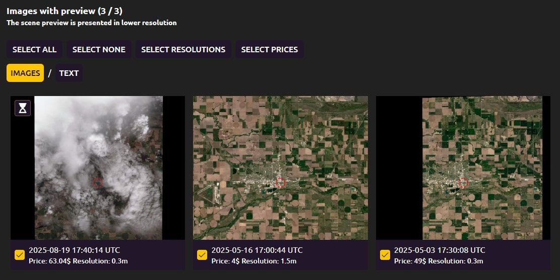
Free Satellite Imagery Archive Search for Your Plot
Before you order a report, OnGeo Intelligence allows you to browse an archive of satellite imagery for your chosen plot for free. This helps you select the satellite images of your plot that best meet your needs.
How to Order a Satellite Imagery Report with OnGeo Intelligence?
Ordering a Satellite Imagery Report is simple and does not require account registration or subscription fees.
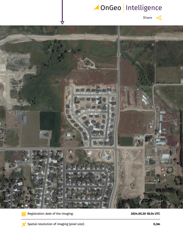
You will receive the final report in PDF format and source files to your email address.
For low-resolution plot satellite imagery, this takes a few minutes; for high-resolution, up to 48 hours.
The report contains satellite images of your plot organized from newest to oldest.
Watch the video tutorial on how to download the OnGeo Intelligence Satellite Report.
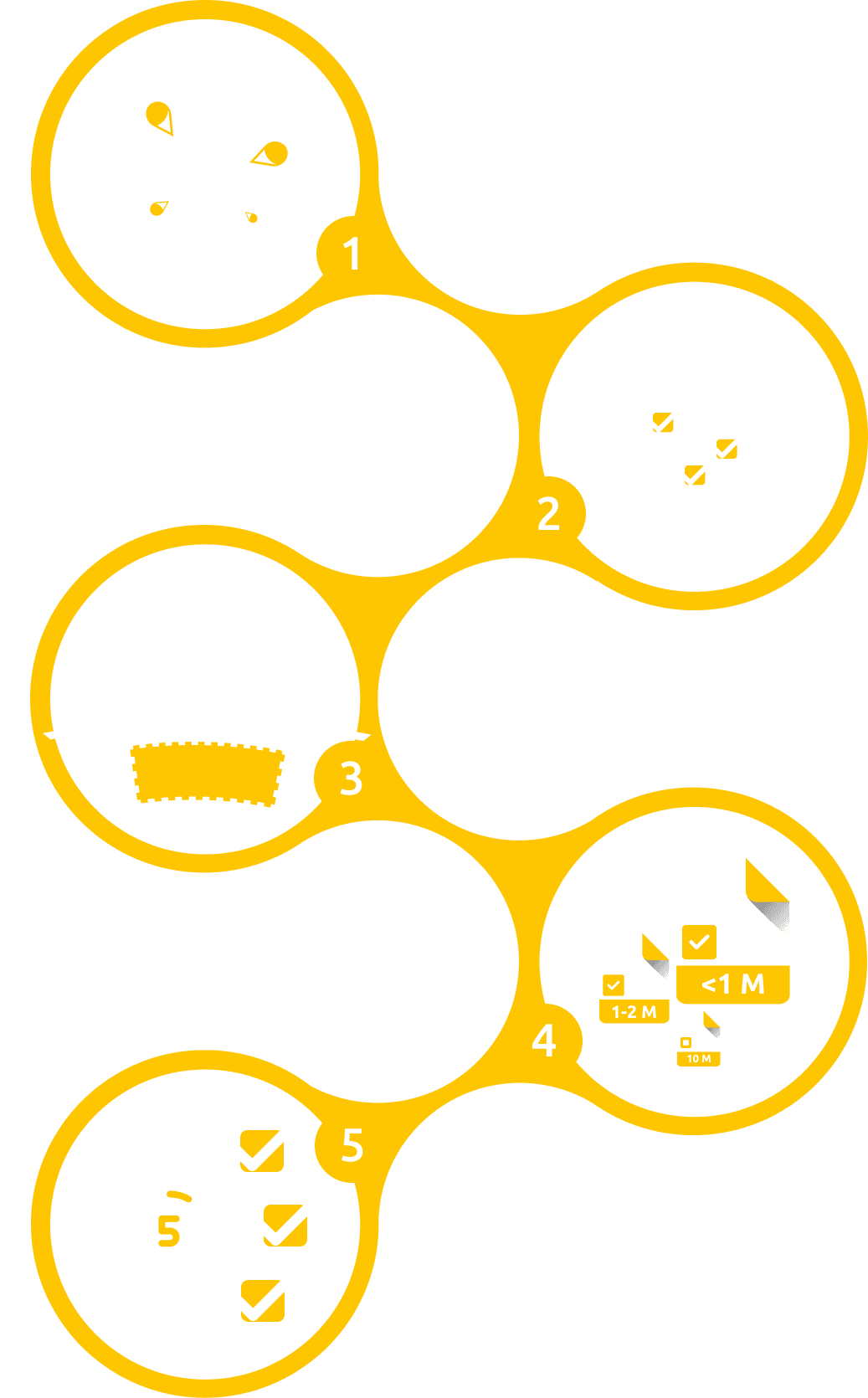
Step-by-Step Instructions to Get Satellite Imagery of Your Plot
- Go to the Satellite Report service, choose your desired date range (max 6 months) for your plot imagery.
- Select Area by drawing your plot's geometry.
Choose the resolution for the satellite images. - The platform automatically searches archives and displays image previews.
- Review previews, check resolution (high/low), and select your desired plot imagery.
- Finalize your order, select the final resolution. Provide your email.
- Receive your PDF Satellite Imagery Report.
FAQ: Frequently Asked Questions About Satellite Imagery of Your Plot
Can I order satellite imagery for any location and any date?
Yes, our service offers global coverage, allowing you to order satellite imagery for virtually any plot on Earth. However, availability depends on whether satellite images exist in the archives for your specific area of interest and selected date range. Our platform searches these archives when you define your query for plot satellite imagery.
Is it possible to get real-time or "live" satellite views of a plot?
No, our service provides access to archived satellite imagery of your plot, not live or real-time views. Satellite data requires processing before it becomes available. You can search our extensive archives for the most recent available satellite images for your plot and date range.
Do I need to create an account, sign a contract, or pay a subscription to get satellite imagery of my plot?
No. Our service is designed for simplicity and accessibility. You don't need to create an account, sign any contracts, or commit to a subscription. You simply pay for the specific report of satellite imagery of your plot you need, when you need it, to obtain plot satellite imagery.
What image resolution should I choose for my plot satellite imagery, and what will I actually see on it?
For plot satellite imagery, resolution dictates detail:
- Low Resolution (10m Sentinel-2): Ideal for broad analysis (farmlands, forests, land cover). No fine details (cars, small buildings).
- High Resolution (0.3m-2m VHR): Crucial for precise details (buildings, vehicles, construction, boundaries). We recommend 0.3m or 0.5m for best quality.
Summary
Obtaining satellite imagery of your plot is now a matter of a few clicks. OnGeo Intelligence demystifies access to professional satellite data, offering a simple, fast, and cost-effective way to get valuable information. Regardless of your needs, our platform will provide you with the necessary tools to obtain satellite images of your plot and look at your property from a completely new perspective.
Start today and get your plot satellite imagery!