Satellite photos as evidence in the case
In today’s legal landscape, satellite photos have emerged as a powerful tool for resolving disputes, particularly in cases involving land and property. OnGeo Intelligence offers a fast, user-friendly service to obtain high-resolution satellite photographs, enabling individuals, legal professionals, and businesses to secure verifiable evidence for court cases or pre-trial proceedings. By providing precise, timestamped, and georeferenced imagery, OnGeo Intelligence empowers clients to strengthen their legal arguments with objective data. Below, we explore how satellite photos as evidence in the case can resolve real-world disputes and highlight practical use cases from our clients.
The Power of Satellite Photos in Legal Disputes
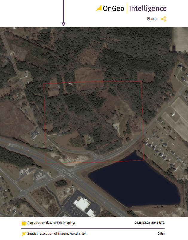
Satellite imagery, obtained through remote sensing, captures detailed information about land, structures, and environmental changes without physical contact. This technology is increasingly used in legal proceedings due to its objectivity, historical data availability, and ability to monitor large or inaccessible areas. OnGeo Intelligence delivers satellite imagery reports in clear, court-ready formats, complete with expert analysis, verified capture dates, and georeferenced data, ensuring admissibility in legal settings.
Key advantages of using satellite photos as evidence include:
Objective Evidence: Unlike witness testimonies, satellite photographs provide unbiased, timestamped visuals of a location, reducing subjectivity in court.
Historical Analysis: Archival imagery dating back to 2008 allows retrospective analysis of land changes, critical for disputes involving construction timelines or land use.
Cost and Time Efficiency: Remote sensing eliminates the need for costly on-site surveys, delivering results in minutes for low-resolution images or within 48 hours for high-resolution data.
Real-World Use Cases of Satellite Photos in Legal Proceedings
1. Resolving Boundary Disputes
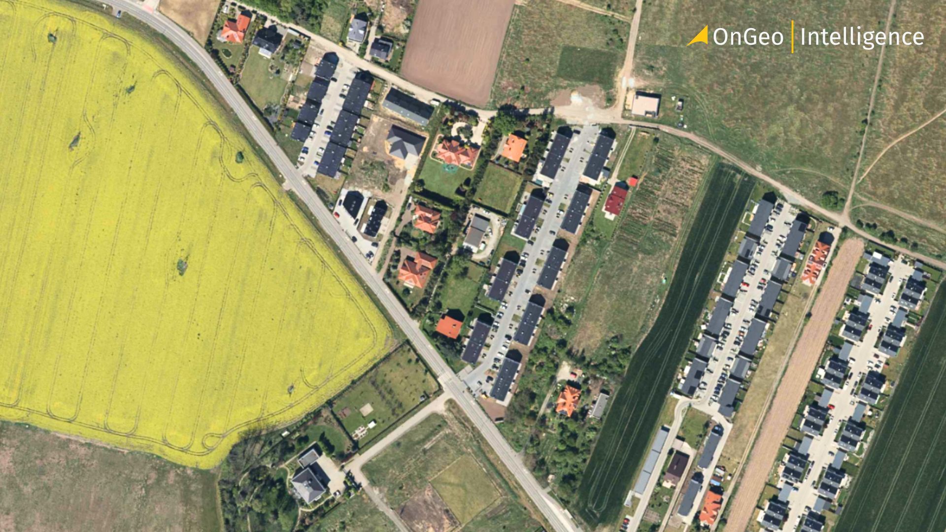
In a small village near Chicago, two neighboring families clashed over a fence erected several meters onto disputed land. The disagreement escalated into a legal battle, with each side claiming ownership of the contested area. Using OnGeo Intelligence’s Satellite Imagery Report, the court received high-resolution satellite photos showing the historical boundaries of the property over time. The imagery, paired with expert interpretation, clearly demonstrated the original boundary, resolving the dispute without expensive land surveys. The fence was relocated, and the case was settled efficiently, saving both parties time and money.
2. Divorce and Property Division
During a contentious divorce, Anna and Tomas disputed ownership of their family home. Tomas claimed the house was built on inherited land before their marriage, making it his sole property. Anna, however, argued that the house was constructed during their marriage with shared funds. OnGeo Intelligence provided archival satellite photographs showing that, at the time of their wedding, the land held only an unfinished structure. Later images confirmed the house’s completion during their marriage. Presented with this irrefutable evidence, the court ruled the house as marital property, ensuring Anna received her fair share. This case highlights how satellite photos can establish critical timelines in property disputes.
3. Illegal Land Use and Environmental Violations
In Ireland, a group of farmers faced allegations of illegally occupying wetlands to graze livestock. They claimed the land had been used for grazing for over a year. However, OnGeo Intelligence’s satellite imagery revealed that grass in the area had only been planted two months prior. The timestamped satellite photos provided undeniable proof, leading to a swift resolution in favor of the authorities. This case demonstrates how satellite photographs can expose unauthorized land use, supporting environmental protection and regulatory enforcement.
4. Insurance Claims and Property Damage
Satellite photos are also invaluable in insurance disputes. In a case involving a property damage claim, a homeowner sought compensation for a collapsed roof, alleging it was caused by a recent storm. OnGeo Intelligence’s high-resolution imagery showed missing roof shingles months before the storm, contradicting the claimant’s narrative. The insurer used this evidence to deny the fraudulent claim, saving significant costs. Such cases underscore the role of satellite photos in verifying the condition of properties over time.
5. Inheritance and Land Ownership Disputes
In a family dispute over inherited land, siblings contested the division of a rural plot. One sibling claimed a larger portion, citing historical use. OnGeo Intelligence provided satellite imagery spanning decades, showing consistent land use patterns that contradicted the claim. The court used this evidence to equitably divide the property, avoiding prolonged litigation. This example illustrates how satellite photos can clarify ownership disputes by providing a historical record of land use.
Why Choose OnGeo Intelligence for Satellite Imagery?
OnGeo Intelligence simplifies the process of obtaining satellite photos for legal purposes. Here’s how it works:
Select Location and Timeframe: Choose the area and date range for your satellite imagery on OnGeo’s user-friendly platform.
Receive Available Images: Within minutes, OnGeo searches its archives and provides a list of cloud-free satellite photos.
Order a Report: Select the desired images and receive a detailed PDF report, complete with georeferenced data and expert analysis, ready for court submission.
Fast Delivery: Low-resolution images are delivered in minutes, while high-resolution reports arrive within 48 hours—no subscriptions or contracts required.
OnGeo Intelligence’s reports are tailored for legal professionals, offering verified capture dates, precise georeferencing, and expert insights to ensure admissibility. Whether it’s a boundary dispute, divorce settlement, or environmental violation, OnGeo’s satellite photographs provide the clarity needed to resolve conflicts.
Applications of Satellite Photos in Various Disputes
Satellite photos as evidence in the case are versatile, addressing a wide range of legal issues, including:
Boundary Disputes: Clarify property lines and detect encroachments using historical imagery.
Land Use Violations: Identify illegal constructions, deforestation, or unauthorized agricultural activities.
Divorce and Inheritance Cases: Establish construction timelines or land use to determine asset division.
Insurance Claims: Verify property conditions to validate or refute claims.
Environmental Litigation: Monitor ecological changes, such as wetlands destruction or oil spills, to hold violators accountable.
Infrastructure Disputes: Confirm the presence or absence of roads, utilities, or other infrastructure on private land.
The Future of Satellite Photos in Legal Proceedings
The use of satellite photos as evidence in legal cases is growing, driven by advancements in remote sensing technology. OnGeo Intelligence is at the forefront, offering accessible, high-resolution imagery that transforms how disputes are resolved. By providing objective, verifiable data, OnGeo empowers clients to present compelling evidence in court, reducing reliance on subjective testimonies or costly surveys.
For anyone facing a land or property dispute, OnGeo Intelligence’s Satellite Imagery Reports offer a reliable, cost-effective solution. Visit OnGeo Intelligence to order your report today and leverage the power of satellite photos to strengthen your case. Seeing is believing—and in court, it’s winning.
Related articles
- Using Satellite Imagery As Evidence In Judicial Proceedings
- Aerial photos as evidence in the case
- How to Find & Order Satellite Images with Ongeo Intelligence?
- How Often Do satelites Take Pictures? Satellite Imagery Frequency
- Discovering the Past from Space: How Satellite Remote Sensing Is Transforming Archaeology?
- How to Obtain Satellite Imagery of Your Plot? OnGeo Intelligence Guide