Enhancing Your QGIS Projects with Satellite Basemaps
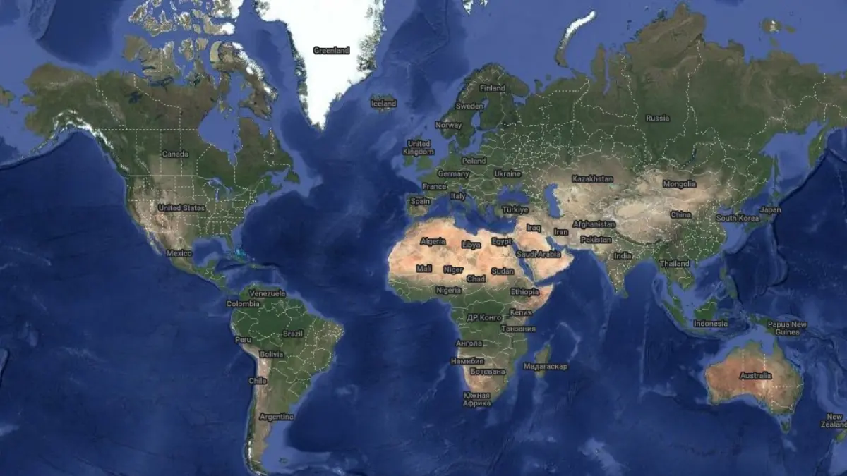
Basemaps are the backbone of any GIS project, offering a foundational layer that brings geographical context to your data. In QGIS, integrating basemaps—such as those featuring roads, rivers, buildings, or land-use patterns—helps users navigate and interpret spatial information effectively. Whether you're mapping urban infrastructure or natural landscapes, basemaps provide the essential reference needed to overlay thematic or point data, like highlighting restaurants atop a city street grid or parks within a forested region.
In this article, we’ll walk you through the process of adding satellite basemaps to QGIS, explore topography options, and introduce a handy tool from OnGeo Intelligence to elevate your projects further.
Adding Satellite Basemaps in QGIS
QGIS makes it seamless to incorporate satellite basemaps—often referred to as "basemaps QGIS" in the geospatial community—using the XYZ Tiles feature. This tool connects you to online tile services from leading providers, delivering high-quality imagery at various zoom levels. Follow these steps to enrich your project with satellite basemaps:
- Launch QGIS: Open the software and start a new project.
- Access XYZ Tiles: In the Browser panel, locate and click the "XYZ Tiles" option.
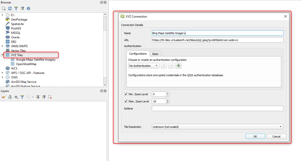
- Create a New Connection: In the XYZ Tiles window, select "New Connection" to input a basemap service.
- Enter Basemap Details: Use the following configurations for popular satellite basemaps:
Google Maps Satellite Hybrid
- Name: Google Maps Satellite Hybrid
- URL: https://mt1.google.com/vt/lyrs=y&x={x}&y={y}&z={z}
Google Maps Satellite Imagery
- Name: Google Maps Satellite Imagery
- URL: https://mt1.google.com/vt/lyrs=s&x={x}&y={y}&z={z}
Bing Maps Satellite Imagery
- Name: Bing Maps Satellite Imagery
- URL: https://t0.tiles.virtualearth.net/tiles/a{q}.jpeg?g=685&mkt=en-us&n=z
ESRI World Imagery
- Name: ESRI World Imagery
- URL: https://services.arcgisonline.com/arcgis/rest/services/World_Imagery/MapServer/tile/{z}/{y}/{x}
- Save the Connection: Click "OK" to store the settings.
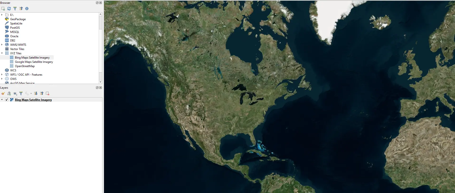
- Add the Basemap: Select your chosen basemap in the XYZ Tiles window and click "Add" to load it into your project.
- Customize as Needed: The basemap will appear in the Layers panel, where you can tweak its opacity or styling.
These satellite basemaps provide a vivid, real-world backdrop to your QGIS projects, making spatial relationships crystal clear.
Adding Topography Basemaps in QGIS
Beyond satellite imagery, topography basemaps offer critical elevation and terrain insights—perfect for analyses involving landscapes or natural features. Adding these layers follows a similar process:
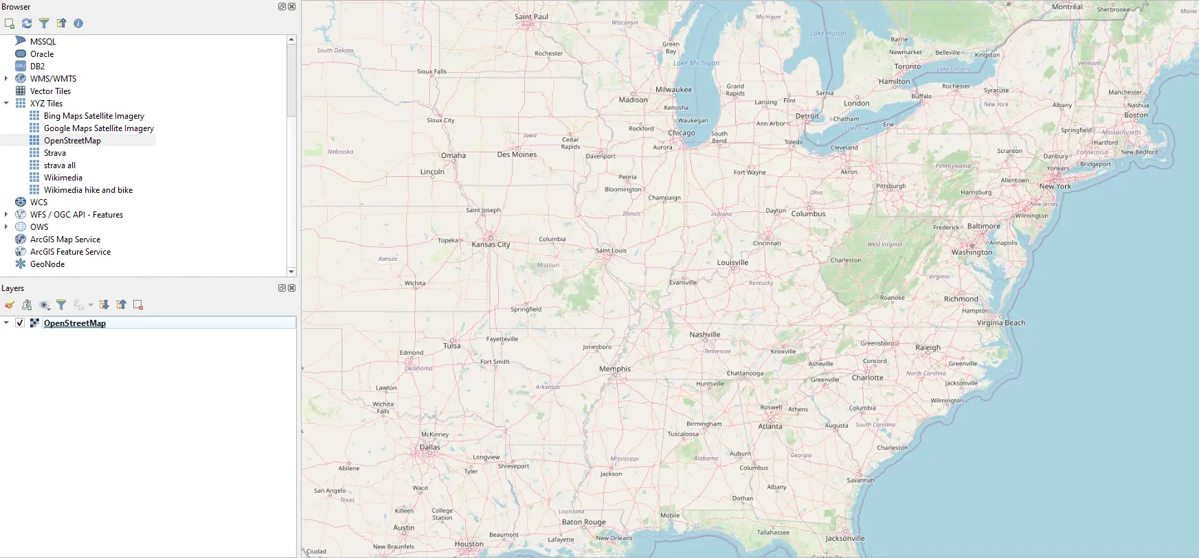
- Navigate to XYZ Tiles: In the Browser panel, click "XYZ Tiles."
- Set Up a New Connection: Click "New Connection" and input the details for topography basemaps:
Open Street Map
- Name: Open Street Map
- URL: https://tile.openstreetmap.org/{z}/{x}/{y}.png
Esri World Street Map
- Name: World Street Map
- URL: https://server.arcgisonline.com/ArcGIS/rest/services/World_Street_Map/MapServer/tile/{z}/{y}/{x}
OpenTopo
- Name: OpenTopo
- URL: https://tile.opentopomap.org/{z}/{x}/{y}.png
Mapzen Global Terrain
- Name: Mapzen Global Terrain
- URL: https://s3.amazonaws.com/elevation-tiles-prod/terrarium/{z}/{x}/{y}.png
- Finalize the Addition: Save the connection with "OK," then select and add the basemap to your project as described above.
For added variety, consider these additional basemaps:
Esri World Boundaries and Places:
- https://server.arcgisonline.com/ArcGIS/rest/services/Reference/World_Boundaries_and_Places/MapServer/tile/{z}/{y}/{x}
Google Maps Terrain:
- https://mt1.google.com/vt/lyrs=t&x={x}&y={y}&z={z}
Google Maps Terrain Hybrid:
- https://mt1.google.com/vt/lyrs=p&x={x}&y={y}&z={z}
Stamen Toner:
- https://stamen-tiles.a.ssl.fastly.net/toner/{z}/{x}/{y}.png (high-contrast, black-and-white style)
Stamen Watercolor:
- https://stamen-tiles.a.ssl.fastly.net/watercolor/{z}/{x}/{y}.jpg (artistic, watercolor effect)
Strava Run:
- https://heatmap-external-b.strava.com/tiles/run/bluered/%7Bz%7D/%7Bx%7D/%7By%7D.png?v=19
These options expand the versatility of basemaps in QGIS, catering to diverse project needs.
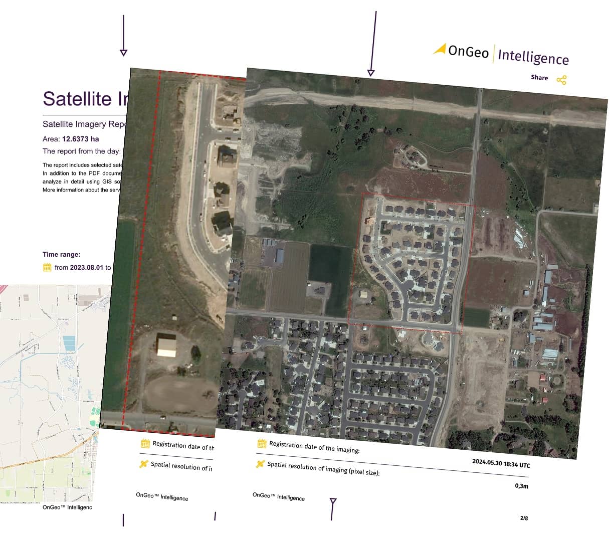
Boost Your Projects with the Satellite Imagery Report
While QGIS basemaps provide an excellent starting point, sometimes you need more detailed or location-specific satellite imagery. That’s where the Satellite Imagery Report service from OnGeo Intelligence shines. This tool lets you access high-resolution satellite images for any spot on the globe with minimal effort. Designed for simplicity, it’s ideal even for those unfamiliar with professional geospatial platforms. No account registration is required- just visit the site, pinpoint your location on the map, and order a clear PDF report, delivered in minutes. This service pairs perfectly with QGIS, allowing you to zoom in on key areas with enhanced detail for analysis, planning, or presentations.
Together with the Satellite Imagery Report, you will receive a package of satellite imagery from Sentinel-2 ready to be loaded into QGIS or other software.
Wrapping Up
Adding satellite basemaps to QGIS is a straightforward way to elevate your geospatial work, providing context and clarity to your data. With the XYZ Tiles feature, you can tap into a wealth of satellite and topography options from trusted providers. And when your project demands more precision, the Satellite Imagery Report from OnGeo Intelligence offers a quick, user-friendly solution to access top-tier imagery. Try these techniques today and take your QGIS projects to new heights!
Related articles
- CORONA Satellite Imagery: The Spy Satellites History
- Maxar Technologies: An Overview of Satellite & Geospatial Solutions
- Pansharpening: The Secret to Sharper, More Detailed Satellite Images
- What Is Location Intelligence? A Guide for Modern Businesses
- Satellites spot plastic waste on beaches: A new era in remote sensing for marine cleanup