Unlocking the Landscape: What Is Land Use/Land Cover (LULC) and Why Maxar’s BaseVue Is a Game-Changer
As satellite Earth Observation continues to revolutionize how we understand and manage our planet, Land Use/Land Cover (LULC) mapping emerges as one of the most powerful tools for monitoring environmental change, planning infrastructure and supporting sustainability. But what exactly is LULC in satellite remote sensing – and how does Maxar’s BaseVue dataset lead the way?
Understanding Land Use/Land Cover (LULC)
Land Use/Land Cover (LULC) is a foundational concept in satellite-based Earth Observation. It refers to two interrelated yet distinct characteristics of the Earth’s surface: land cover, meaning the physical material covering the land (such as forests, grasslands, water bodies, or built-up areas), and land use, which captures how humans utilize that land (e.g., agriculture, industry, or residential zones).
Advancements in Satellite-Based LULC Mapping
With the evolution of EO technologies, satellites now deliver data with ever-increasing spatial, spectral, and temporal resolution, offering a far more efficient and scalable alternative to traditional field surveys. Modern LULC products are generated using semi-automated classification methods applied to satellite imagery – such as Landsat, Sentinel, or Maxar’s own high-resolution satellites – often enhanced by artificial intelligence and multitemporal analysis. These datasets enable global or regional assessments of land change over time, providing critical input for climate models, environmental monitoring, resource management, disaster mitigation, and urban development.
Diverse Applications of LULC Data
LULC data supports a wide range of applications critical to understanding and managing Earth’s resources. Key uses include:
Detecting deforestation to monitor forest loss and support conservation efforts.
Monitoring wetland loss to protect ecosystems and biodiversity.
Estimating carbon stocks for climate change mitigation strategies.
Mapping agricultural expansion to assess food security and land use trends.
Assessing urban sprawl to inform sustainable urban planning.
Tracking refugee settlements in humanitarian contexts for aid and resource allocation.
Analyzing terrain for logistical planning in defense operations.
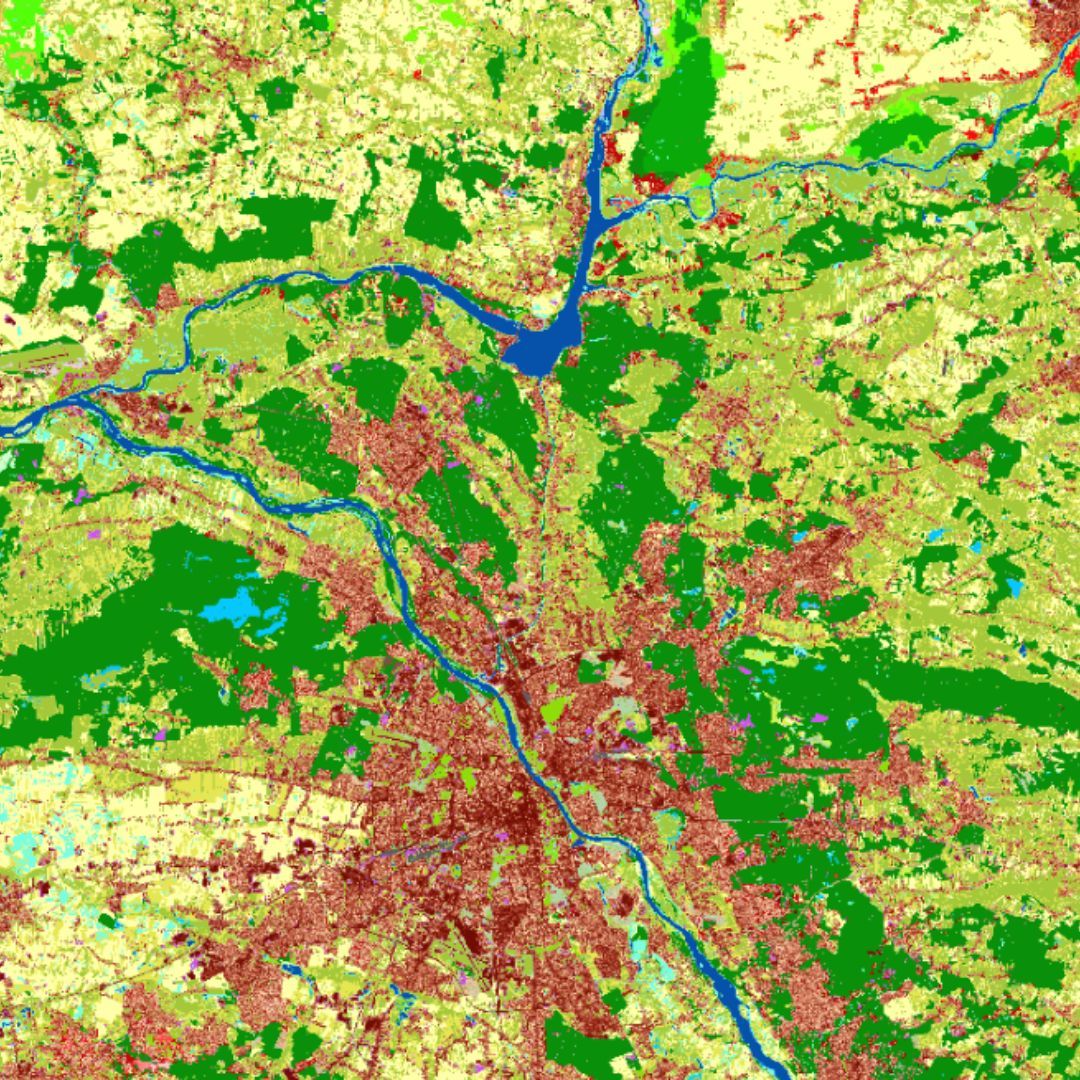
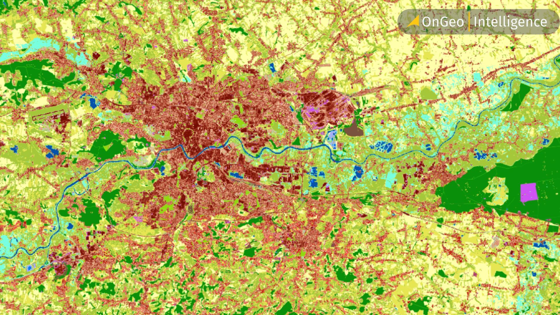
Introducing Maxar’s BaseVue LULC Product
Among the most versatile and reliable LULC products on the market today is BaseVue LULC, developed by Maxar Technologies. Designed to offer global consistency and detail at a cost-effective price point, BaseVue maps land use and land cover at a resolution of 30 meters, based on Landsat 8 imagery and refined with multitemporal, semi-automated classification. The dataset has evolved from its initial 2014 release to newer versions like BaseVue 2016, which offers a globally cloud-free product. It is also available in 10 m resolution via Sentinel-2, and optionally 2 m resolution using Maxar’s proprietary satellite data.
Technical Features of BaseVue LULC
BaseVue LULC is engineered for precision and flexibility, offering the following features:
Up to 21 land cover classes, including deciduous and evergreen forests, paddy agriculture, wetlands, barren land, and multiple urban density levels.
Minimum Mapping Unit of 1.4 hectares, ideal for detailed regional analyses.
Available in GeoTIFF rasters or shapefiles with WGS84 geodetic reference.
Global or custom coverage options to suit diverse project needs.
Resolutions of 30 m (Landsat 8), 10 m (Sentinel-2), or 2 m (Maxar proprietary data).
Practical Use Cases of BaseVue Across Industries
What sets BaseVue apart is its practical utility across a wide spectrum of use cases. It supports applications in urban planning, carbon accounting, environmental risk assessment, energy infrastructure siting, and surface hazard detection. For instance, tracking land use change in Dubai between 1990 and 2018 using BaseVue clearly reveals the scale of urban growth and coastal development. Similarly, BaseVue has been used in Latin America to support reforestation programs and in Asia for agricultural productivity assessments.
The Critical Role of LULC in a Changing World
Whether you are a policymaker, urban developer, conservationist, or geospatial analyst, BaseVue LULC offers the data reliability and thematic richness needed to turn satellite imagery into actionable insight. In a world increasingly shaped by human-environment interactions, accurate and accessible LULC data is no longer a luxury – it is a necessity. And with products like Maxar’s BaseVue, that necessity is being met with precision, scalability, and clarity.
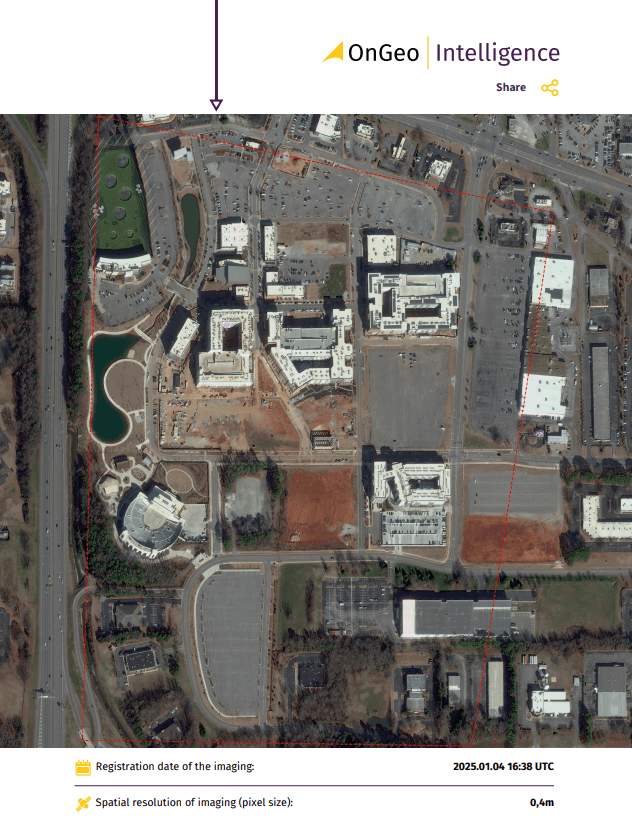
Satellite Imagery Report
With OnGeo Intelligence, accessing satellite imagery has never been easier. The user-friendly Satellite Imagery Report offers high-quality data in a streamlined PDF format, eliminating the need for registration or long-term commitments. Users worldwide can obtain detailed imagery and actionable insights tailored to their area of interest, enabling efficient decision-making and planning across various industries. This report simplifies the process of utilizing satellite data for accurate analysis and effective strategy development.