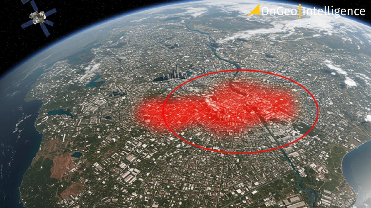
Satellite Imagery in Spatial Planning
Spatial planning is a crucial element in managing the development of urban, rural, and natural areas. It involves organizing space in a way that promotes sustainable development, environmental protection, and improved quality of life for residents. In this context, the use of satellite imagery has become an indispensable tool, enabling precise and effective spatial management.
What is satellite imagery and why should we use it?
The traditional approach to spatial planning relies on maps, measurements, and data that are often outdated. We need something more – a broader view that gives us a more complete picture of the situation. This is where satellite imagery comes in.
But what exactly is it?
It's simply a collection of images of the Earth captured by satellites orbiting our planet. Through them, we can gather information not only about visible light but also about infrared radiation, allowing us to analyze many aspects of our planet.
Thanks to these images, we have access to constantly updated information and can observe how our surroundings change over time.
This temporal aspect is vital for tracking environmental and urban changes. Planners no longer have to rely on outdated information; they have real-time satellite imagery at their fingertips.
From a satellite's perspective, we can see much more than from street level. We can observe entire networks of connections – infrastructure, green spaces, water bodies, and even agricultural fields. This enables us to better understand how different elements of the landscape interact.
Modern satellite imagery provides us with such precise data that we can accurately measure distances, map areas, and even analyze buildings. This is particularly important when planning the construction of new residential areas or roads.
What's more, satellite imagery allows us to go back in time. Thanks to archival satellite data, we can track how space has changed over the years. This is a powerful tool that helps us understand urban development, ongoing urbanization and environmental changes.
What about places that are difficult to access? Satellite imagery can easily reach areas where a surveyor cannot. This makes it possible to plan in all conditions, regardless of terrain accessibility. Thanks to satellite images, we can observe processes such as deforestation, soil degradation, and changes in the extent of water bodies.
Examples of applying satellite imagery in spatial planning
Urban planning and city development
In cities, satellite imagery is used to monitor development, assess population density, and analyze the availability of green spaces. It also helps in evaluating the condition of urban infrastructure, such as roads, bridges, and buildings an essential aspect when planning revitalization or expansion.
There are countless applications, including:
- creating accurate inventories,
- assessing buildings conditions,
- designating areas for development and new investments,
- designating public spaces,
- monitoring urban growth,
- tracking illegal construction,
- assessing population density,
- analyzing the impact of investments.
Satellite data also plays a key role in monitoring and reducing the urban heat island effect, allowing for precise determination of surface temperature at any location in the city.
Creating maps for spatial planning
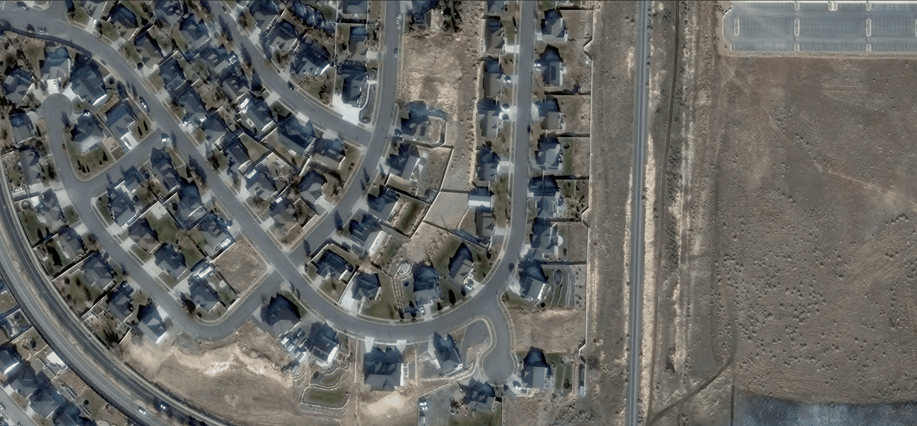
Using satellite images to monitor housing development
Up-to-date satellite data is essential for creating and maintaining accurate maps used in urban planning. These maps help designate construction zones, green spaces, infrastructure networks, and more, ensuring well-organized and sustainable city growth.
Monitoring and analyzing land use changes
Satellite imagery enables continuous tracking of land use changes, such as urban expansion, deforestation, and shifts in agricultural patterns. Regular image updates allow for monitoring large-scale transformations and identifying areas that require intervention in spatial planning.
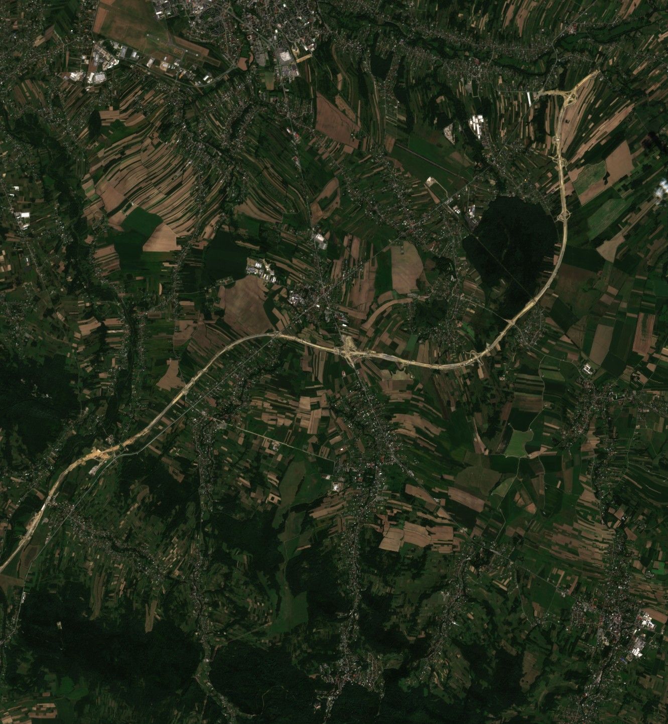
Infrastructure planning
Satellite imagery provides precise information about existing infrastructure and space available for new investments. This makes it possible to create maps and spatial models that support decision-making processes regarding the construction of new roads, bridges, railways, airports, or residential estates. Furthermore, analyzing satellite imagery enables the identification of areas with the greatest development potential, which is especially important in rapidly growing urban areas.
See how precisely the progress of road infrastructure development can be tracked using satellite imagery.
Environmental monitoring
One of the most important applications of satellite imagery is monitoring changes in the natural environment. These images allow observation of processes such as:
- deforestation,
- soil degradation,
- changes in the extent of water bodies,
- the development of built-up areas.
In the context of spatial planning, monitoring these processes is crucial for making decisions about protecting valuable natural areas and controlling urban sprawl.
Spatial data management
GIS systems that use satellite data allow for advanced spatial analysis, trend identification, and simulation of various planning scenarios.
Assessment of ground conditions
Satellite imagery enables assessment of terrain topography, which is crucial when planning construction, especially in areas with diverse terrain.
It can also help identify areas prone to landslides, floods, or other environmental threats, which also affects the decision-making of planners and urban developers in shaping spatial development.
Challenges and limitations of using satellite imagery in spatial planning
However, the use of satellite imagery also involves certain challenges. The costs of acquiring and processing satellite data can be high, which may limit the availability of these technologies for smaller municipalities and regions.
Interpretation of satellite data requires specialized knowledge, which poses challenges for public administration in terms of training and employing adequately qualified specialists.
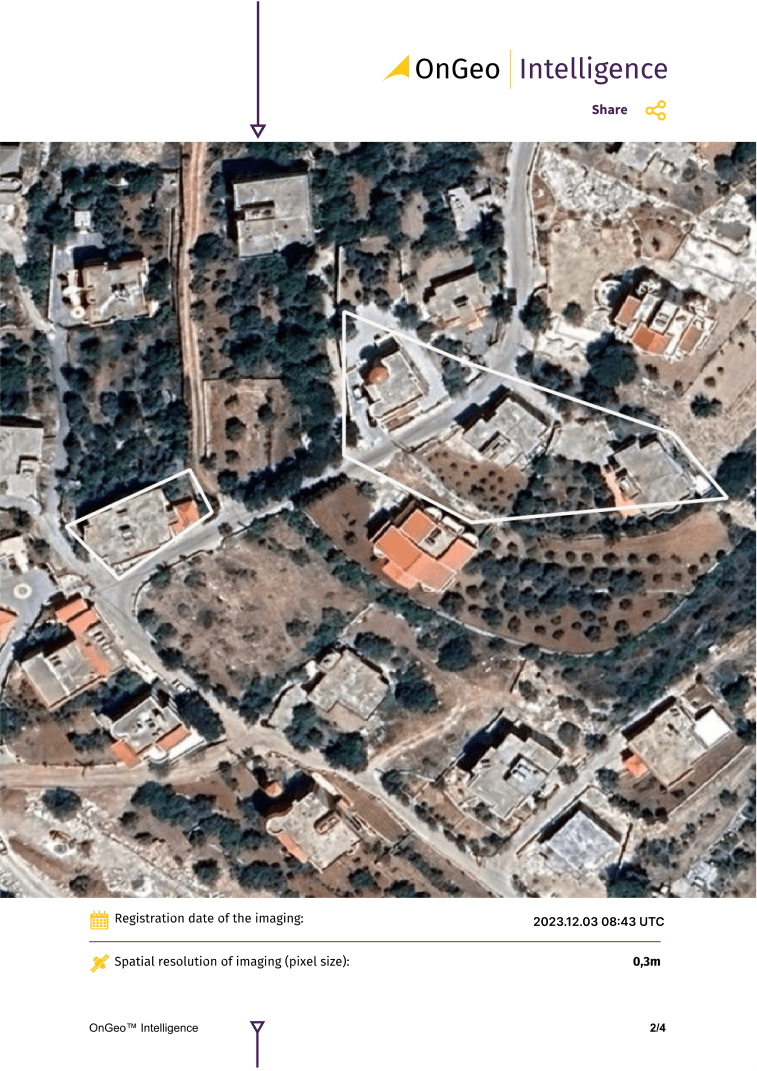
The good news is that there are solutions and services that provide satellite imagery in a fast and simple way.
You can download high resolution satellite imagery in few minutes.
Order precise satellite imagery from Ongeo Intelligence.
high quality satellite photos without registration
no contracts and subscriptions
monitoring land changes
supporting documentation of evidence.
Investing in the Future of Cities and Regions
Satellite imagery is not just a tool; it's a revolution in spatial planning. Thanks to it, we can look at our cities and regions from a completely new perspective. We can better understand how space functions and make decisions that will help us create better, more sustainable places to live.
Satellite data plays an important role in spatial planning of both urban and rural landscapes. By using EO data, you can review the area of interest and conduct complex analyses. Investing in access to satellite data is an investment in a better future.
Wondering how satellite imagery can help your work?
We're happy to help you. We provide access to high-quality imagery and support in its analysis. Check our offer and see for yourself how much you can gain by looking at the Earth from space.
Order Satellite Imagery Report Ongeo™ Intelligence today.
Related articles
- Why Accuracy Matters in High-Resolution Satellite Imagery
- Satellites spot plastic waste on beaches: A new era in remote sensing for marine cleanup
- Detecting asbestos roofs using Satellite Imagery
- Earth Observation: How Satellite Views of Your House Are Now at Your Fingertips
- Satellite Maps: Viewing Your Neighborhood and Beyond
- Essential Tips for Interpreting Satellite Imagery Like a Pro
- Detection of Illegal Construction in Satellite Images