A Guide to Maxar's Analysis-Ready Data (ARD)
In a world flooded with raw satellite imagery, Maxar's Analysis-Ready Data (ARD) offers a streamlined gateway from pixels to insights. Learn how ARD reshapes the landscape of geospatial analytics with ready-to-use imagery stacks tailored for precision, speed and scalability.
What Is Maxar Analysis-Ready Data and Why It Matters
When working with satellite imagery, time is often the most limiting factor. Data scientists, analysts and decision-makers alike spend significant effort on preprocessing tasks – correcting, aligning and calibrating raw images before any actual analysis can begin. That’s where Maxar’s Analysis-Ready Data (ARD) steps in to transform how geospatial intelligence is delivered and used.
Maxar ARD is a curated, preprocessed and standardized stack of satellite imagery designed to be "ready out of the box" for immediate analytical applications. Each ARD image has undergone rigorous preprocessing, including atmospheric correction, orthorectification and pixel-level alignment using Maxar’s proprietary Bundle Block Adjustment (BBA). These processes remove noise, enhance consistency and ensure that time-series stacks of imagery are precisely aligned – a critical requirement for change detection, object recognition and feature extraction.
How Maxar ARD Streamlines Geospatial Workflows
The importance of ARD lies not just in its technical refinement but in its practical impact on workflows. Instead of spending days or even weeks preparing data, users can directly feed ARD into machine learning models, GIS applications, or AI pipelines. This significantly accelerates the pixel-to-answer journey while reducing storage needs and lowering operational costs.
With API-based access and cloud delivery integration, Maxar ARD allows users to search, filter and order imagery that meets specific criteria: resolution, cloud cover, acquisition date and area of interest (AOI). The imagery is delivered as pansharpened RGB, multispectral and panchromatic GeoTIFFs, complete with extensive metadata and cloud masks, all optimized for cloud-native environments such as AWS. This seamless access reduces the need for manual handling and supports real-time or near-real-time analytics.
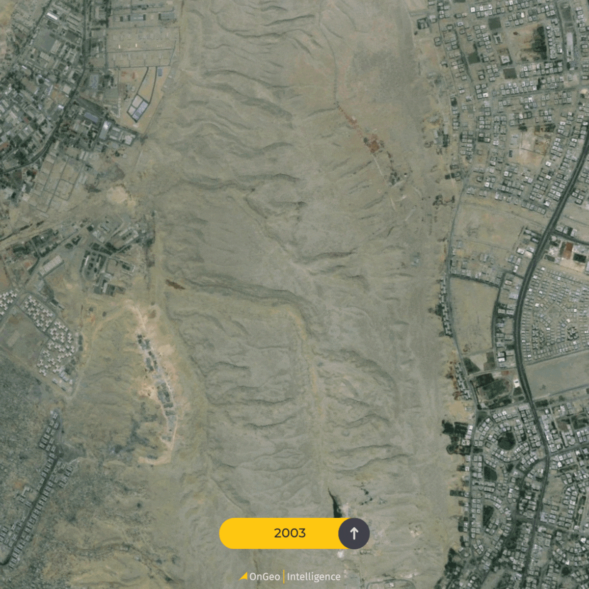
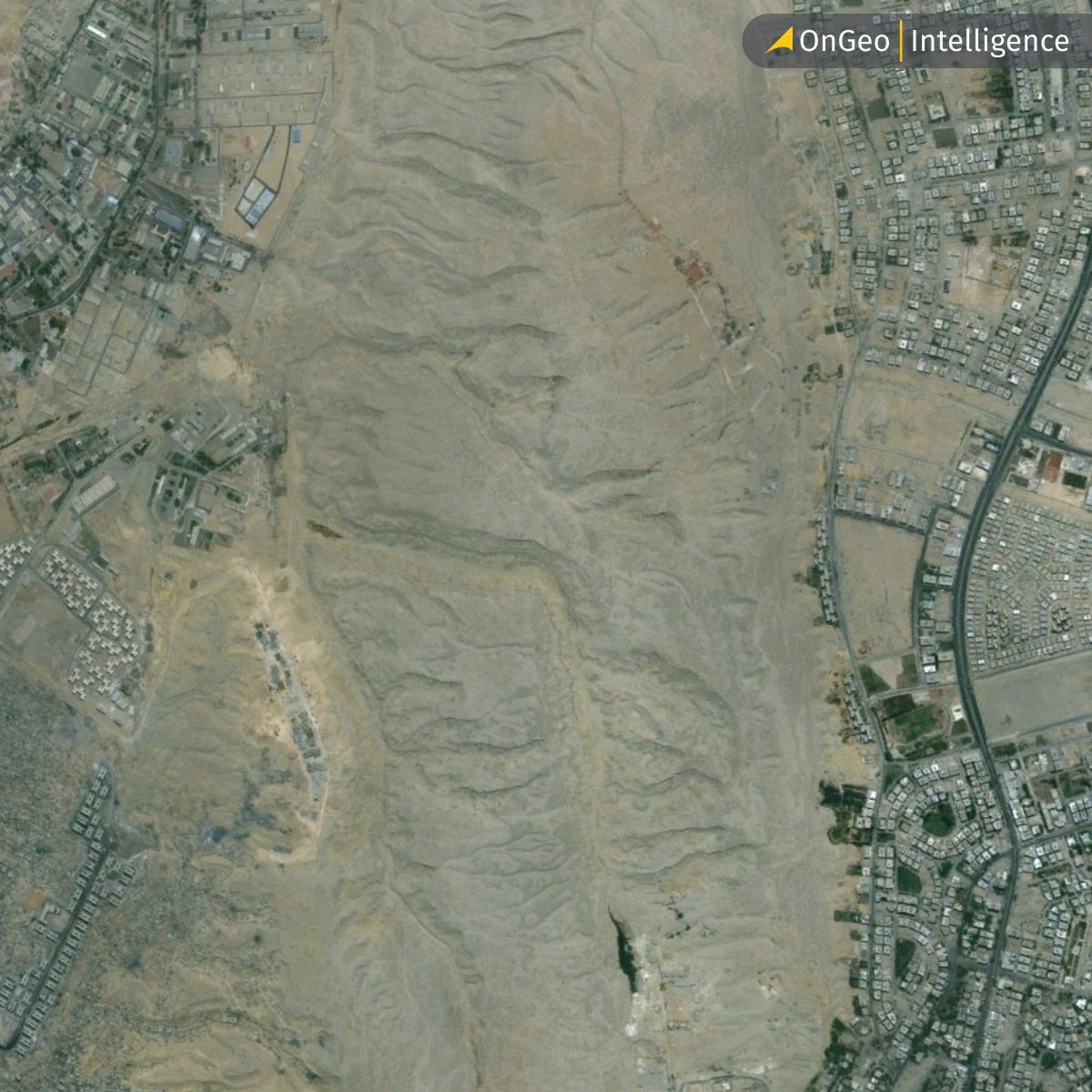
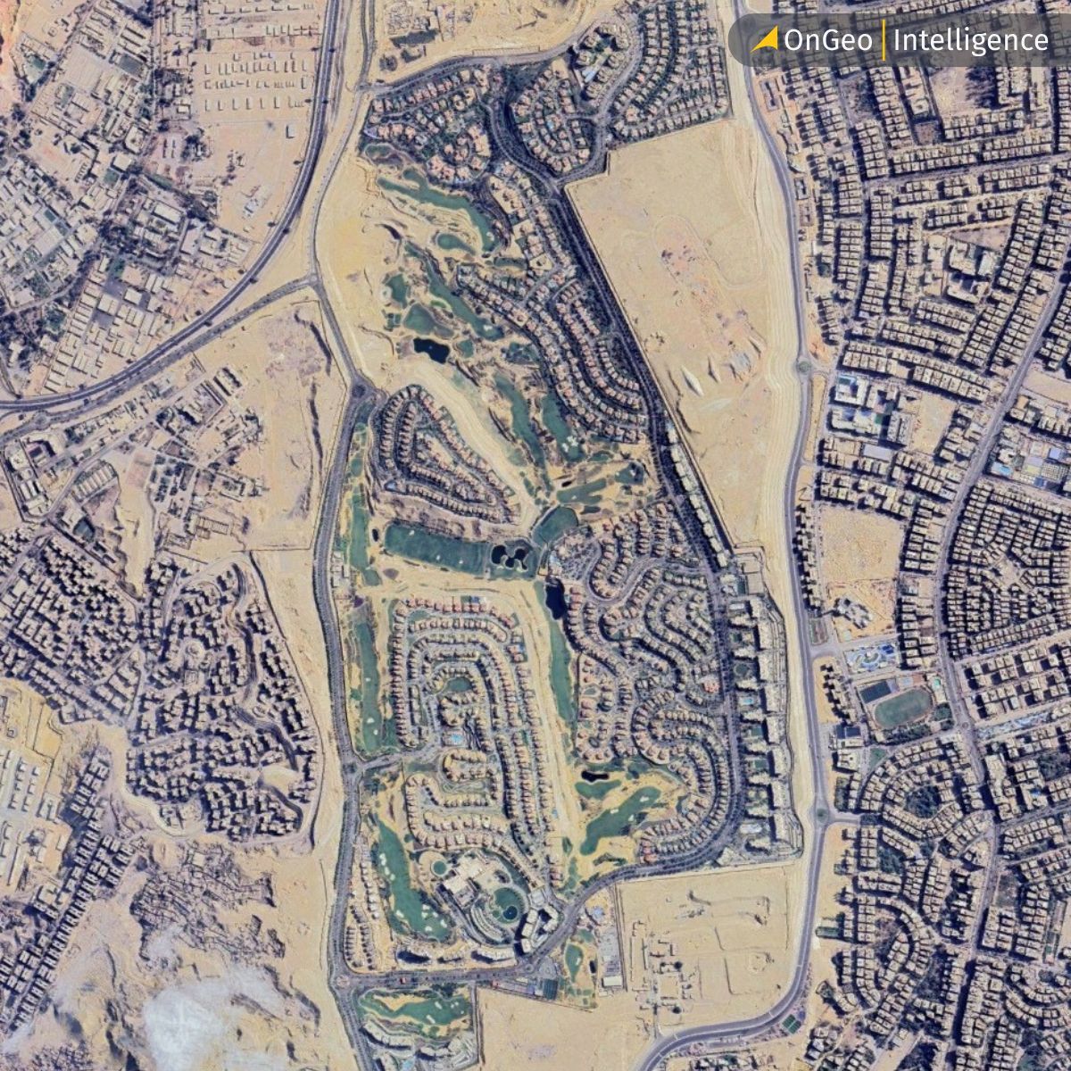
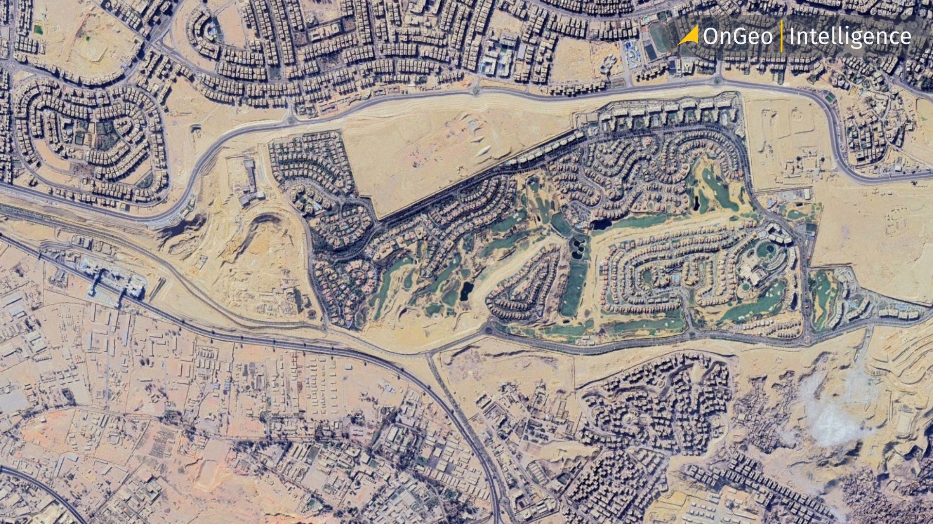
Cairo, Egypt – 2003 vs. 2024
Real-World Applications: Maxar ARD in Action
But the real power of Maxar ARD is best illustrated through its applications. For instance, the award-winning road safety initiative by Agilysis in Africa used Maxar ARD to extract key road features across Kenya and Ethiopia. By leveraging ARD’s aligned time-series stacks, they applied machine learning algorithms to map traffic flow, speed profiles and road hazards -supporting The World Bank's efforts to reduce road fatalities. The pre-aligned, radiometrically consistent imagery accelerated their analysis and made results available faster and more reliably than traditional methods.
In another case, Maxar data scientists compared object detection models trained on standard image strips versus ARD. The results showed that models trained on ARD achieved an average precision (AP50) score that was 12% higher, learned faster and required fewer training iterations. The consistency in pixel resolution, alignment and color balancing proved essential in detecting features like vehicles – even under challenging conditions such as shadows, cloud interference, or high off-nadir angles.
Key Benefits of Maxar ARD for Scalable Geospatial Solutions
Maxar ARD empowers organizations to scale their geospatial analytics with unmatched efficiency and precision. By eliminating the complexities of data preprocessing, ARD enables users to focus on deriving actionable insights. Its key benefits include:
Time Savings: Preprocessed imagery reduces preparation time from weeks to hours, accelerating project timelines.
Enhanced Accuracy: Consistent alignment and radiometric calibration improve the reliability of machine learning and AI-driven analyses.
Cost Efficiency: Reduced storage requirements and streamlined workflows lower operational expenses.
Scalability: Cloud-native delivery and API access support large-scale, global applications with ease.
These advantages make ARD a game-changer for industries ranging from urban planning to environmental conservation.
Why ARD Is Ideal for Global Monitoring and Mapping
For global monitoring applications, ARD simplifies the creation of large-scale land use and land cover maps. Its consistent quality across time and geography makes it ideal for longitudinal studies, environmental monitoring, disaster response and infrastructure planning.
Ultimately, Maxar’s ARD is not just a product – it’s a strategic enabler for any organization relying on satellite imagery for decision-making. Whether you're mapping urban growth, detecting illegal logging, planning smart cities, or deploying AI at scale, ARD allows you to skip the tedious setup and go straight to insight. And in an era where timely information is everything, that makes all the difference.
Related articles
- Maxar and Satellogic Partner to Advance Geospatial Intelligence
- A Guide to Maxar’s Persistent Change Monitoring (PCM)
- Planet Labs: A Guide to Their Satellite & Geospatial Intelligence
- WorldView Legion: Advanced Satellite Imaging & Observation
- How to get free satellite images on your phone
- War in Sudan: How Satellite Imagery Reveals Hidden Atrocities