War in Sudan: How Satellite Imagery Reveals Hidden Atrocities
On October 26, 2025, the world woke up to shocking news - reports of a massacre in Al-Fashir, the capital of North Darfur. Satellite imagery and eyewitness accounts revealed widespread destruction, mass killings, and the burning of entire neighborhoods. Yet, while global attention remains focused on the wars in Ukraine and Gaza, a forgotten conflict continues to devastate Sudan - largely unseen, unreported, and undocumented.
Since April 2023, fighting between the Sudanese Armed Forces (SAF) and the Rapid Support Forces (RSF) has plunged the country into chaos. Entire cities have been razed, millions displaced, and humanitarian access severely restricted. In the absence of journalists or international observers, the truth about what is happening on the ground often depends on what can be seen from above.
In this information vacuum, satellite imagery has become an essential tool for uncovering atrocities and verifying ground realities. High-resolution data from commercial satellites and open Earth observation missions now provide independent evidence of violence - mapping burned villages, destroyed infrastructure, and mass movements of displaced people across Darfur, Chartum and Kordofan.
Background: The Conflict Behind the Al-Fashir Massacre
The massacre in Al-Fashir did not happen in isolation. It is part of a broader civil conflict that erupted in April 2023, when tensions between Sudan’s two most powerful military factions - the Sudanese Armed Forces (SAF), led by General Abdel Fattah al-Burhan, and the Rapid Support Forces (RSF), commanded by Mohamed Hamdan Dagalo (“Hemedti”) - escalated into full-scale war.
Initially allies during the 2021 military coup that derailed Sudan’s democratic transition, the two groups turned against each other over control of the state, economy, and armed forces. What began as a political power struggle in Khartoum quickly spread across the country, with the Darfur and Kordofan regions bearing the brunt of the violence.
In Darfur, long a flashpoint for ethnic conflict, the RSF and allied militias have been accused of conducting systematic attacks on civilians, particularly targeting non-Arab communities. Reports by the United Nations, Amnesty International, and Human Rights Watch describe patterns of mass killings, sexual violence, and village burnings - actions reminiscent of the early 2000s Darfur genocide.
By mid-2025, Al-Fashir, one of the last remaining strongholds under SAF control, became the focal point of the conflict. The RSF’s months-long siege culminated in the October 2025 massacre, during which hundreds of civilians were reportedly killed and large parts of the city set ablaze. Due to restricted access and communication blackouts, independent verification was difficult - until satellite imagery revealed undeniable evidence of widespread destruction.
This event underscored a critical reality of modern warfare: when access to the ground is impossible, space-based intelligence becomes the primary witness.
What Satellite Imagery Reveals About the Al-Fashir Massacre
Recent high-resolution satellite imagery has provided clear, independent evidence of the atrocities that unfolded in Al-Fashir in late October 2025. Images analyzed by conflict-monitoring organizations and research labs show widespread destruction, clusters of human remains, and tactical military movements consistent with targeted killings by the Rapid Support Forces (RSF).
Key Findings from Remote Sensing
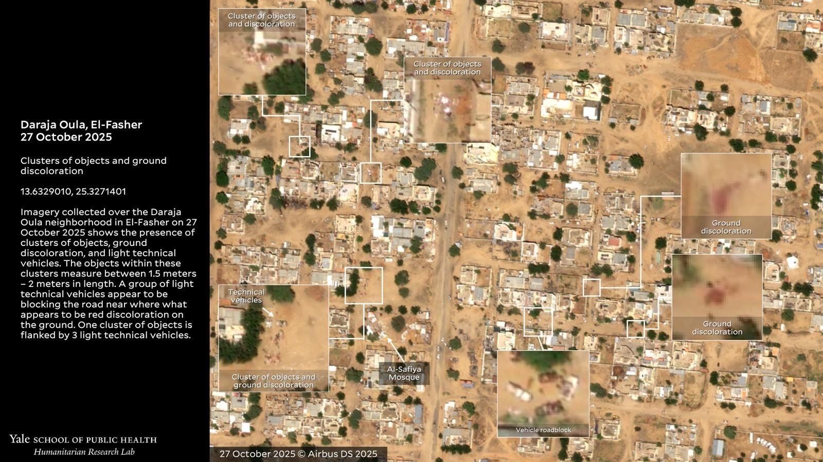
Satellite imagery from October 27–28, 2025 shows multiple clusters of objects consistent with human bodies in open areas, along escape routes, and near hospital compounds.
Analysts identified reddish discoloration patterns on the ground - interpreted as possible blood stains or mass body disposal zones - particularly near the city’s western and southern outskirts.
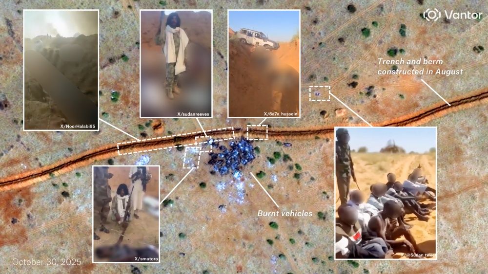
A series of sand berms and barricades constructed by the RSF encircled sections of the city, including known civilian escape routes. The presence of body clusters near these berms suggests civilians may have been killed while attempting to flee.
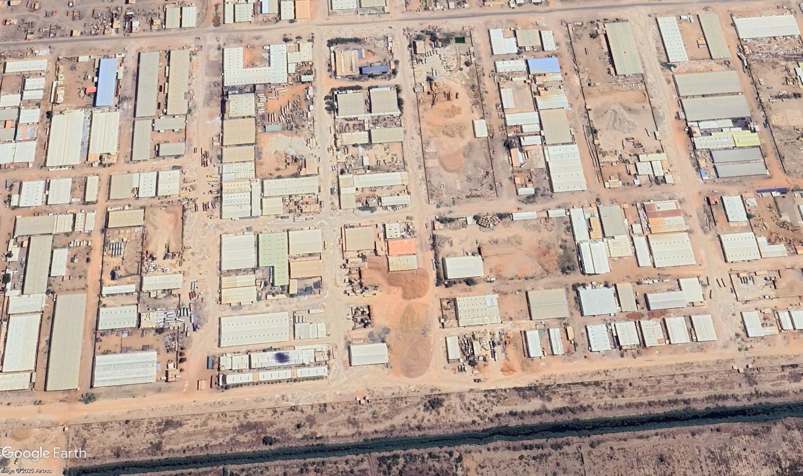
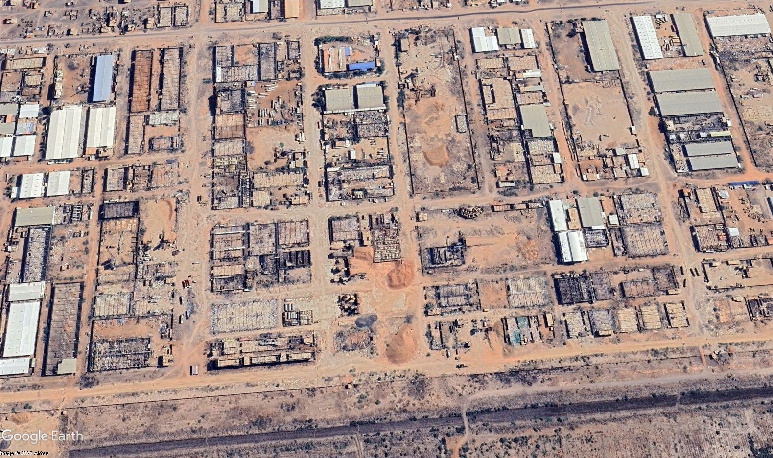
Imagery of the Daraja Oula neighborhood shows RSF vehicles arranged in blockades and tactical formations, implying organized clearance operations rather than random violence.
Population movement indicators show that after the RSF’s entry, civilian displacement abruptly stalled, suggesting killings, detentions, or restrictions on movement.
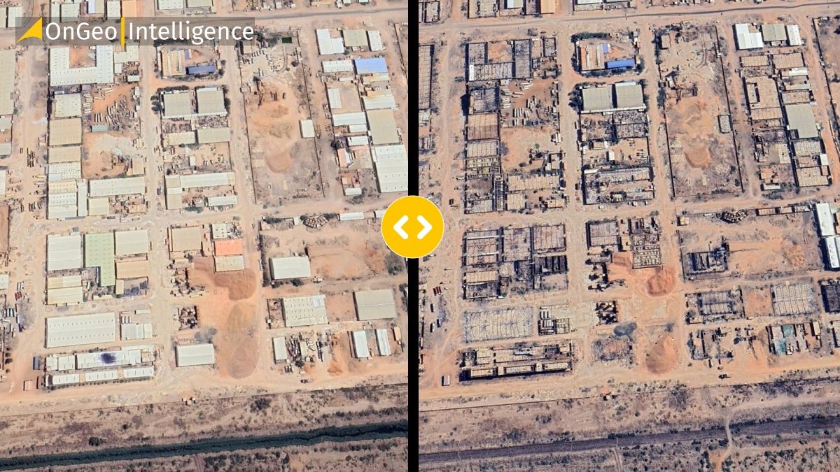
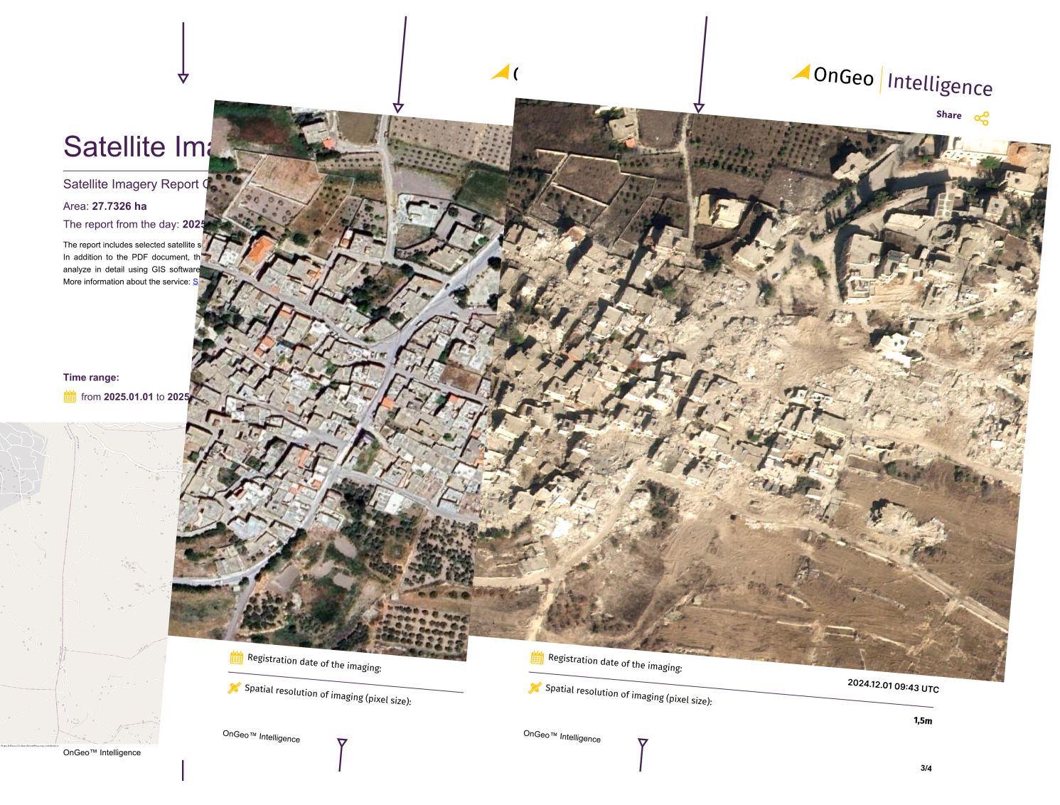
Before and afrer satellite imagery, west Darfur city of El Geneina. Airbus / Google Earth
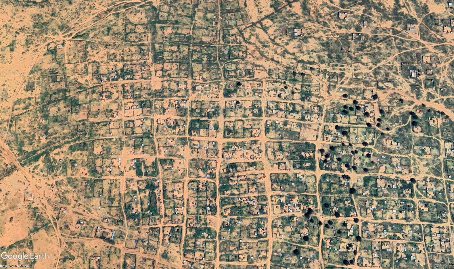
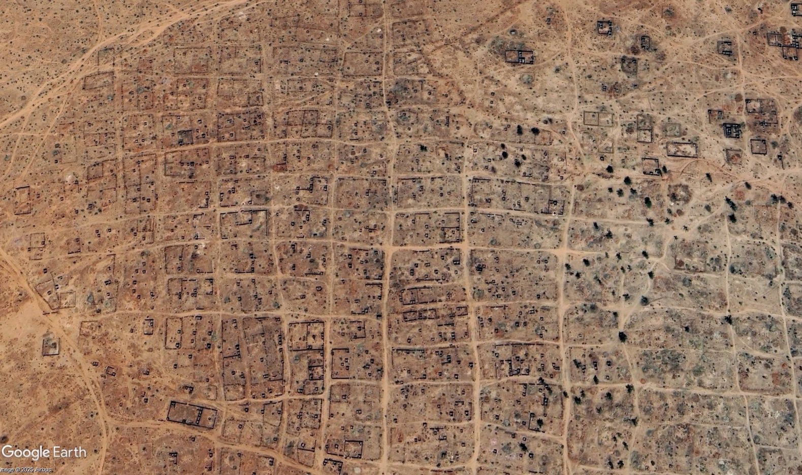
Before and afrer satellite imagery, Chartum. Airbus / Google Earth
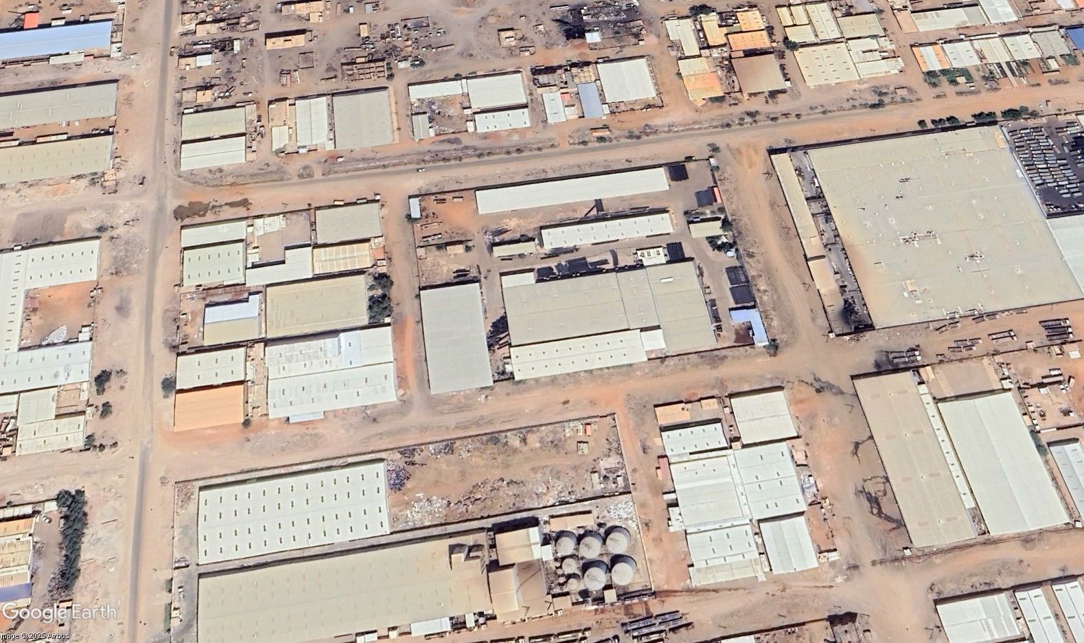
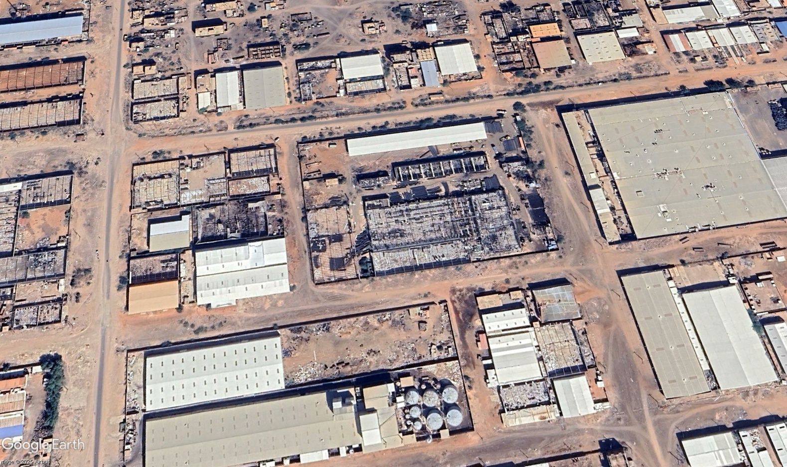
Before and afrer satellite imagery, Chartum. Airbus / Google Earth
What the Imagery Implies
The spatial distribution of apparent bodies and burn scars across civilian zones strongly suggests mass killings rather than collateral combat damage. The concentration of violence near hospitals, residential areas, and barricades points to systematic targeting of civilians.
Patterns of vehicle deployment and the sequencing of destruction visible from space indicate coordinated operations - fitting a broader RSF strategy of siege and control seen across Darfur. When cross-referenced with open-source videos and eyewitness testimony, the imagery forms a verifiable picture of deliberate, large-scale violence.
Why This Matters
The Al-Fashir massacre highlights the growing importance of geospatial intelligence (GEOINT) in documenting conflicts. When access for journalists and investigators is blocked, remote sensing becomes the only reliable witness.
The Importance of Satellite Imagery in Conflict Zones
1. A Tool for Truth and Accountability
Satellite imagery provides objective, time-stamped evidence that can verify claims, track events, and support international investigations. In Al-Fashir, imagery exposed destruction and killings that ground reports alone could not confirm.
2. Monitoring Vast and Inaccessible Areas
Sudan’s conflict spans immense terrain. High-frequency constellations like: Airbus, Maxar/Vantor, PlanetScope and Sentinel-2 allow near-daily monitoring of changes, from new burn scars to roadblocks or population shifts.
3. Integrating AI and Geospatial Analysis
AI-driven change detection tools can flag anomalies such as destroyed buildings or rapid land-surface changes across huge datasets. This enables near real-time crisis detection and response.
4. Preserving Evidence Before It Vanishes
Physical evidence in conflict zones is often destroyed. Satellite imagery creates a permanent digital record, forming a verifiable timeline of violence useful in legal and humanitarian contexts.
5. Supporting Humanitarian Action
By mapping destruction and displacement, satellite data helps humanitarian agencies plan relief operations, identify safe routes, and locate new settlements or refugee camps.
A New Era of Geospatial Witnessing
The Al-Fashir massacre illustrates a defining shift in modern warfare: satellites are the silent witnesses of history. They record what governments deny and what survivors cannot safely testify. As access to high-resolution and open-source imagery expands, geospatial intelligence is reshaping humanitarian monitoring and redefining truth-telling in the age of disinformation.
Limitations and Analytical Considerations
Satellite imagery cannot confirm individual identities or exact victim counts. Environmental factors such as cloud cover, lighting, and image resolution can obscure details. Nonetheless, the consistency and scale of visual indicators provide compelling, high-confidence evidence of atrocities.
Where OnGeo Intelligence Applies
At OnGeo Intelligence, geospatial technology bridges the gap between raw data and humanitarian action. The Al-Fashir case demonstrates how integrated OnGeo workflows transform satellite imagery into actionable intelligence for crisis response and documentation.
Conflict Verification and Reporting – Combining high-resolution imagery, open-source data, and AI-assisted analysis, OnGeo methodologies verify incidents.
Geospatial Forensics and Accountability – Structured analysis pipelines support evidence archiving, mapping, and correlation, creating verified datasets for humanitarian or legal use.
Decision Support for Aid Operations – OnGeo’s geospatial products guide NGOs and relief agencies, identifying access routes, damage zones, and displacement patterns to allocate resources effectively.
In conflicts like Sudan’s, the combination of open satellite data, AI, and expert interpretation represents not just technological progress but a moral obligation: to see, record, and preserve the truth when it is otherwise hidden.
Final Thoughts
The tragedy in Al-Fashir shows how modern conflict has evolved - not only in tactics but also in how truth itself is contested. In such environments, satellite imagery becomes more than a scientific tool; it becomes an instrument of justice.
From Darfur to Gaza, from Khartoum to Kyiv, the same principle holds: even when witnesses are silenced and borders are closed, the Earth continues to speak through its data. The mission of platforms like OnGeo Intelligence is to ensure that every image captured from orbit helps turn the invisible into visible - and that no atrocity remains unseen.
Related articles
- Satellite imagery of Gaza reveals the massive scale of destruction
- Satellite Images Reveal Devastating Before-After Views of Gaza City
- Israeli Strikes on Natanz: A Satellite Imagery Analysis
- Lebanon Bombing: Satellite Images Reveals Scale of Destruction
- Maxar Restores Ukraine’s Access to Satellite Imagery
- Aerial photos as evidence in the case
- Myanmar Earthquake: Damage Revealed by Maxar Satellite Images
- Satellite Images from Sentinel-2 Available to Everyone