🌍 Capture the world at 100% OFF! Use code ongeo100on 10 meters satellite image resolutions – limited time only! Higher resolution satellite images remain subject to payment.
🌍 Capture the world at 100% OFF! Use code ongeo100on 10 meters satellite image resolutions – limited time only! Higher resolution satellite images remain subject to payment.
Satellite Image Resolution
2024-08-30
(Article updated:
2024-11-29
)
~ 5 min
The resolution of satellite images is one of the most crucial parameters that significantly affects the quality and overall usefulness of satellite imagery across various applications. In this paper, we will delve into the concept of spatial resolution, explore the different types of satellite image resolution, and provide a comparison with the resolutions of images obtained through aircraft and drones.
High-Quality Satellite Imagery, Hassle-Free
Explore any location on Earth with precision. Order a detailed Satellite Imagery Report—no sign-ups, no contracts. Delivered in a clear PDF for instant insights.
The spatial resolution of satellite images plays a vital role in determining the level of detail with which objects can be observed in the image. It serves as a measure of the minimum distance at which two distinct points on the Earth's surface can be recognized as separate entities. Essentially, the higher the resolution, the smaller the objects that can be discerned in the image. This aspect is particularly important in fields such as geodesy, urban planning, environmental monitoring, and defense. Spatial resolution is typically expressed in meters, which indicates the size of the smallest pixel on the Earth's surface. For instance, if the resolution is 1 meter, each pixel in the image represents a square area with a side length of 1 meter on the Earth's surface. This means that finer details can be captured, allowing for more accurate analysis and interpretation of the data.
Types of Satellite Image Resolution
Satellite image resolution can be categorized into several types based on their application and the technology employed to acquire them. Generally, we can distinguish three main types of resolution: low, medium, and high.
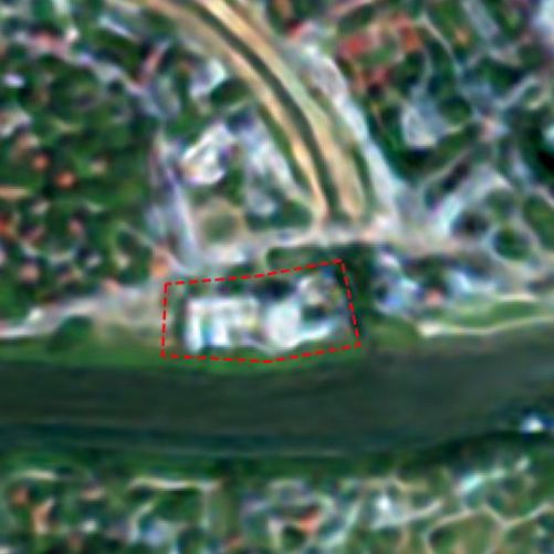
Low Resolution
Low resolution satellite image (NOAA)
Images classified as low resolution have a spatial resolution that ranges from several tens to hundreds of meters. These images are often utilized for monitoring global climate changes, tracking ice cover, observing oceans, or assessing large forest areas. Examples of satellites that provide low-resolution data include MODIS, which offers resolutions between 250 to 1000 meters, and NOAA AVHRR, which has a resolution of approximately 1100 meters. While these images may lack fine detail, they are invaluable for understanding broader environmental trends and changes.
Medium Resolution
This category encompasses images with a resolution that ranges from several meters to several dozen meters. Such images are employed for more detailed analyses, including land use monitoring, agricultural assessments, and natural resource management. Notable examples of satellites providing medium-resolution imagery are the Landsat satellites, which offer a resolution of 30 meters, and Sentinel-2, which provides resolutions between 10 to 20 meters. These images strike a balance between detail and coverage, making them suitable for a variety of applications.
Medium resolution satellite image (Sentinel-2)
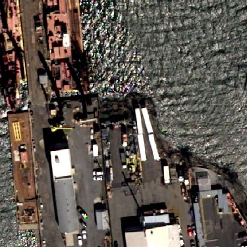
High and Very High Resolution
Very high resolution (VHR) satellite image (Pléiades Neo)
Images that possess a resolution below 1 meter, and even down to several dozen centimeters, are utilized in applications that require high precision. These applications include urban mapping, infrastructure planning, disaster monitoring, and intelligence activities. Examples of satellites that offer such high spatial resolution include WorldView-3, which provides a remarkable resolution of 31 centimeters, GeoEye-1 with a resolution of 41 centimeters, and Pleiades, which offers a resolution of 50 centimeters. The ability to capture such fine details allows for more accurate assessments and decision-making in critical areas.
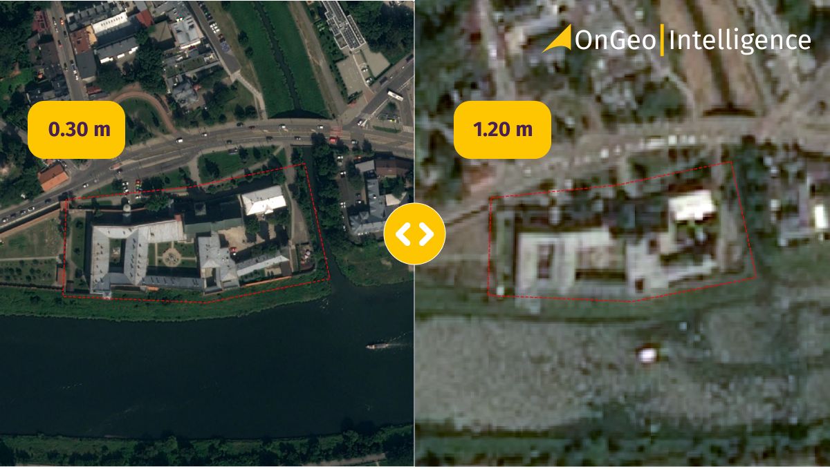
Pixel Value - Spatial Resolution
Spatial resolution characterizes the terrain size of a pixel - it determines the ability to distinguish objects in a photo. Below I present a sample graphic that illustrates different spatial resolutions:
Different spatial resolutions
Comparison with Aircraft and Drone Image Resolution
While satellite image resolution has reached impressive levels, airborne technologies, such as aircraft and drones, can provide even greater image detail.
Aircraft
Aerial photogrammetry
Aerial photogrammetry, which involves imaging using aircraft, can achieve resolutions at the level of a few centimeters, typically ranging from 5 to 10 centimeters. This level of detail is ideal for tasks that require very high precision, such as detailed urban mapping, infrastructure analyses, and other applications where accuracy is paramount. The ability to capture images at such high spatial resolution allows for a more comprehensive understanding of the area being studied.
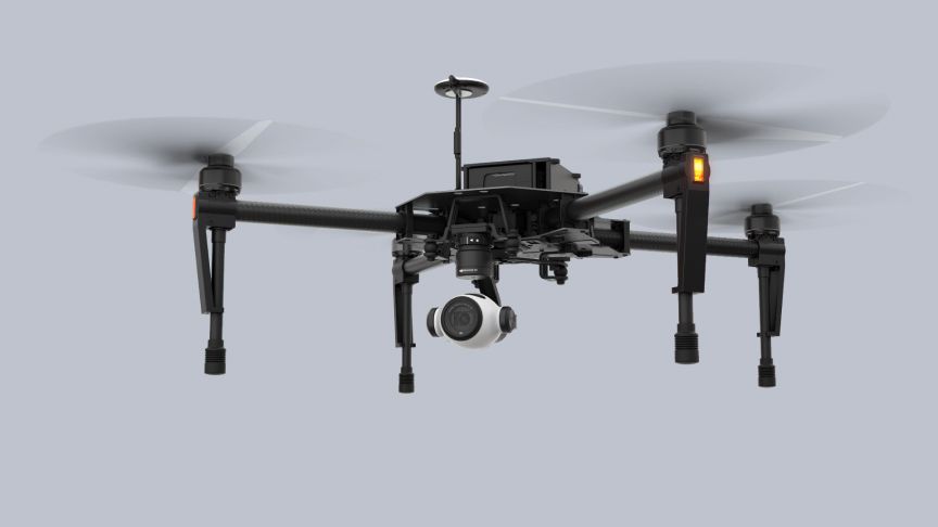
Drones
Drones, or unmanned aerial vehicles (UAVs), have also emerged as powerful tools for capturing high-resolution images. They can fly at lower altitudes compared to traditional aircraft, enabling them to capture images with resolutions that can rival those of aerial photogrammetry. Drones are particularly useful for localized studies, such as monitoring agricultural fields, assessing construction sites, or conducting environmental surveys. Their flexibility and ease of use make them an attractive option for many industries.
Drone for photography
Conclusion
The resolution of satellite images is a key parameter determining their application in various fields. Depending on the needs, we can choose images with low, medium, or high resolution. Although satellite images offer a wide field of view and access to remote areas, aircraft and drones allow for obtaining images with exceptional detail, making them excellent complements to satellite data in many applications. The choice of the appropriate technology depends on the specific task and the required precision of the analyses. In summary, while satellite image resolution provides a broad perspective, the high spatial resolution achievable through drones enhances the ability to conduct detailed assessments, ensuring that professionals can make informed decisions based on accurate and reliable data. This combination of technologies ultimately leads to better outcomes in various industries.
We use cookies to run our website, analyze your use of our services, manage your online preferences & personalize ad content. By accepting our cookies, you'll get relevant content and social media features, personalized ads, and an enhanced browsing experience. To manage your choices, click "Cookie Settings." Necessary cookies are required for the core website functionality and cannot be rejected. For more information, see our Cookie Policy.
About cookies on this site
Cookies used on the site are categorized. Below you can allow or deny some or all of them, except for Necessary Cookies which are required to provide core website functionality. When categories that have been previously allowed are disabled, all cookies assigned to that category will be removed from your browser.
Some cookies are required to provide core functionality. The website won't function properly without these cookies and they are enabled by default and cannot be disabled.
Preference cookies enables the web site to remember information to customize how the web site looks or behaves for each user. This may include storing selected currency, region, language or color theme.
Analytical cookies help us improve our website by collecting and reporting information on its usage.
Marketing cookies are used to track visitors across websites to allow publishers to display relevant and engaging advertisements. By enabling marketing cookies, you grant permission for personalized advertising across various platforms.
The cookies in this category have not yet been categorized and the purpose may be unknown at this time.