🌍 Capture the world at 100% OFF! Use code ongeo100on 10 meters satellite image resolutions – limited time only! Higher resolution satellite images remain subject to payment.
🌍 Capture the world at 100% OFF! Use code ongeo100on 10 meters satellite image resolutions – limited time only! Higher resolution satellite images remain subject to payment.
Satellite images reveal devastating floods in Poland
2024-09-20
(Article updated:
2024-11-29
)
~ 4 min
Recent satellite imagery reveals the unprecedented extent of floods in Poland. We present selected flood-affected areas through satellite images obtained from OnGeo-Intelligence.com. These images provide crucial information for emergency services and decision-makers. Photos from the European Space Agency's (ESA) Sentinel-2 satellite show vast swathes of the country submerged, underscoring the urgent need for action in response to this escalating disaster.
High-Quality Satellite Imagery, Hassle-Free
Explore any location on Earth with precision. Order a detailed Satellite Imagery Report—no sign-ups, no contracts. Delivered in a clear PDF for instant insights.
New satellite images expose the dramatic landscape of flooded areas
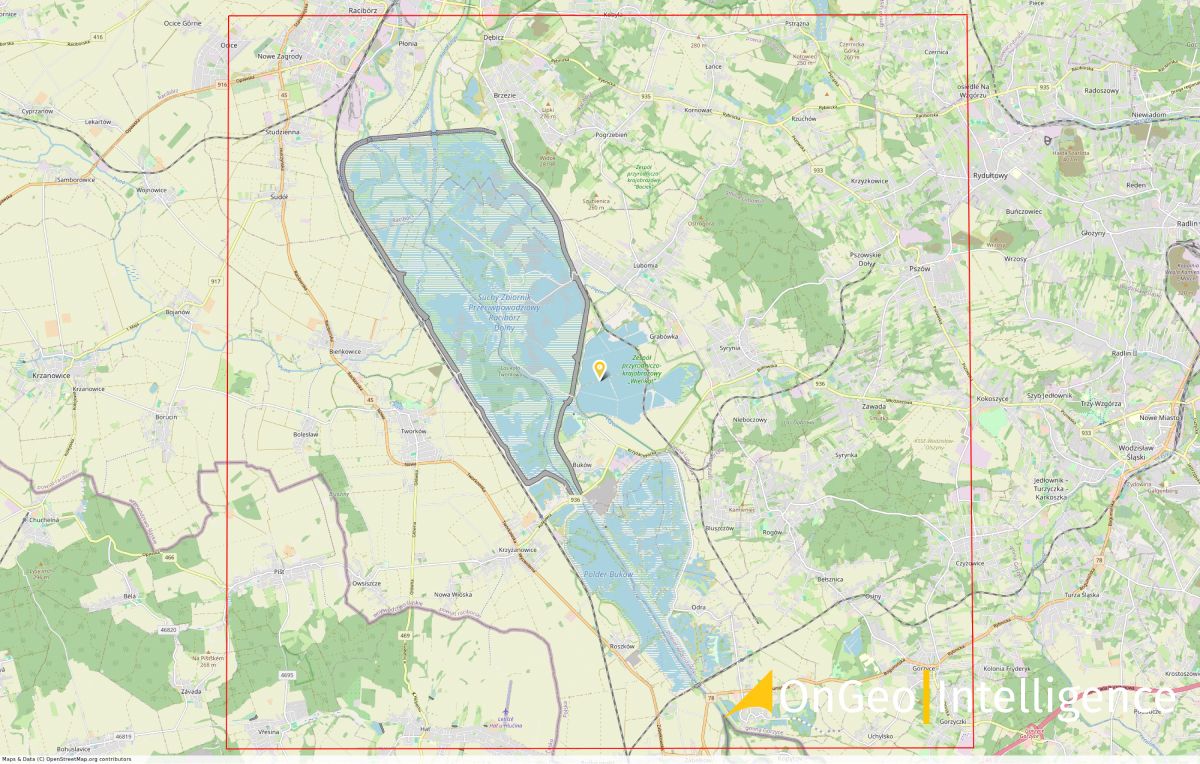
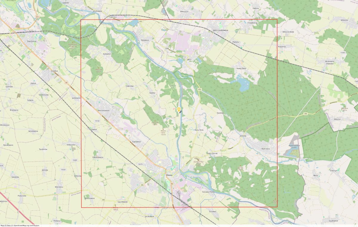
Satellite maps, available in the OnGeo Intelligence Satellite Image Report, precisely depict the flood-affected regions. The extent of the flooded areas significantly exceeds previous estimates, further emphasizing the importance of this data for effective crisis management.
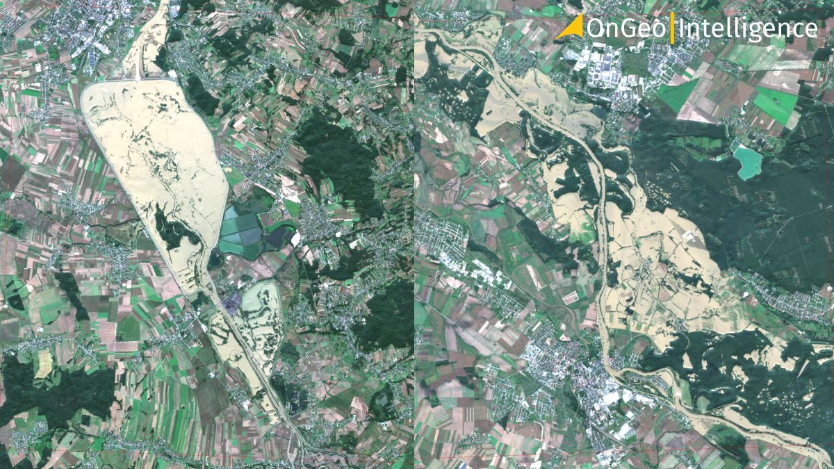
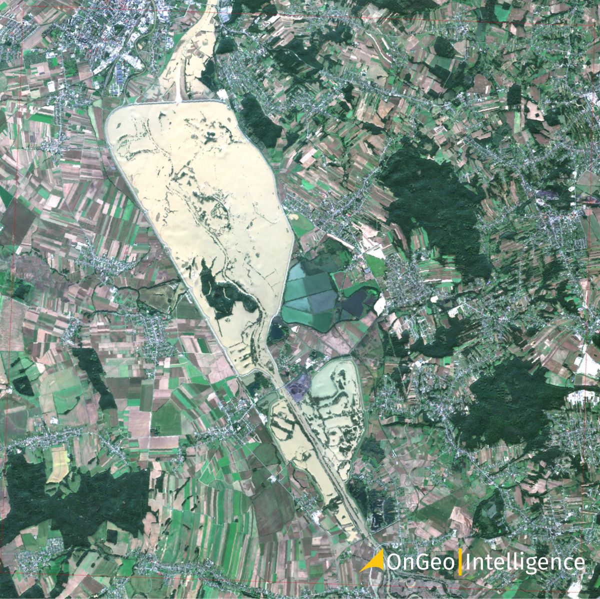
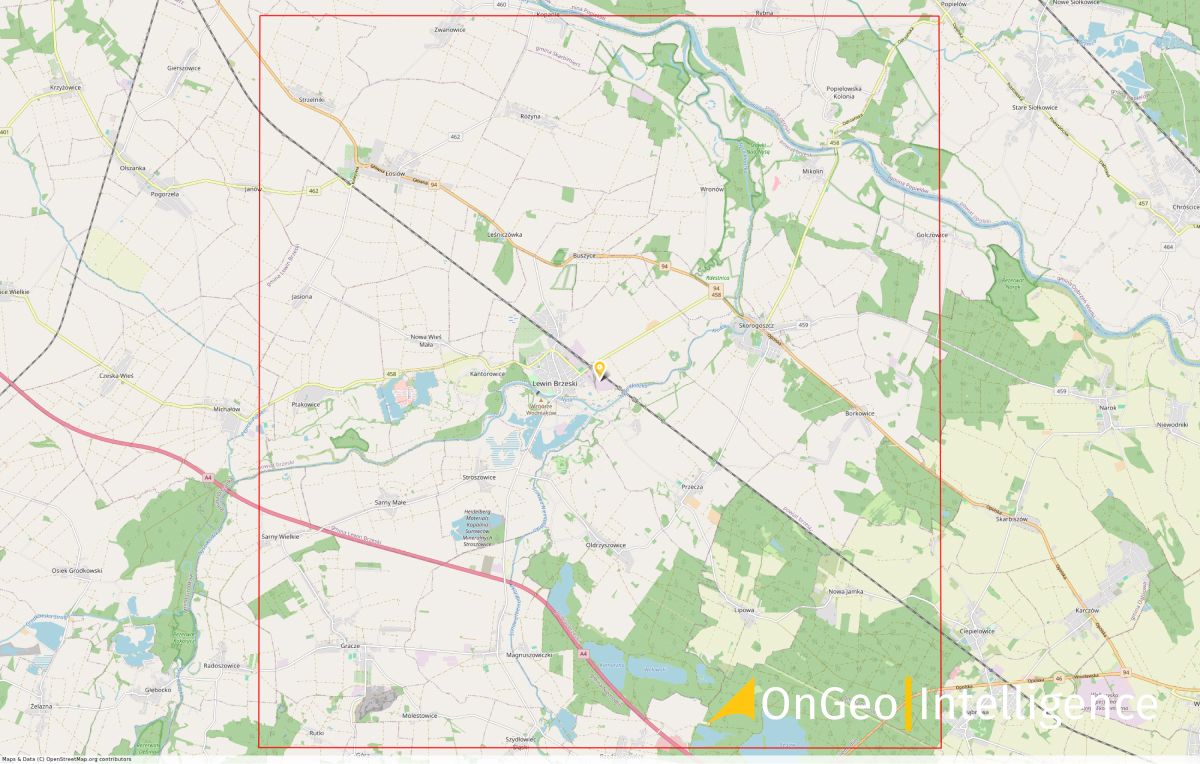
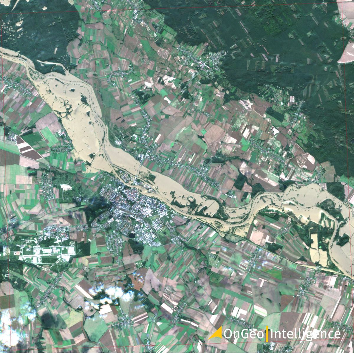
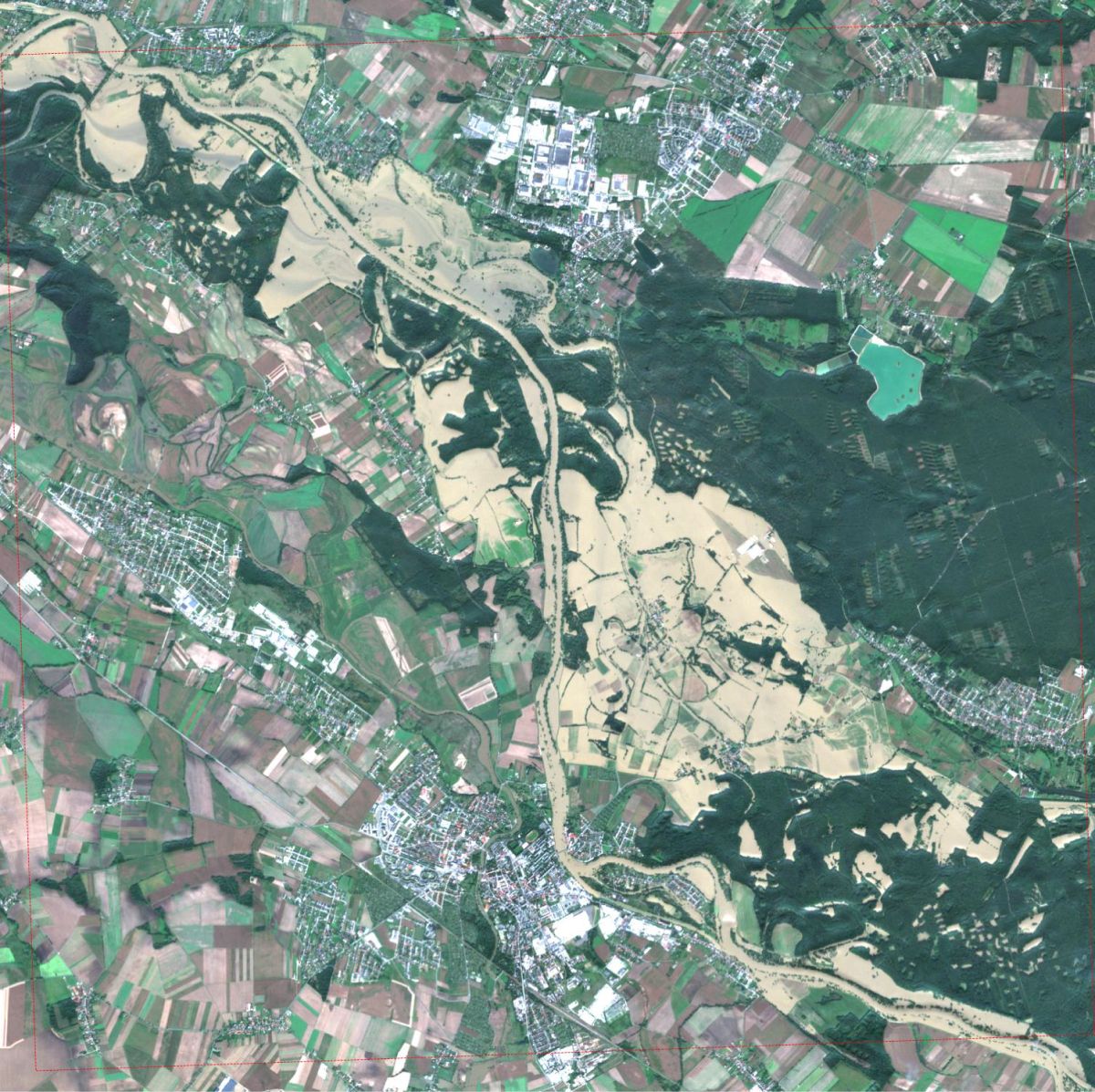
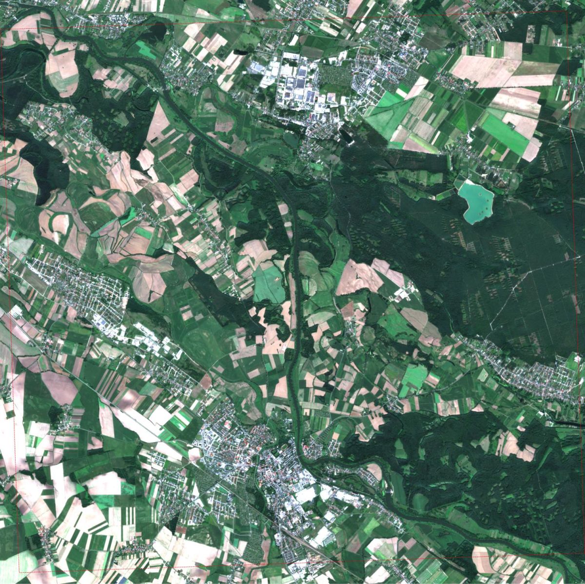
Racibórz Dolny (Odra) - Floods Captured in Satellite Images
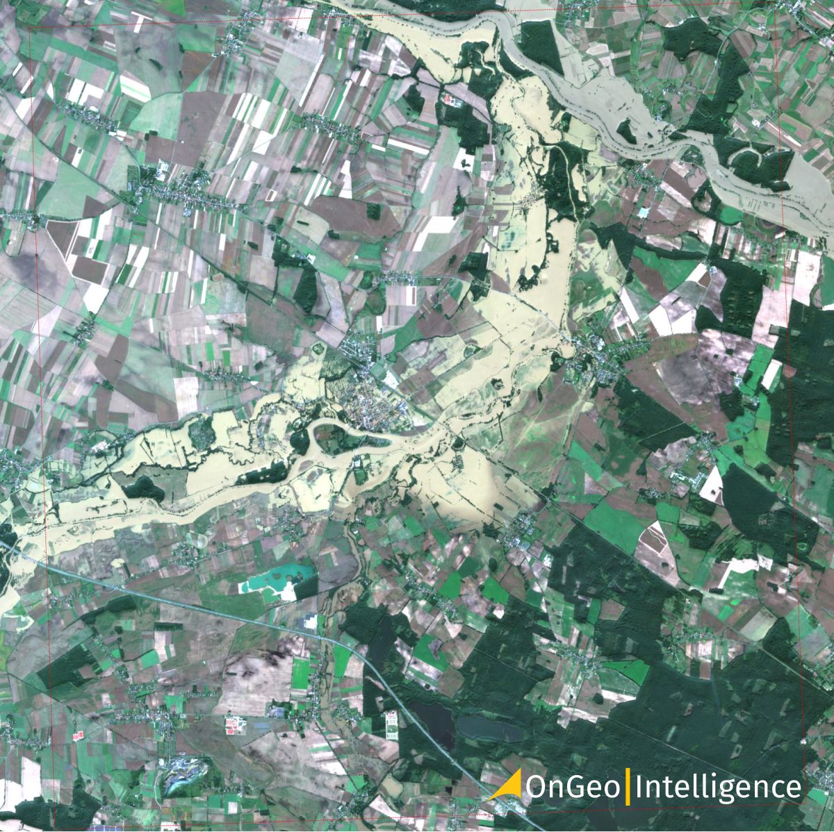
Satellite Image: Flooded areas in Oława (2024.09.18, 09:50 UTC)
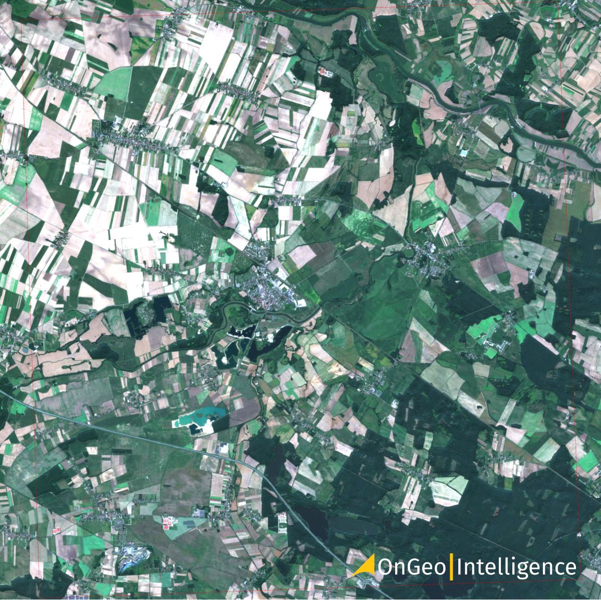
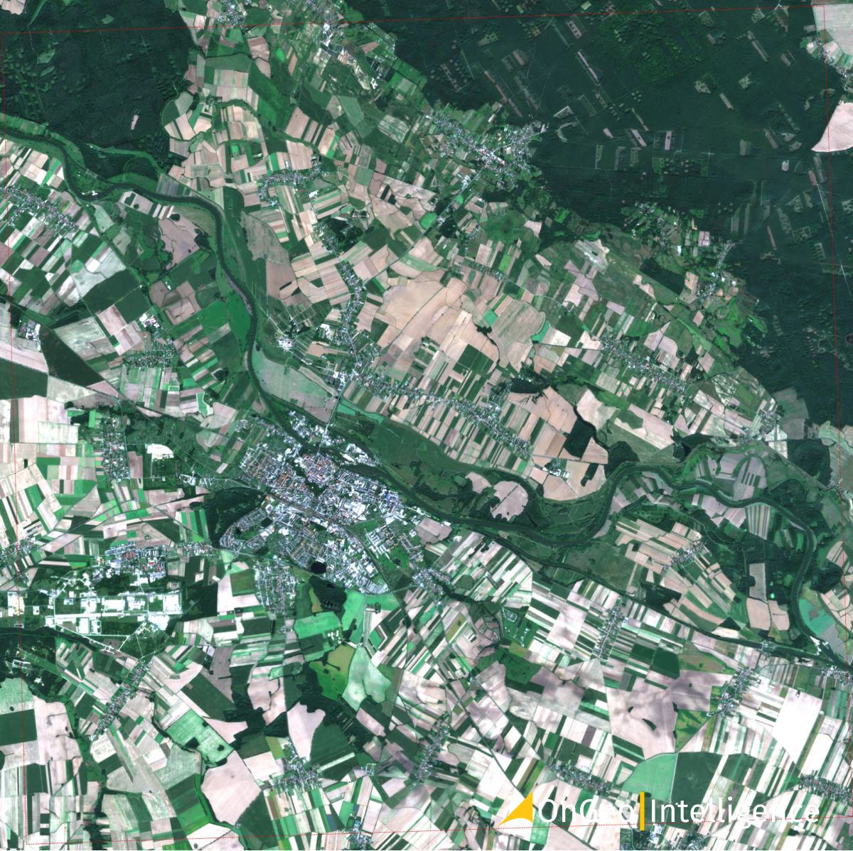
Satellite Image: Before the Flood areas in Oława (2024.08.24)
"Satellite imagery has become a game-changing tool for understanding and managing flood situations in Poland. These high-resolution images from Sentinel-2, processed by OnGeo-Intelligence.com, provide rapid and precise assessments of flood damage, enabling more efficient rescue operations and potentially saving lives."
Krzysztof Biel, remote sensing expert at OnGeo Intelligence
The Satellite Image Reports OnGeo Intelligence provide detailed flood mapping, which is crucial for:
Identifying high-risk areas
Planning evacuations and aid distribution
Assessing threats to critical infrastructure
Real-time monitoring of evolving situations
As floods in Poland become increasingly common due to climate change, advanced technologies like satellite imaging are essential for mitigating the impact of such disasters. Sentinel-2 imagery not only documents current crises but also provides valuable data for long-term flood analysis and prevention planning.
We use cookies to run our website, analyze your use of our services, manage your online preferences & personalize ad content. By accepting our cookies, you'll get relevant content and social media features, personalized ads, and an enhanced browsing experience. To manage your choices, click "Cookie Settings." Necessary cookies are required for the core website functionality and cannot be rejected. For more information, see our Cookie Policy.
About cookies on this site
Cookies used on the site are categorized. Below you can allow or deny some or all of them, except for Necessary Cookies which are required to provide core website functionality. When categories that have been previously allowed are disabled, all cookies assigned to that category will be removed from your browser.
Some cookies are required to provide core functionality. The website won't function properly without these cookies and they are enabled by default and cannot be disabled.
Preference cookies enables the web site to remember information to customize how the web site looks or behaves for each user. This may include storing selected currency, region, language or color theme.
Analytical cookies help us improve our website by collecting and reporting information on its usage.
Marketing cookies are used to track visitors across websites to allow publishers to display relevant and engaging advertisements. By enabling marketing cookies, you grant permission for personalized advertising across various platforms.
The cookies in this category have not yet been categorized and the purpose may be unknown at this time.