Satellite images reveal devastating floods in Poland
Recent satellite imagery reveals the unprecedented extent of floods in Poland. We present selected flood-affected areas through satellite images obtained from OnGeo-Intelligence.com. These images provide crucial information for emergency services and decision-makers. Photos from the European Space Agency's (ESA) Sentinel-2 satellite show vast swathes of the country submerged, underscoring the urgent need for action in response to this escalating disaster.
New satellite images expose the dramatic landscape of flooded areas
Satellite maps, available in the OnGeo Intelligence Satellite Image Report, precisely depict the flood-affected regions. The extent of the flooded areas significantly exceeds previous estimates, further emphasizing the importance of this data for effective crisis management.
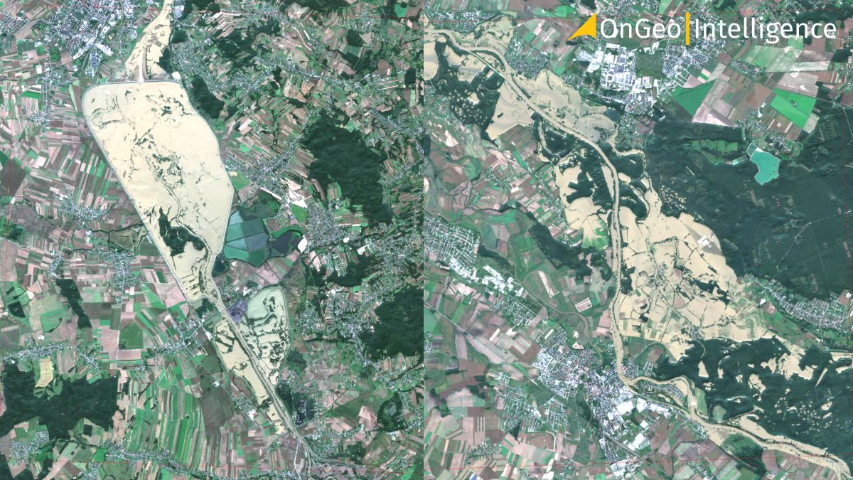
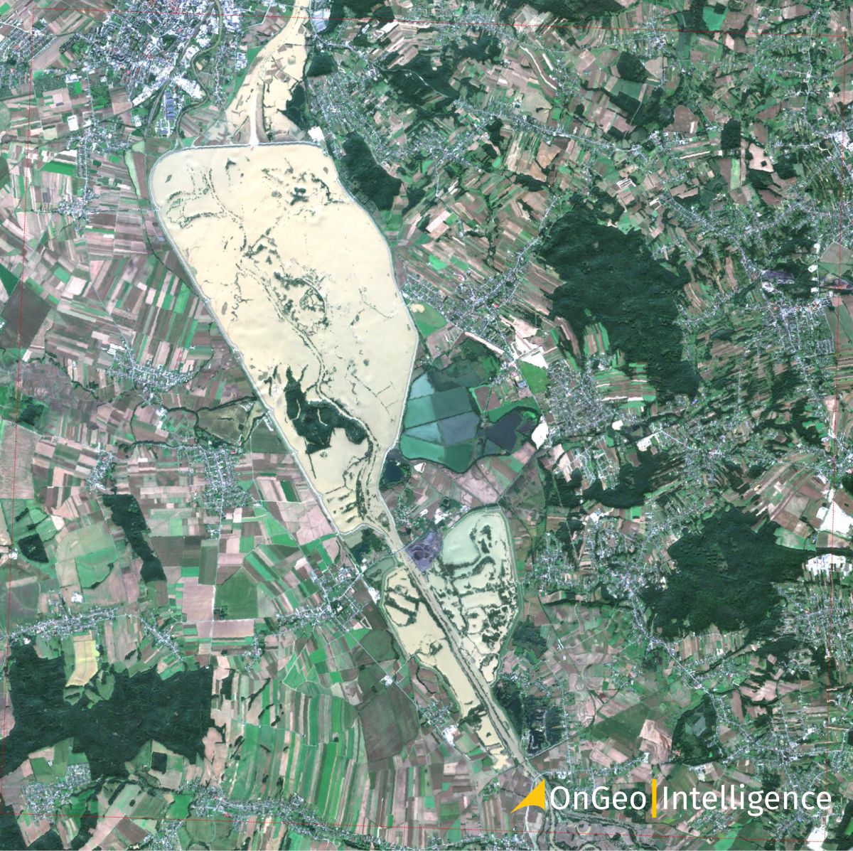
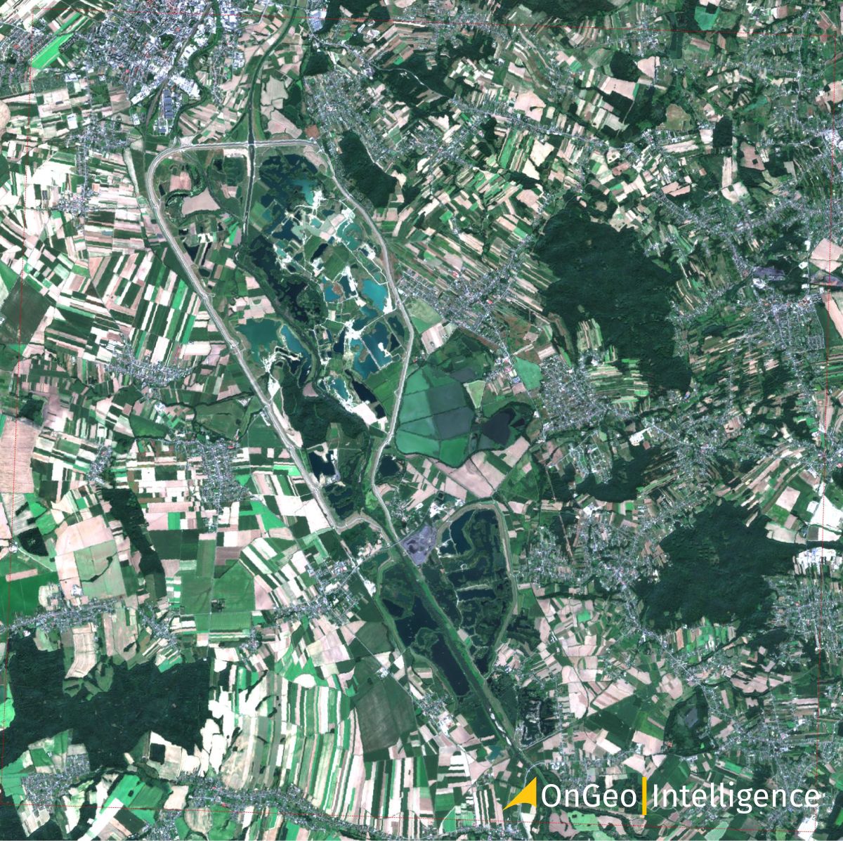
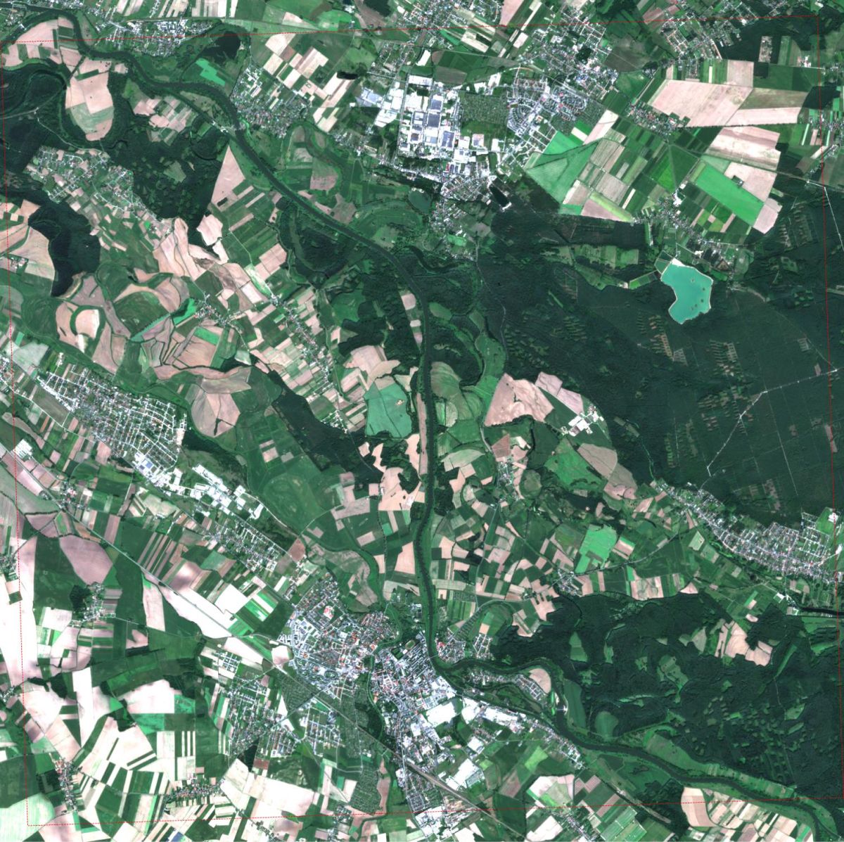
Racibórz Dolny (Odra) - Floods Captured in Satellite Images
Download: Satellite Imagery Report OnGeo™ Intelligence, Racibórz Dolny
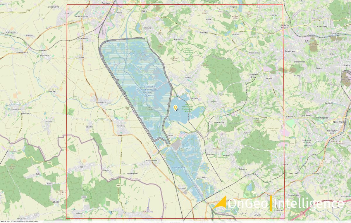
Location: Poland, Racibórz Dolny Flood Control Reservoir
Satellite Image: Racibórz Dolny reservoir filled with water (2024.09.18, 09:50 UTC)
Satellite Image: Before the Flood: Racibórz Dolny reservoir (2024.08.24, 09:45 UTC)
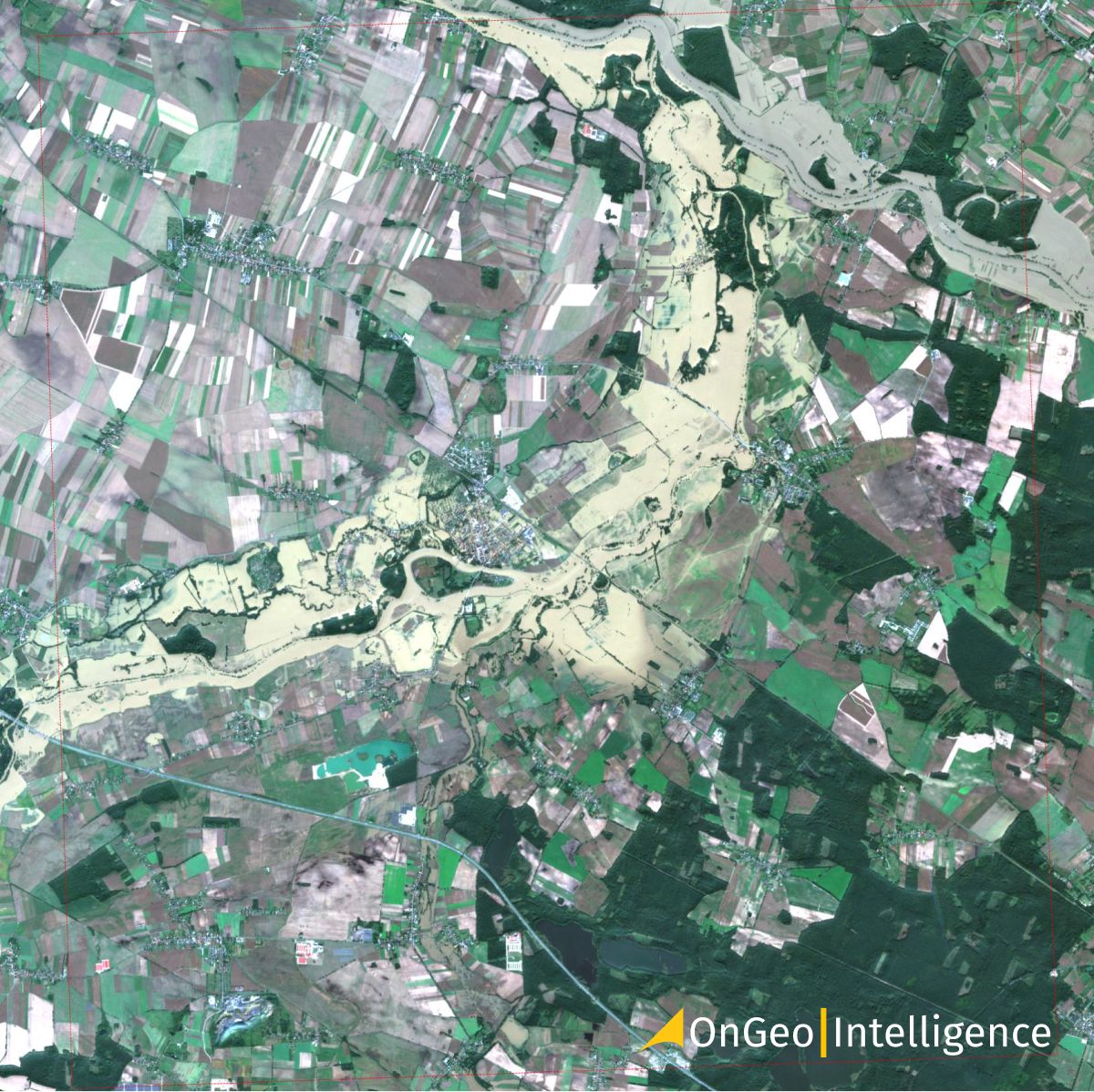
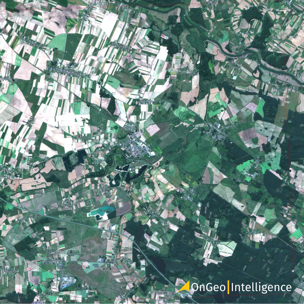
Floods in Lewin Brzeski - Satellite Images
Download: Satellite Imagery Report OnGeo™ Intelligence Lewin Brzeski
Location: Poland, Lewin Brzeski town
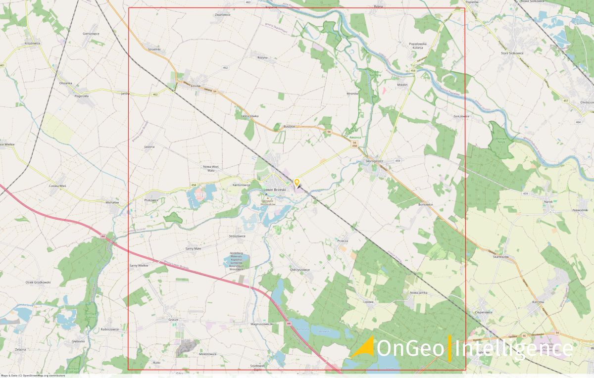
Satellite Image: Flooded areas in Lewin Brzeski (2024.09.18, 09:50 UTC)
Satellite Image: Before the Flood: Lewin Brzeski (2024.08.24, 09:45 UTC)
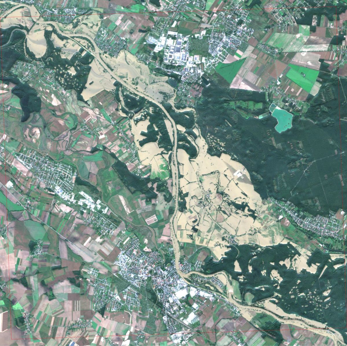
Flood Impact on Brzeg (Odra) - Satellite Analysis
Download: Satellite Imagery Report OnGeo™ Intelligence Brzeg (Odra)
Location: Poland, Brzeg
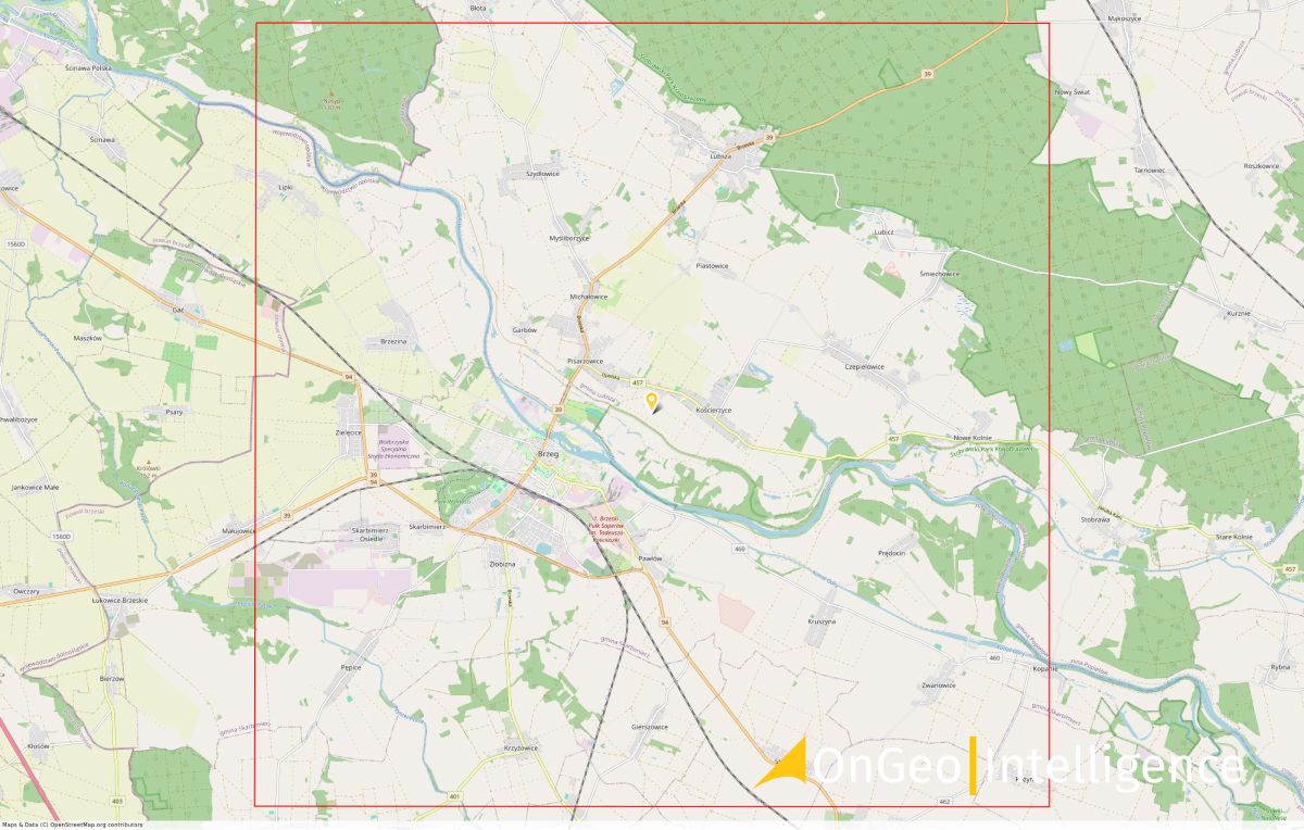
Satellite Image: Flood extent in Brzeg (2024.09.18, 09:18 UTC)
Satellite Image: Before the Flood: Brzeg (2024.08.24)
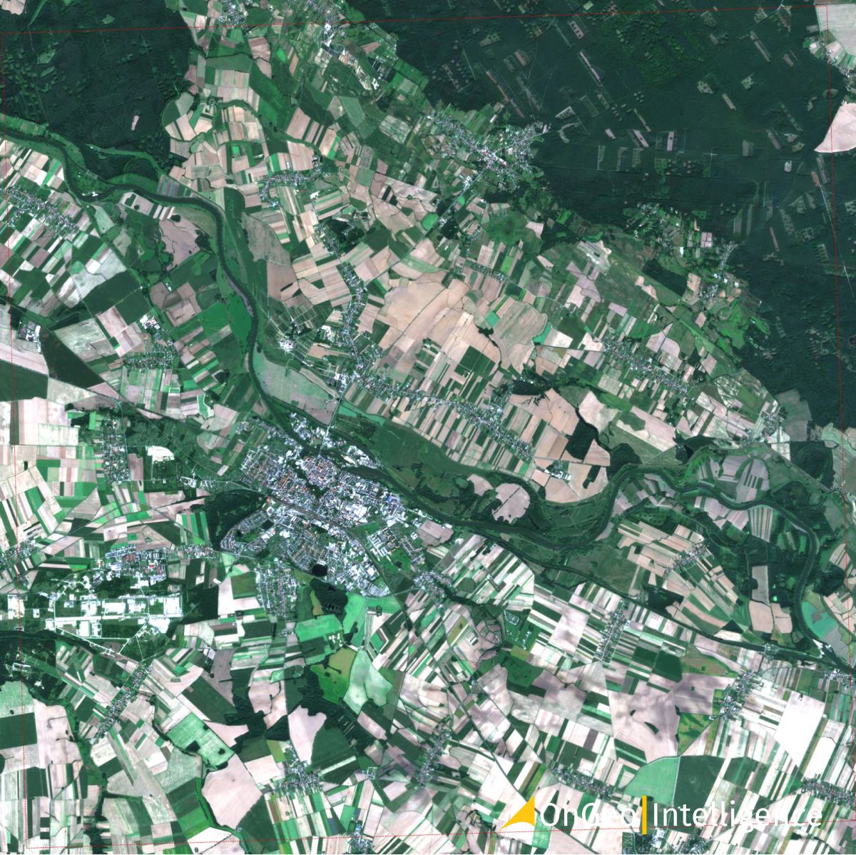
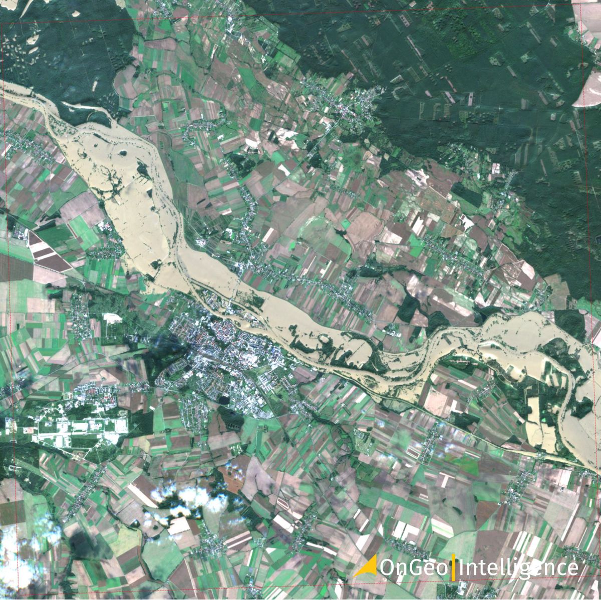
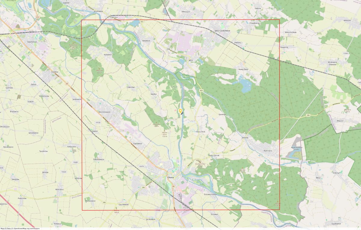
Oława (Odra) Flood Assessment via Satellite Imagery
Download: Satellite Imagery Report OnGeo™ Intelligence Oława (Odra)
Location: Poland, Oława (Geoportal Map)
Satellite Image: Flooded areas in Oława (2024.09.18, 09:50 UTC)
Satellite Image: Before the Flood areas in Oława (2024.08.24)
"Satellite imagery has become a game-changing tool for understanding and managing flood situations in Poland. These high-resolution images from Sentinel-2, processed by OnGeo-Intelligence.com, provide rapid and precise assessments of flood damage, enabling more efficient rescue operations and potentially saving lives."
Krzysztof Biel, remote sensing expert at OnGeo Intelligence
The Satellite Image Reports OnGeo Intelligence provide detailed flood mapping, which is crucial for:
- Identifying high-risk areas
- Planning evacuations and aid distribution
- Assessing threats to critical infrastructure
- Real-time monitoring of evolving situations
As floods in Poland become increasingly common due to climate change, advanced technologies like satellite imaging are essential for mitigating the impact of such disasters. Sentinel-2 imagery not only documents current crises but also provides valuable data for long-term flood analysis and prevention planning.
Related articles
- Satellite Maps: Viewing Your Neighborhood and Beyond
- Earth Observation: How Satellite Views of Your House Are Now at Your Fingertips
- Satellite Images from Sentinel-2 Available to Everyone
- Types of Earth Observation Satellites & Their Use Cases
- Lebanon Bombing: Satellite Images Reveals Scale of Destruction
- LA wildfires: Satellite images expose the scale of destruction
- How to Get a Current Satellite Map of My Property
- Biebrza National Park Fire: Destruction & Recovery Efforts