🌍 Capture the world at 100% OFF! Use code ongeo100on 10 meters satellite image resolutions – limited time only! Higher resolution satellite images remain subject to payment.
🌍 Capture the world at 100% OFF! Use code ongeo100on 10 meters satellite image resolutions – limited time only! Higher resolution satellite images remain subject to payment.
Satellite images reveal: Horrifying picture of Lebanon after Israeli bombings
2025-01-10
(Article updated:
2025-01-10
)
~ 7 min
Armed conflicts invariably bring tragic consequences, their effects visible not only through human stories but also in the images of destroyed cities and infrastructure. Recently, Lebanon has become another example of a place where military actions have left painful scars. In this article, we will take a closer look at the destruction in Lebanon, using high-resolution satellite images obtained through the OnGeo Intelligenceplatform and expert analysis to present the scale of the problem. Satellite images taken in November and December 2024, allow us to see destruction that may escape the human eye on a daily basis.
High-Quality Satellite Imagery, Hassle-Free
Explore any location on Earth with precision. Order a detailed Satellite Imagery Report—no sign-ups, no contracts. Delivered in a clear PDF for instant insights.
Satellite Imagery as a Tool for Documenting Destruction
Satellite images are an indispensable tool for monitoring and documenting the effects of armed conflicts. Thanks to them, we can see the destruction from a bird's-eye view, assess its scale and type. Images from the OnGeo Intelligence service provide the ability to obtain high-quality satellite images from any place on Earth, without the need for registration, which makes them exceptionally accessible and useful in the analysis of crisis situations.
The images from November and December 2024 that we present in this article show, among other things:
Destroyed residential buildings and public facilities
Damaged roads and transport infrastructure
Ruined residential areas and industrial zones
A wide range of damage in key urban and rural areas
These images are not only evidence of destruction but also proof of the suffering of the people of Lebanon, which is a consequence of the ongoing conflict.
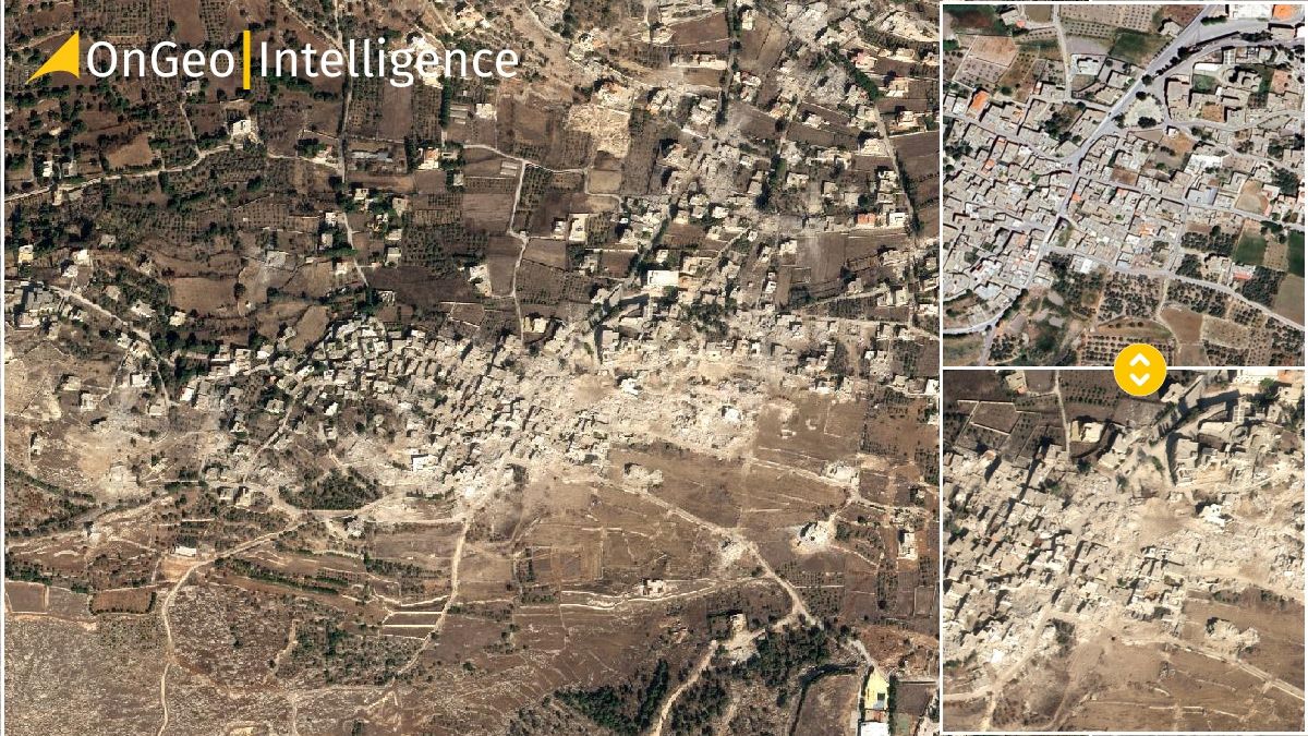
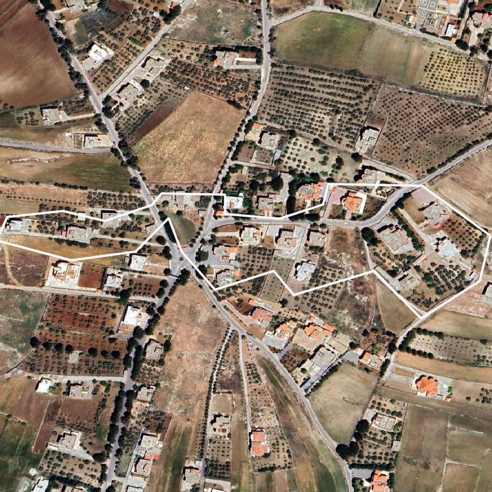
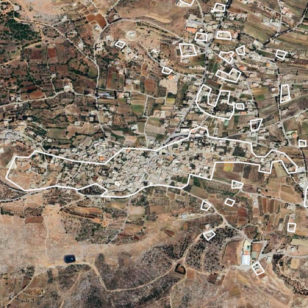
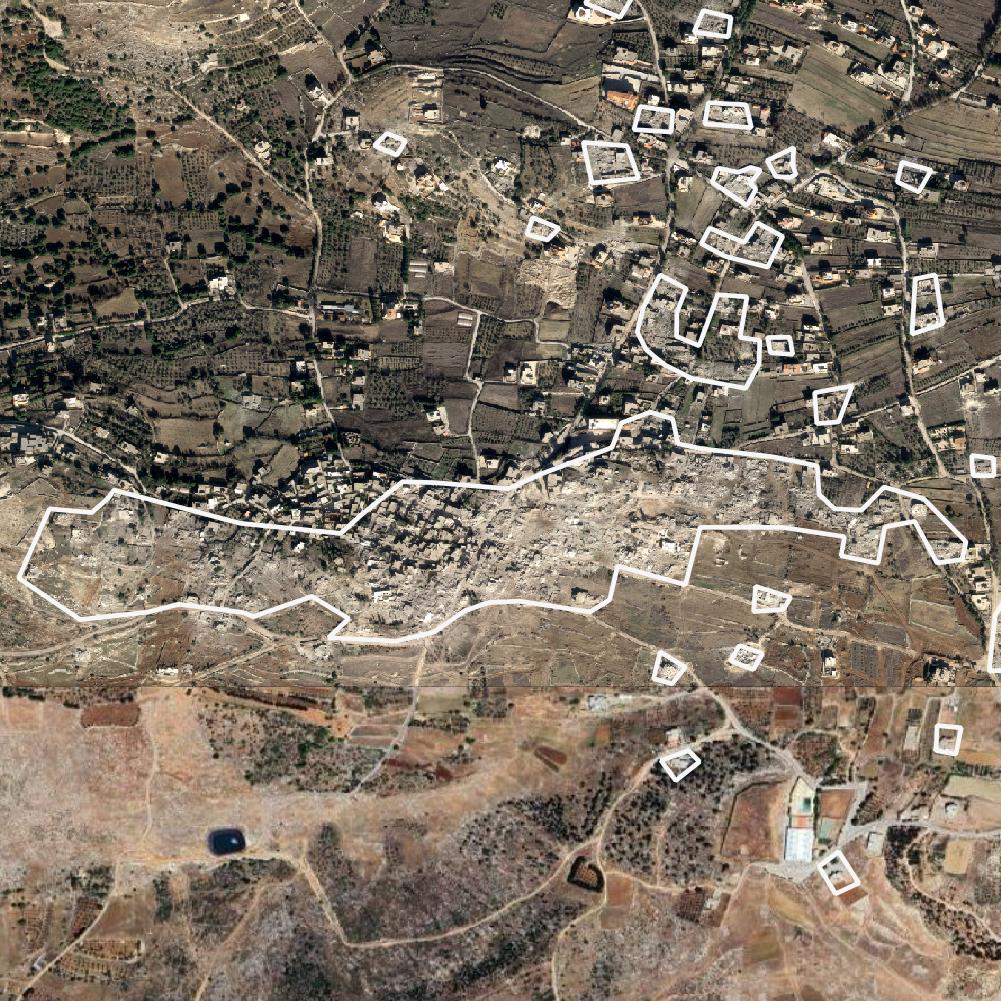
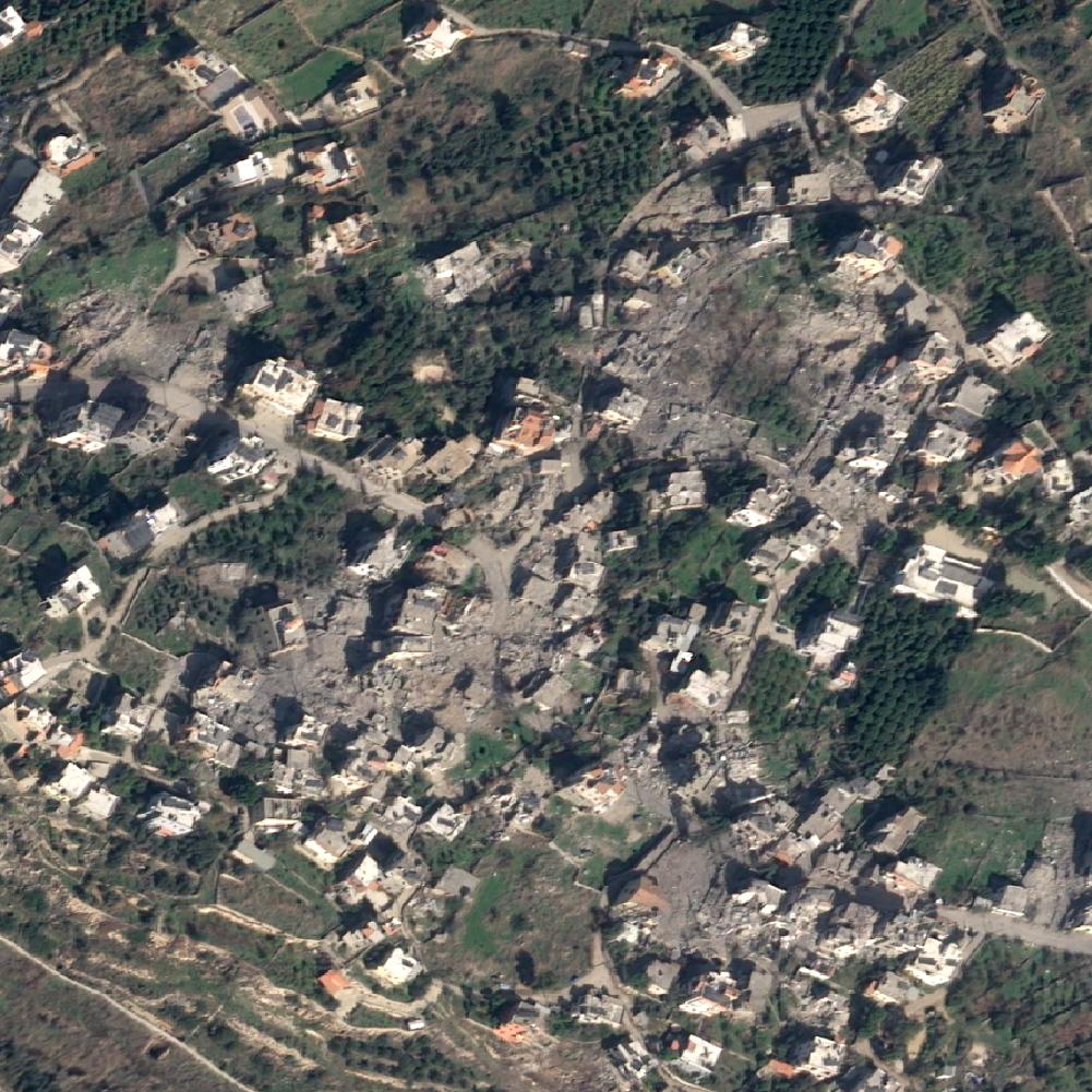
A visual testimony: satellite images of destruction Lebanon
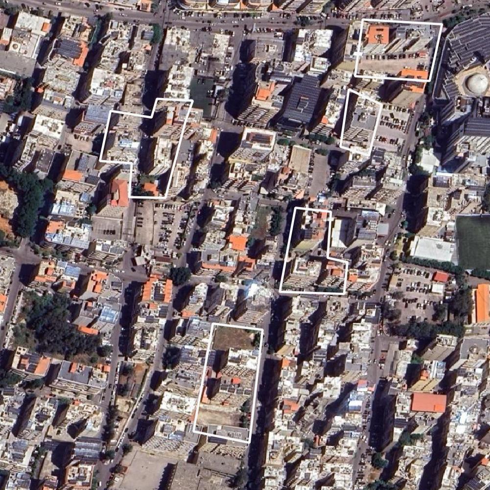
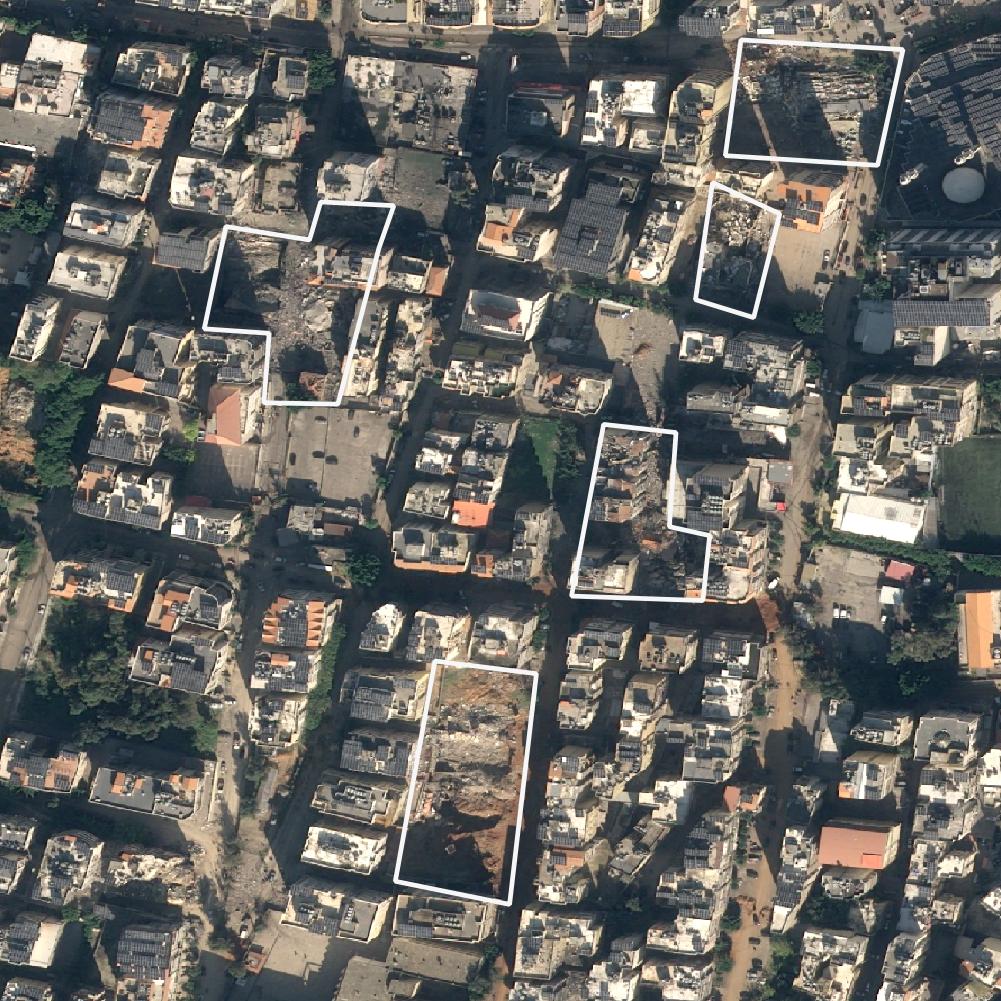
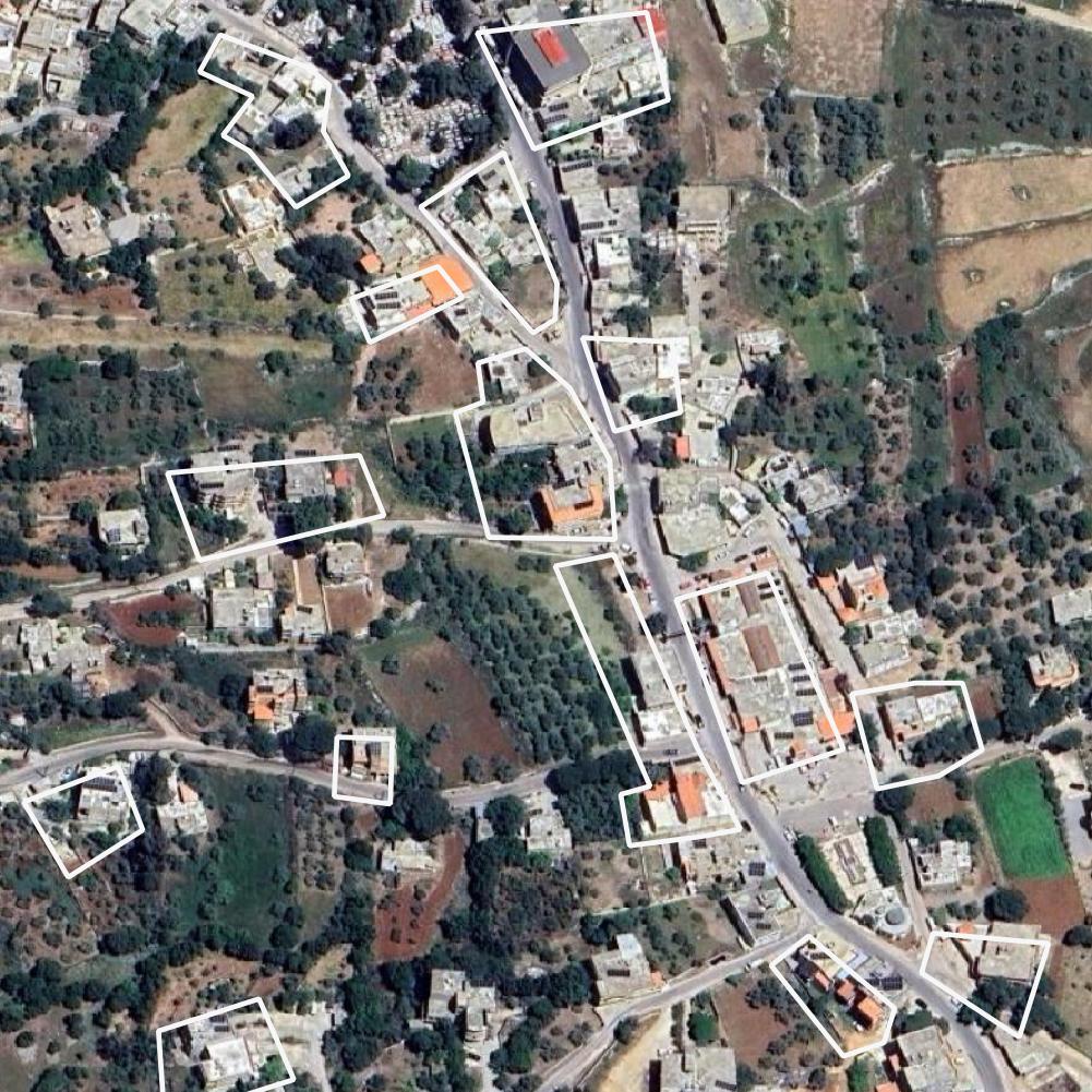
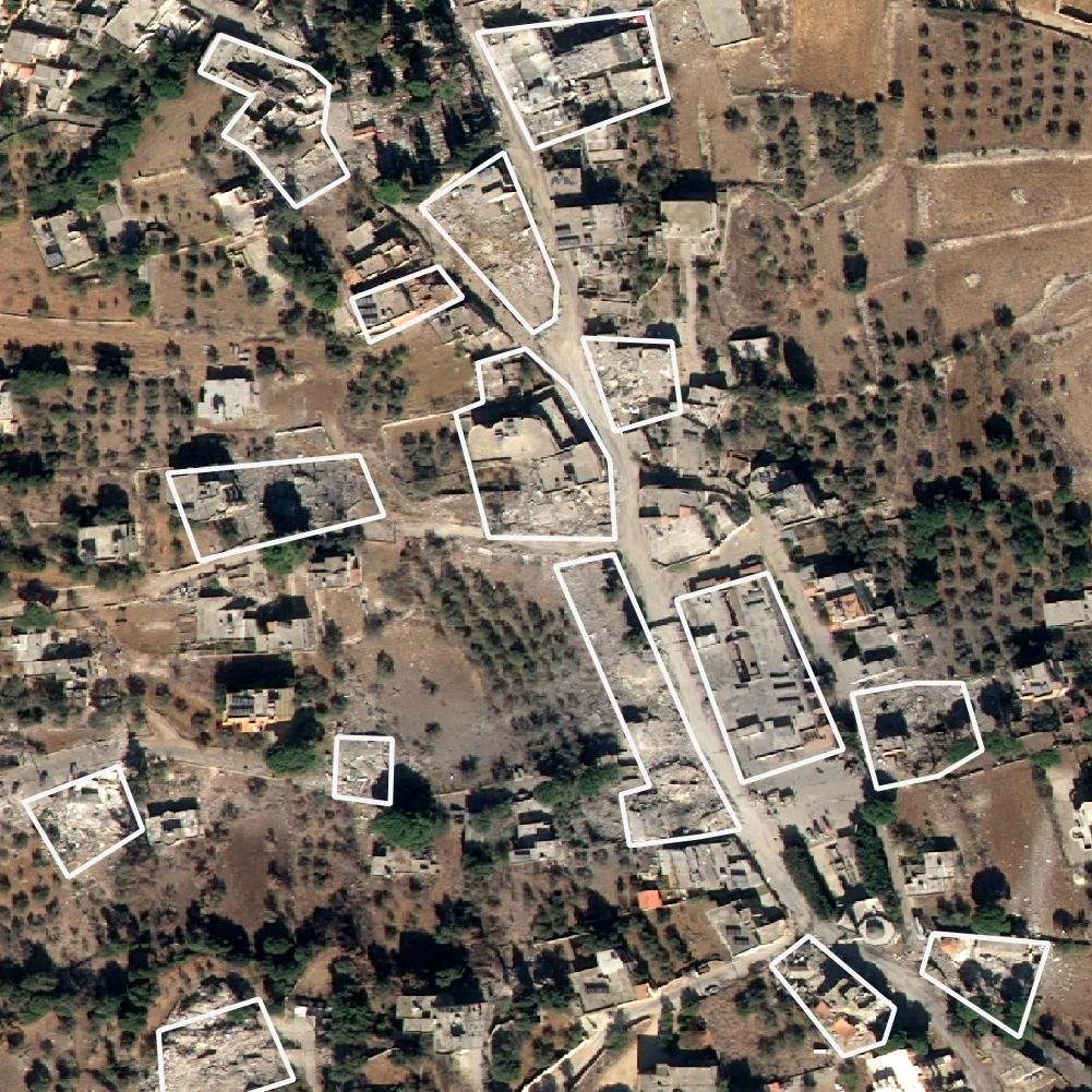
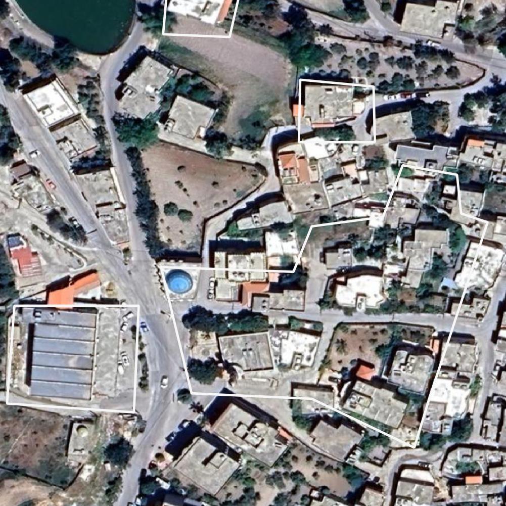
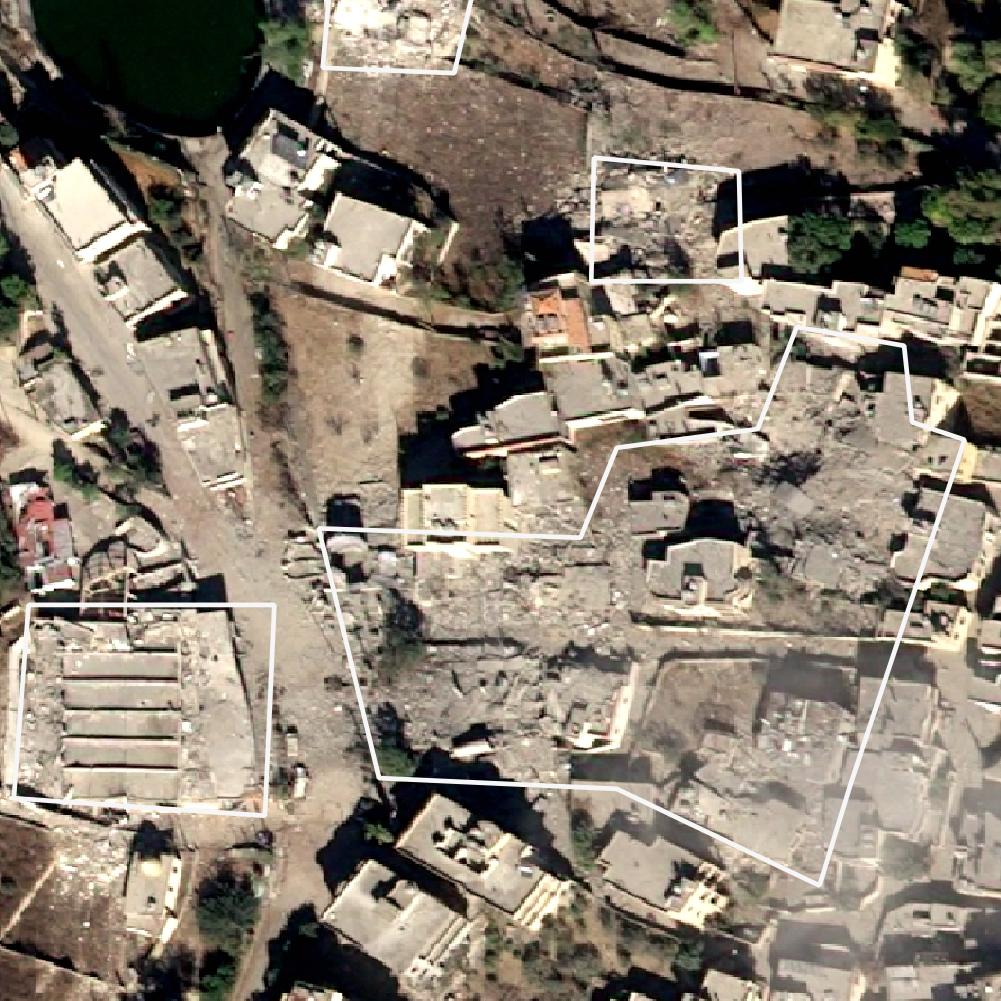
In this section, we present a series of satellite images that vividly illustrate the scale of destruction caused by the Israeli bombings in Lebanon. These before-and-after images, some with marked areas of damage, provide a stark visual testimony to the devastation. The Satellite images were obtained from the OnGeo Intelligence service and represent various locations affected by the conflict in Lebanon.
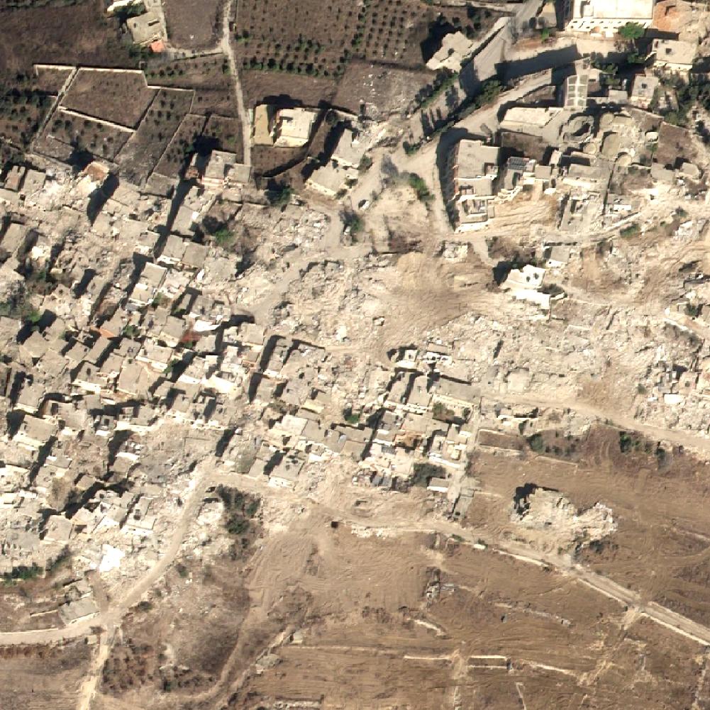
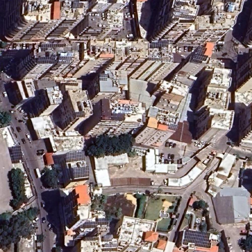
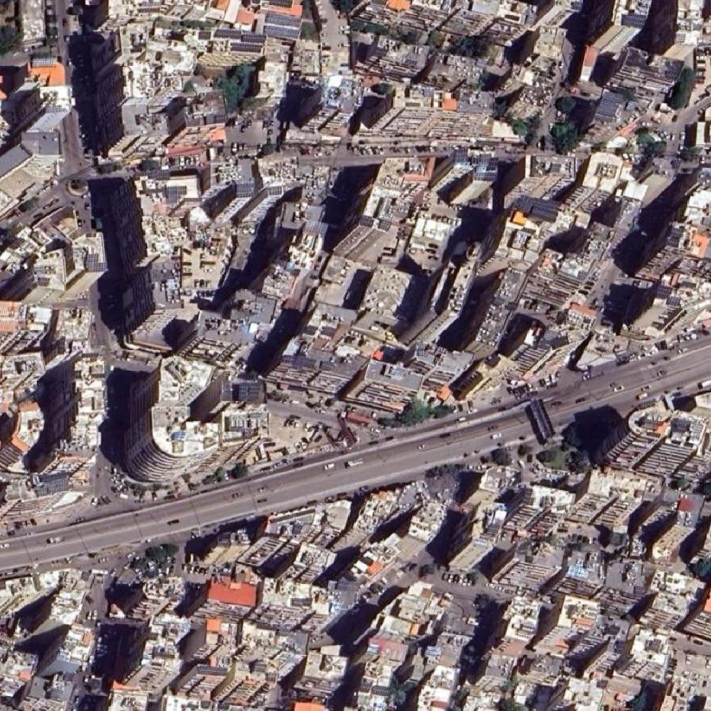
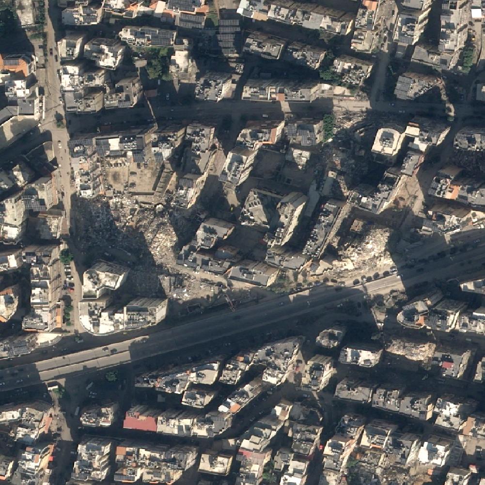
Google satellite image 1_1, before the bombing, location: Maroun Al Ras, Yaroun, Bint Jbeil District, Muhafaza An-Nabatijja, Liban. OnGeo-Intellitence satellite image 1_2: After the bombing, location: Maroun Al Ras, Yaroun, Bint Jbeil District, Muhafaza An-Nabatijja, LibanGoogle satellite image 2_1, before the bombing, location: Yaroun, Bint Jbeil District, Muhafaza An-Nabatijja, LibanOnGeo-Intellitence satellite image 2_2: After the bombing, location: Yaroun, Bint Jbeil District, Muhafaza An-Nabatijja, LibanGoogle satellite image 3_1, before the bombing, location: Yaroun, Bint Jbeil District, Muhafaza An-Nabatijja, LibanOnGeo-Intellitence satellite image 3_2: After the bombing, location: Yaroun, Bint Jbeil District, Muhafaza An-Nabatijja, LibanGoogle satellite image 4_1, before the bombing, location: Beirut, Rue 87, Haret Hreik, Baabda District, Muhafaza Dżabal Lubnan, 1001, LibanOnGeo-Intellitence satellite image 4_2: After the bombing, location: Beirut, Rue 87, Haret Hreik, Baabda District, Muhafaza Dżabal Lubnan, 1001, LibanGoogle satellite image 5_1, before the bombing, location: Beirut, Haret Hreik, Baabda District, Muhafaza Dżabal Lubnan, 1001, LibanOnGeo-Intellitence satellite image 5_2: After the bombing, location: Beirut, Haret Hreik, Baabda District, Muhafaza Dżabal Lubnan, 1001, LibanGoogle satellite image 6_1, before the bombing, location: Beirut, Damascus Highway, Haret Hreik, Baabda District, Muhafaza Dżabal Lubnan, 1001, LibanOnGeo-Intellitence satellite image 6_2: After the bombing, location: Beirut, Damascus Highway, Haret Hreik, Baabda District, Muhafaza Dżabal Lubnan, 1001, LibanGoogle satellite image 7_1, before the bombing, location: Majdel Selm, Marjayoun District, Muhafaza An-Nabatijja, LibanOnGeo-Intellitence satellite image 7_2: After the bombing, location: Majdel Selm, Marjayoun District, Muhafaza An-Nabatijja, LibanGoogle satellite image 8_1, before the bombing, location: Bint Jbail, Bint Jbeil District, Muhafaza An-Nabatijja, LibanOnGeo-Intellitence satellite image 8_2: After the bombing, location: Bint Jbail, Bint Jbeil District, Muhafaza An-Nabatijja, LibanGoogle satellite image 9_1, before the bombing, location: Ash Shumara, Borj En-Naqoura, Kada Tyr, Dystrykt Południowy, LibanOnGeo-Intellitence satellite image 9_2: After the bombing, location: Ash Shumara, Borj En-Naqoura, Kada Tyr, Dystrykt Południowy, Liban
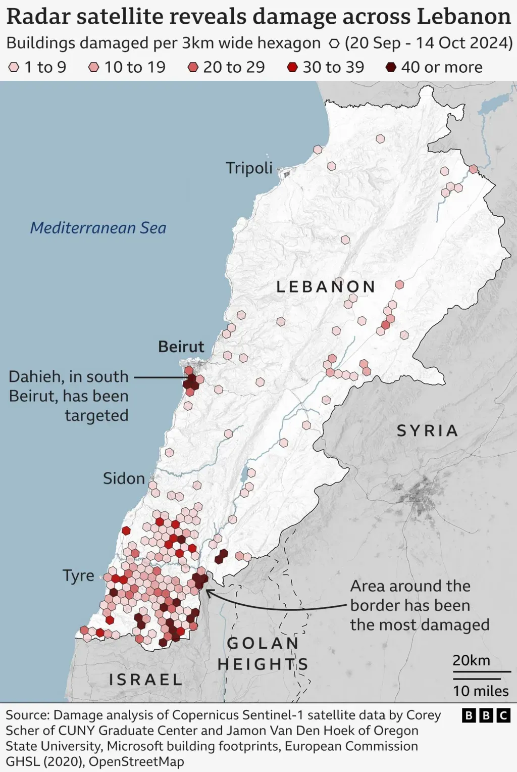
Radar analysis: confirming the scale of destruction
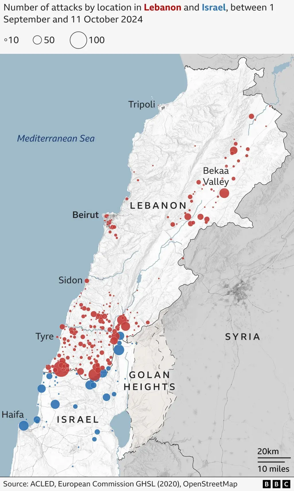
In addition to satellite images, radar analysis performed by Corey Scher of the City University of New York and Jamon Van Den Hoek of Oregon State University, as reported by the BBC, played a key role in assessing the damage. The article, which you can find here: https://www.bbc.com/news/articles/cvgx3zjvjg3o, shows how precise radar data allows scientists to accurately estimate the extent of the damage in Lebanon. This analysis confirms that the effects of the bombings are enormous and far-reaching.
Satellite photos, radar imagery, and military records show recent Israeli bombardment in Lebanon has focused on the southern border region. It has also expanded to central and northern areas, including the Bekaa Valley and Beirut's southern suburbs.
Consequences of the Destruction
The destruction visible in satellite images and confirmed by radar analysis has serious consequences:
Humanitarian Crisis: The loss of homes and infrastructure leads to displacement of the population and generates humanitarian needs.
Economic Problems: Destroyed infrastructure hinders reconstruction and economic development of the country.
Psychological Trauma: The conflict and its consequences have a long-term impact on the mental health of the population.
Summary
The analysis of satellite images and radar data reveals the scale of the destruction in Lebanon after the Israeli bombings. These images and data are an important reminder of the effects of armed conflicts and the need to find peaceful solutions. Thanks to the OnGeo Intelligence platform and scientific research, we can better understand the consequences of the ongoing war. Let us remember that behind every destroyed building, road, or settlement, there are human dramas and stories. May these images become a call for peace and human solidarity.
We use cookies to run our website, analyze your use of our services, manage your online preferences & personalize ad content. By accepting our cookies, you'll get relevant content and social media features, personalized ads, and an enhanced browsing experience. To manage your choices, click "Cookie Settings." Necessary cookies are required for the core website functionality and cannot be rejected. For more information, see our Cookie Policy.
About cookies on this site
Cookies used on the site are categorized. Below you can allow or deny some or all of them, except for Necessary Cookies which are required to provide core website functionality. When categories that have been previously allowed are disabled, all cookies assigned to that category will be removed from your browser.
Some cookies are required to provide core functionality. The website won't function properly without these cookies and they are enabled by default and cannot be disabled.
Preference cookies enables the web site to remember information to customize how the web site looks or behaves for each user. This may include storing selected currency, region, language or color theme.
Analytical cookies help us improve our website by collecting and reporting information on its usage.
Marketing cookies are used to track visitors across websites to allow publishers to display relevant and engaging advertisements. By enabling marketing cookies, you grant permission for personalized advertising across various platforms.
The cookies in this category have not yet been categorized and the purpose may be unknown at this time.