Lebanon Bombing: Satellite Images Reveals Scale of Destruction
Armed conflicts invariably bring tragic consequences, their effects visible not only through human stories but also in the images of destroyed cities and infrastructure. Recently, Lebanon has become another example of a place where military actions have left painful scars. In this article, we will take a closer look at the destruction in Lebanon, using high-resolution satellite images obtained through the OnGeo Intelligence platform and expert analysis to present the scale of the problem. Satellite images taken in November and December 2024, allow us to see destruction that may escape the human eye on a daily basis.
Satellite Imagery as a Tool for Documenting Destruction
Satellite images are an indispensable tool for monitoring and documenting the effects of armed conflicts. Thanks to them, we can see the destruction from a bird's-eye view, assess its scale and type. Images from the OnGeo Intelligence service provide the ability to obtain high-quality satellite images from any place on Earth, without the need for registration, which makes them exceptionally accessible and useful in the analysis of crisis situations.
The images from November and December 2024 that we present in this article show, among other things:
- Destroyed residential buildings and public facilities
- Damaged roads and transport infrastructure
- Ruined residential areas and industrial zones
- A wide range of damage in key urban and rural areas
These images are not only evidence of destruction but also proof of the suffering of the people of Lebanon, which is a consequence of the ongoing conflict.
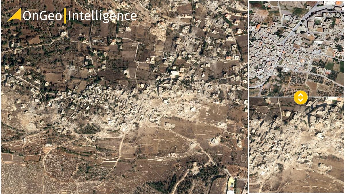
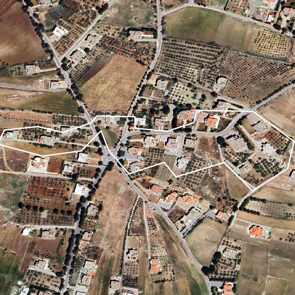
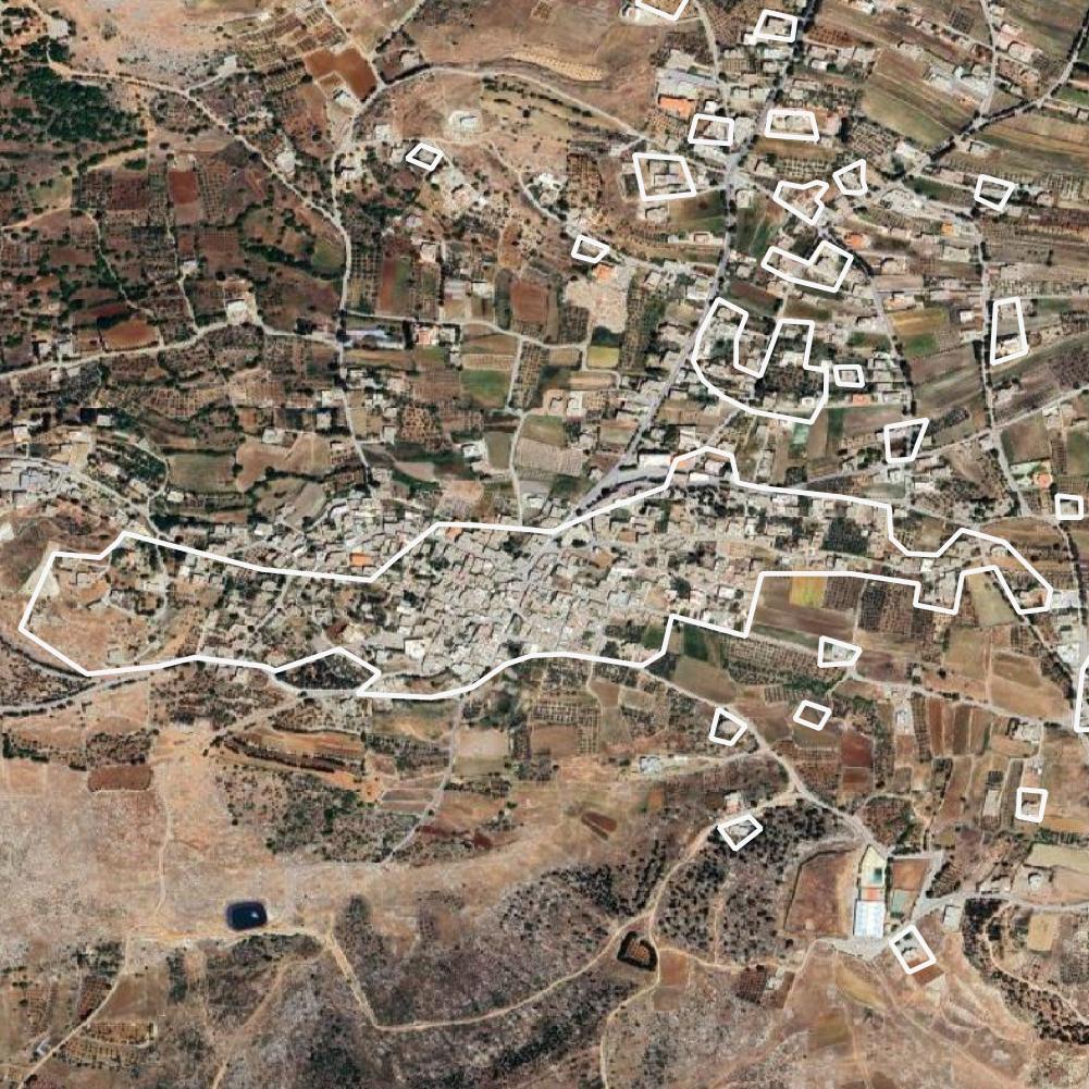
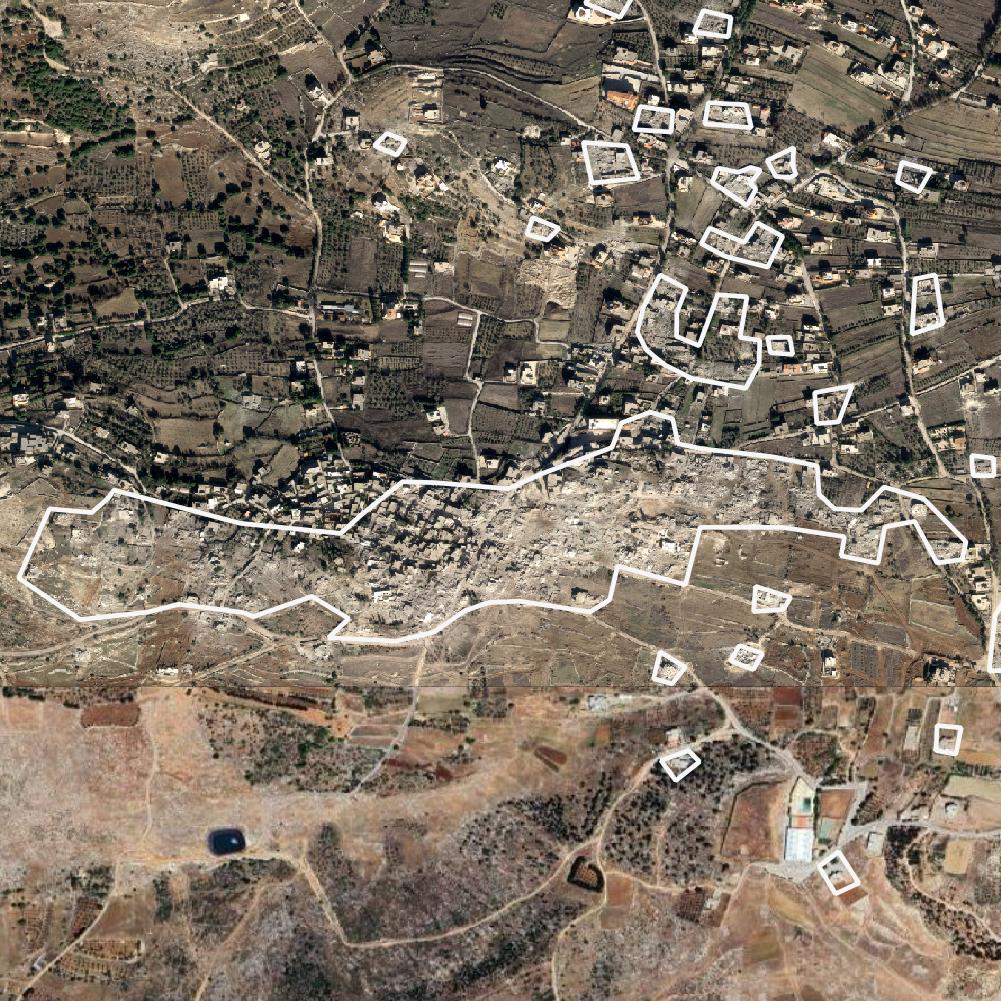
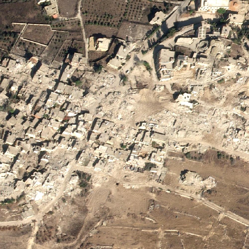
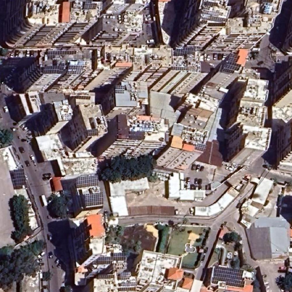
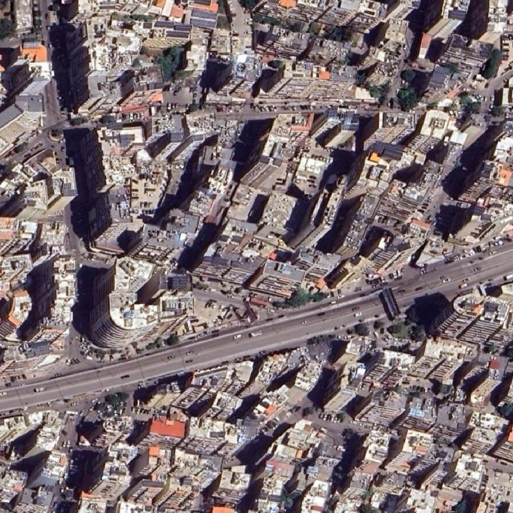
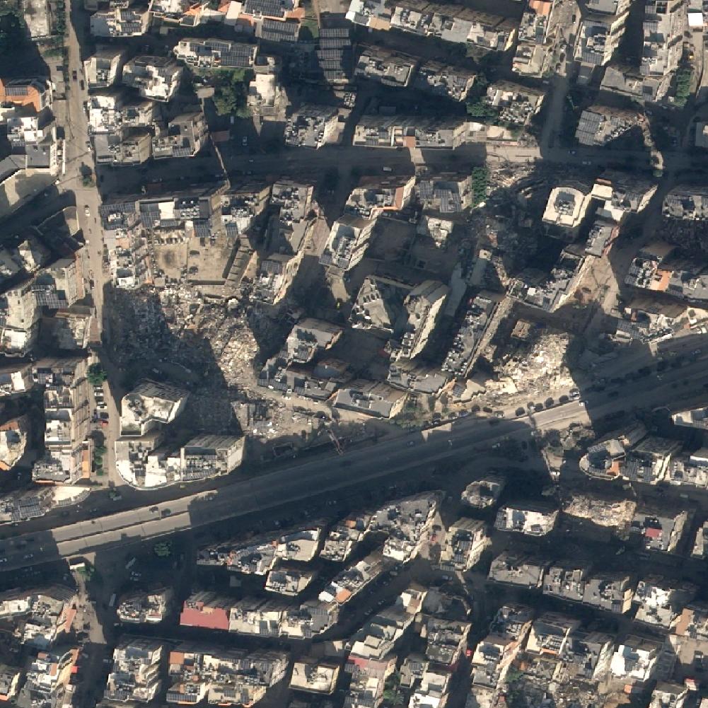
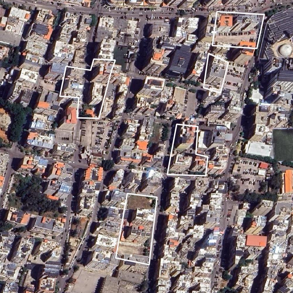
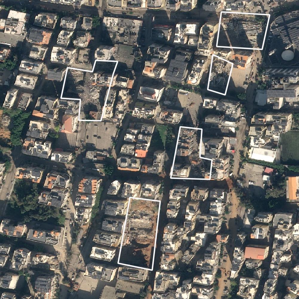
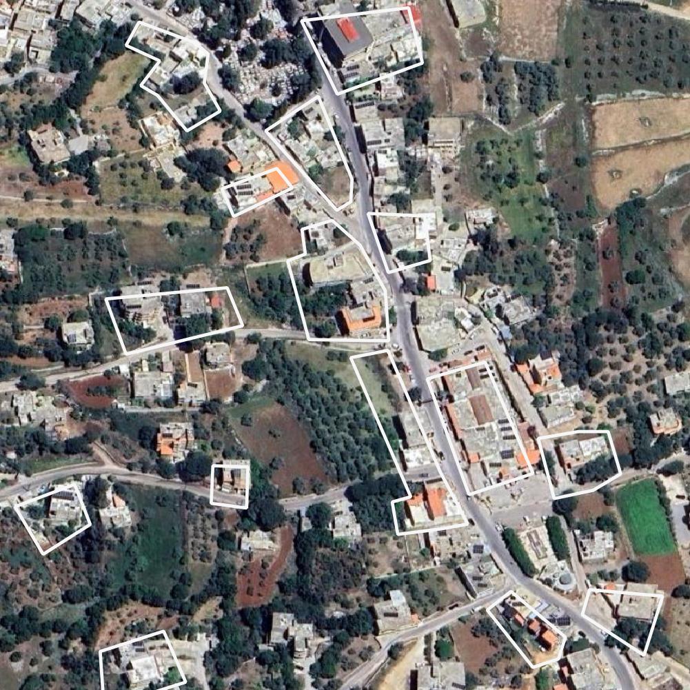
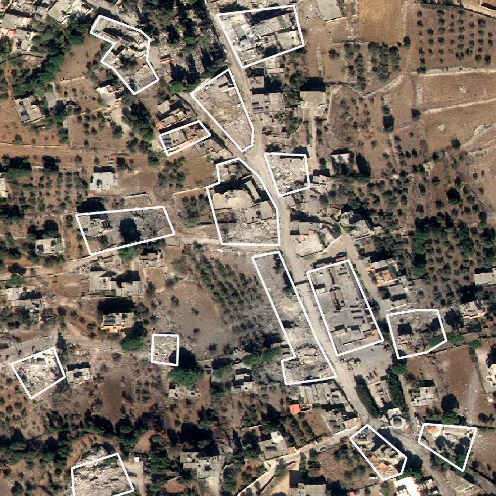
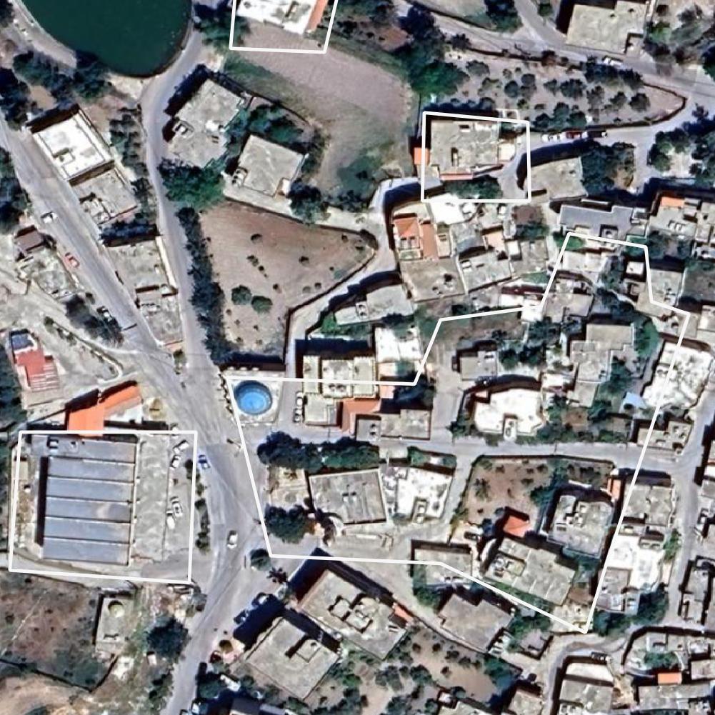
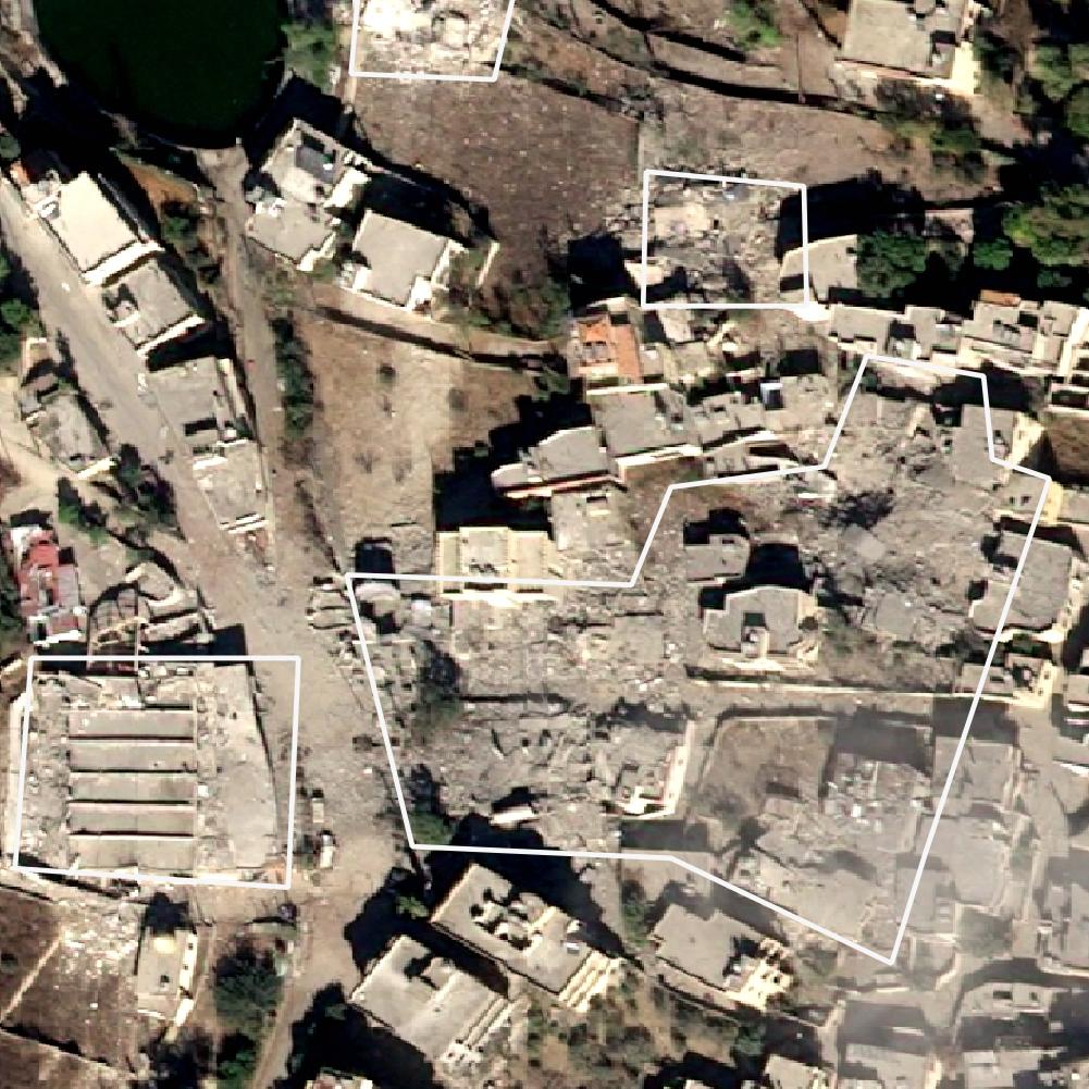
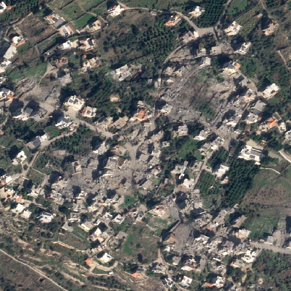
A visual testimony: satellite images of destruction Lebanon
In this section, we present a series of satellite images that vividly illustrate the scale of destruction caused by the Israeli bombings in Lebanon. These before-and-after images, some with marked areas of damage, provide a stark visual testimony to the devastation. The Satellite images were obtained from the OnGeo Intelligence service and represent various locations affected by the conflict in Lebanon.


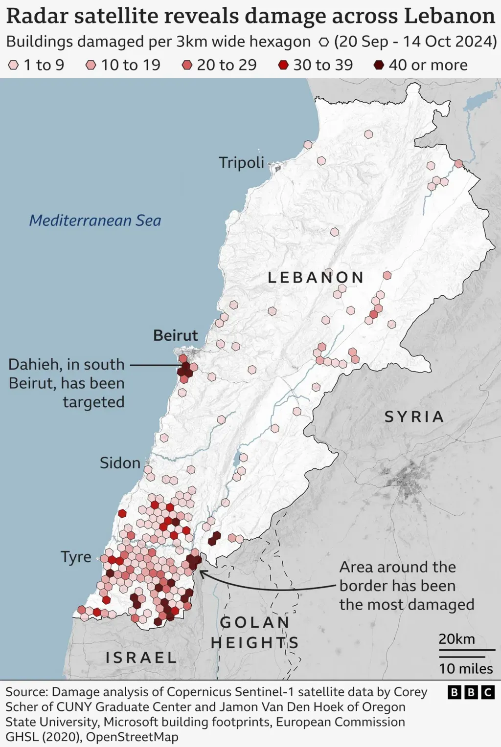
Radar analysis: confirming the scale of destruction
In addition to satellite images, radar analysis performed by Corey Scher of the City University of New York and Jamon Van Den Hoek of Oregon State University, as reported by the BBC, played a key role in assessing the damage. The article, which you can find here: https://www.bbc.com/news/articles/cvgx3zjvjg3o, shows how precise radar data allows scientists to accurately estimate the extent of the damage in Lebanon. This analysis confirms that the effects of the bombings are enormous and far-reaching.
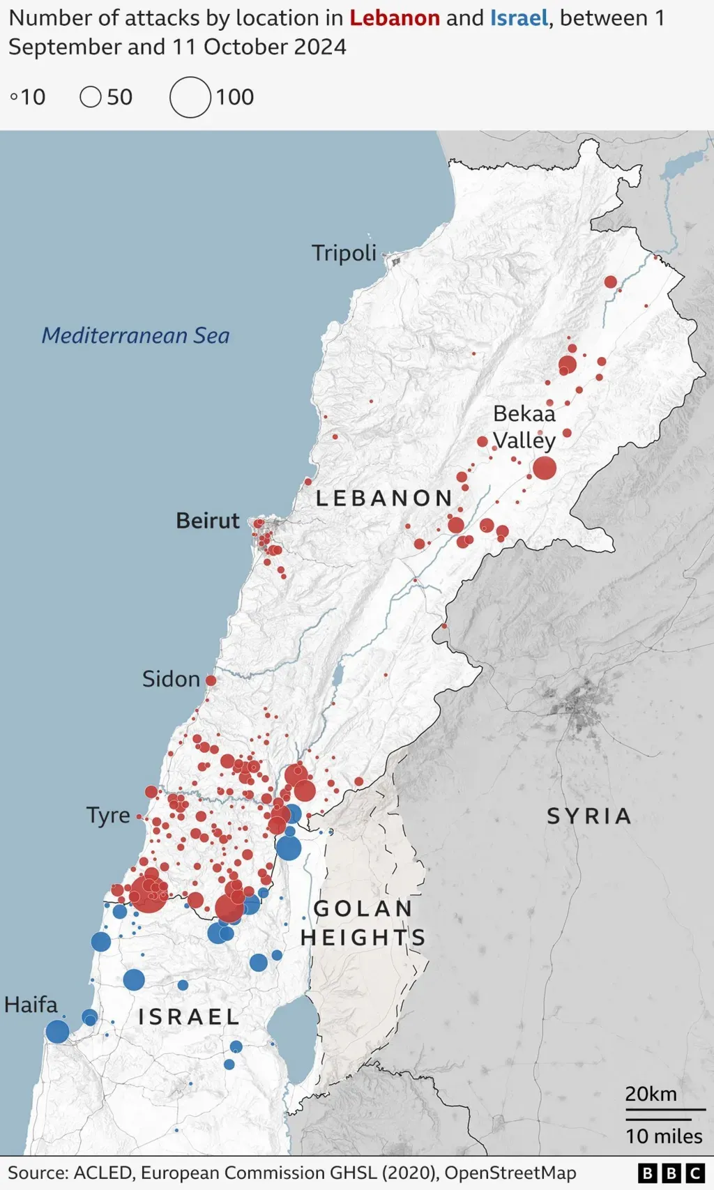
Satellite photos, radar imagery, and military records show recent Israeli bombardment in Lebanon has focused on the southern border region. It has also expanded to central and northern areas, including the Bekaa Valley and Beirut's southern suburbs.
Consequences of the Destruction
The destruction visible in satellite images and confirmed by radar analysis has serious consequences:
- Humanitarian Crisis: The loss of homes and infrastructure leads to displacement of the population and generates humanitarian needs.
- Economic Problems: Destroyed infrastructure hinders reconstruction and economic development of the country.
- Psychological Trauma: The conflict and its consequences have a long-term impact on the mental health of the population.
Summary
The analysis of satellite images and radar data reveals the scale of the destruction in Lebanon after the Israeli bombings. These images and data are an important reminder of the effects of armed conflicts and the need to find peaceful solutions. Thanks to the OnGeo Intelligence platform and scientific research, we can better understand the consequences of the ongoing war. Let us remember that behind every destroyed building, road, or settlement, there are human dramas and stories. May these images become a call for peace and human solidarity.
Related articles
- Earth Observation: How Satellite Views of Your House Are Now at Your Fingertips
- Real-Time Satellite Imagery
- Satellite Maps: Viewing Your Neighborhood and Beyond
- LA wildfires: Satellite images expose the scale of destruction
- Maxar Restores Ukraine’s Access to Satellite Imagery
- How Insurance Companies Use Satellite Imagery for Damage Assessment
- Satellite Images Reveal Devastating Before-After Views of Gaza City
- Satellite Imagery Reveals M23’s Environmental Destruction in Eastern DRC