Did you ever think it would be possible to see your home or business from an aerial view in just a click or two? With the advancements in Earth Observation technology, the answer is that it is no longer wishful thinking; it’s all reality. These days, satellites make imagery easily available; you can view satellite images of my house or perhaps anything else that piques your interest, with vivid detail and accuracy at any time you like.
It’s no longer a service made available to government and large corporations. Recently, the general public has found some unexpected uses of Earth Observation for their gain.
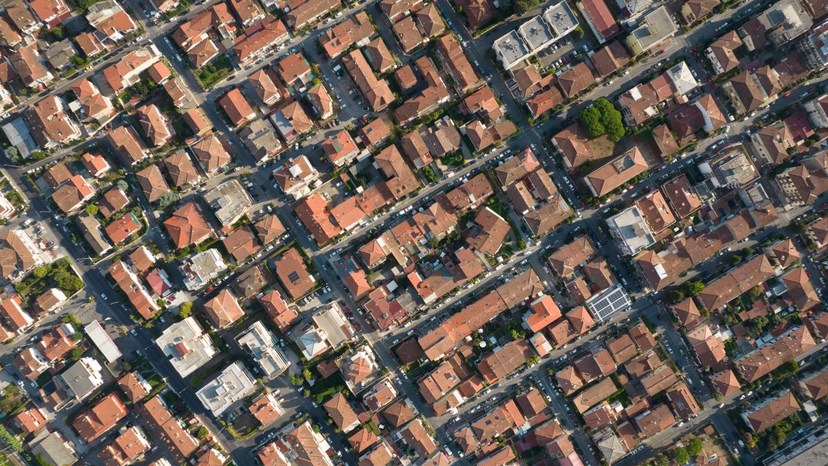
High-Quality Satellite Imagery, Hassle-Free
Explore any location on Earth with precision. Order a detailed Satellite Imagery Report—no sign-ups, no contracts. Delivered in a clear PDF for instant insights.
What is Earth Observation?
In its simplest form, Earth Observation is a way to collect information about Earth via space satellites. These satellites hover the outside of Earth, taking photos, to send the data back to The Earth’s surface for study.
In the earlier days, the information was often used to track larger issues, like environmental changes or disaster tracking. As time went by, people became creative with the use of Earth Observation data.
Nowadays, services like the Satellite Image Report over at OnGeo-Intelligence allow just about anyone to access the world of satellite images easily. You don’t have to be a professional, a researcher, or have a government badge to use the service and view the imagery up close.
Why ordinary citizens are turning to satellite data
But what are some other uses? Why would a regular person like me need access to the satellite view of my house? In truth, there are many ways that this can help average people and businesses. For starters:
- Legal matters and court proceedings
Whether you have a property line dispute tribunal meeting or are just trying to prove a point, a satellite view of your house or any location can be great evidence. High-res images can help show how land and its ownership have changed over the years or even document a disaster and more. - Monitoring construction progress
If your business operates on a construction site of any kind, trying to keep up to date with the progress of a project is next to impossible at ground level, especially on new construction or infrastructure projects.
With Earth Observation, you can request regular satellite images to be taken specifically for you and your area. They can be sent to your computer or smartphone. By having a bird's eye view of your build, you can be sure it’s on track and catch anything likely to turn into a problem early. Agriculture and land management
Even farmers are not left out. Many of them are using these images to monitor their land. Now, so can you! Take the power of Earth Observation to view your land from above. You can learn if it’s healthy. You can get an informed opinion about how productive it is. These images say a lot about things like soil moisture, heat stress, and crop health.
Insurance and property assessments
Insurance companies and property owners will have use for satellite house images and property satellite imagery. After any kind of natural disaster or major event, satellite imagery makes it possible to check if there was any damage done without actually visiting the property. If there is any continued environmental issue, such as the risk of flood or subsidence — the kind of thing that would instantly void all home and contents policies — you should keep using the house via satellite.
Spatial planning and development
Information can be pulled from high-resolution satellite imagery if you are a land owner, town planner, or property developer. A satellite image of your property shows a top view and details the current land use, infrastructure, trees, and water courses. And all of that is valuable when considering building, roads, and service placement. You need to know you are putting your structure in the right place and not causing yourself new problems.
The power of OnGeo-Intelligence’s Satellite Image Report
- No signup needed: There is no long-term contract to subscribe. Just buy a report when you need it.
- High and Very High-Resolution imagery: Get high and very high-resolution satellite imagery right on the shelf to fit your specific needs. We are sure you will find we exceed your expectations.
- Layman’s language in PDF: The report is in PDF format, so anyone can read it and understand it.
- Instant, fast: The good thing about the report is you will not have to wait longer to buy. You will have it instantly.
- Global: Location doesn’t matter in this case because you can get an image of any place in this world.
Download exemplary report
Using satellite views for eart observations
Earth Observation is an amazing science. It has made it possible to easily see features like satellite views of my home and property. Now, thanks to the Satellite Image Report from OnGeo-Intelligence, you can enjoy an array of uses and images.