Discovering the Past from Space: How Satellite Remote Sensing Is Transforming Archaeology?
What if you could uncover lost cities, forgotten temples or ancient roadways without touching a shovel? Satellite remote sensing is making that a reality, giving archaeologists the power to explore humanity’s past from hundreds of kilometers above the Earth’s surface.
Exploring the Past from Space
Archaeology is no longer confined to the trench. In recent decades, remote sensing has become an essential part of archaeological research, offering unprecedented access to data over vast and often inaccessible areas.
How Satellite Sensors Detect Ancient Remains
Using a combination of optical, infrared, radar and LiDAR sensors, satellites now assist researchers in detecting subtle anomalies on Earth’s surface that hint at buried structures, landscape modifications or ancient human activity.
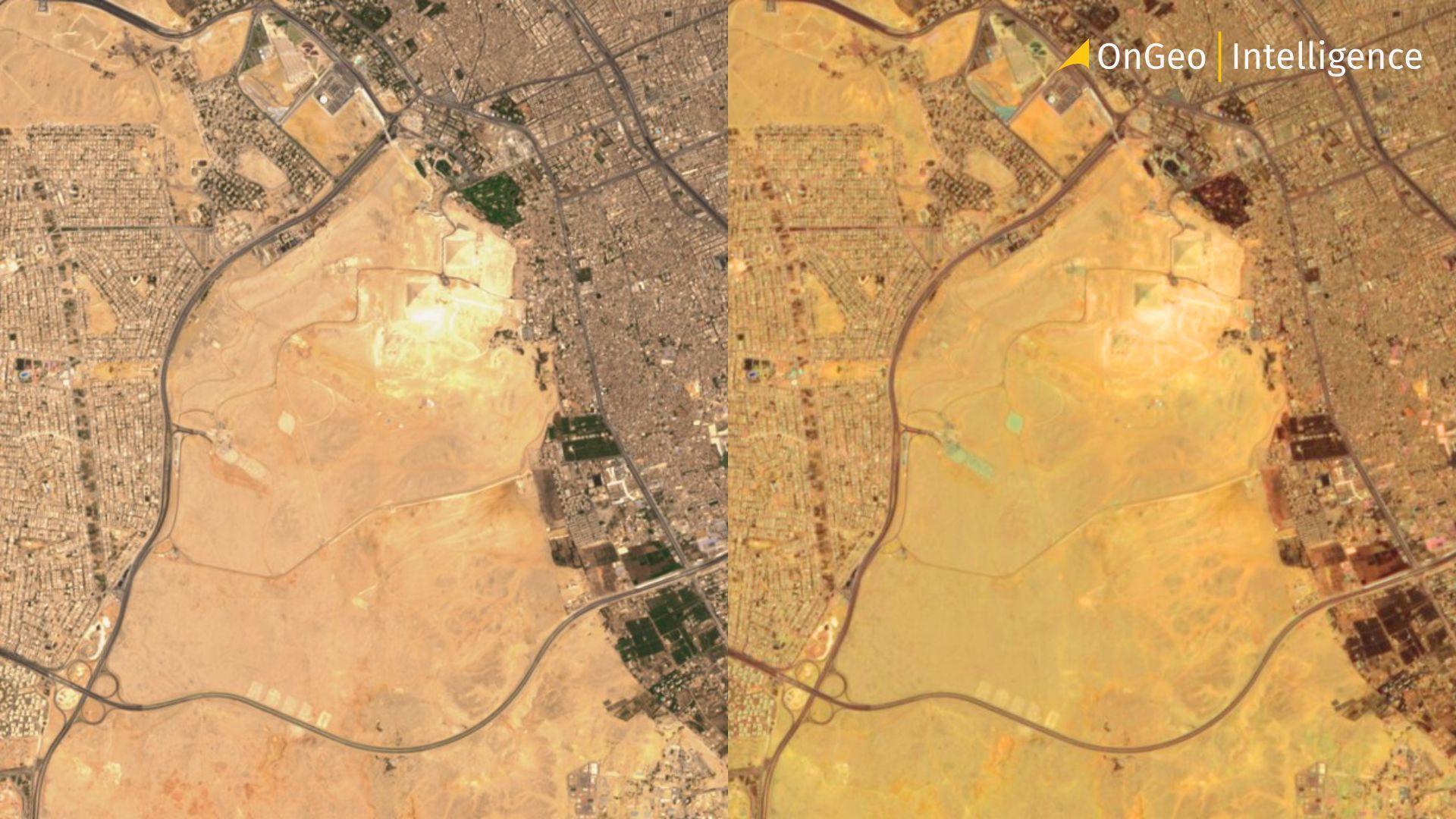
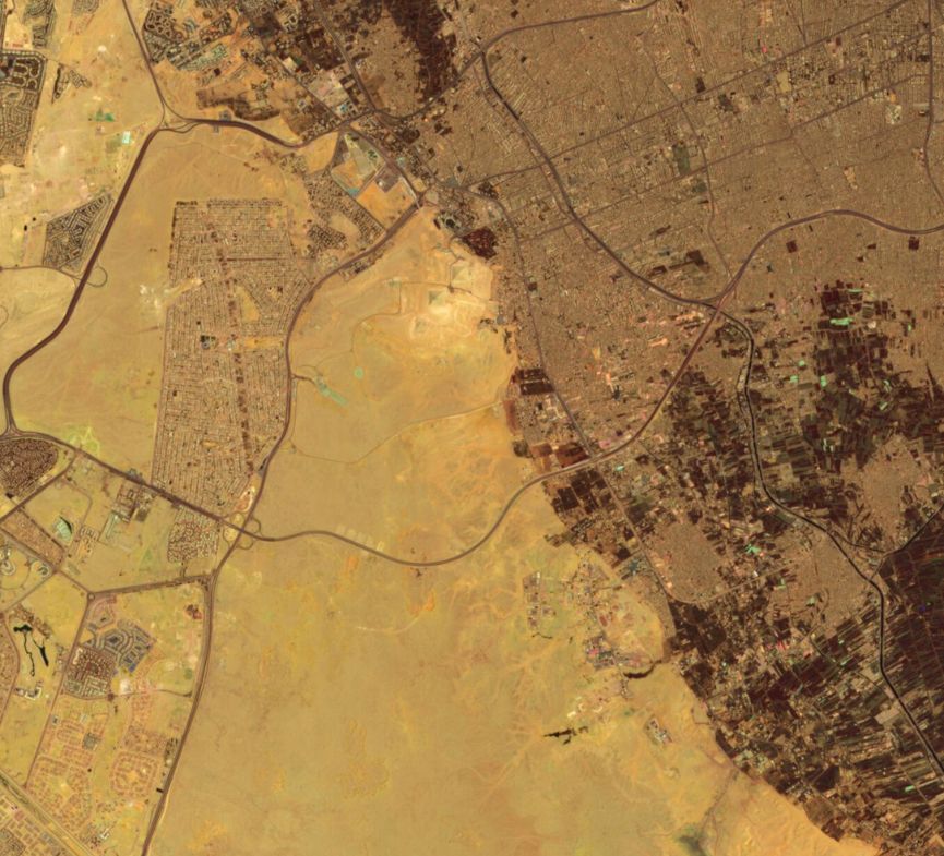
One of the best-known examples is the identification of over 3,000 ancient sites in Egypt by space archaeologist Sarah Parcak. Using infrared satellite imagery, she and her team located 17 possible pyramids, 1,000 tombs and entire settlement networks previously unknown. These discoveries were possible because buried mudbrick walls retain moisture differently than surrounding soil. This difference affects the vegetation and surface texture, which can be picked up by satellites equipped with multispectral sensors.
Monitoring Damage and Looting from Orbit
In Syria, researchers have used freely available Landsat and commercial high-resolution images to document extensive looting at archaeological sites during the civil war. Thousands of small circular pits, visible in before-and-after satellite images, revealed illegal excavations across the region. Without satellite monitoring, these losses would have gone unnoticed in many dangerous or inaccessible zones.
Reconstructing Lost Landscapes and Infrastructure
In Peru’s Chaco Canyon, thermal infrared imaging revealed straight, 30-foot-wide ancient roads extending outward from the central pueblo complexes. These lines were almost invisible on the ground due to centuries of erosion and sedimentation. By using the Thermal Infrared Multispectral Scanner (TIMS), NASA researchers were able to map these sacred roads with precision and later verify them through fieldwork.
Another remarkable case comes from the Sinai Peninsula. Satellite infrared data uncovered ancient copper mining infrastructure and hidden water sources used by early civilizations. These features were detected due to the reflective properties of different minerals and soils in the shortwave infrared bands. The ability to see what water has shaped - and where it has gone - often points directly to human activity, especially in arid environments.
Innovative Detection Across the Mediterranean
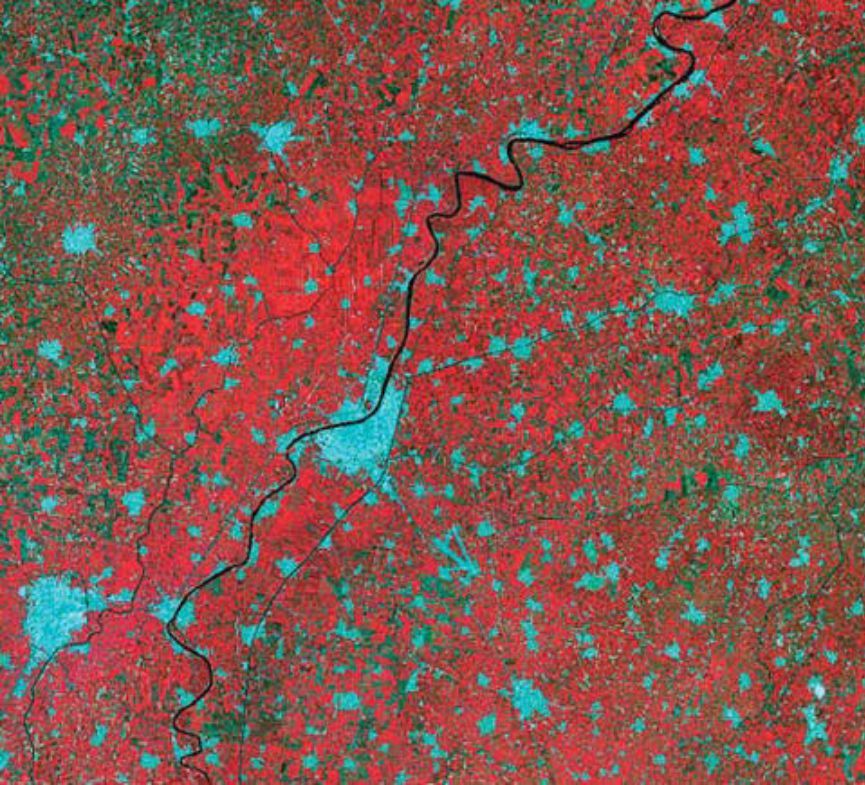
In the Mediterranean, the plains of Thessaly in Greece have been extensively studied using a combination of Sentinel-1 radar and Sentinel-2 multispectral data. Researchers implemented machine learning algorithms to detect Neolithic settlement mounds known as tells. These subtle elevations are barely visible to the eye, but they disrupt the surrounding vegetation and soil structure in ways detectable by remote sensors. The classification models successfully identified new potential sites based on spectral and spatial patterns.
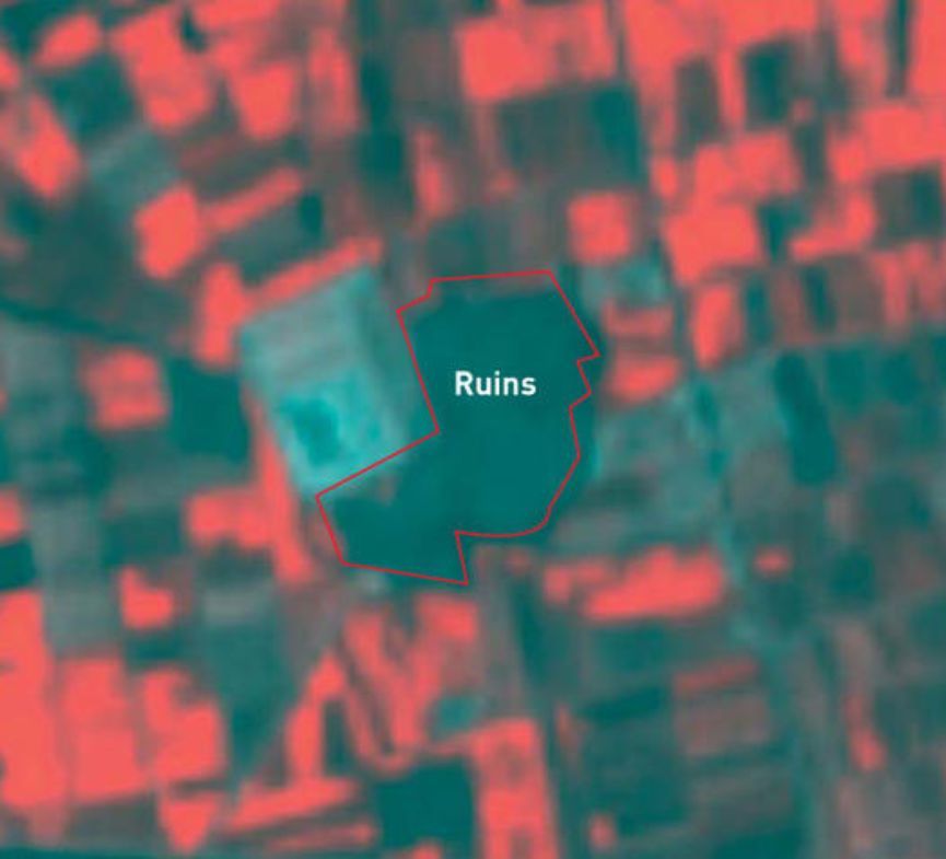
Cyprus has also become a proving ground for new techniques. At the archaeological site of Nea Paphos, scientists applied pansharpened multispectral imagery and vegetation suppression algorithms to enhance faint traces of buried structures. Even in areas with mixed vegetation and urban interference, they could detect crop marks and soil changes indicating foundations and walls below the surface.
On Easter Island, researchers combined high-resolution satellite data with ground testing to trace how the moai statues were transported. They mapped ancient road networks visible only in satellite images and confirmed that the statues were likely “walked” upright using ropes. These paths, now partially obscured by erosion and modern development, became clear through false-color composites and shadow analysis.
High-Tech Tools Advancing the Field
Among the most advanced tools currently used in archaeological remote sensing is the WorldView-3 satellite belonging to Maxar Technologies. With a spatial resolution of just 31 cm for panchromatic images, eight multispectral bands (with 1.24 m resolution) and eight shortwave infrared (SWIR) bands - WorldView-3 allows archaeologists to distinguish between construction materials, detect buried stone walls or track subtle changes in vegetation. In regions like the Middle East or North Africa, this level of detail helps uncover ancient road systems, city outlines and irrigation channels hidden beneath sand or agricultural fields.
Modern sensors continue to evolve. Landsat 8 and Sentinel-2 deliver multispectral imagery every few days with increasing resolution. Hyperspectral missions like EnMAP and future commercial platforms will add new dimensions, allowing archaeologists to distinguish specific construction materials and organic residues. Each improvement opens up new possibilities for understanding and preserving the past.
Combining Traditional and Technological Methods
Remote sensing doesn’t replace traditional archaeology - it enhances it. Ground verification, historical research and excavation remain essential. But satellites offer scale, speed and coverage that were unimaginable just a few decades ago. With open-access data, machine learning and ever-growing archives, more researchers than ever can join this global effort.
Whether tracing lost trade routes across the Sahara, mapping submerged ports in the Mediterranean or monitoring looting damage in real time, remote sensing is revolutionizing archaeology. It's a discipline where ancient history meets modern technology - where satellites act as digital time machines, helping us rediscover the footprints of civilizations long gone.