
How to Find Free Satellite Imagery: A List of Open Data Sources
Access to free satellite imagery has transformed the way we analyze our planet. However, behind the promise of no-cost data lie significant challenges: complex interfaces, the need for specialized knowledge, and time-consuming processing. In this article, we will guide you through the best open sources for free satellite imagery, detailing their capabilities and, more importantly, their limitations. We will also reveal why ready-made analytical reports are a simpler, faster, and often more effective alternative for professionals and businesses.
Global archives of Earth observation data are at our fingertips, but to fully leverage them, you need to know where to look and what to expect. Here is a detailed review of the most powerful platforms offering free satellite imagery.
Leading Platforms for Free Satellite Imagery
1. USGS Earth Explorer
Undoubtedly one of the largest and most important archives of Earth observation data, managed by the United States Geological Survey. Its greatest strength is providing access to the complete historical Landsat mission archive, which documents changes on our planet for over 50 years. This is an invaluable source of historical free satellite imagery.
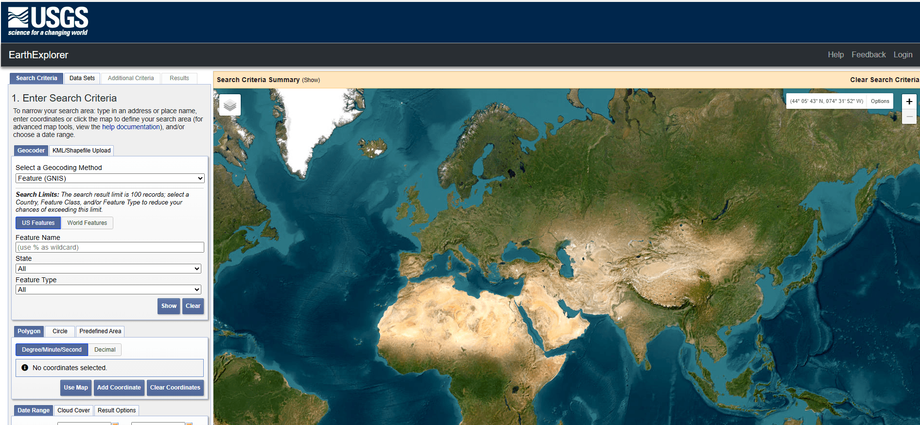
- Available Data: In addition to the Landsat series, the platform offers data from MODIS and Sentinel-2 satellites, aerial photographs, hyperspectral and radar data, and digital elevation models.
- Search Features: The search functionality is incredibly precise. You can define an area of interest using an interactive map, coordinates, addresses, or even by uploading KML or shapefiles. Filters allow you to narrow down results by date or cloud cover percentage.
- The Challenge: Earth Explorer's power is also its biggest hurdle for non-expert users. The platform primarily delivers raw data (satellite scenes) that is useless without further processing. To extract valuable information, you need proficiency in specialized GIS software (like QGIS or ArcGIS) and an understanding of remote sensing fundamentals, such as atmospheric correction and band combinations. The path from downloading free satellite imagery to getting actionable insight is long and complex.
2. Sentinel Hub
This cloud-based service is a game-changer, enabling users to access and process data without downloading it. Its primary data source is the European Copernicus program and its Sentinel satellites, which provide up-to-date free satellite imagery of the entire globe every few days.
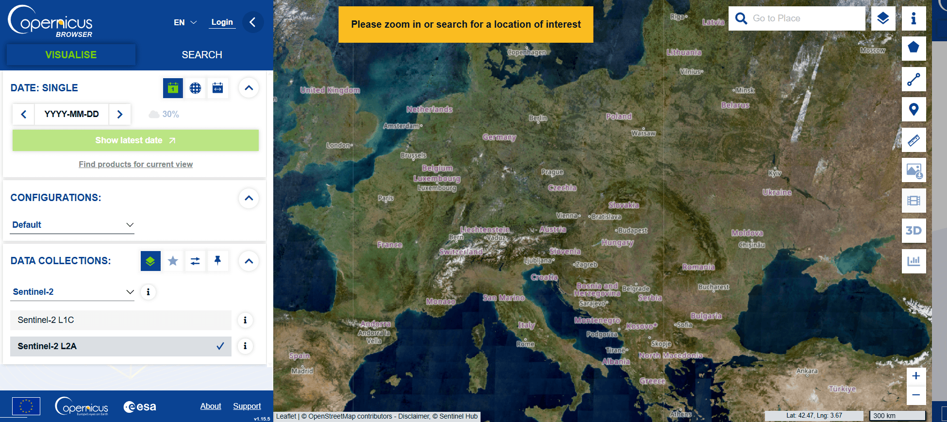
- Available Data: Sentinel-1 (radar), Sentinel-2 (optical), Landsat, and even commercial PlanetScope data.
- Search Features: The platform excels at on-the-fly data processing. Using the EO Browser interface, you can create visualizations, mosaics, and simple analyses (e.g., NDVI) directly in your web browser. For advanced users, APIs and a QGIS plugin are available.
- The Challenge: Sentinel Hub operates on a "freemium" model. Basic browsing and simple analyses are free, but unlocking the tool's full potential - API access, batch processing for large areas, or advanced analytical scripts - requires a paid subscription. The "free" aspect has clear limits, especially for professional applications that require more than just a quick look.
3. NASA Earthdata Search
This is the main gateway to NASA's vast scientific data resources, collected by dozens of satellite missions. It is a powerful tool designed primarily for the scientific community seeking very specific datasets.
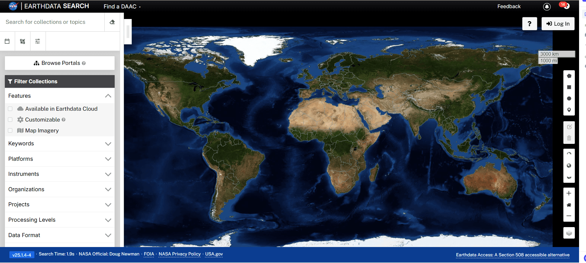
- Available Data: Collections from missions like Aqua, Terra, GOES, Suomi-NPP, and many others, covering atmospheric, oceanographic, climate, and cryosphere data.
- Search Features: The platform is a robust data discovery portal. It allows filtering by mission, instrument, and temporal or spatial parameters, making it possible to find highly specific free satellite imagery and data.
- The Challenge: The interface is complex and unintuitive for anyone outside the scientific world. Earthdata Search offers no built-in analytical tools; it is designed to help you find and download raw, often highly specialized data that you must then process on your own.
4. Google Earth Pro
A tool familiar to almost everyone, Google Earth Pro revolutionized how we view our planet. Now completely free, it offers several useful features for basic visualization.
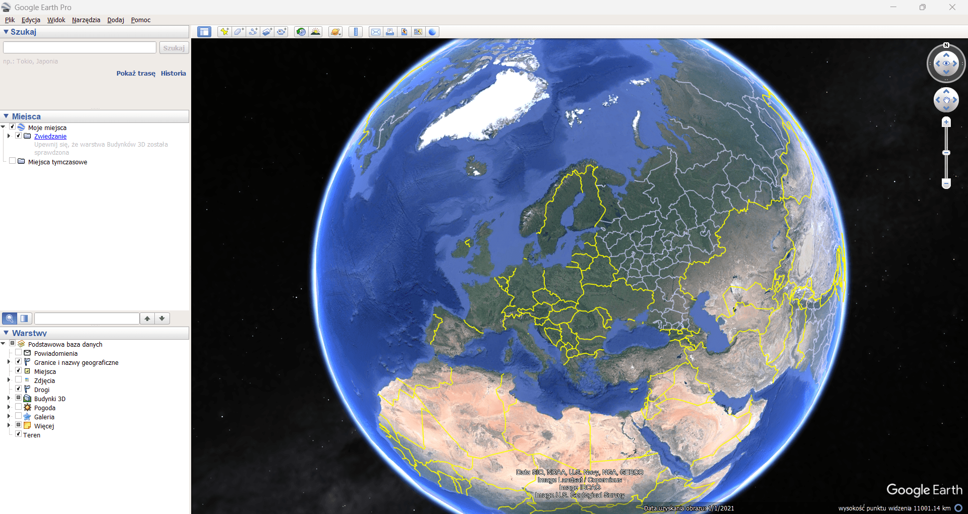
- Key Features: An intuitive interface, global coverage, and a historical imagery feature that allows you to see changes over time. The desktop application is perfect for basic visualization, measuring distances, or creating simple presentations.
- The Challenge: Google Earth Pro is primarily a virtual globe, not an analytical tool. The resolution of its free satellite imagery is often insufficient for detailed analysis, and the data itself is a processed mosaic not intended for professional quantitative studies. It's an excellent tool for exploration but not for precise analysis.
The Simpler Alternative: A Ready-Made Report Instead of Raw Data
As you can see, working with free satellite imagery demands time, specialized knowledge, and the right software. But what if you need a specific answer, not a pile of raw data to analyze yourself?
This is where the Satellite Imagery Report comes in.

Instead of spending hours searching, downloading, and processing data, you get a ready-to-use product in just a few minutes. It is the perfect solution for professionals in real estate, agriculture, urban planning, and environmental management.
Learn more about Satellite Imagery Report Download Sample Report
Why is an Ongeo Intelligence Report a Better Choice?
- Simple and Hassle-Free Access: Orders are placed via an intuitive online form - no account registration, unnecessary contracts, or subscriptions required.
- Free access to satellite imagery with code ongeo100: Generate reports at no cost during this promotion period for resolutions up to 10 m.
- High-Resolution Imagery: We offer data with resolutions as high as 0.3 meters, providing the detail needed for precise analysis.
- Clear and Organized Report: The imagery is delivered in a clean, easy-to-read PDF report where scenes are arranged chronologically, making it effortless to track changes over time in your chosen area.
Try It for Free and See for Yourself!
Ongeo Intelligence offers a chance to test its solution at no cost. By using the discount code ONGEO100, you can generate a full report based on Sentinel free satellite imagery for your chosen area, completely free of charge. It's the perfect opportunity to compare the convenience of a finished product with the challenges of working with raw, open data.