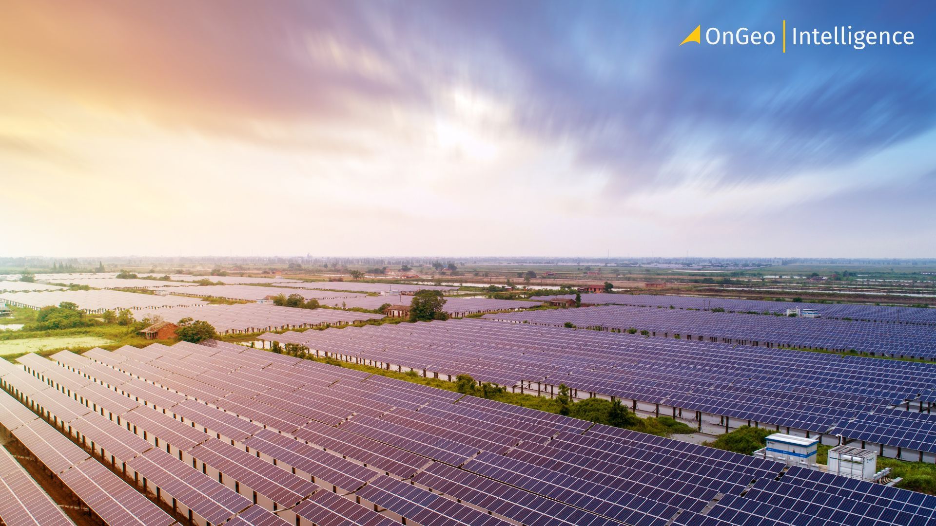
How Satellite Earth Observation Is Powering the Future of Solar Energy
The integration of satellite Earth Observation (EO) data into the solar energy sector is quietly transforming how solar systems are designed, deployed and managed. As renewable energy scales globally, satellite imagery is becoming essential for planning infrastructure, predicting output and maintaining performance across diverse geographic and climatic regions.
The Essential Role of EO Data in Solar Development
Solar energy is widely seen as one of the cornerstones of a sustainable future. However, to fully realize its potential, accurate data about terrain, sunlight availability and environmental conditions is critical. This is where satellite Earth Observation steps in. EO data allows for a comprehensive and scalable approach to solar development, reducing reliance on manual inspections and outdated records. It enables developers and operators to oversee large-scale solar assets, improve precision in system design and ensure that renewable energy infrastructure delivers its full potential.
Optimizing Site Selection Using Satellite Imagery
One of the most significant applications of satellite imagery in solar energy lies in site selection. Traditional planning methods – based on registry maps, in-person surveys or aerial photography – are too slow and limited in scope for today’s rapid energy transition. Satellite data, particularly very high-resolution (VHR) imagery with resolutions of 30–50 cm, can help identify optimal areas for installation by evaluating solar irradiance, shading, terrain and proximity to the power grid. Combined with AI and machine learning, this imagery allows for the automated identification of suitable rooftops, land plots or even artificial water surfaces for floating solar farms.
Enhancing Planning and Installation with EO Technology
Once a site is selected, satellite imagery continues to add value during the planning and installation phase. Designers can use it to measure usable rooftop area, assess roof pitch and detect obstructions such as chimneys or skylights—without visiting the site. This accelerates project timelines and enables the use of automated tools for proposal generation, often delivering results within hours or even minutes. For large solar parks, Earth Observation supports construction monitoring and compliance verification through multi-temporal imagery, providing visual evidence of progress and adherence to plans.
Satellite Data for Solar Operation and Maintenance
The use of satellite data does not end at deployment. On the contrary, it becomes even more critical during the operation and maintenance phase. EO imagery allows operators to track sunlight availability through irradiance mapping and to detect inefficiencies in panel performance caused by dust, shading or malfunctioning components. Advanced systems process weather satellite data, such as that from Meteosat-10, in near real-time to calculate sunlight reaching the surface and feed this into machine learning models. These models then generate highly accurate short-term forecasts of power output for individual installations, helping manage expectations and improve grid stability.
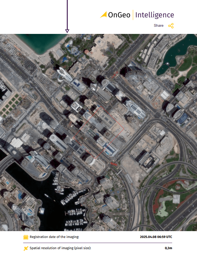
Simple Access to High-Resolution Satellite Imagery
OnGeo-Intelligence offers a straightforward solution for obtaining high-quality satellite imagery reports. Unlike other platforms, there’s no need for account registration, lengthy contracts, or complicated software. Simply select your area of interest, and we’ll deliver a detailed satellite image report directly to you in a user-friendly PDF format
Case Study: High-Resolution Panel Detection in Germany
A notable example of satellite-based panel detection comes from southern Germany, where researchers used WorldView-3 imagery enhanced to 15.5 cm resolution. Over 2,500 panel arrays were accurately mapped and validated using Google Earth, achieving over 97% precision. This case highlights how high-resolution EO data can support reliable infrastructure mapping at scale.
Environmental Monitoring and Addressing Spatial Injustice
Moreover, EO data enables ongoing environmental monitoring. It allows for the detection of vegetation overgrowth, erosion risks and changes in land use around solar farms. Such information is essential for regulatory compliance and supports the long-term sustainability of installations. In certain regions, satellite analysis has even uncovered spatial injustice in energy distribution. For instance, in Taiwan, the majority of land-intensive solar installations were concentrated in the central and southern parts of the country – regions that also suffered the greatest land use change – while energy consumption remained highest in the north. This raises important questions about fairness in renewable energy development, which satellite data can help quantify and address.
Key Benefits of Satellite Earth Observation in Solar Energy
- Enhanced Site Selection: High-resolution satellite imagery (30–50 cm) evaluates solar irradiance, shading, terrain, and grid proximity, enabling automated identification of optimal sites for solar installations, including rooftops and floating solar farms.
- Streamlined Planning and Installation: EO data measures rooftop areas, assesses obstructions, and monitors construction progress, accelerating project timelines and ensuring compliance without on-site visits.
- Improved Operation and Maintenance: Real-time irradiance mapping and weather data integration detect panel inefficiencies and provide accurate power output forecasts, enhancing grid stability.
- Environmental and Regulatory Compliance: Satellite monitoring tracks vegetation overgrowth, erosion risks, and land use changes, supporting sustainable solar farm management and addressing spatial inequities in energy distribution.
- Scalable Infrastructure Mapping: High-precision EO data, as demonstrated in southern Germany with 97% accuracy, supports large-scale solar panel detection and validation.
Limitations of Satellite EO in Solar Applications
Despite its many advantages, the use of satellite EO in solar energy does have limitations. Lower-resolution imagery may not capture small rooftop details and weather conditions such as cloud cover can delay data acquisition or reduce image quality. In some cases, satellite images may be outdated, requiring supplementary data or drone validation. However, ongoing technological improvements – including HD processing, 3D photogrammetry and integration with drone surveys – are steadily overcoming these obstacles.
The Future of Solar Energy Powered by Satellite Observation
The trend is clear: satellite EO is becoming an integral part of the solar energy ecosystem. From macro-scale site selection to micro-level fault detection, this technology is enabling solar providers to act faster, manage more efficiently and plan more sustainably. As the world works toward ambitious climate goals – such as the European Union’s REPowerEU plan or the IEA’s Net Zero by 2050 roadmap – the ability to monitor and manage solar infrastructure with precision will be indispensable. Satellite data offers not only a bird’s-eye view of the present but also a reliable foundation for the future of clean energy.