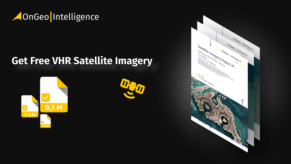
Free Maxar Imagery: Take Part in the OnGeo Promotion and Get Very High Resolution Satellite Images for Free
OnGeo Intelligence has kicked off a special campaign that gives you access to free Maxar imagery. As part of this promotion, you can request a Satellite Imagery Report with free high-resolution satellite imagery (down to 30 cm/pixel) from Maxar’s top constellations - including WorldView, WorldView Legion, and GeoEye satellites.
The campaign runs until September 30, 2025, and it’s open to anyone willing to share their story, idea, or use case for free satellite imagery.
What is the OnGeo Intelligence Satellite Imagery Report?
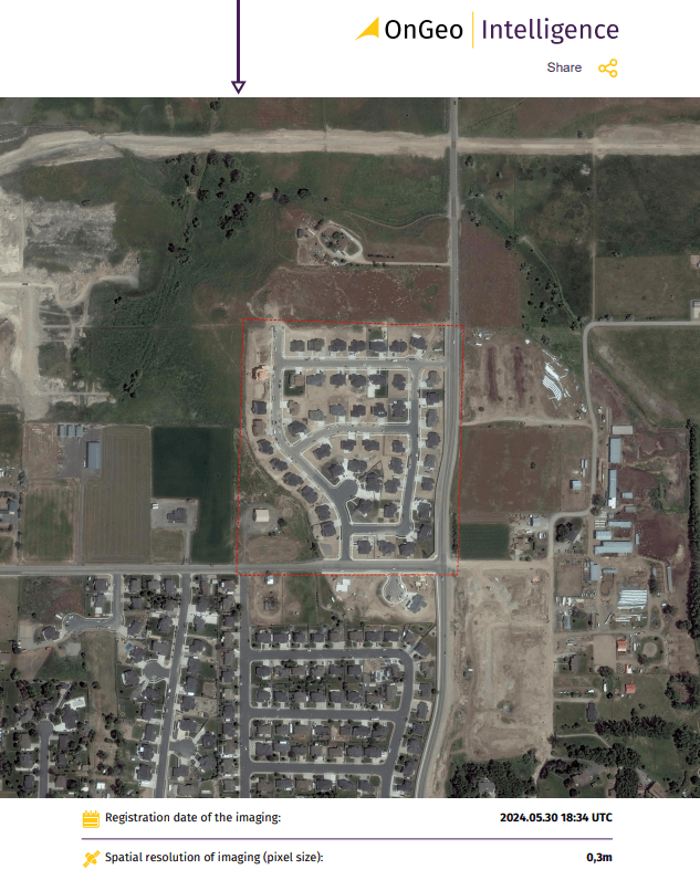
The Satellite Imagery Report from OnGeo Intelligence gives you access to high-resolution satellite images (down to 30 cm/pixel) of any location on Earth.
It uses premium commercial constellations such as WorldView-1 to 4, GeoEye-1, and the new WorldView Legion satellites - delivering highly detailed, accurate, and up-to-date imagery.
You can use the report for all sorts of purposes - from monitoring land and the environment, to urban planning, agriculture, journalism, or even just personal curiosity. Normally, this is a paid service, but right now you’ve got a unique chance to get high-resolution imagery for free.
Satellite Imagery Report - Your Key to Information
One of OnGeo Intelligence's flagship services is the Satellite Imagery Report.
Each report includes a satellite orthophotomap, detailed metadata (acquisition date, resolution), and a chronological series of images showing changes over time.
The report is delivered as a clear PDF summary plus a downloadable data package.
The OnGeo Intelligence Satellite Report service isn't just about current images; it also allows for historical data analysis, letting you monitor changes over time.
How Does the Promotion Work?
To qualify for free WorldView satellite imagery, free WorldView Legion satellite imagery, or free GeoEye satellite imagery, all you need to do is share a short story or description of how you’d use the data.
Send your story, idea, or use case by email to: contact@ongeo-intelligence.com
It could be a personal project, a business idea, or something completely different - what matters is that your story shows the practical or creative value of satellite images. We’re especially looking for authentic use cases from everyday people, not big institutions.
The most interesting entries will be featured on the OnGeo Intelligence blog and in our social media, showing how free high-resolution satellite imagery can help individuals and local communities around the world.
Example User Story: Divorce Drama, Who Really Built the House?

Anna and Thomas, a couple married for many years, found themselves in court during their divorce proceedings. The main dispute centered on the house they had built together. The land had been gifted to Thomas by his parents before the marriage, and he argued that this made the house solely his property. Anna disagreed, insisting that the house was constructed during the marriage with both of their financial and physical efforts, which entitled her to a share.
The case turned out to be challenging. The court needed solid proof of when the house had actually been built - vague memories and scattered receipts weren’t enough. That’s when Anna’s lawyer proposed using an unconventional source of evidence: the OnGeo Intelligence Satellite Imagery Report.
“We ordered a report for that exact plot,” Anna recalls. “It turned out that the archival satellite images clearly showed that at the time of our wedding, there was only a small, unfinished shed on the property. The house we lived in began construction only after we were married.”
“The satellite evidence was decisive! Once the court saw the images, it ruled that the house was part of our marital property. I received the share I was entitled to. It was a tough period, but the OnGeo Intelligence report helped me reclaim what I had worked so hard for,” Anna says with relief. Thanks to modern technology, justice prevailed.
Examples of how people use our reports:
Monitoring construction progress or land development
Tracking environmental changes such as deforestation or flooding
Verifying property conditions before buying land
Rules of the Campaign
Here’s what you need to know before you apply:
Send your story, idea, or use case by email to: contact@ongeo-intelligence.com
Your description should be at least 500 characters long. There’s no maximum - the more details, the better.
Once we receive your email, our team will review it and let you know if you qualify.
Selection depends on creativity, authenticity, and the practical value of your idea.
If we get a lot of submissions, we’ll choose the most inspiring ones.
The campaign lasts until September 30, 2025.
Qualified participants will get 1 free Satellite Imagery Report for their chosen location and timeframe.
The free report includes imagery from Maxar satellites (WorldView 1–4, Legion 1–6, GeoEye-1), depending on availability.
Each free report covers imagery worth up to $100 on the OnGeo Intelligence platform.
You’ll need to specify both the area of interest and the time period.
Other technical limits may apply, depending on the nature of the request. After we get your info, our team will check the availability of imagery and prepare your personalized report.
Why Take Part?
This is a rare chance to get high-resolution imagery for free and see for yourself how powerful satellite data can be. Whether you’re a farmer, landowner, student, journalist, or just curious about changes in your surroundings - free Maxar imagery gives you insights you won’t find anywhere else.
Your story could also inspire thousands of others by showing how free satellite imagery can be useful in everyday life.
How to Apply
👉 Send your story or idea today to contact@ongeo-intelligence.com
If you’ve got any questions, feel free to drop us an email - we’ll be happy to help.
📅Don’t wait too long - the promotion only lasts until September 30, 2025. Share your story, claim your free Satellite Imagery Report, and discover how satellite data can make a real difference.
Related articles
- Aerial photos as evidence in the case
- The Atlantic Forest Deforestation: South America's Silent Drama Seen from Space
- Detection of Illegal Construction in Satellite Images
- How to Find Free Satellite Imagery: A List of Open Data Sources
- Fighting modern slavery from space: How satellite data is shaping a new era of human rights protection