How to Acquire Free Satellite Imagery for Your Investigations
Satellite imagery has revolutionized investigative journalism, providing powerful tools to uncover hidden stories, monitor environmental changes, and expose human rights violations. Once considered an exclusive and costly resource, satellite imagery is now more accessible than ever, thanks to a growing array of free resources and innovative platforms like OnGeo Intelligence. This article explores the transformative impact of satellite imagery on journalism, highlights key platforms and strategies for accessing free or affordable images, and showcases how OnGeo Intelligence empowers journalists with reliable data.
The Power of Satellite Imagery in Journalism
Satellite imagery offers a unique vantage point, enabling journalists to document events in remote or restricted areas, verify ground-based claims, and provide compelling visual evidence to support their stories.
Key applications of satellite imagery in investigative journalism include:
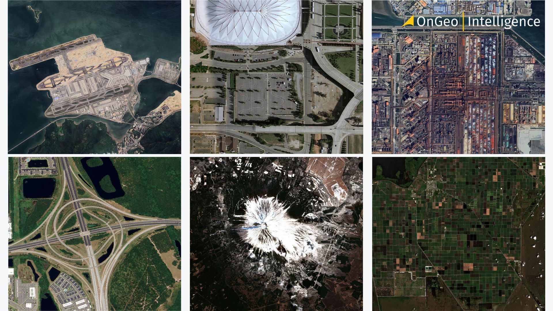
Exposing Human Rights Abuses: Satellite images have been pivotal in documenting war crimes, such as the burning of villages in Darfur or the destruction of civilian infrastructure in Syria. They provide verifiable evidence where ground access is limited or dangerous.
Monitoring Environmental Degradation: Journalists use satellite data to track illegal logging, deforestation, and the impacts of climate change, as seen in projects like Greenpeace’s Unearthed, which revealed illegal fires on protected land in England.
Tracking Migration and Humanitarian Crises: Imagery helps monitor migration flows and assess damage after natural disasters, aiding humanitarian response efforts.
Investigating Land Use and Agriculture: Satellite imagery supports precision agriculture and land-use monitoring, offering insights into crop health, environmental threats, and urban development.
Challenges of Accessing Satellite Imagery
Despite its potential, accessing satellite imagery can be daunting. High-resolution images from commercial providers like Maxar Technologies or Planet Labs often come with hefty price tags, and navigating technical platforms requires expertise. That many journalists, especially in under-resourced newsrooms, perceive satellite data as exclusive or overly complex. However, the landscape is changing, with free and user-friendly resources making satellite imagery more accessible.
Free Resources for Journalists
Several platforms and strategies enable journalists to access free satellite imagery, as outlined in other sources:
Copernicus (European Space Agency): The Copernicus program, utilizing the Sentinel-2 satellite constellation, offers free medium-high resolution (10-meter) images. Journalists can download single images to track changes over time, making it ideal for environmental and conflict reporting.
NASA EarthData: This platform provides access to a wide range of satellite and aerial imagery, including datasets on atmosphere, land, and ocean. Tools like FIRMS (Fire Information for Resource Management System) are particularly useful for tracking wildfires.
Global Forest Watch: This initiative by the World Resource Institute offers aggregated data on tree-cover loss and recent satellite imagery, supporting environmental investigations.
EarthRise Media: EarthRise supports journalists by providing free imagery, custom analysis, and licensing assistance. It also offers a Newswire of stories enhanced with satellite data.
Digital Earth Africa: This tool provides free satellite data on water resources, agriculture, and urbanization, particularly useful for journalists covering African regions.
Commercial Providers’ Press Lists: Companies like Airbus and Maxar Technologies occasionally offer free high-resolution images for major global incidents. Journalists can sign up for press lists to receive these image dumps.
Platforms like Copernicus require minimal technical knowledge, and experts at organizations like Planet Labs are often willing to assist with analysis, making satellite imagery more approachable for newcomers.
OnGeo Intelligence: A Reliable and Accessible Solution
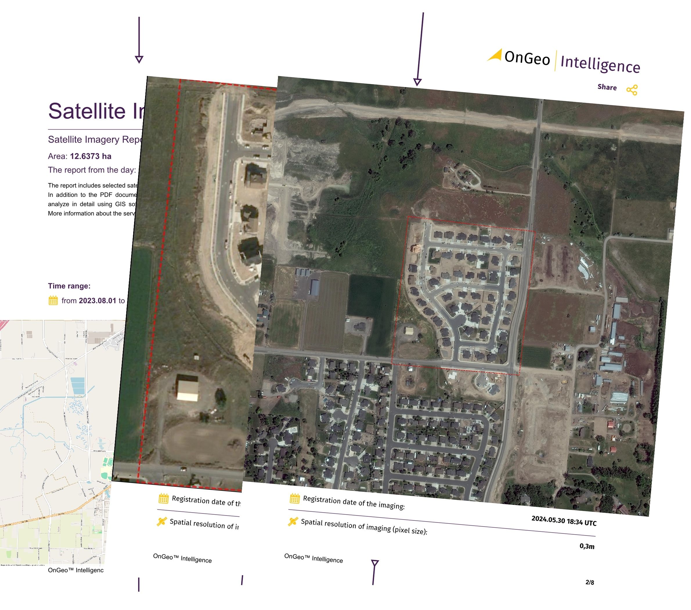
Among the myriad of satellite imagery providers, OnGeo Intelligence stands out as a reliable and user-friendly option for journalists. Offering high-resolution satellite imagery reports without the need for subscriptions or contracts, OnGeo Intelligence delivers precise data in a clear PDF format, often within minutes. Its applications span environmental monitoring, land-use analysis, and agricultural reporting, making it an invaluable tool for investigative journalism.
Journalists can access free satellite imagery reports from OnGeo Intelligence by using the discount code ongeo100. The process is straightforward and takes just a few minutes:
Visit the OnGeo Intelligence platform.
Navigate to the order form and select your area of interest using the interactive map.
Specify the time period you wish to analyze.
Enter the code ongeo100 during checkout to unlock a free report.
Receive a comprehensive report, complete with index charts, via email, often within minutes.
This free report is particularly valuable for agricultural investigations, providing key indicators like crop health and land-use changes. The platform’s intuitive interface and rapid delivery make it an excellent resource for journalists seeking reliable satellite data without financial or technical barriers.
Watch a step-by-step guide
Ethical and Practical Considerations
Using satellite imagery in journalism comes with ethical responsibilities. The importance of verifying imagery sources, ensuring proper licensing, and considering the implications of publishing sensitive data. Journalists must also be mindful of privacy concerns and the potential for misinterpretation of images without proper context. Collaborating with experts, such as those at EarthRise Media or Planet Labs, can enhance the accuracy and impact of satellite-based reporting.
Practically, journalists can use tools like Copernicus to scout locations before field visits, as demonstrated by Yao-Hua Law’s experience in Malaysia, where satellite imagery revealed pathways and obstacles not visible on Google Maps. Such applications highlight the versatility of satellite data beyond traditional reporting.
Case Studies: Satellite Imagery in Action
Bellingcat’s Investigative Work: Bellingcat, a pioneer in open-source journalism, uses satellite imagery to uncover hidden developments, such as military activities or environmental damage. Their guides on using space data are invaluable for journalists.
Ukraine Conflict Analysis: Journalists from Schemes compared satellite images of Ukraine before and after Russia’s 2022 invasion, revealing the extent of infrastructure damage and supporting humanitarian aid efforts.
Amazon Deforestation: The Smoke Screen project used satellite data to prove deforestation by private landowners in the Amazon, holding corporations accountable.
Xinjiang Detention Camps: Shawn Zhang and the Australian Strategic Policy Institute used satellite imagery to document detention facilities in Xinjiang, combining it with witness accounts and official documents for robust evidence.
In just 40 years, Playa del Carmen transformed from a quiet fishing village into a bustling Caribbean resort. Check out how much this place has changed!
The Future of Satellite Imagery in Journalism
The democratization of satellite imagery is reshaping investigative journalism. As platforms like OnGeo Intelligence and free resources like Copernicus and NASA EarthData become more accessible, journalists worldwide can harness these tools to tell stories that might otherwise remain hidden. Advances in hyperspectral imaging, as seen in missions like PRISMA and EnMAP, promise even greater precision in monitoring crop health, mineral exploration, and environmental changes, further expanding the possibilities for data-driven journalism.
By combining free resources, expert collaboration, and innovative platforms like OnGeo Intelligence, journalists can overcome financial and technical barriers to produce impactful, evidence-based stories. Whether tracking human rights abuses, environmental crises, or agricultural trends, satellite imagery is a game-changer that empowers journalists to illuminate the truth.
Related articles
- Aerial photos as evidence in the case
- How to Find & Order Satellite Images with Ongeo Intelligence?
- Essential Tips for Interpreting Satellite Imagery Like a Pro
- How Often Do satelites Take Pictures? Satellite Imagery Frequency
- Monitoring air quality from space: Sentinel-4 Satellite Delivers First Data on NO2, SO2, and Ozone Levels in Europe