🌍 Capture the world at 100% OFF! Use code ongeo100on 10 meters satellite image resolutions – limited time only! Higher resolution satellite images remain subject to payment.
🌍 Capture the world at 100% OFF! Use code ongeo100on 10 meters satellite image resolutions – limited time only! Higher resolution satellite images remain subject to payment.
Clouds may seem harmless from the ground, but from a satellite’s perspective, they are a major obstacle. In Earth Observation, cloud masking is not just a technical necessity – it’s a foundation for reliable analysis. Learn how modern EO systems tackle clouds to unlock clean, actionable insights from space.
High-Quality Satellite Imagery, Hassle-Free
Explore any location on Earth with precision. Order a detailed Satellite Imagery Report—no sign-ups, no contracts. Delivered in a clear PDF for instant insights.
Satellite imagery has revolutionized how we observe, measure, and manage our planet. But there's one persistent challenge that continues to cloud the view – literally. Optical satellites like Sentinel-2, Landsat, or commercial platforms such as WorldView produce data that’s invaluable across agriculture, forestry, urban planning and disaster response. However, clouds and their shadows often interfere with that data, obscuring the ground and degrading accuracy.
Cloud masking is the process of detecting and filtering out cloud-covered pixels and their shadows in satellite images, making datasets usable for time-sensitive and detail-rich analyses. Unlike synthetic aperture radar (SAR) systems that can see through clouds, optical sensors are helpless in cloudy conditions. Therefore, identifying and masking clouds is a critical preprocessing step before any further data analysis can take place.
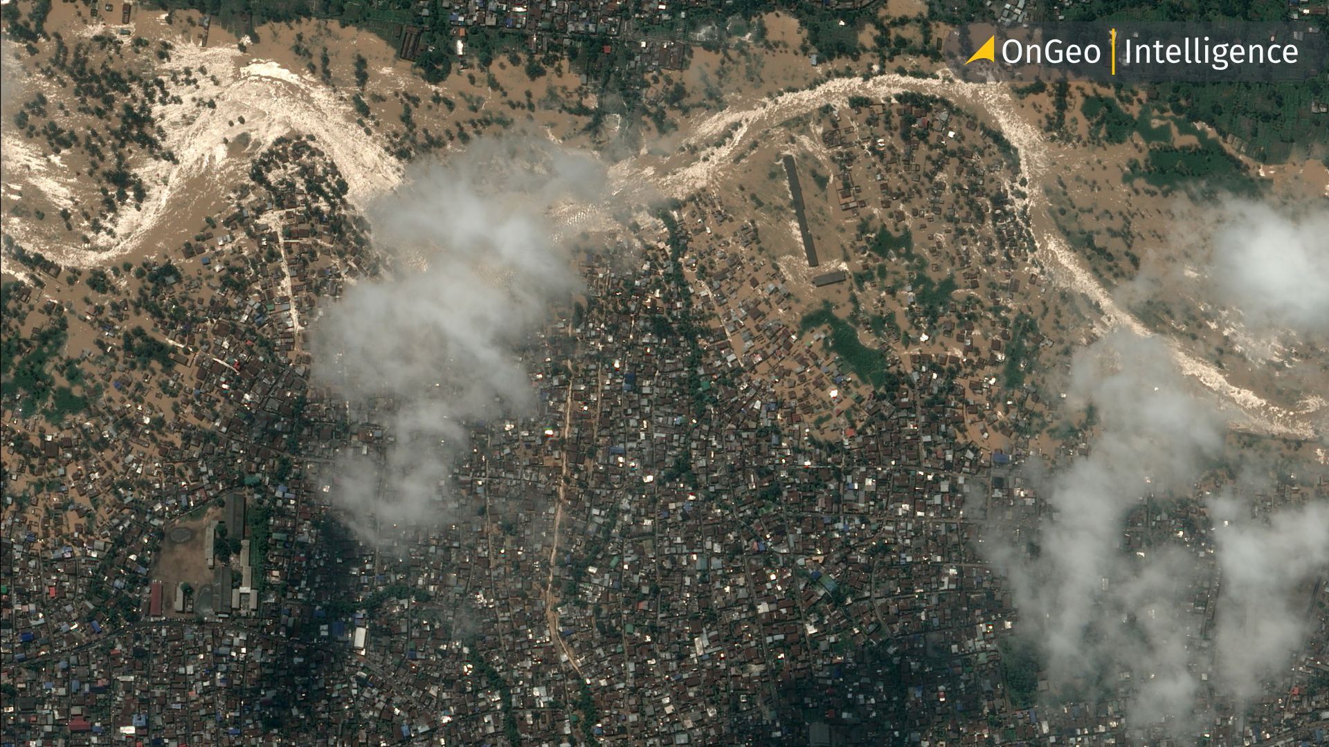
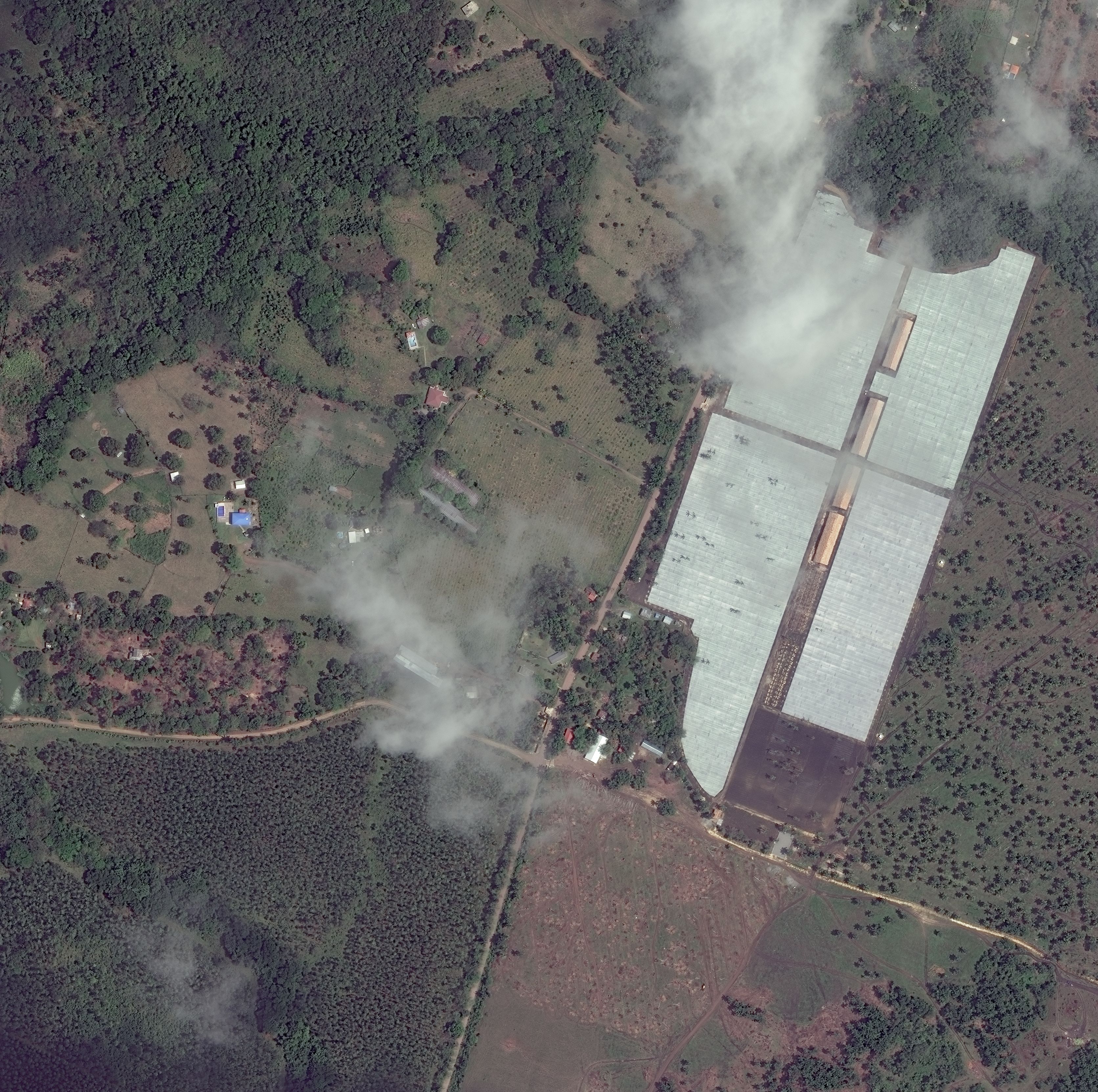
Example of a high-resolution satellite image partially obscured by clouds.
Sample cloud-covered satellite image from an Ongeo Intelligence report.
Applications Across Industries
At its core, cloud masking removes "noisy" information, allowing analysts and algorithms to focus on valid surface data. This becomes essential in applications such as crop monitoring, where a farmer needs up-to-date, clear NDVI maps to make decisions about irrigation or pest control. Similarly, urban planners rely on cloud-free composites to assess land use or infrastructure changes. Environmental agencies monitoring deforestation or mining activity can’t afford to misinterpret data due to a stray cumulus cloud.
Methods of Cloud Detection
Various strategies exist to tackle this challenge. A common approach is to stack and mosaic images taken on different dates, selecting cloud-free patches to construct a full scene. This works when time is not critical—but often, the need is for near-real-time data. Hence, automated cloud detection and masking have become the norm. Advanced systems, such as OnGeo intelligence, automatically exclude images with more than 60% cloud cover. Some even generate cloud-free indices using radar data as a fallback.
The Rise of AI in Cloud Masking
But modern cloud masking goes beyond rule-based classification. AI-driven models like KappaMask, developed by Estonia’s KappaZeta in partnership with ESA Φ-lab, use active learning to create accurate masks for Sentinel-2 imagery. By training on the most informative image samples and leveraging both cloud and shadow detection, this tool has outperformed many previous solutions. Initially trained on Northern European summer data, it is now being expanded to global, year-round coverage.
Filling in the Gaps
More sophisticated techniques also address cloud-induced data gaps. Methods like DINEOF (Data Interpolating Empirical Orthogonal Functions), geostatistical Kriging, and neural networks can reconstruct missing pixel values using historical time series. These “gap-filling” methods are powerful but not foolproof—particularly when detecting sudden, unexpected events like floods or wildfires, where prediction based on past data may lead to misleading results.
The Haze and Snow Conundrum
A particularly nuanced challenge lies in distinguishing between clouds and haze. Though both appear similarly bright in visible bands, they differ in water vapor content and optical thickness. For some tasks, haze can be ignored; for others, it’s a crucial factor. Another classic confusion arises between clouds and snow. Both are bright in visible bands and cold in thermal infrared, making differentiation tricky. For example, snow at high altitudes can mimic cirrus clouds, and snow-soil mixtures can resemble cloud patterns. Solving these ambiguities may require additional spectral bands or even hyperspectral sensors.
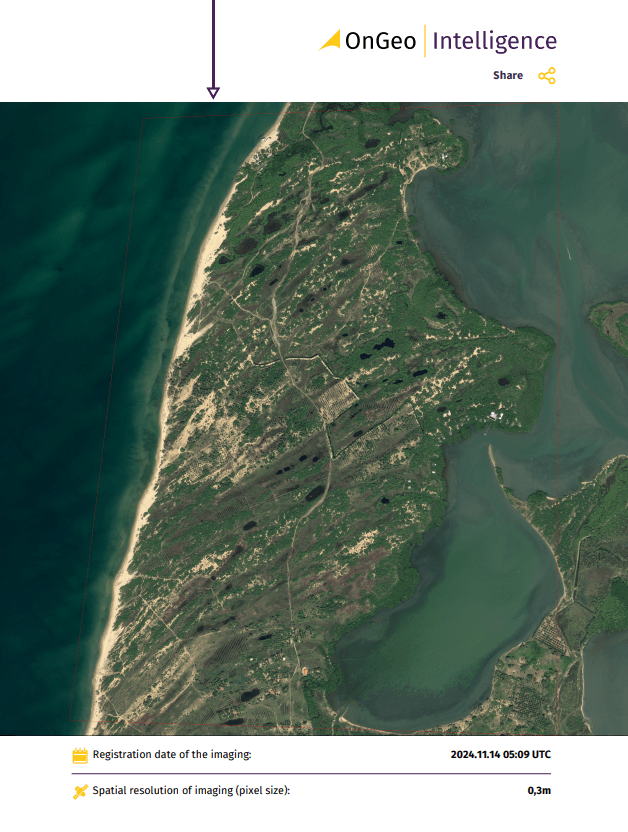
The OnGeo Intelligence Satellite Image Report service provides detailed satellite images tailored to the user’s selected area and time period. This comprehensive report includes a chronological arrangement of satellite imagery, offering clear insights into changes over time. Requested data will be delivered in a PDF document. Users can choose from a range of image resolutions to meet their specific needs, including:
very high-resolution images: 0.3 - 1.0 meters,
high-resolution images: 1-2 meters,
images with a 10-meter resolution.
Enjoy exceptional convenience and accessibility with the OnGeo Intelligence Satellite Imagery Report service – no account registration, contracts, or subscription fees required.
The impact of effective cloud masking is hard to overstate. In sectors like precision agriculture, masking enables accurate yield estimation and targeted fertilization. In environmental protection, it ensures the integrity of long-term land cover monitoring. For emergency response, it accelerates reliable damage assessment after storms or fires. Even defense and intelligence applications rely on precise masks to avoid misinterpretation of satellite scenes. As the volume of satellite data continues to grow, and machine learning models become more robust, cloud masking is evolving from a technical hurdle into a sophisticated, integrated part of Earth Observation workflows. It's no longer just about hiding clouds – it's about revealing the truth beneath them.
Votes: 0, Average rating: 0
Payment operators:
We use cookies to run our website, analyze your use of our services, manage your online preferences & personalize ad content. By accepting our cookies, you'll get relevant content and social media features, personalized ads, and an enhanced browsing experience. To manage your choices, click "Cookie Settings." Necessary cookies are required for the core website functionality and cannot be rejected. For more information, see our Cookie Policy.
About cookies on this site
Cookies used on the site are categorized. Below you can allow or deny some or all of them, except for Necessary Cookies which are required to provide core website functionality. When categories that have been previously allowed are disabled, all cookies assigned to that category will be removed from your browser.
Some cookies are required to provide core functionality. The website won't function properly without these cookies and they are enabled by default and cannot be disabled.
Preference cookies enables the web site to remember information to customize how the web site looks or behaves for each user. This may include storing selected currency, region, language or color theme.
Analytical cookies help us improve our website by collecting and reporting information on its usage.
Marketing cookies are used to track visitors across websites to allow publishers to display relevant and engaging advertisements. By enabling marketing cookies, you grant permission for personalized advertising across various platforms.
The cookies in this category have not yet been categorized and the purpose may be unknown at this time.