Near Infrared: A key tool for vegetation and crop health monitoring
The Near Infrared band is particularly useful in agriculture for crop health monitoring and assessing the overall condition of vegetation. In general it is used for assesment of the condition of vegetation. It is possible due to NIR’s strong correlation with the plants’ chlorophyll level. Healthy plants with high levels of chlorophyll are able to reflect the NIR light very efficiently. On the other hand when the plants are in bad condition for example because of drought, diseases or improper fertilization their ability to reflect NIR light decreases.
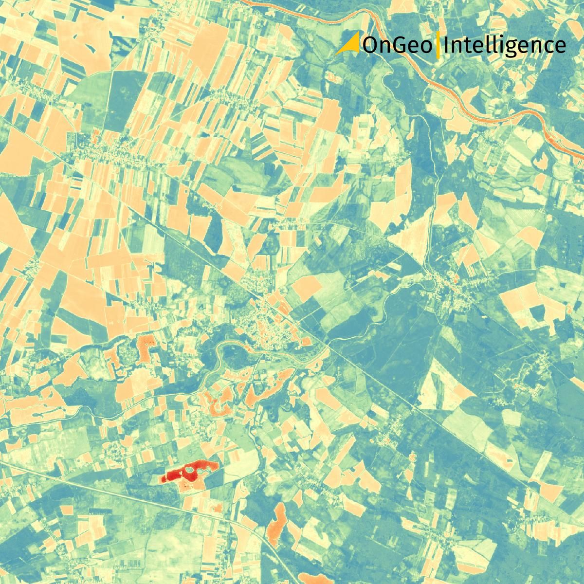
The Normalized Difference Vegetation Index (NDVI) is a widely used index in agriculture related remote sensing to assess vegetation health. NDVI is based on the contrast between NIR and red light. It is a vital tool for monitoring crop health and forest conditions. Moreover, NDVI Index negative changes in vegatation quite early, allowing for timely intervention in agricultural and environmental management.
NDVI index example imagery OnGeo™ Intelligence. Areas covered with greenery take on green colors. Urbanized areas and water - red.
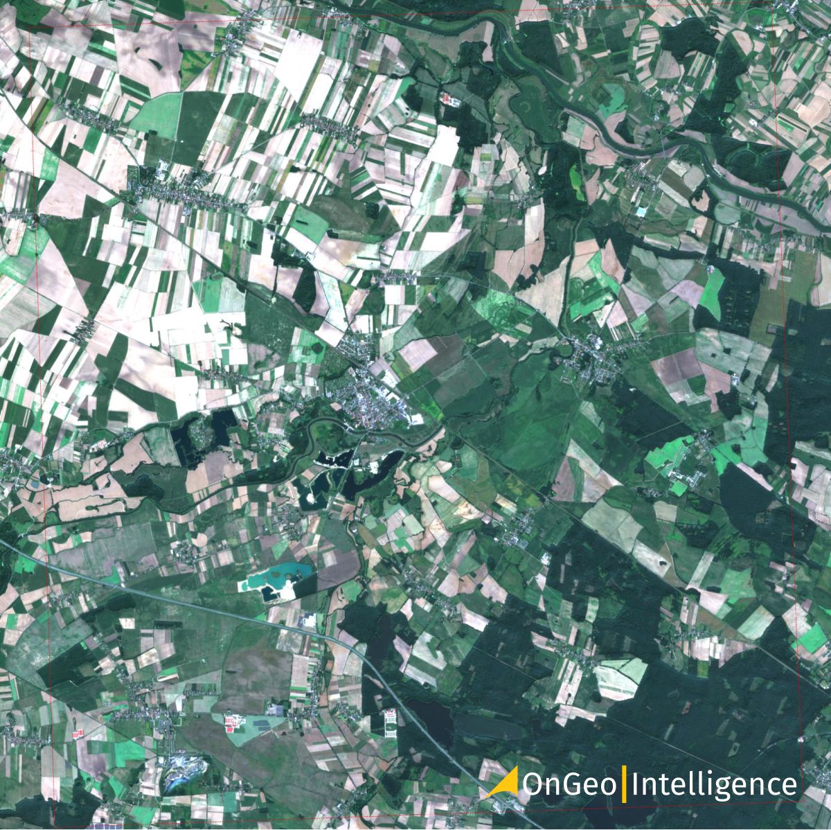
The same image in RGB colors OnGeo™ Intelligence.
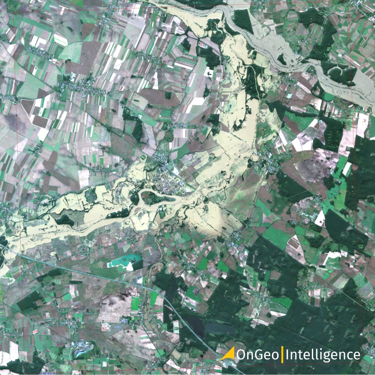
Poland, Lewin Brzeski, 24.08.2024
Using NIR for water body identification
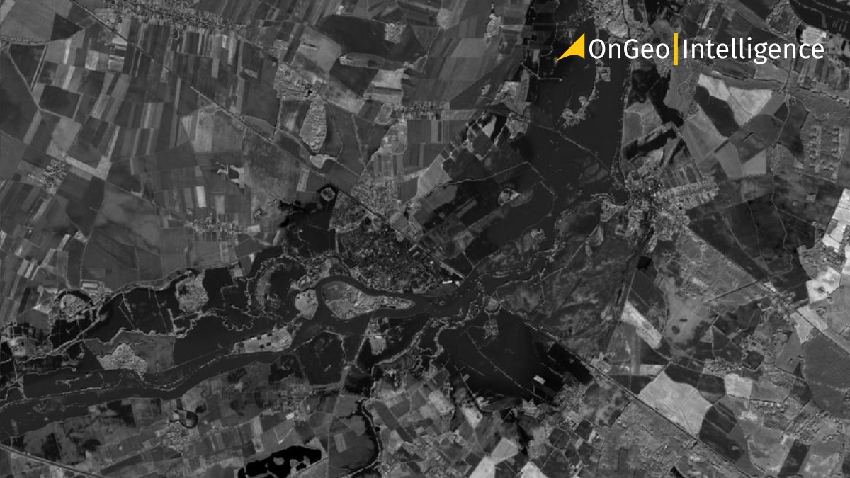
NIR imagery is very useful in distinguishing water bodies. Near Infrared wavelengths are strongly absorbed by water. In fact, contrary to the visible light which is highly reflected by water surface NIR is almost completely absorbed by water.
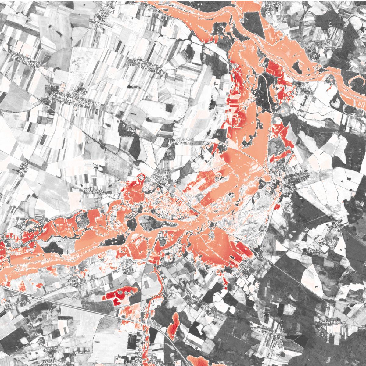
As a result in acquired images the water bodies seem to be pretty dark. They contrast very strongly with the surrounding land, vegetation or built-areas, as all of those reflect NIR light very strongly. Thanks to this phenomenon NIR might be very helpful in for example monitoring the flood area – clearly showing the maximum water range. It can also support long term hydrological studies performed by the experts enabling them to monitor long time coastal changes of the river banks.
Example of a satellite image with calculated NDVI index, flood area: Poland, Lewin Brzeski, 18.09.2024
Satellite image in RGB (Red, Blue, Green) colors, flood area: Poland, Lewin Brzeski, 18.09.2024
NIR in urban planning and infrastructure monitoring
NIR spectral band can also be used in urban planning and urban expansion studies. Thanks to Near Infrared the researchers are able to distinguish between vegetation and impervious surfaces such as buildings, roads and sidewalks. According to the research published in 2020 proper analysis of differences between shortwave infrared (SWIR) and Near Infrared (NIR) bands can be successfully used to separate urban from non-urban areas in an image. The authors of the paper reported an accuracy of this method to reach 92.6%.
In this domain NIR may facilitate urban heat islands monitoring as well as infrastructure planning. Near Infrared is useful for monitoring linear infrastructure such as pipelines or power grids, particularly in relation to vegetation management. NIR imagery helps detect areas where vegetation is growing too close to power lines or pipelines. This is particularly useful for preventing vegetation encroachment that could pose a risk to infrastructure, such as causing damage to pipelines or leading to power outages.
As mentioned above, using NIR, the linear infrastructure operators can assess the health of nearby vegetation. Healthy trees that reflect more NIR may indicate a higher risk if they are close to infrastructure because they are growing rapidly. On the other hand trees in poor condition pose a risk of falling.
Get clear insights on any location using OnGeo™ Satellite Imagery Report
Satellite Imagery Report OnGeo™ Intelligence is the simplest way to obtain small scenes of high resolution satellite images within an average of 5 minutes, for low-resolution scenes and up to a maximum of 48 hours for high-resolution data. In addition to providing high-definition imagery, the service includes images with a 10-meter resolution that feature not only the basic Red, Blue, and Green (RGB) channels, but also Near Infrared (NIR) and Shortwave Infrared (SWIR) bands. These additional spectral channels are essential for performing in-depth analyses using GIS software.
Additionally, the OnGeo Intelligence Report includes a remote sensing idicies report that features graphical representations of the variability of NDVI, NDMI and NDWI over time, corresponding to the satellite images chosen for the report. This enables users to track changes and trends, providing valuable insights into vegetation health, land use, or other environmental factors.
Learn more about: Satellite Image Report service
Download: Sample Satellite Imagery Report
Vital tool for vegetation and land cover monitoring
To sum up, satellite remote sensing based on NIR plays a key role in tracking vegetation health and its growth patterns. It helps the scientists to analyse land use and land cover. Near Infrared is nowadays is a truly powerful tool in satellite Earth observation for environmental monitoring, agricultural management, forestry, infrastructure mapping and urban planning.
Among the satellites able to provide the end users with NIR imaging there are for instance WorldView-2, WorldView-3 and Pleiades Neo.