Download the Satellite Map of São Paulo – Free Printable PDF
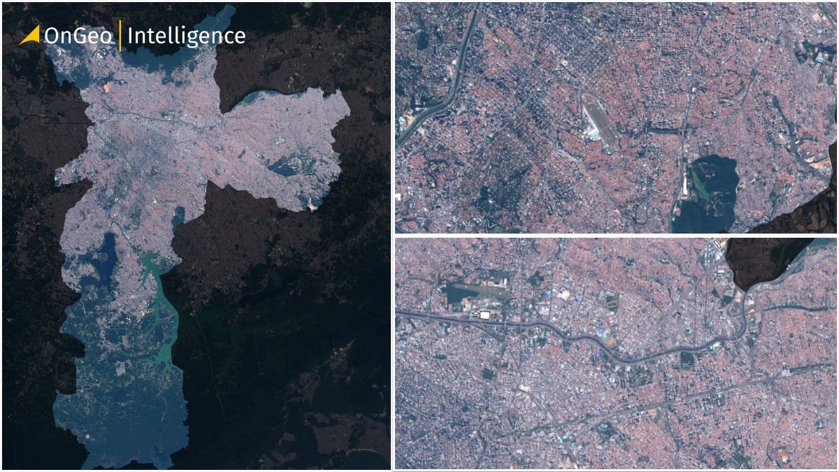
São Paulo, the pulsating economic and cultural heart of Brazil, is one of the world’s largest and most dynamic cities. Its vast urban sprawl, intricate road networks, and green spaces make it a fascinating subject for satellite observation. Satellite mapping provides a powerful, objective perspective on São Paulo’s growth, infrastructure, and environmental features-essential for planners, researchers, and anyone curious about the city’s evolution.
Download a High-Quality Satellite Map of São Paulo – PDF
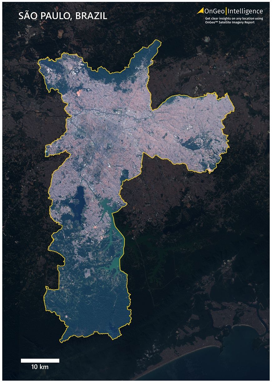
View São Paulo in stunning detail with our free, printable satellite map. This map uses 2024 Sentinel-2 imagery at 10 meters per pixel resolution and is available as an A3 PDF (24.9 MB).
📥[Download High-Quality Satellite Map of São Paulo (PDF, 24.9 MB)]
Format: A3 PDF
Resolution: 10 meters/pixel (RGB, natural color)
File Size: 24.9 MB
Year: 2024
Features: Yellow city boundary, darkened background, scale bar, OnGeo Intelligence branding
São Paulo Satellite Map Thumbnail Low Quality
What the Satellite Map of São Paulo Contains
Our 2024 satellite map of São Paulo is crafted for clarity and usability. Key features include:
Natural Color (RGB) Imagery: See São Paulo’s true colors, from dense urban zones to parks and rivers.
City Boundary Highlight: A vivid yellow outline marks the official limits of São Paulo.
Contrast-Enhanced Background: The area outside the city is darkened for visual emphasis.
Scale Bar: Located in the bottom-left for accurate distance reference.
Title: “São Paulo, Brazil” at the top.
A3 Printable Quality: Perfect for reports, presentations, or wall display.
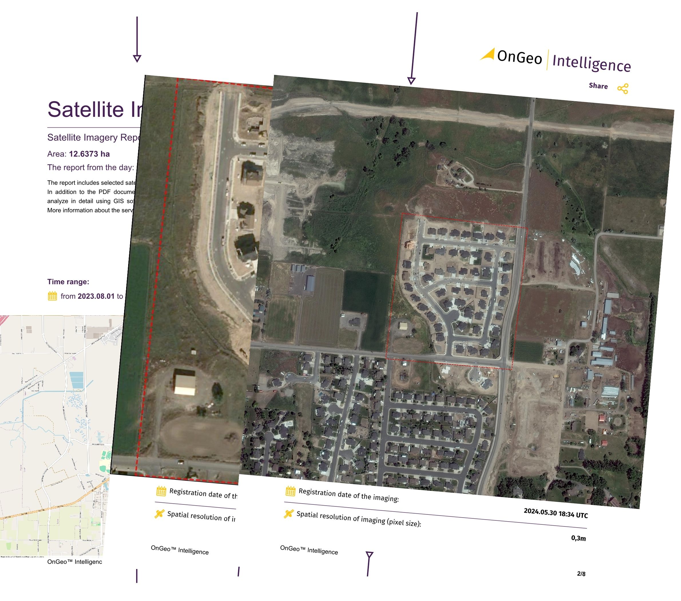
OnGeo Satellite Imagery Report – Instant Map of Your Property
Need satellite imagery of a specific property, parcel, or zone in Brazil or anywhere else?
With the OnGeo Satellite Imagery Report, you can generate a custom satellite map in seconds — no login required.
🛰 Highlights:
Very high-resolution satellite images
Fast, mobile-friendly PDF access
Order directly from your phone or desktop
Ideal for landowners, architects, investors, and planners
Explore OnGeo Intelligence:
Who Created the Map and How It Was Made
This map was produced by the OnGeo Intelligence team using data from the European Space Agency’s Sentinel-2 satellite. Our specialists process and enhance the imagery for maximum clarity, ensuring accurate color and geographic detail. With decades of GIS and remote sensing experience, OnGeo delivers maps you can trust.
Satellite Map of São Paulo – Tailored to Your Needs
Need a custom map of São Paulo or another area? OnGeo Intelligence offers bespoke satellite maps to fit your needs-whether it’s a specific district, a different time period, or additional data layers. Contact us at contact@ongeo-intelligence.com to discuss your project or request advanced analysis.
How to Use the Map
You are welcome to use and print this map for:
🎓Personal, educational, or research purposes
📝Reports, presentations, and publications (please credit: “Source: OnGeo Intelligence, Sentinel-2 imagery”)
🏤Urban planning, real estate, or environmental projects
⚠️You may modify the map for your own use, but please retain attribution to OnGeo Intelligence.
Explore More City Maps Soon
Stay tuned for more high-quality satellite maps from OnGeo Intelligence. Upcoming cities include Lima, Bogotá, Santiago, and more. Follow our blog for the latest releases!
Related articles
- Download the Satellite Map of Buenos Aires – Free Printable PDF
- Download the Satellite Map of Rio de Janeiro – Free Printable PDF
- Download the Satellite Map of Mexico City – Free Printable PDF
- How to Get a Current Satellite Map of My Property
- How Often Do satelites Take Pictures? Satellite Imagery Frequency