The Atlantic Forest Deforestation: South America's Silent Drama Seen from Space
The Atlantic Forest, once a vast green belt of South America, faces unprecedented deforestation. Discover how satellite imagery reveal the scale of this ecological drama and what can be done to protect this remarkable biome.
South America is a continent of immense biodiversity, with vast forests at its heart. When thinking about their destruction, our attention naturally turns to the Amazon deforestation. However, in the shadow of this giant, an equally dramatic story unfolds - the silent disappearance of the Atlantic Forest (Bosque Atlántico), the second-largest forest biome in the region.
It once stretched majestically across eastern and southern Brazil, eastern Paraguay, and northern Argentina, providing a home for countless plant and animal species. Today, its remnants constitute only a fraction of its original area.
This article delves into the scale of this problem, leveraging the reliable insights provided by Landsat satellites, which precisely document changes in our planet's landscape. Prepare for an in-depth look at how satellite data reveals the relentless pace of Atlantic Forest deforestation.
Why is the Atlantic Forest so important?
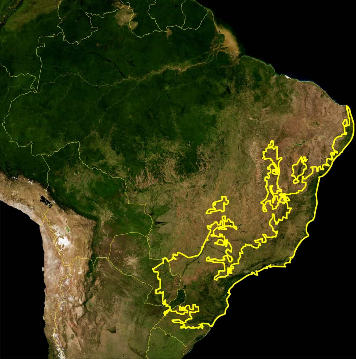
The Atlantic Forest, though often overlooked in public discourse, is a true gem of ecosystems. It boasts extraordinary biodiversity, often surpassing that of many parts of the Amazon. It is home to endemic species found nowhere else in the world. These are the green lungs of South America, regulating climate, retaining water, and stabilizing soils. Its loss is not just a local issue, but a global one.
Initial spread of the Atlantic Forest.
Landsat Satellites: Our Guardians in Space
In the face of such a widespread problem, traditional monitoring methods are insufficient. This is where satellites come to the rescue. Programs like Landsat, and more recently Copernicus with its flagship Sentinel satellites, provides invaluable data for monitoring Earth's forests. Landsat images, along with Sentinel-2 imagery (from 2015 onwards), thanks to their spatial resolution and revisit frequency, allow for precise tracking of changes in land cover. Specialized satellite data analyses, including vegetation indices (such as NDVI), enable the identification of areas where deforestation is occurring, even in remote regions.
Silent Disappearance: The Scale of Atlantic Forest Deforestation
The data is alarming. It is estimated that from the Atlantic Forest's original area of approximately 1.3 million km², only 12-16% remains in scattered fragments. The largest losses have been recorded in Brazil, but Paraguay also faces a severe problem.
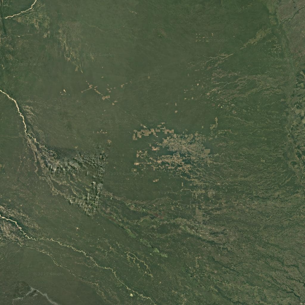
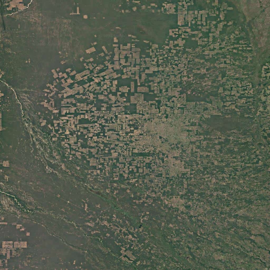
The dramatic decline of the Atlantic Forest: 1984 vs. 2020
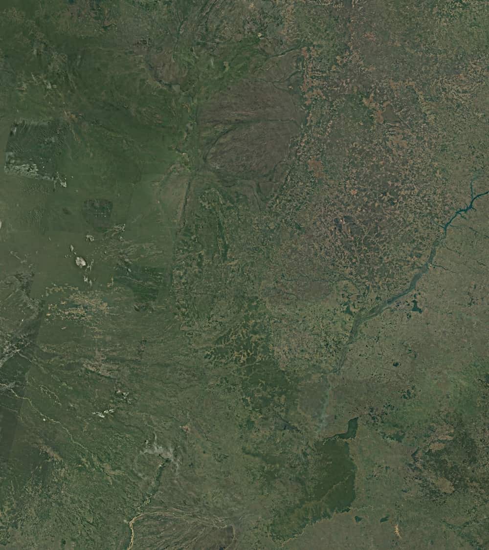
A Landsat/Google Earth comparison.
Main Causes of Deforestation
- Agricultural Expansion: This is undoubtedly the biggest culprit. The growing demand for soy (primarily used as animal feed) and increased cattle farming lead to massive forest clearing. Sentinel images show how forests give way to gigantic agricultural fields and pastures.
- Illegal Logging: Although to a lesser extent than agriculture, illegal logging remains a problem.
- Urbanization and Infrastructure: The development of cities and road construction also contribute to the fragmentation and destruction of forest habitats.
Paraguay: An Epicenter of Destruction
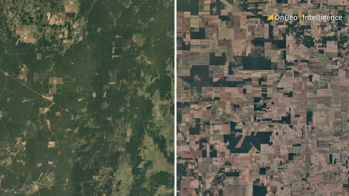
Paraguay, especially its eastern region, has become a tragic example of dynamic deforestation. In just 50 years, 90% of the Atlantic Forest in the country has been destroyed. How does this look from space?
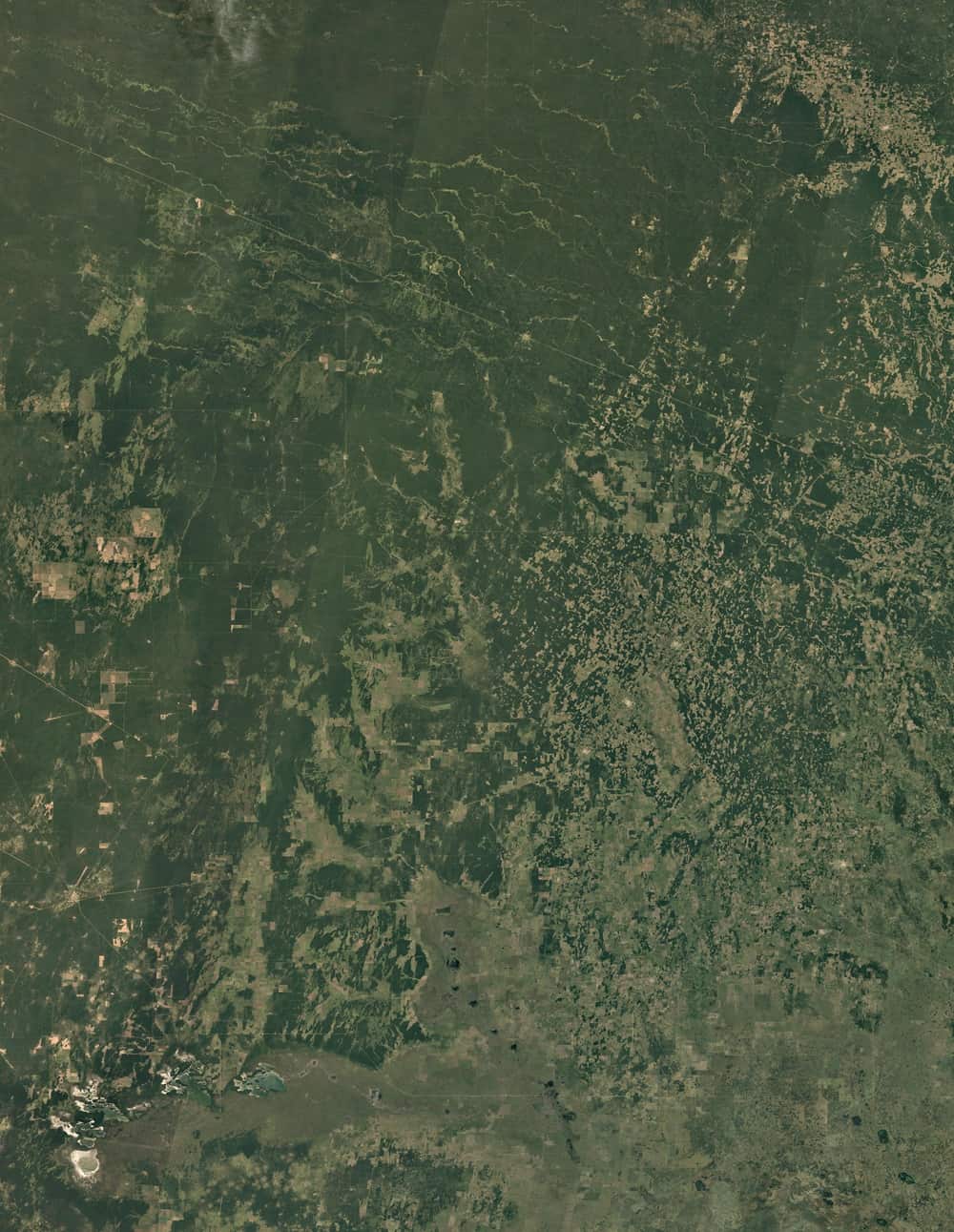
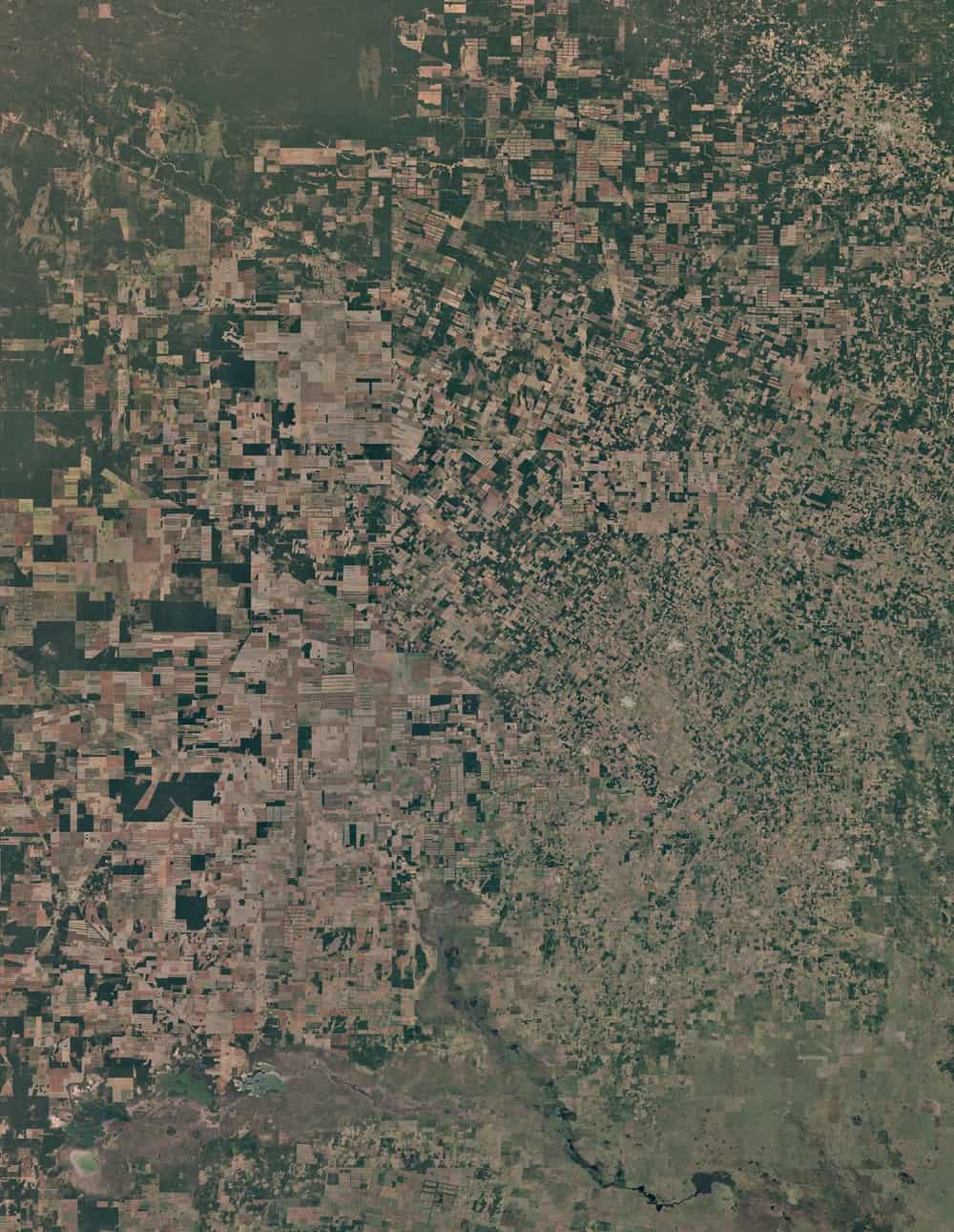
Satellite images reveal dramatic changes in Paraguay: 1986 vs. 2020
A Landsat/Google Earth comparison.
Green forest patches shrink, giving way to a mosaic of agricultural fields, mainly soy. This is visual evidence of who profits from this practice and who loses - international agricultural corporations gain, while local communities and the environment bear the costs.
Satellite Imagery Report for free! Code: ongeo100
Use the code ongeo100 to download a free OnGeo Intelligence Satellite Imagery Report with low-resolution images (10m, AI-enhanced to 2.5m), perfect for analyzing large areas – this is your chance for free access to satellite data.
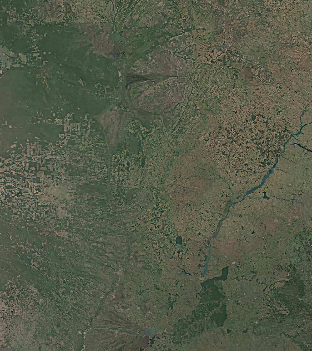
Argentina Chaco: Deforestation 1984 vs. 2020
A Landsat/Google Earth comparison.
Note the numerous areas, which are remnants of deforested regions. These places were once part of a lush forest.
Consequences for Environment and Humanity
The effects of deforestation are manifold:
- Loss of Biodiversity: The extinction of endemic species is an irreversible loss.
- Climate Change: The Atlantic Forests absorb vast amounts of carbon dioxide. Their clearing contributes to global warming.
- Soil Erosion and Desertification: The absence of trees leads to faster erosion, weakening the soil's ability to retain water.
- Disruption of the Hydrological Cycle: Fewer forests mean less rainfall and longer periods of drought.
What Can Be Done? The Role of Satellite Monitoring and Sustainable Development
While the picture may seem bleak, we are not defenseless. Satellite monitoring, such as that conducted by the Landsat systems, is a crucial tool in the fight against deforestation. It allows for rapid identification of illegal logging, provides data for scientists and NGOs, and supports governments in law enforcement.
The drama of the Atlantic Forest deforestation is a reminder of the global consequences of our local actions. Thanks to Landsat Sentinel satellites, we have a unique opportunity to observe these changes from a distance and understand their scale. Let us use this knowledge to act before it is too late. Protecting the Atlantic Forest means protecting global biodiversity, climate stability, and the future of our planet.
Related articles
- Biebrza National Park Fire: Destruction & Recovery Efforts
- A List of Earth Observation Satellites & Optical Parameters
- Amazon Deforestation: What Satellite Reports Reveal
- Satellites vs. Deforestation: Monitoring Earth's Forests
- How Satellite Earth Observation Is Powering the Future of Solar Energy
- Satellite Imagery Reveals M23’s Environmental Destruction in Eastern DRC
- Satellite Forest Monitoring from Space: Global Tree Mapping with Satellite Earth Observation