LA wildfires: Satellite images expose the scale of destruction
The wildfires that swept through Los Angeles are etched in the city's history as some of the most destructive ever recorded. In the wake of these catastrophic events, the true scale of devastation is only now coming into sharp focus. With a tragic death toll reaching 24, these fires, primarily the Palisades fire burning nearly 10,000 hectares and the Eaton fire near Pasadena consuming over 5,500, have left a scar on the landscape. This article will use powerful satellite imagery to showcase the sheer magnitude of the damage, demonstrating the real impact of these recent wildfires. You will see firsthand what was lost, thanks to high-resolution satellite imagery.
Visualizing the inferno: Satellite imagery of fire in Los Angeles
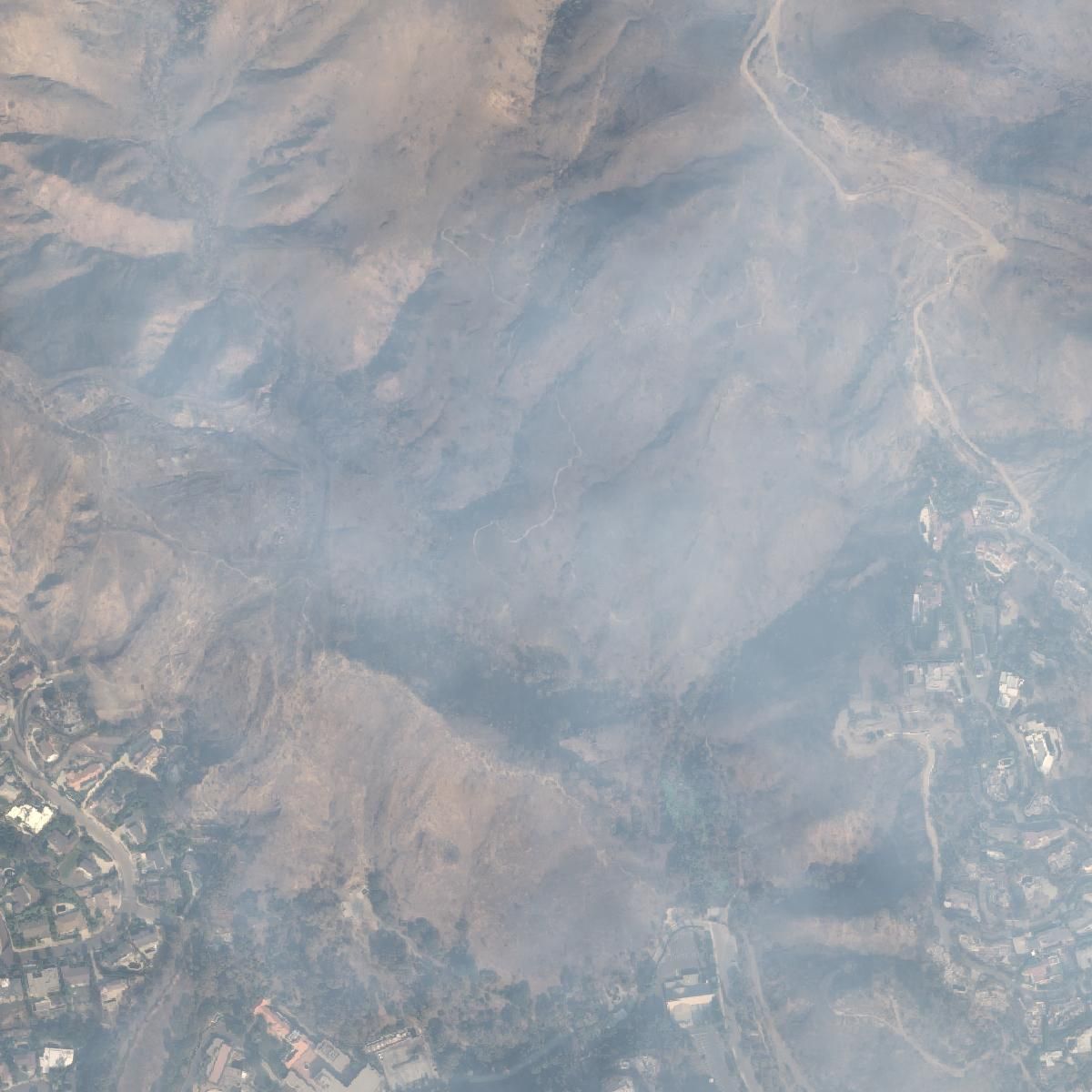
The power of satellite imagery allows us to bypass the limitations of ground-level perspectives. We gain an unhindered view of the vast areas affected by the wildfires. These satellite images, from OnGeo Intelligence service, capture the scope and intensity of the fires with clarity, showing the devastation inflicted on homes, businesses, and vital infrastructure. The high-resolution satellite images clearly portray the burned areas, providing an objective and stark representation of the infernos.
OnGeo Intelligence offers satellite imagery reports in PDF, allowing for easy sharing of this critical information, without registration, you can find more on page: Satellite Imagery Report.
These images, captured in January 2025, showcase the scorched areas of Los Angeles, illustrating the profound and far-reaching impact of wildfires. The high resolution allows for a clear understanding of the devastation.
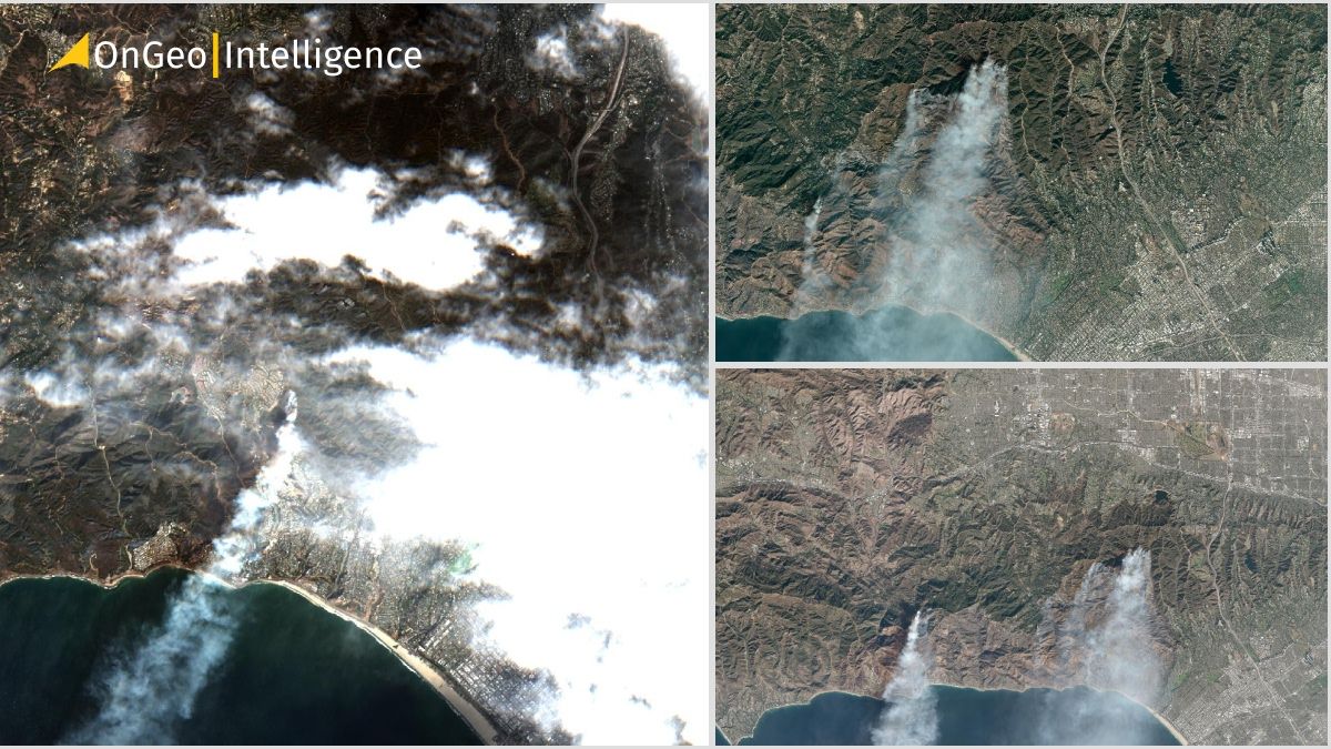
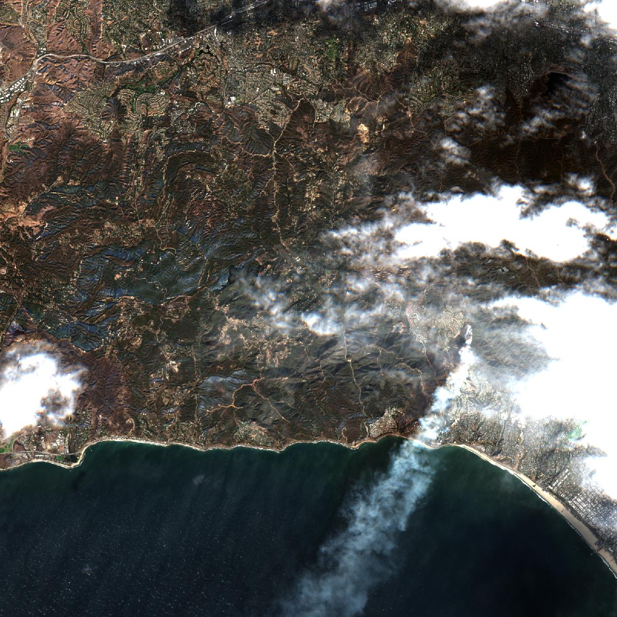
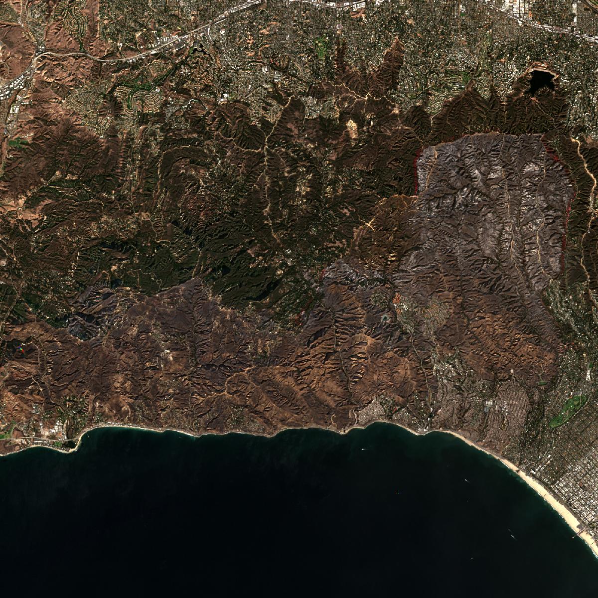
Satellite images depicting the Los Angeles fire, taken from a significant distance, allowing us to grasp the full extent of the blaze
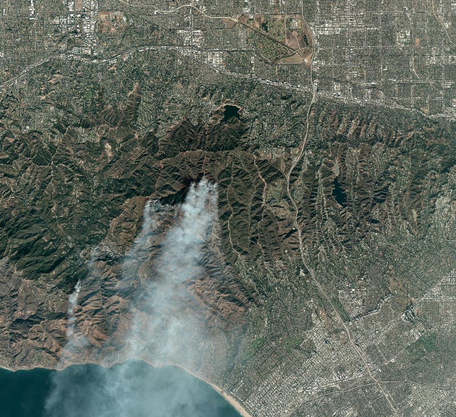
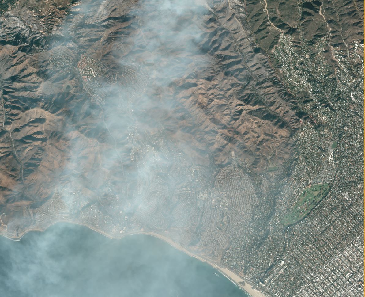
Sentinel-2 satellite images showing the Los Angeles area before, during, and after the wildfire
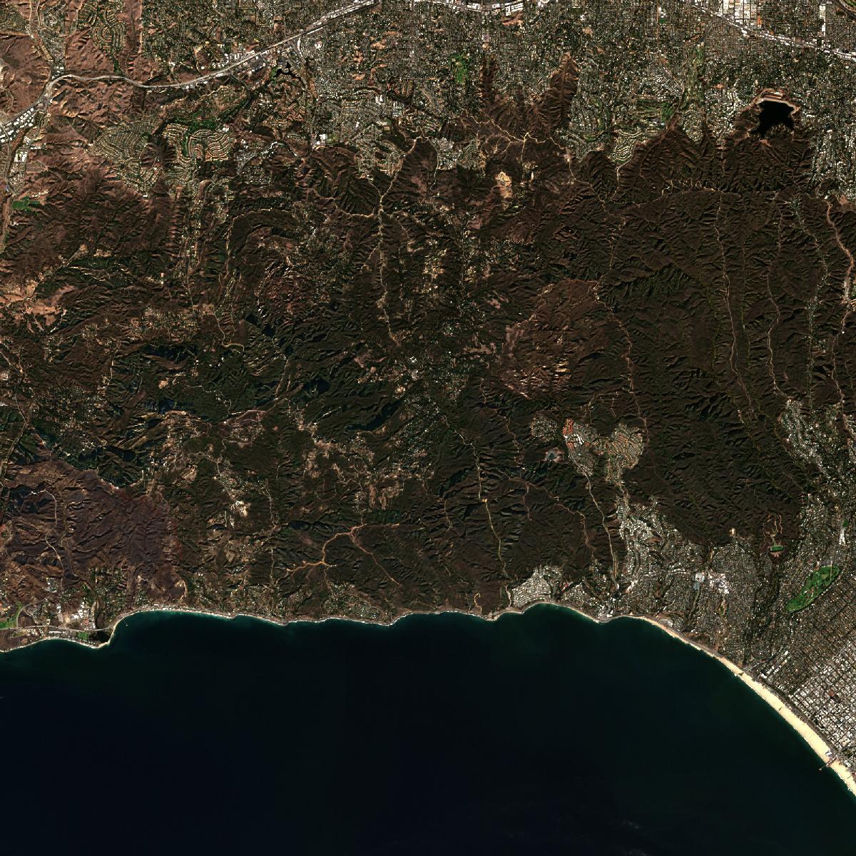
Before and after high-resolution satellite photos: the shocking transformation of Los Angeles
To truly grasp the devastation, we must compare the landscape before and after the fires. This "before and after" perspective dramatically highlights the scale of the destruction, moving beyond numbers and statistics to provide a visceral understanding of the events. These satellite images will show the areas which were once thriving and populated, now turned to ash and debris.
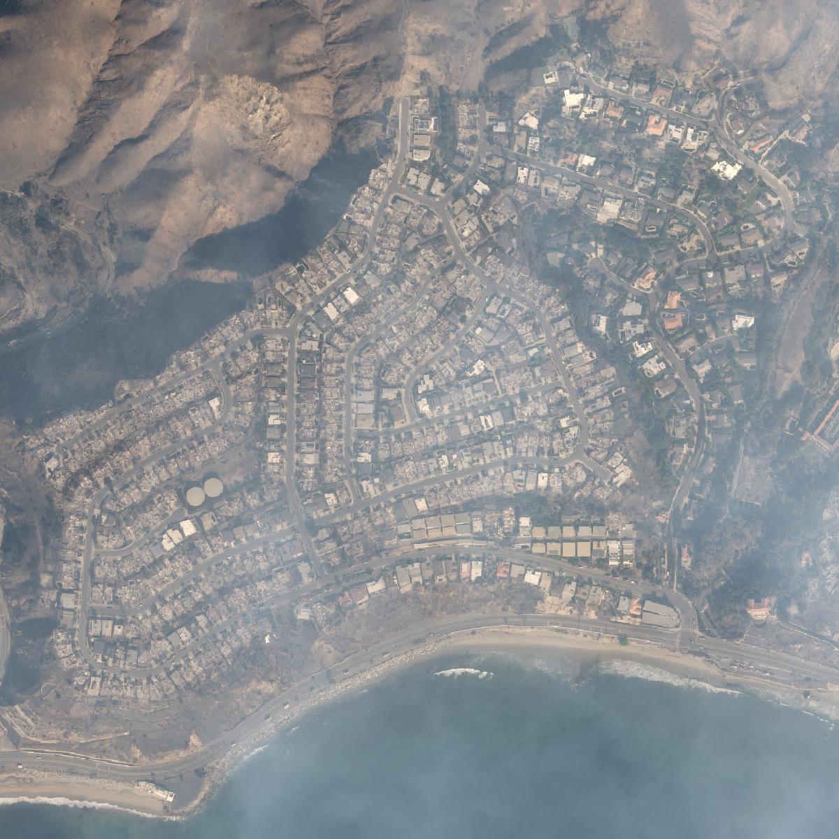
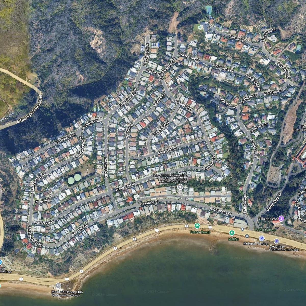
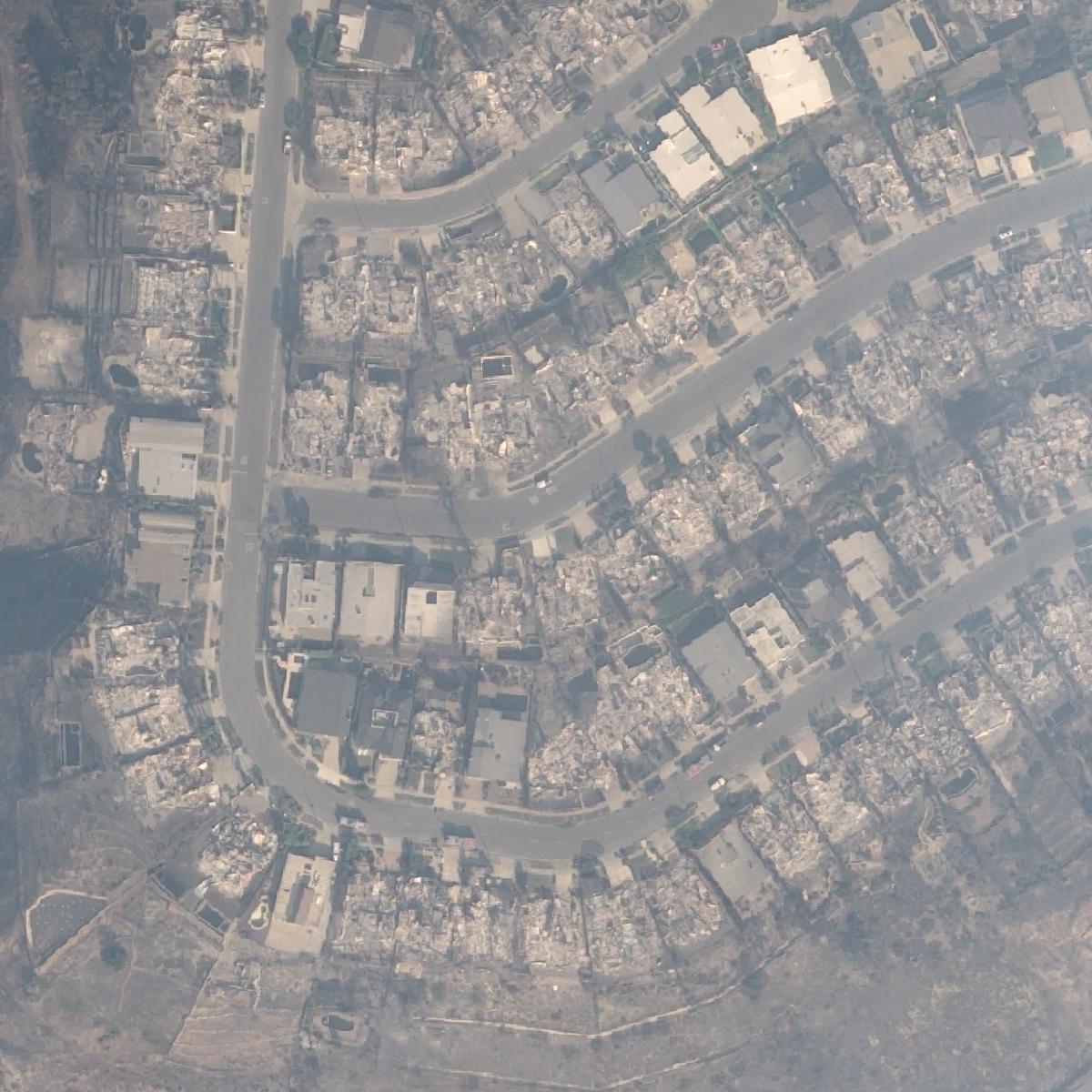
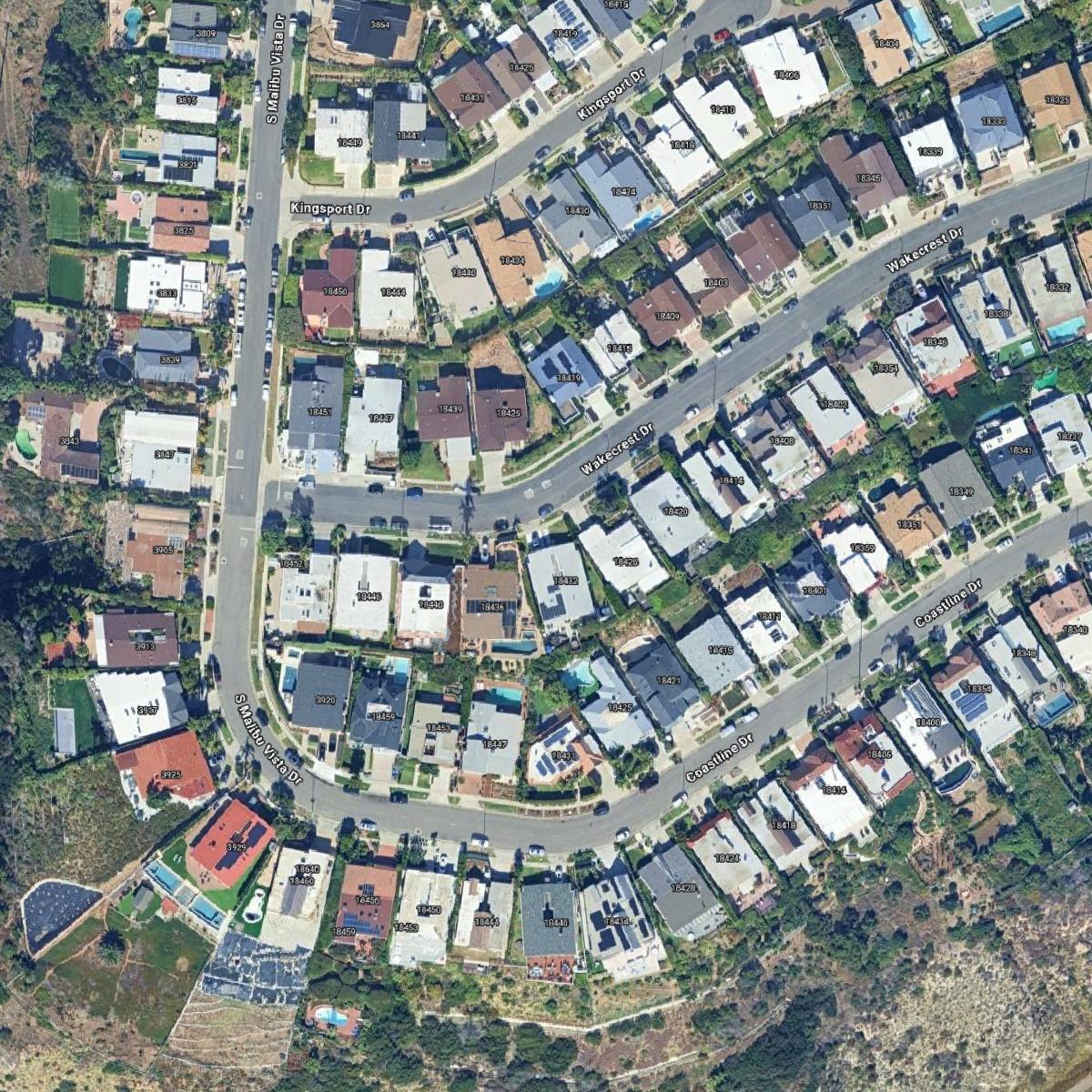
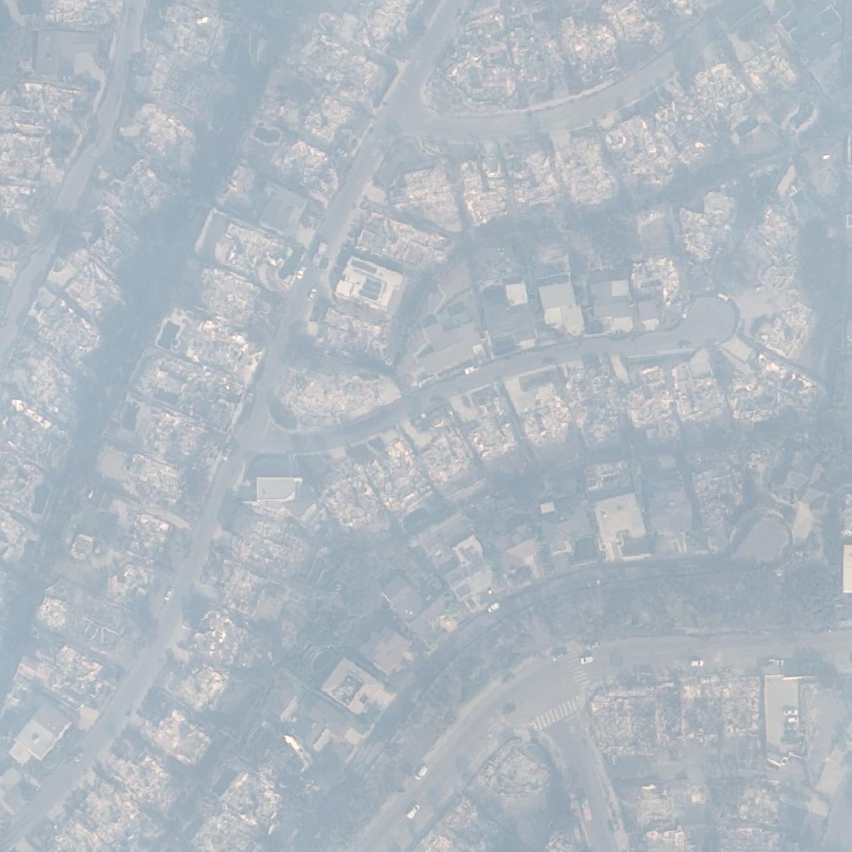
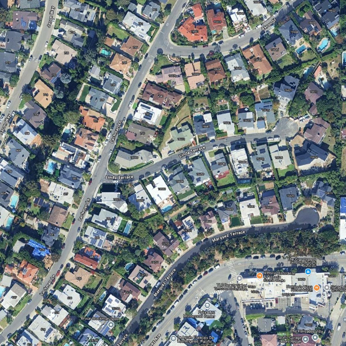
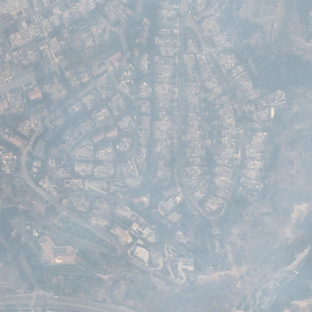
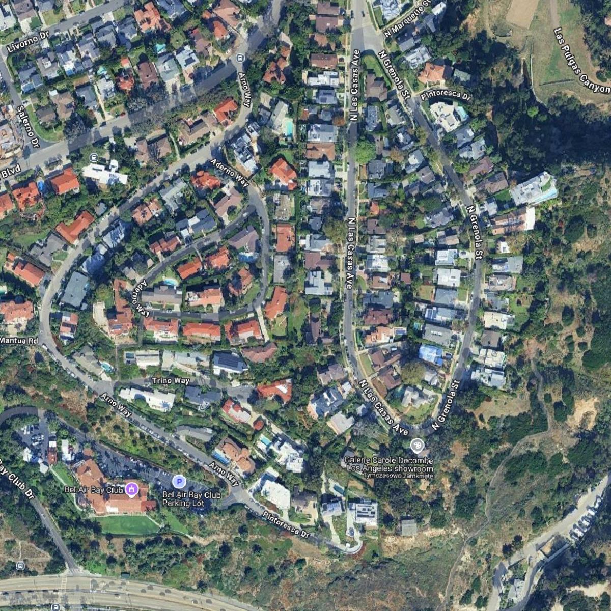
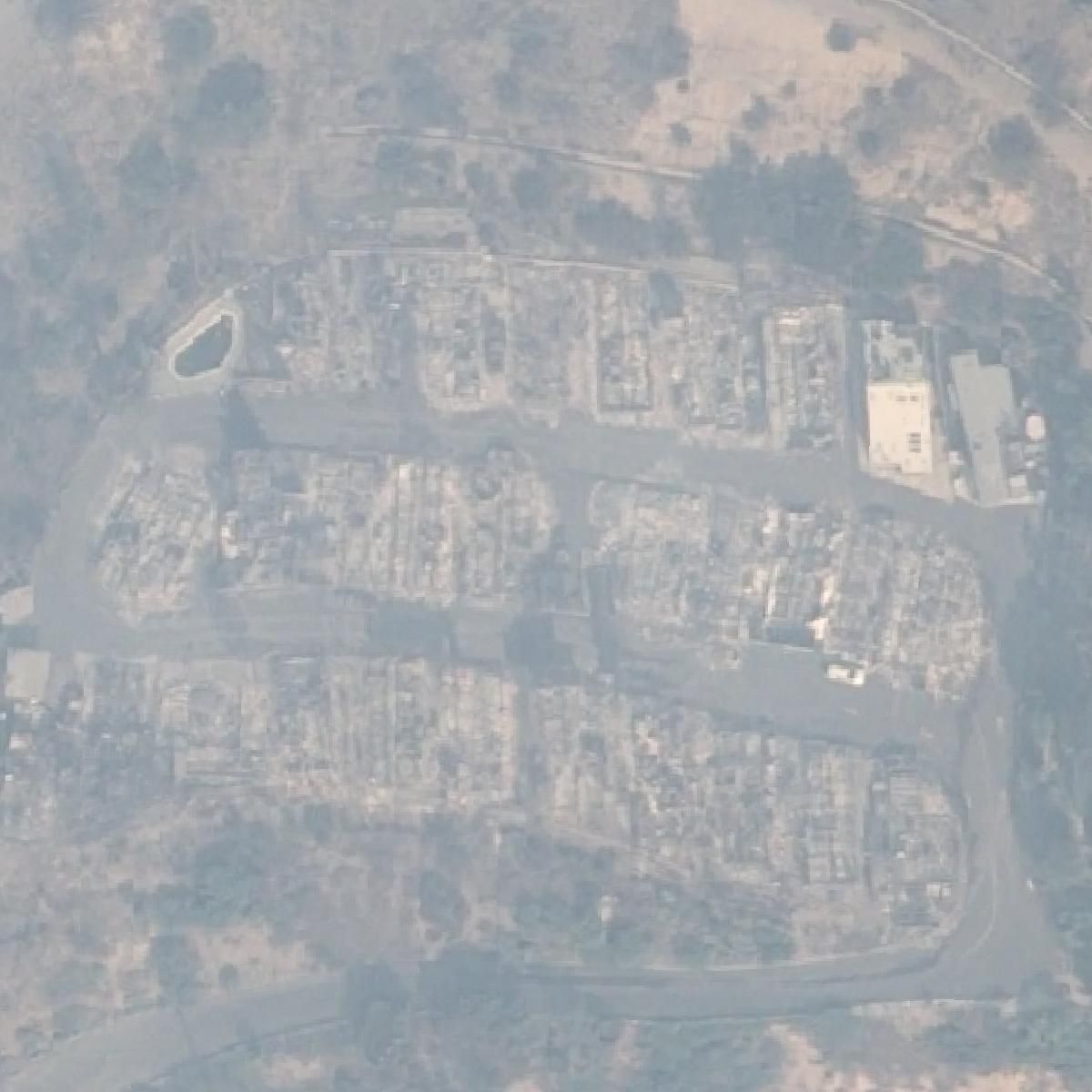
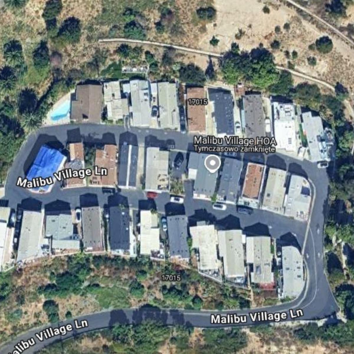
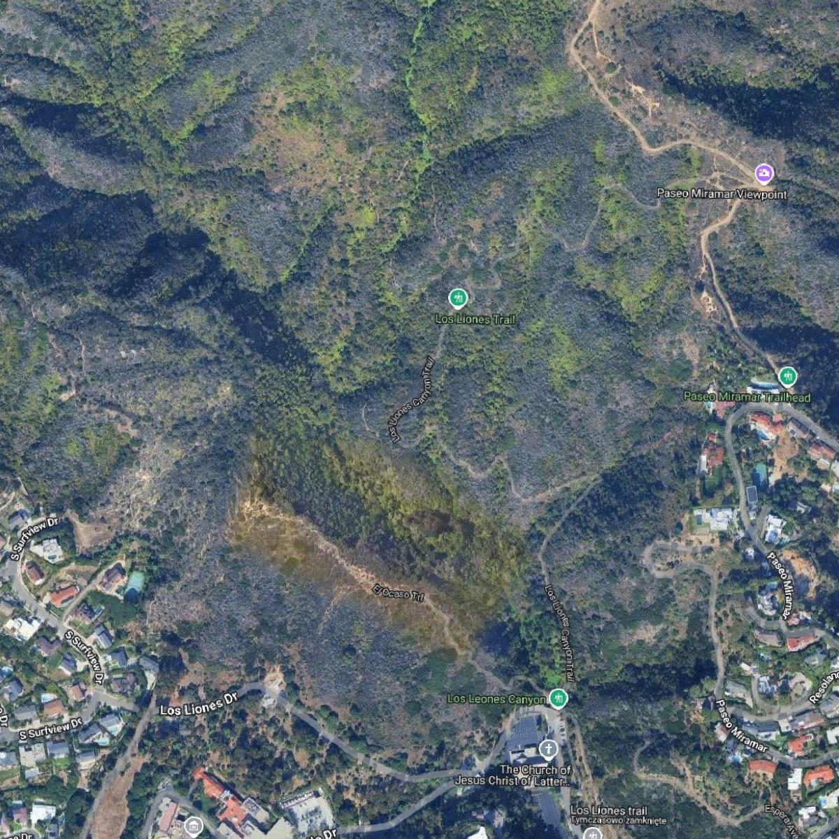
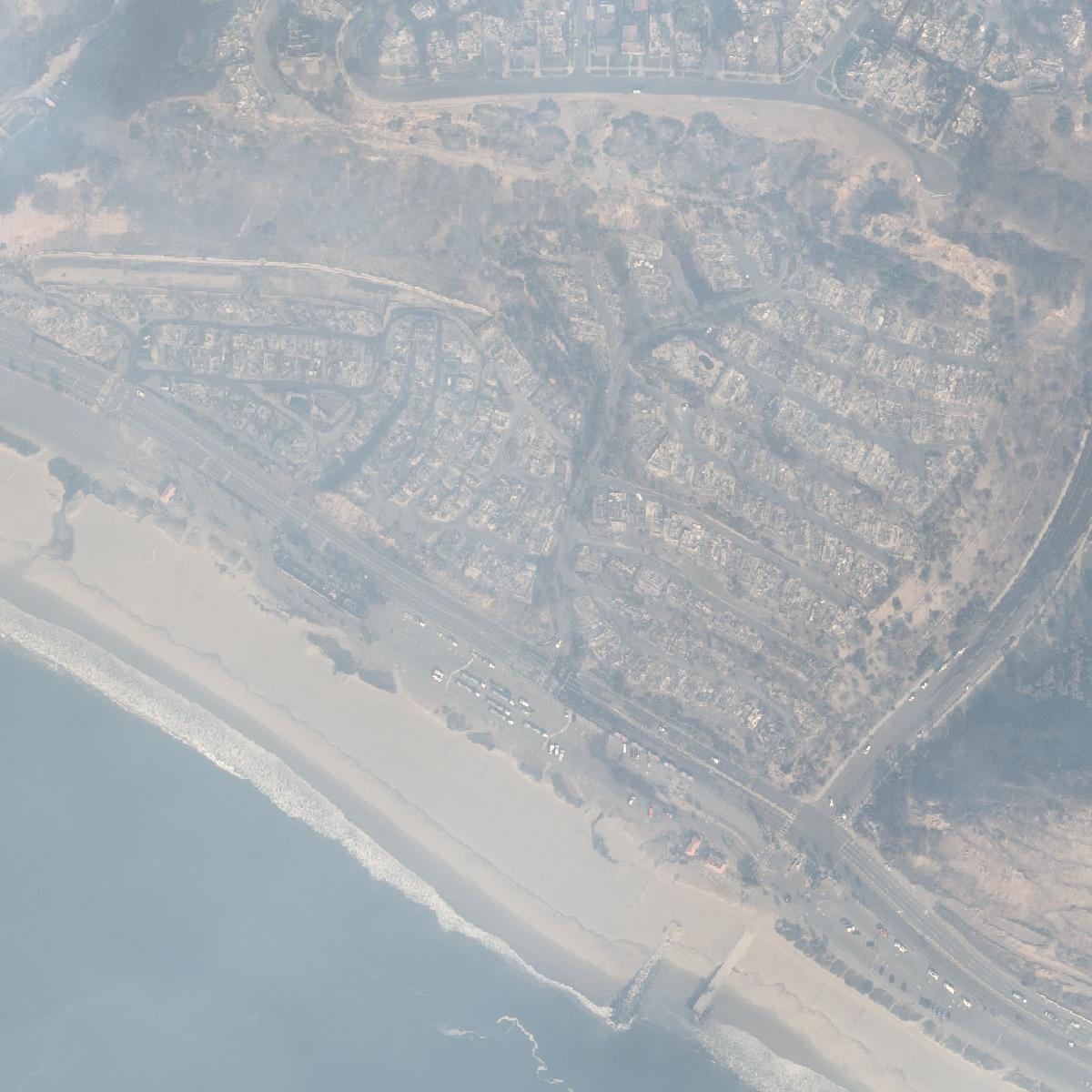
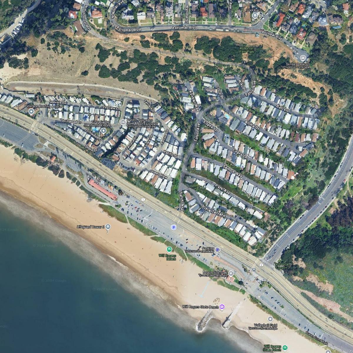
Comparing the images side by side reveals the almost unrecognizable transformation of the city. This underscores the urgent need to address wildfire risks, and work with local residents to develop plans that will prevent damage of this scale in the future.
Mapping the chaos: current wildfire information
While satellite imagery reveals the aftermath, it's equally important to stay updated on active fire locations and evacuation zones. Here are some valuable resources for real-time information:
- Genasys Protect Map: This map provides up-to-date information on active fires and evacuation zones, categorized by color to indicate evacuation orders or warnings.
- Watch Duty Map: Similar to Genasys, Watch Duty uses red and yellow to mark evacuation orders and warnings respectively. It also pinpoints locations of shelters, food distribution points, and family assistance centers.
- California Wildfires Map: Published by the Los Angeles Times, this map draws data from various sources to offer a comprehensive view of active fires, evacuation zones, and additional details on each fire's history and impact.
These tools are crucial for residents of Los Angeles seeking current, reliable information during wildfires.
Conclusion
The Los Angeles wildfires have left an indelible mark. Through the use of powerful satellite images of fire in Los Angeles, we can truly understand the scale of the destruction. From satellite imagery of fire LA and Before and after satellite photos, we gain the perspective to work towards change. By utilizing resources like LA wildfire satellite images and real time updates from maps, we are equipped with valuable tools. The stark reality of these images serves as a reminder of the urgent need for better fire preparedness, community engagement and climate change action. Let these images not only tell a story of destruction but inspire us to build a more resilient future.
Related articles
- Lebanon Bombing: Satellite Images Reveals Scale of Destruction
- Earth Observation: How Satellite Views of Your House Are Now at Your Fingertips
- High Resolution Satellite Imagery: Best Quality Sources
- Satellite Images from Sentinel-2 Available to Everyone
- How Insurance Companies Use Satellite Imagery for Damage Assessment
- Biebrza National Park Fire: Destruction & Recovery Efforts