🌍 Capture the world at 100% OFF! Use code ongeo100on 10 meters satellite image resolutions – limited time only! Higher resolution satellite images remain subject to payment.
🌍 Capture the world at 100% OFF! Use code ongeo100on 10 meters satellite image resolutions – limited time only! Higher resolution satellite images remain subject to payment.
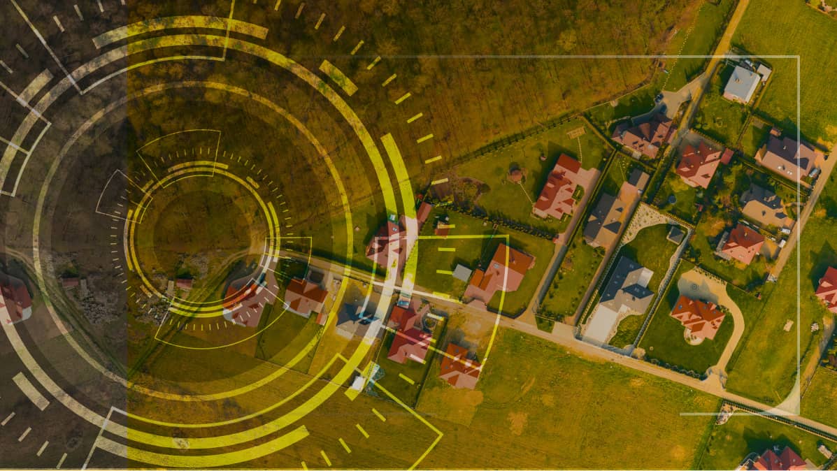
Understanding Location Intelligence: A Game-Changer for Modern Businesses
2024-06-19
(Article updated:
2024-11-29
)
~ 5 min
In the fast-paced digital age, businesses are constantly searching for innovative ways to gain a competitive advantage. One such innovation that is making a significant impact across various industries is Location Intelligence. This cutting-edge approach involves the use of geospatial data and advanced analytics to extract valuable insights, which can drive strategic decision-making, optimize operations, and enhance customer experiences. In this article, we explore the concept of Location Intelligence, its numerous benefits, and how businesses can effectively leverage its potential.
High-Quality Satellite Imagery, Hassle-Free
Explore any location on Earth with precision. Order a detailed Satellite Imagery Report—no sign-ups, no contracts. Delivered in a clear PDF for instant insights.
Location Intelligence involves the process of deriving meaningful insights from geospatial data. This data is collected from various sources, including GPS devices, satellite imagery, mobile phones, social mediaplatforms, and IoT devices. Through sophisticated tools and technologies, such as Geographic Information Systems (GIS) and data analytics, businesses can visualize and analyze spatial relationships, patterns, and trends.
How Location Intelligence Enhances Decision-Making for Businesses
One of the primary benefits of Location Intelligence is its ability to enhance decision-making processes. Businesses can leverage geospatial data to gain a comprehensive understanding of spatial dynamics. For instance, retail companies can analyze foot traffic patterns to select optimal locations for new stores, while logistics firms can optimize delivery routes based on real-time traffic conditions. This data-driven approach ensures decisions are rooted in empirical evidence rather than intuition, leading to more effective and efficient outcomes.
Improving customer experience is another significant advantage of Location Intelligence. By understanding the geographical distribution of their customer base, businesses can tailor their marketing strategies and service offerings to meet the specific needs of different regions. A restaurant chain, for instance, can use Location Intelligence to identify popular menu items in various locations and adjust their offerings accordingly.
Location Intelligence also contributes to operational efficiency. It helps businesses streamline their operations by optimizing supply chain management, asset tracking, and workforce management. Utility companies, for example, can use geospatial data to monitor and maintain infrastructure, reducing downtime and improving service reliability.
Moreover, Location Intelligence provides businesses with a competitive advantage. Companies that leverage geospatial insights can identify emerging market trends and opportunities, allowing them to stay ahead of the competition and capitalize on new growth prospects. This proactive approach can be crucial in dynamic markets where staying one step ahead is key to success.
Unlocking Insights with Location Intelligence: The OnGeo™ Intelligence Satellite Imagery Report
Location intelligence is an essential tool in the modern era, driving significant advancements in various industries by leveraging geospatial data to gain valuable insights. A critical component of location intelligence is satellite imagery, which provides a comprehensive and real-time view of the Earth's surface. The OnGeo™ Intelligence Satellite Imagery Report stands out as a premier resource in this domain, offering high-resolution satellite images that empower businesses, governments, and researchers with precise and actionable information.
Understanding the dynamics of location intelligence begins with recognizing the value of satellite imagery. These images capture vast areas of the Earth's surface, providing detailed visual data that can be analyzed to monitor environmental changes, track urban development,and optimize logistics. The OnGeo™ Intelligence Satellite Imagery Report excels in this arena, delivering images that are not only clear and accurate but also updated regularly to ensure relevance. This allows users to observe changes over time, identify trends, and make informed decisions based on the most current data available.
In the agricultural sector, the OnGeo™ Intelligence Satellite Imagery Report proves indispensable. Farmers and agronomists utilize thesehigh-resolution images to monitor crop health, assess soil conditions, and predict yields. By analyzing vegetation indices and other parameters provided in the report, they can implement precision farming techniques, optimize resource use, and enhance productivity. Similarly, environmental agencies rely on satellite imagery to track deforestation, monitor wildlife habitats, and assess the impact of natural disasters. The detailed data from the OnGeo™ Intelligence Satellite Imagery Report enables these agencies to respond swiftly and effectively to environmental challenges.
Satellite Imagery Report OnGeo Intelligence for agricultural sector
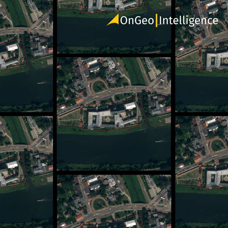
Urban planning and development also benefit significantly from the insights provided by location intelligence and satellite imagery. City planners use the OnGeo™ Intelligence Satellite Imagery Report to visualize and manage urban growth, plan infrastructure projects, and improve public services. The ability to see detailed images of urban areas helps planners make informed decisions about zoning, transportation networks, and green spaces, ultimately leading to more sustainable and livable cities.
Satellite Imagery Report OnGeo Intelligence for Urban planning
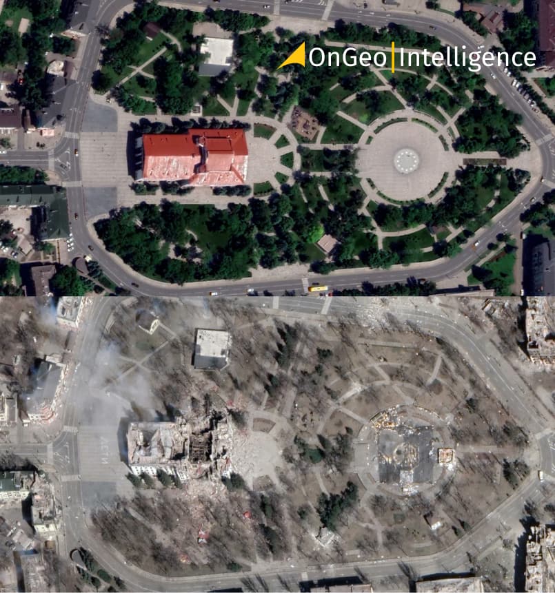
In the realm of securityand defense, the strategic value of satellite imagery cannot be overstated. The OnGeo™ Intelligence Satellite Imagery Report equips military and intelligence agencies with crucial information about terrain, infrastructure, and potential threats.
Ukraine satellite images, Theater in Mariupol
In conclusion, location intelligence, powered by advanced satellite imagery like that provided by the OnGeo™ Intelligence Satellite Imagery Report, is revolutionizing how we understand and interact with the world around us. By offering precise, up-to-date visual data, the OnGeo™ Intelligence Satellite Imagery Report supports a wide range of applications across agriculture, environmental monitoring, urban planning, security, and business. The ability to transform raw geospatial data into actionable insights is what makes location intelligence an indispensable tool for tackling contemporary challenges and seizing new opportunities.
We use cookies to run our website, analyze your use of our services, manage your online preferences & personalize ad content. By accepting our cookies, you'll get relevant content and social media features, personalized ads, and an enhanced browsing experience. To manage your choices, click "Cookie Settings." Necessary cookies are required for the core website functionality and cannot be rejected. For more information, see our Cookie Policy.
About cookies on this site
Cookies used on the site are categorized. Below you can allow or deny some or all of them, except for Necessary Cookies which are required to provide core website functionality. When categories that have been previously allowed are disabled, all cookies assigned to that category will be removed from your browser.
Some cookies are required to provide core functionality. The website won't function properly without these cookies and they are enabled by default and cannot be disabled.
Preference cookies enables the web site to remember information to customize how the web site looks or behaves for each user. This may include storing selected currency, region, language or color theme.
Analytical cookies help us improve our website by collecting and reporting information on its usage.
Marketing cookies are used to track visitors across websites to allow publishers to display relevant and engaging advertisements. By enabling marketing cookies, you grant permission for personalized advertising across various platforms.
The cookies in this category have not yet been categorized and the purpose may be unknown at this time.