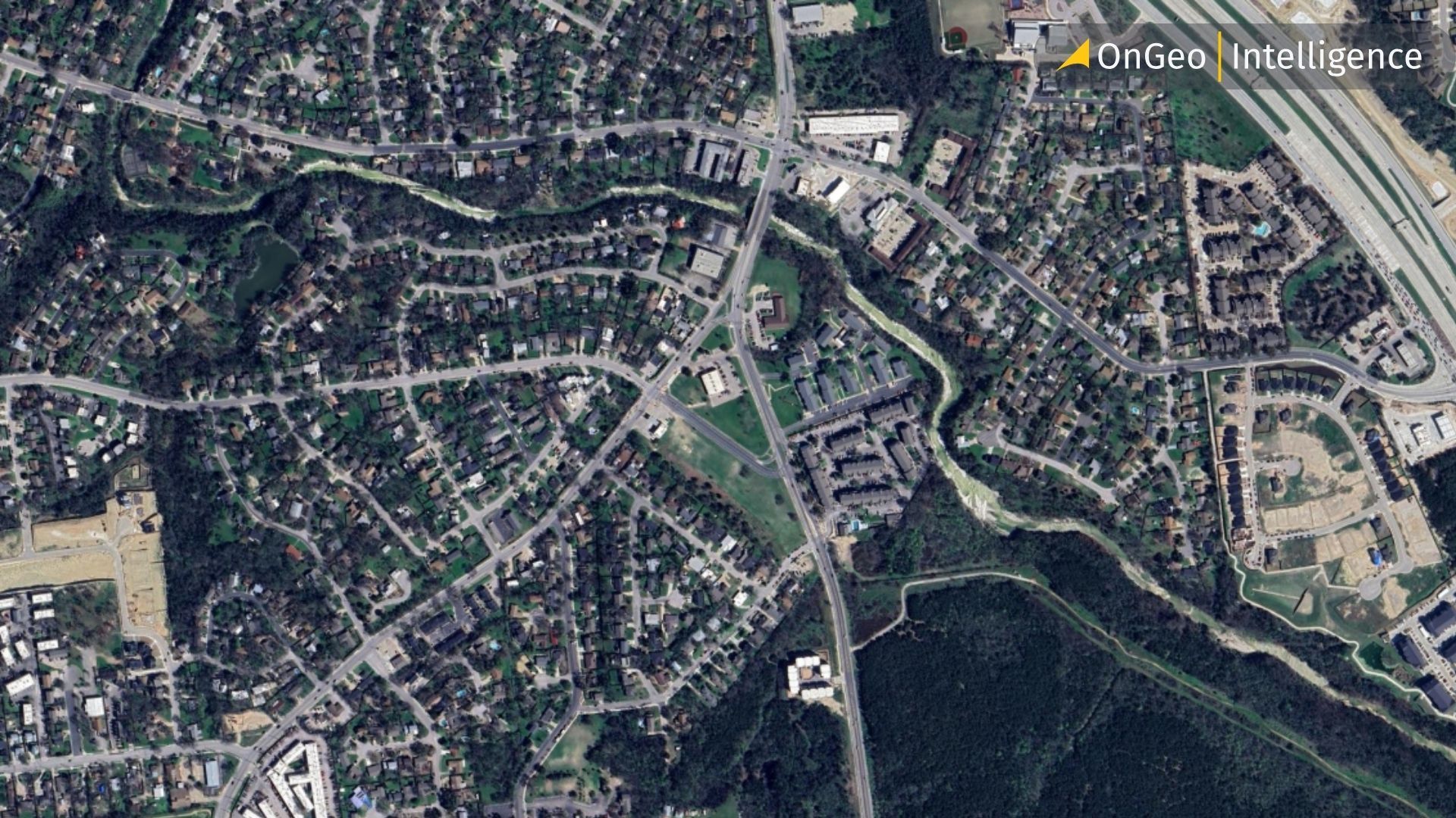
How Satellite Imagery Is Revolutionizing Legal Evidence in Court
When legal disputes turn into a "he said, she said" stalemate, concrete proof is everything. In modern courtrooms, eyewitness testimony can be flawed, and ground-level photos can be easily manipulated or contested. Enter high-resolution satellite imagery an objective, time-stamped witness orbiting 500 kilometers above the Earth.
At OnGeo Intelligence, we have seen a dramatic shift in how spatial data is utilized across legal domains. What was once reserved for military operations and climate science is now one of the most compelling forms of evidence in civil litigation, property disputes, environmental law, and insurance claims.
Here is a closer look at how satellite imagery is transforming the judicial landscape and how real-world litigants have leveraged OnGeo Intelligence data to win their cases.

When the Past Holds the Answer: Why Satellite Imagery Is a Game-Changer
Unlike photographs taken by property owners or witnesses, satellite imagery is collected independently and systematically. Every image is linked to a specific location and acquisition date, allowing experts to reconstruct events that took place months or even years earlier.
Historical imagery cannot replace official legal documents or cadastral surveys, but it often provides the missing context that explains how a dispute developed. In many cases, seeing the property from space reveals details that are no longer visible on the ground.
The following examples demonstrate how satellite imagery can support different types of property-related legal cases.
Case Study 1: Boundary Disputes & Historical Encroachment
When Michael purchased a rural property outside Austin, Texas, he didn't expect a simple boundary fence to lead to a lawsuit. Months after moving in, a neighbor claimed that a three-meter strip of land on Michael's side belonged to him. Both property owners produced old, inconclusive survey documents, and witness recollections were contradictory.
Michael turned to OnGeo Intelligence to trace the land's history. Historical satellite archives revealed that the fence had been moved between 2017 and 2019. Earlier images clearly established its original alignment, supporting Michael’s position. Armed with this timeline, both parties' surveyors reached an agreement, settling the dispute before going to trial.
Michael later commented
"Without the historical images, we would have had only conflicting opinions. The satellite archive gave us an independent timeline of what actually changed."
Case Study 2: Marital Property & Construction Timelines
After filing for divorce, Sarah from North Carolina faced a disagreement over ownership of the family home.
Her former spouse argued that construction had started before their marriage, making the property separate rather than marital. Unfortunately, some construction records had been lost, and the available paperwork was incomplete.
Satellite imagery offered an unexpected solution.
OnGeo Intelligence retrieved historical images covering the entire construction period. Earlier images showed an empty lot, while subsequent acquisitions documented the gradual development of the house. The completed building only appeared months after the couple had married.
The chronological sequence of satellite images became an important supporting document during legal proceedings, helping establish a more accurate timeline of the property's development. The visual evidence provided definitive support for Sarah's legal team.
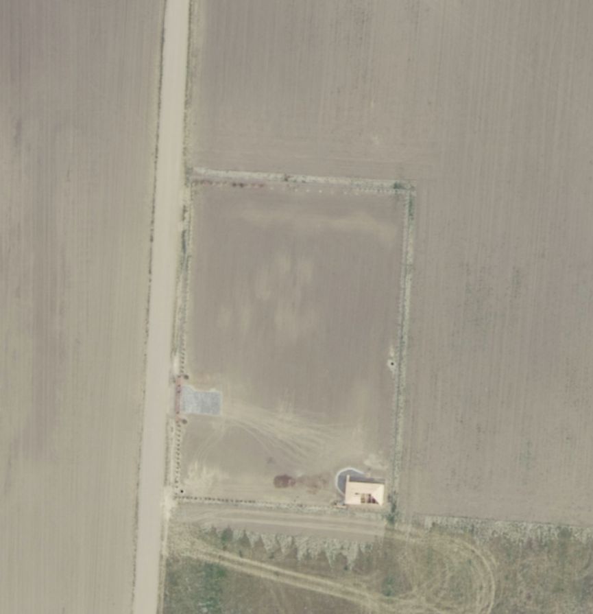
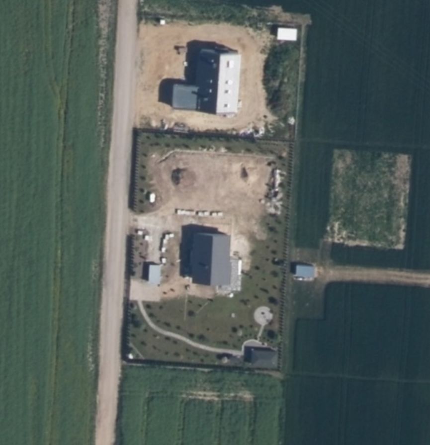
Photo taken before the start of construction and during construction
Case Study 3: Challenging Insurance Claim Denials
After a severe hailstorm in Colorado, David filed an insurance claim for extensive roof damage to his commercial warehouse. The insurer denied coverage, arguing the damage was pre-existing wear and tear.
David generated a historical satellite report comparing pre-storm and post-storm imagery. Photos taken just weeks before the event showed the roof fully intact, while the first post-storm imagery clearly displayed damage consistent with violent weather. Paired with local meteorological data, the report prompted the insurer to reverse its decision and settle the claim.
Case Study 4: Uncovering Illegal Land Clearing & Trespassing
Emily owned several hectares of woodland inherited from her parents in western Virginia. During a routine visit, she noticed that part of the forest bordering a neighboring property had been cleared.
The neighboring landowner claimed the trees had been removed years earlier and that the land had always been open.
Historical satellite imagery told a different story.
OnGeo Intelligence imagery spanning two years and identified the exact period when the forest disappeared. The report showed that the clearing had taken place only months before Emily discovered it.
The evidence helped establish a factual timeline and became an important part of the legal documentation submitted by her attorney.
Why Satellite Data Is Becoming Essential for Legal Counsel
These cases highlight a universal legal challenge, establishing historical truth. Satellite imagery addresses this by offering:
Unbiased Objectivity: Data collected automatically without human bias or selective framing.
Verifiable Timestamps: Clear chronological evidence to track changes over precise intervals.
Broad Spatial Coverage: Comprehensive views of hard-to-reach, expansive, or modified terrains.
From Satellite Images to Court-Ready Reports
A satellite image alone rarely tells the complete story. To become useful in legal proceedings, it must be carefully selected, interpreted, and documented.
OnGeo Intelligence prepares professional satellite imagery reports designed specifically for property investigations and legal matters. Each report combines historical satellite imagery with technical information, acquisition dates, location data, and expert analysis, presenting complex geospatial information in a clear and understandable format.
Instead of simply delivering archived images, our team focuses on answering the questions that matter most: What changed? When did it happen? And how can those changes help clarify the facts?

How OnGeo Intelligence Satellite Imagery Report Supports Legal Investigations
The OnGeo Intelligence Satellite Imagery Report is a powerful resource for legal professionals seeking high-resolution satellite images for their cases. It enables:
- Historical Analysis: Compare past and present conditions to track changes.
- Custom Imaging Solutions: Obtain tailored satellite images for specific cases.
- Enhanced Legal Documentation: Strengthen legal arguments with irrefutable evidence.
Looking Back to Move Forward
Property disputes often depend on evidence that no longer exists on the ground.
Historical satellite imagery provides a unique opportunity to look back in time and reconstruct the evolution of a property with remarkable accuracy. As satellite technology continues to advance, this type of evidence is becoming an increasingly valuable resource for lawyers, surveyors, insurers, businesses, and property owners around the world.
Sometimes, resolving a dispute does not require another witness.
It simply requires seeing the property as it really looked years ago.
With OnGeo Intelligence, historical satellite imagery becomes more than just a picture it becomes objective evidence that helps uncover the truth.
Related articles
- Land Disputes: How Satellite Imagery Helps Prove Who Owns, Built or Used What and When
- How Insurance Companies Use Satellite Imagery for Damage Assessment
- Test Our Satellite Data with a Free Satellite Imagery Report
- Tracking Urban Changes with SaUrban Change Detection with Satellite Imageryellite Imagery: How Change Detection Reveals City Transformations
- Legalisation of unauthorised buildings using satellite images
- Detection of Illegal Construction in Satellite Images