How to get a historical satellite map of my property
Historical satellite imagery has transformed from a specialized tool reserved for governments, researchers, and large organizations into something accessible to ordinary internet users. Whether you own a house, a plot of land, a farm, or are considering buying real estate, archival satellite maps let you look back in time and see how a specific location has evolved. Platforms like OnGeo Intelligence make this process straightforward, requiring no technical expertise, GIS software, or long-term subscriptions.
This article explains why historical satellite maps matter, how an everyday user can obtain them through OnGeo Intelligence, what you receive, and practical ways to use the results for analyzing terrain changes and long-term planning.

Why Historical Satellite Maps Are Valuable
Satellite images captured years or even over a decade ago provide an objective, timestamped record of the Earth’s surface. Unlike ground-level photos or verbal accounts, they offer a consistent overhead perspective that reveals patterns invisible from the ground.
Key benefits include:
- Analyzing terrain and land-use changes: Track the growth or removal of vegetation, expansion of built structures, changes in water bodies, erosion, or the appearance of new roads and paths. For property owners, this can show when a neighboring building was erected, whether trees were cleared, or how a plot has been developed over time.
- Long-term planning: Before investing in landscaping, construction, solar panels, or agricultural improvements, historical views help assess site conditions, drainage patterns, shading history, or previous land use that might affect future plans. Investors and buyers can evaluate development history without multiple site visits.
- Documentation and evidence: Timestamped images serve as supporting material in boundary disputes, insurance claims, legal proceedings related to construction timelines, inheritance matters, or environmental compliance. Courts and authorities increasingly accept high-quality satellite imagery as objective evidence.
- Environmental and agricultural insights: Monitor vegetation health trends, detect past flooding or drought impacts, or evaluate soil and water changes using spectral indices derived from the imagery.
- Remote assessment: Property owners living far away or managing multiple sites can review changes from anywhere.
Free tools such as Google Earth Pro offer some historical views, but coverage is often limited, update frequency varies by location, and resolution may not show fine details. Commercial archives (e.g., Maxar, Airbus) and open data (Sentinel-2) contain far richer material, yet accessing them traditionally required specialized knowledge or contracts. OnGeo Intelligence bridges this gap by aggregating archives and delivering ready-to-use reports.
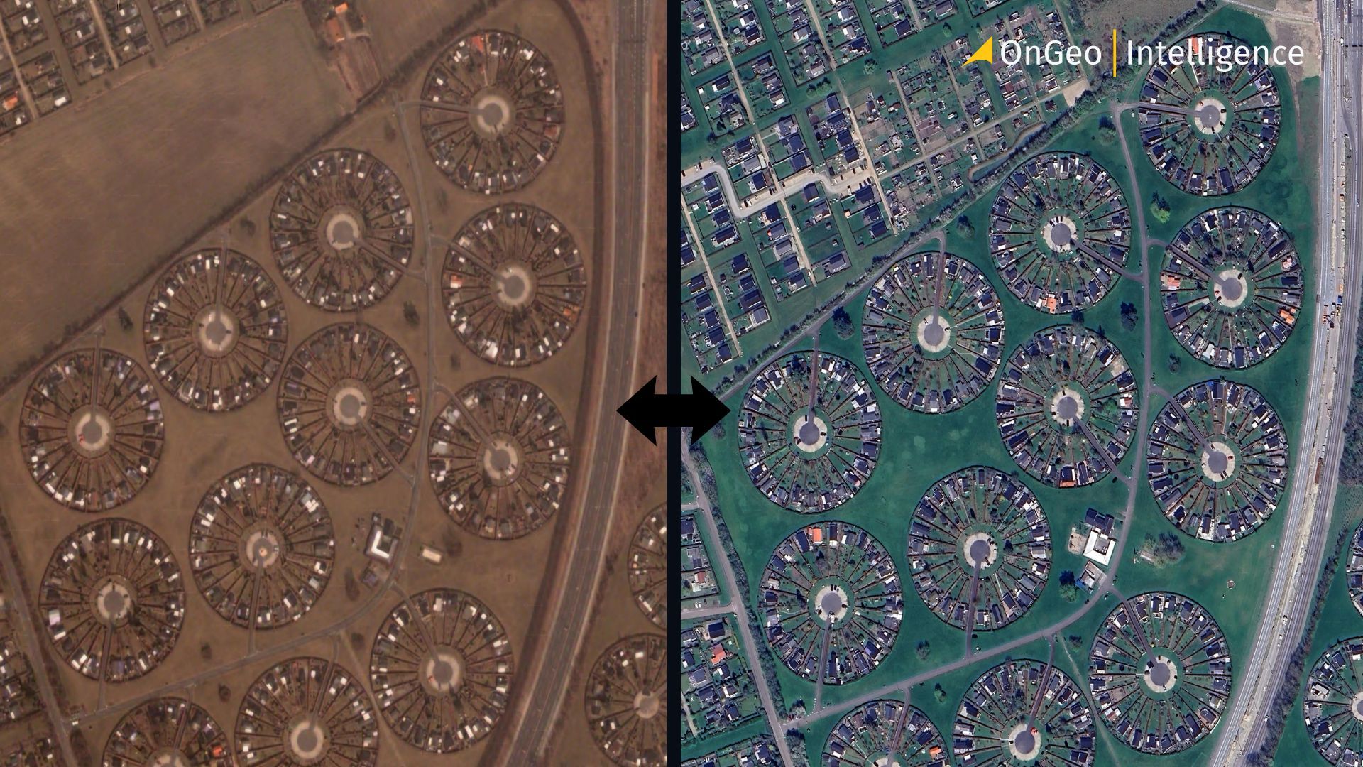
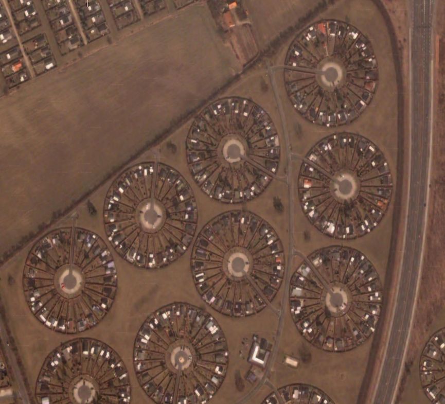
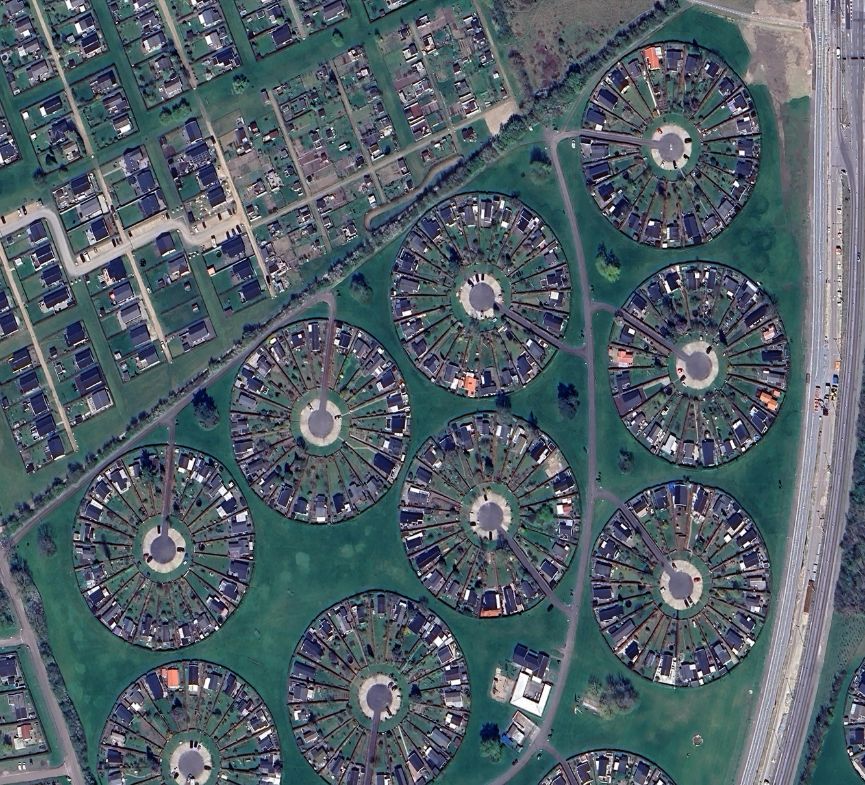
Garden City in Brøndby has transformed over the past two decades from 2003 to 2024, changes can be seen on historical satellite maps
What OnGeo Intelligence Offers
OnGeo Intelligence provides a web-based Satellite Imagery Report service designed for accessibility. Key features include:
- Global coverage of virtually any location on Earth.
- Access to both recent and historical (archival) imagery, with the oldest available data dating back to around 2008.
- Multiple resolutions: 10 m (medium, often AI-enhanced/sharpened to approximately 2.5 m), 1–2 m (high), and sub-meter (very high resolution down to 0.3 m).
- Cloud-free or low-cloud prioritization with previews so you can inspect quality before purchasing.
- No account registration, contracts, or subscriptions required pay only for the specific report you need.
- Delivery as a clear PDF report plus optional data packages, usable on computers or mobile devices without specialized software (GIS tools are needed only for advanced Sentinel-2 processing).
- Prices starting from approximately $12.99 USD for reports; lower-resolution options have been available free via promotional codes such as ongeo100 (check the current offer on the site).
The platform sources data from commercial providers (Airbus constellations) and non-commercial sources such as Sentinel-2. It focuses on natural-color (RGB) scenes organized chronologically and supplements them with remote-sensing indices.
Step-by-Step Guide: Obtaining a Historical Satellite Map of Your Property
The process is designed for ordinary users and can be completed in a browser (desktop or mobile). Here is the typical workflow:
- Visit OnGeo Intelligence and open the Satellite Imagery Report / Search form. No account or registration is required.
- Choose the time period you are interested in. You can select a custom date range or use ready presets (e.g. last 30/60/90 days or specific past months). For historical analysis, pick ranges that cover the years or events you want to examine.
- Find your property on the interactive map (search by address or zoom manually). Draw the precise outline of your plot or area of interest using the drawing tool.
- Select the image resolution:
- 10 m (good for general overview, suitable for broader land-cover or vegetation analysis)
- Higher resolutions (1–2 m or down to 0.3 m) for detailed views of buildings, boundaries, and small features.
- Click “Search images”. Within seconds the system scans the archives and displays available scenes with dates, resolution, price, and thumbnail previews. Review the previews and deselect any cloudy or unsuitable images.
- Select the scenes you want, add them to the cart, enter your email address, and complete the payment.
- You will receive the PDF report by email (usually within a few minutes for lower resolution, up to 48 hours for high-resolution imagery), along with optional source data and remote-sensing indices.
Always inspect previews thoroughly before ordering, as images are purchased on demand and quality issues visible in the preview are generally not refundable.
Free satellite imagery reports
Use the code ongeo100 to download a free OnGeo Intelligence Satellite Imagery Report with low-resolution images 10m.
What the Report Contains and How to Use It
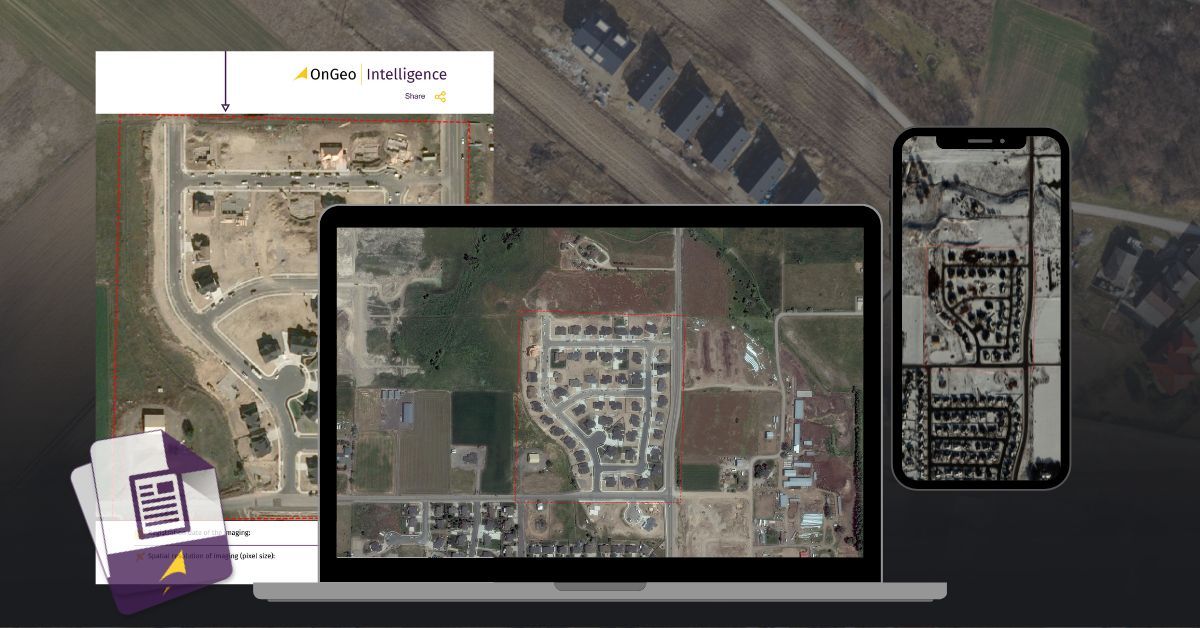
A typical OnGeo Intelligence Satellite Imagery Report presents:
- Chronologically ordered natural-color satellite images of your exact area.
- Capture dates and resolution information for each scene.
- Georeferenced source low resolutione data for advanced users.
Practical applications for property analysis and planning include:
- Comparing images side-by-side or in sequence to identify when structures appeared, vegetation was cleared or grew, or land use shifted.
- Documenting the “before” state of a property for future reference or legal purposes.
- Assessing long-term trends in drainage, erosion risk, or neighboring development that could affect your plans.
- Supporting decisions about renovations, extensions, planting, or investments by understanding historical site conditions.
- Generating visual evidence for discussions with surveyors, insurers, local authorities, or in dispute resolution.
Because the images are timestamped and derived from established satellite systems, they provide a credible record of change over time.
Tips for Best Results
- Start with a free archive search or promotional lower-resolution report to explore availability for your location and dates.
- For multi-year history, run several queries covering successive periods and compare the resulting reports.
- Prioritize low-cloud, near-nadir (overhead) scenes for maximum clarity.
- Higher resolution is preferable when fine details (buildings, boundaries, small features) matter; medium resolution suffices for broader environmental or agricultural monitoring.
- Combine the visual PDF with the optional data package if you want quantitative analysis of vegetation or moisture trends.
- Note that availability depends on actual satellite passes and weather at the time of acquisition some locations or periods may have denser coverage than others.
Conclusion historical satellite map
Obtaining a historical satellite map of your property no longer requires specialized skills or expensive contracts. Through OnGeo Intelligence, any internet user can define a location and time period, preview available cloud-free archival imagery, and receive a professional, easy-to-read PDF report plus supporting data often within minutes to a couple of days.
These historical views unlock powerful insights into terrain evolution, construction timelines, environmental shifts, and site potential. They support better-informed long-term planning, remote monitoring, documentation, and decision-making for homeowners, buyers, farmers, investors, and professionals alike.
Visit OnGeo Intelligence explore the archive search for your own property and discover what the past reveals about the land you care about.