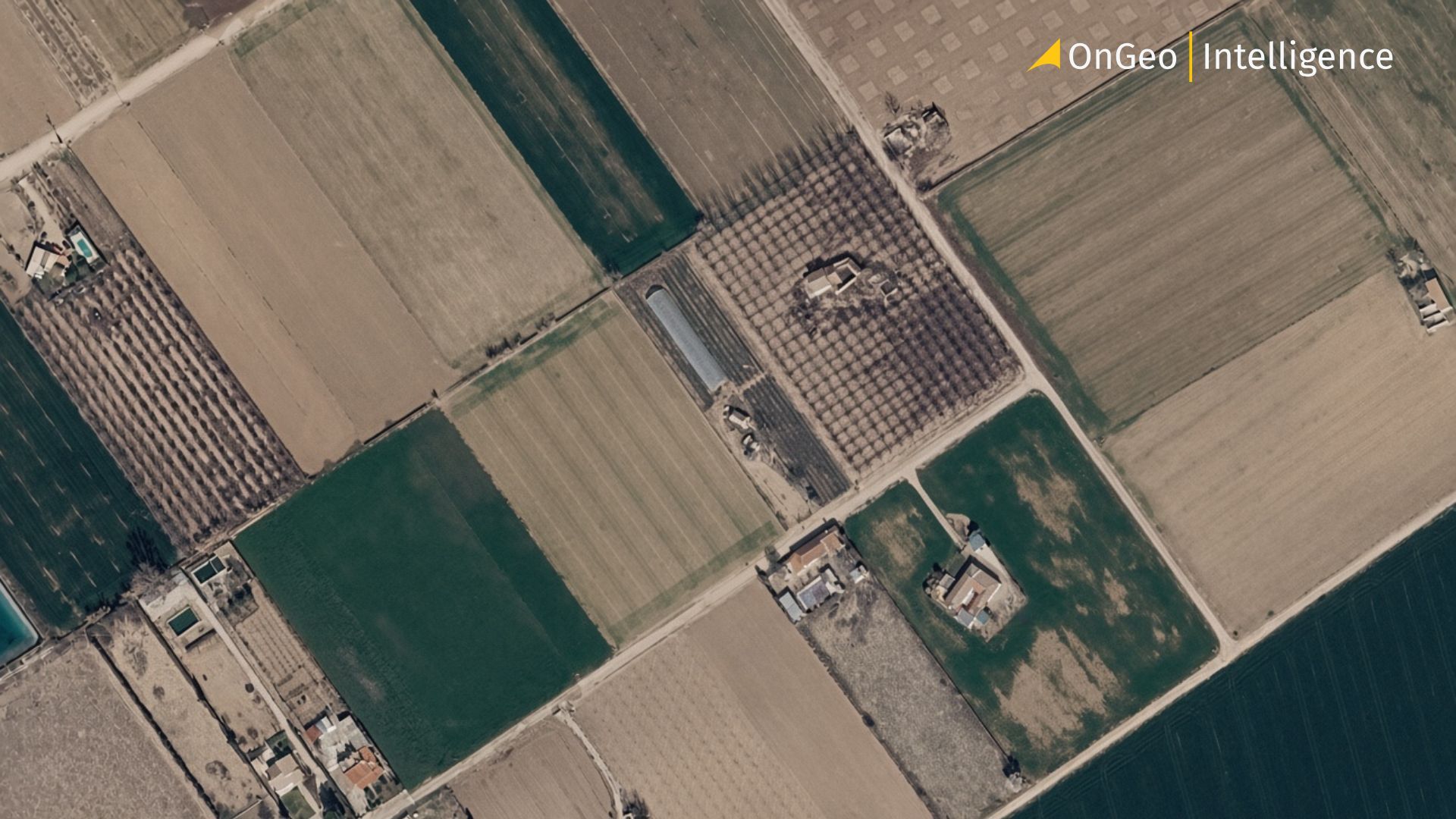
Land Disputes: How Satellite Imagery Helps Prove Who Owns, Built or Used What and When
A fence moved a few metres overnight. A house that one side says was built before the wedding and the other says was built after. A contractor who claims the work was finished on time, and a client who insists it was not. Different stories, same root problem: a land dispute, and a shortage of reliable evidence about what the land looked like on a specific date.
In this guide we explain what land disputes are, why they arise, what the most common types look like, how they are usually resolved, and why satellite imagery and archival aerial photography have become one of the most objective forms of evidence available. You will also see how you can obtain such imagery in minutes with the OnGe Intelligence Satellite Imagery Report.

What Is a Land Dispute?
A land dispute is a conflict between a landowner or land user and another party a neighbour, co-owner, relative, contractor or public authority over the ownership, possession, use, boundaries or disposal of a parcel of land. Some disputes concern only the land itself (a boundary, access, an obstacle to use). Others concern land together with what stands on it, such as dividing a plot between co-owners of a house.
Both kinds usually end up in negotiations, court or arbitration, and the decisive question is almost always the same: what was physically on the ground, and when?
Common Causes and Types of Land Disputes
Most land conflicts grow out of a handful of causes:
- Unclear boundaries – old surveys, missing markers, fences never formally recorded.
- Errors in documents and registers – wrong cadastral entries, outdated maps, duplicated records.
- Inheritance and divorce – competing heirs, or disagreement over whether a house is separate or shared property.
- Unauthorised construction and encroachment – building on someone else's land or beyond one's own border.
- Contract and lease breaches – missed construction deadlines, land not used as agreed, a plot sold twice.
- Decisions by authorities – zoning changes, expropriation, infrastructure crossing private land.
In practice they show up as boundary disputes, ownership and title disputes, land-and-property disputes, contract and lease disputes, administrative disputes with public bodies, and damage and compensation claims (for example, flooding after works on a neighbouring plot).
How Land Disputes Are Resolved
The details differ by country, but the path is similar: the parties first try a pre-trial settlement (claims, negotiation, mediation); if that fails, the case goes to a court or administrative body, where each side must prove its claims; a decision can often be appealed and is then enforced.
At every stage, the quality of evidence matters most. Documents can be outdated or contradictory, witnesses forget, and surveys describe only the day they were done. What you need is a neutral, dated, georeferenced picture of the land from the legally relevant period and that is what satellite and aerial imagery provides.
How Satellite Imagery Help
Earth observation satellites photograph the planet regularly, and the images are captured by third-party operators with no stake in your dispute. That gives them properties that matter in a legal setting:
- Objectivity – the image shows what was physically there, whatever either party claims.
- A verifiable date – each scene has metadata describing when, where and how it was captured.
- Precise location – imagery is georeferenced, so it can be tied to coordinates or a parcel.
- A historical archive – you can look back years, even more than a decade.
- Remote access – you can examine distant or fenced-off land without visiting it.
Satellite data adds regular updates and coverage of almost any place on Earth, without commissioning a flight.
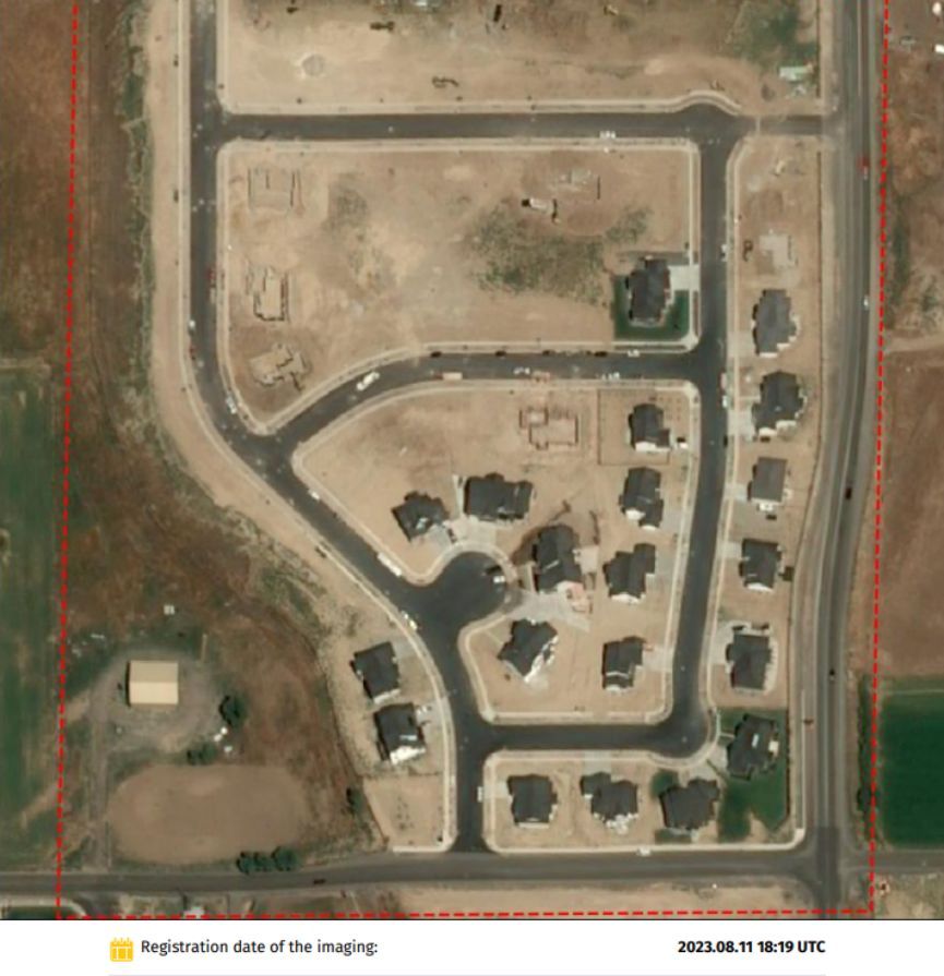
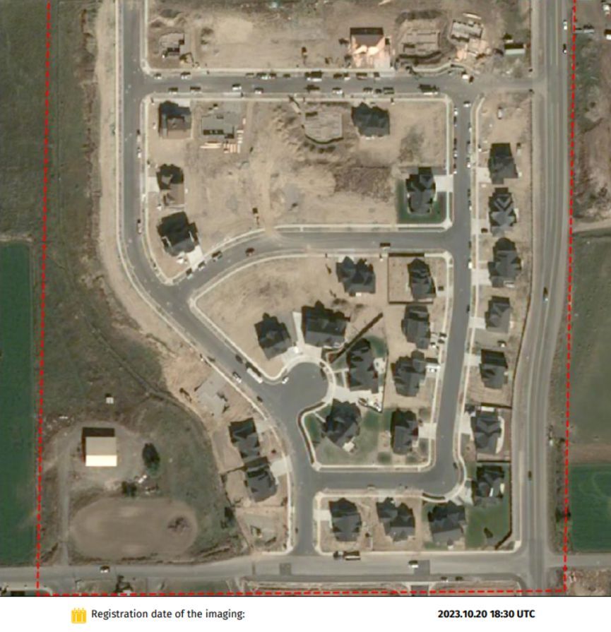
A comparison of how the area changed over the course of a few months.
What Imagery Can Prove
- When a building was constructed – crucial in divorce and inheritance cases, where the date decides whether a house is separate or shared property.
- Whether a structure existed on a given date – confirming or contradicting claims that something was demolished, rebuilt or never built.
- Whether contractual deadlines were met – documenting construction stages, excavation or the removal of equipment.
- Whether someone crossed a boundary – comparing how a field, landfill, yard or fence expanded between dates.
- Whether land was used as agreed – vegetation indices such as NDVI can show whether crops grew on leased farmland.
- How a plot changed over time – including flooding, erosion, illegal extraction or unauthorised building.
Keep in Mind
- Resolution matters. About 10 m per pixel suits fields and forests; buildings, fences and construction stages need high-resolution imagery (about 2 m down to 0.3 m).
- Choose the right dates: before the conflict, when the disputed action started, and after it.
- Keep the originals, with metadata and exact coordinates.
- An expert may be needed. Depending on the jurisdiction, courts may expect an expert opinion interpreting the images, and a lawyer can advise how to present them. See our article on using satellite imagery as evidence in judicial proceedings.
Also read:
How OnGeo Intelligence Delivers the Data You Need
OnGeo Intelligence is a specialized platform that makes high-quality satellite imagery available to anyone property owners, lawyers, surveyors and businesses without requiring technical expertise or long-term contracts.
The Satellite Imagery Report service provides global coverage, so users can order imagery for virtually any location on Earth. Resolution options range from free or open 10-metre Sentinel-2 data up to commercial very-high-resolution imagery as fine as 0.3 metres. Low-resolution reports often arrive within minutes; high-resolution commercial scenes are typically ready within 48 hours. No registration or subscription is required: users simply select the area, choose dates and resolution, pay, and receive the report by email.
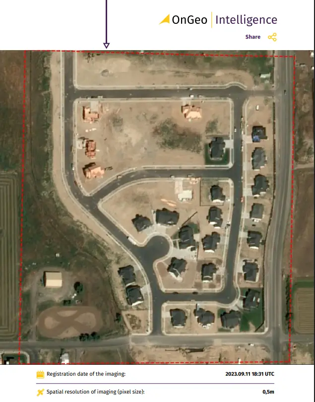
Deliverables include a professional PDF report with chronologically ordered natural-colour images and georeferenced source files suitable for GIS software. An archive search function lets users browse available cloud-free scenes free of charge before ordering, ensuring the most relevant dates are selected.
Meet OnGeo Intelligence: Satellite Evidence in a Few Clicks
Until recently, high-resolution satellite data was reserved for large organisations. At OnGeo Intelligence, anyone a landowner, lawyer, investor, insurer or surveyor can order a Satellite Imagery Report for virtually any place on Earth. It is a curated set of satellite images of your location, delivered as an easy-to-read PDF by email and arranged from newest to oldest, so you can see how the land changed.
How to Order Satellite Imagery on OnGeo Intelligence
- Visit the OnGeo Intelligence platform at ongeo-intelligence.com.
- Define your area of interest by drawing on the map, entering coordinates, or uploading a boundary file.
- Select the desired time range and preferred resolution.
- Review the available cloud-free scenes in the free archive search.
- Place the order (no account or subscription required). Use code ongeo100 for free access to selected reports.
- Receive the professional PDF report and georeferenced data package by email usually within minutes for low-resolution imagery or up to 48 hours for high-resolution commercial scenes.
OnGeo Intelligence addresses the complexity of satellite data by providing:
- Automated preprocessing, including cloud masking and data normalization.
- Ready-to-use insights such as vegetation indices, change detection, and land-cover classification.
OnGeo Intelligence is useful for lawyers, surveyors, notaries, real-estate professionals, insurers and local authorities as well as private owners.
Practical Benefits in Real Dispute Scenarios
Users of OnGeo Intelligence have successfully employed these reports in neighbour boundary conflicts where historical fence lines were reconstructed from sequential imagery, in inheritance and divorce cases that required proof of construction timelines, in challenges to unauthorized buildings or land-use changes, in insurance claims involving damage or pre-existing conditions, and in pre-purchase due diligence to verify the actual development history of a parcel.
Because the imagery is georeferenced and timestamped, it integrates smoothly with cadastral maps and expert reports, strengthening the overall evidentiary package.
Frequently Asked Questions
Can satellite images be used as evidence in a land dispute? Yes, imagery is increasingly used as supporting evidence. How it is assessed depends on the jurisdiction and on how it is presented, so consult a legal professional.
How far back can I go? OnGeo™ offers archival imagery dating back to 2008, subject to availability. Read more about satellite imagery archives.
Can I see a small house or a fence? With high-resolution imagery (about 2 m to 0.3 m), yes. With 10 m imagery, small objects are not distinguishable, so always check the preview.
How quickly will I get the imagery? Low-resolution images arrive within minutes; high-resolution imagery typically within 48 hours.
Conclusion
Land disputes are stressful, and they are won or lost on evidence. Satellite imagery gives you an objective, dated, georeferenced record that complements documents, surveys and witness statements – and it is now available to everyone, not only large institutions.
Order your Satellite Imagery Report from OnGeo Intelligence choose your location, pick cloud-free images and receive a clear PDF report by email, with no registration or contract.
Related articles
- Using Satellite Imagery As Evidence In Judicial Proceedings
- Aerial photos as evidence in the case
- Satellite Imagery vs Aerial Photography: Key Differences Explained
- How to Obtain Satellite Imagery of Your Plot? OnGeo Intelligence Guide
- Legalisation of unauthorised buildings using satellite images
- How to Acquire Free Satellite Imagery for Your Investigations
- Tracking Urban Changes with SaUrban Change Detection with Satellite Imageryellite Imagery: How Change Detection Reveals City Transformations