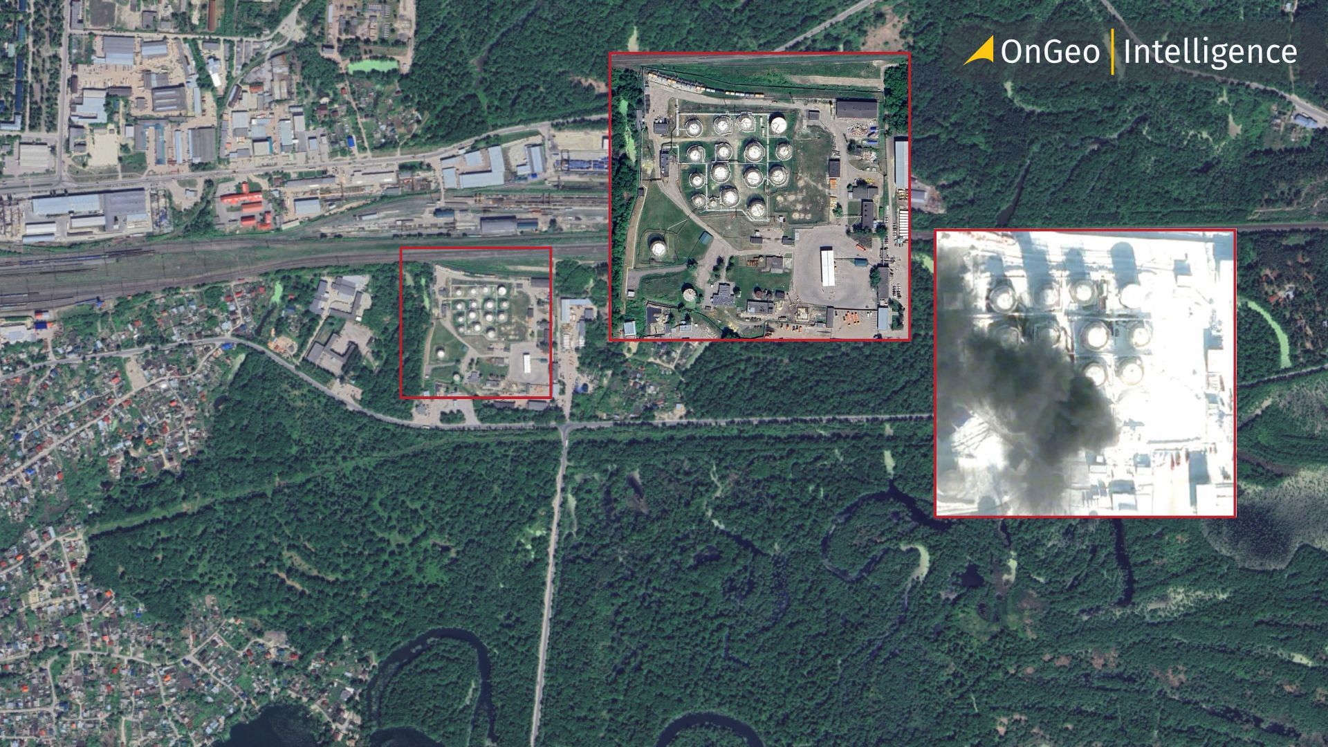
Satellite Imagery Reveals the Aftermath of the Strike on the Penza Oil Depot
Satellite imagery has once again proven its critical role in modern intelligence and conflict analysis. Newly released satellite images show the scale of destruction following a Ukrainian drone strike on the PenzaNefteProdukt oil depot in Russia’s Penza region, one of the largest fuel storage facilities in the area.
The images, captured from orbit, provide clear and verifiable evidence of the damage caused by the attack and underline the growing importance of satellite imagery in monitoring military and strategic infrastructure worldwide.
Satellite Images Show Destroyed Fuel Tanks After Two-Day Fire
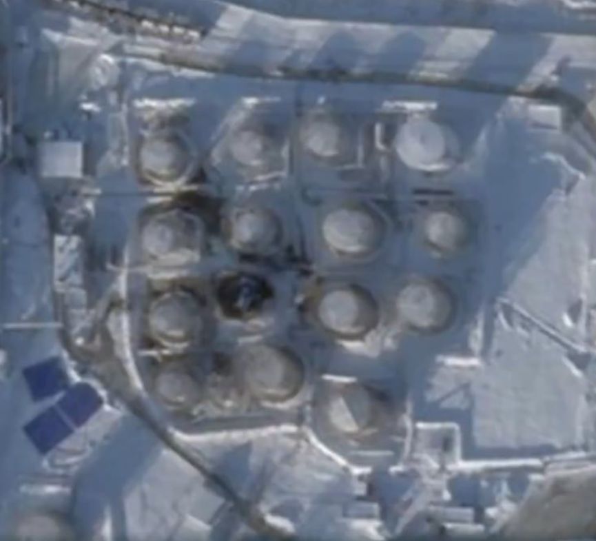
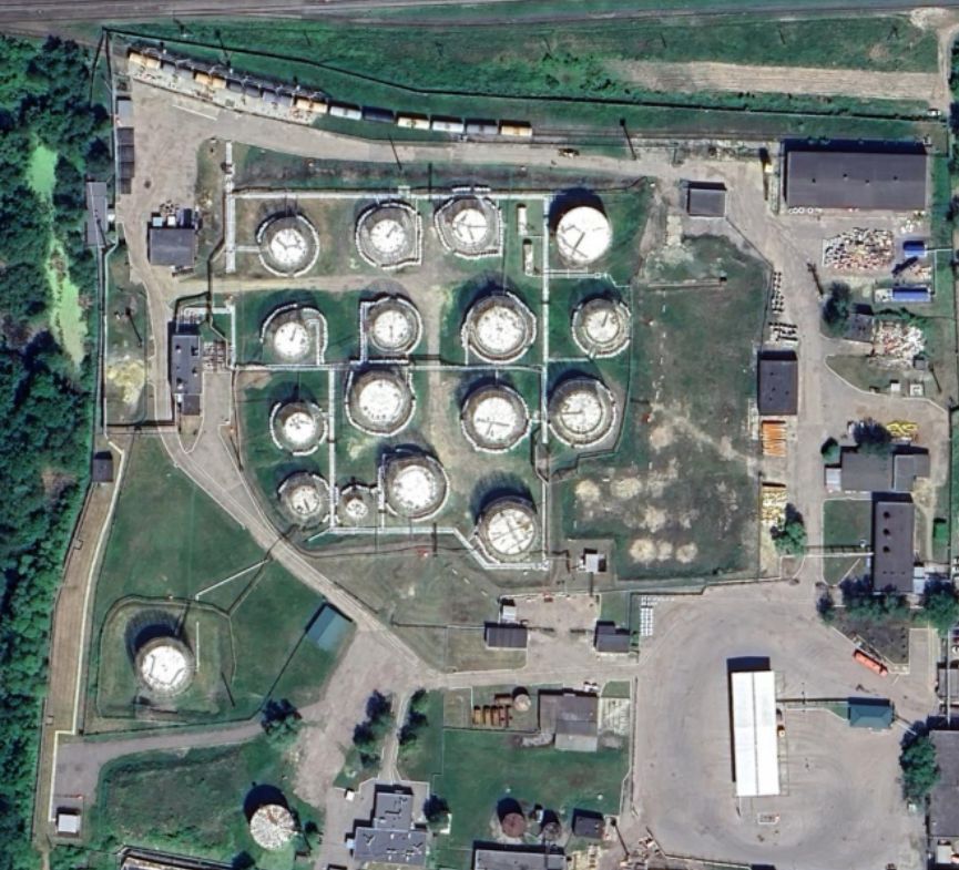
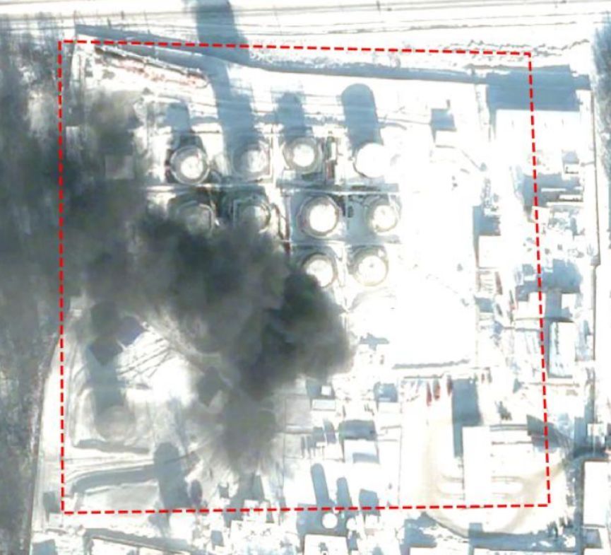
According to satellite imagery supplied by OnGeo Intelligence, at least one fuel storage tank at the Penza oil depot has been completely destroyed. Several neighboring tanks show visible signs of severe heat exposure, indicating structural damage caused by a fire that burned for more than two days.
Thermal discoloration, deformation of installations, and scorched ground patterns visible in high resolution satellite imagery suggest that the facility’s operational capacity has been significantly reduced and may even be rendered unusable in its previous form.
The attack took place during the night of January 22–23, and involved Ukrainian drones. While the exact number of unmanned aerial vehicles used in the strike has not been disclosed, the aftermath visible in satellite imagery confirms the precision and effectiveness of the operation.
Penza Attack Highlights Expanding Reach of Ukrainian Operations
Penza is located more than 500 kilometers from the Ukrainian border, underscoring the increasing range of Ukrainian strikes against Russian logistical and energy infrastructure. The PenzaNefteProdukt fuel depot is part of the Rosneft corporate structure and plays a key role in supplying both civilian sectors and Russian military units involved in the war against Ukraine.
The satellite imagery clearly documents how attacks on energy infrastructure can disrupt supply chains far from the front lines - a trend that has become increasingly visible through orbital data analysis.
Series of Attacks Confirmed by Orbital Intelligence
The strike on the Penza oil depot was not an isolated incident. Just one day earlier, Ukrainian drones reportedly targeted an oil refinery in Slavyansk-na-Kubani in Russia’s Krasnodar region. The Ukrainian General Staff stated that the facility was part of Russia’s energy backbone supporting military operations.
In the same week, Russian military warehouses in the occupied parts of the Donetsk and Zaporizhzhia regions were also hit. Ukrainian Commander-in-Chief General Oleksandr Syrskyi revealed in an interview with LB.ua that 719 strikes on Russian logistics and infrastructure were carried out in 2025, resulting in an estimated $15 billion loss to the Russian budget.
Each of these events has been independently analyzed and confirmed using satellite imagery, reinforcing its value as a transparent and reliable source of intelligence.
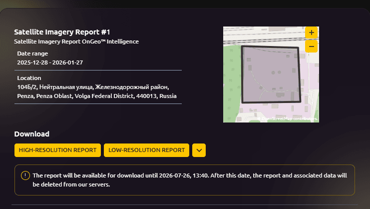
View the full satellite imagery report
Satellite Imagery as a Cornerstone of Modern Intelligence
The Penza case is another powerful example of how satellite imagery has become an indispensable tool in military operations, intelligence gathering, and strategic analysis. From the war in Ukraine to conflicts in the Middle East, orbital data allows analysts, journalists, and decision-makers to verify events in near real time.
While satellite reconnaissance was already used during earlier conflicts such as the Gulf War in 1991 or operations in Afghanistan today’s scale of usage is unprecedented. This is largely due to the availability of commercial satellite imagery, which can now be accessed not only by governments, but also by private companies, researchers, and civil organizations.
Access Professional Satellite Imagery with OnGeo Intelligence
As demonstrated by the latest images from Penza, access to high-quality satellite imagery enables precise damage assessment, situational awareness, and independent verification of events anywhere in the world.
Platforms like OnGeo Intelligence make it possible to:
Acquire up-to-date satellite imagery from multiple providers
Monitor critical infrastructure and strategic locations
Analyze changes over time using historical satellite data
Support intelligence, security, and research operations
If you need reliable, professional access to satellite imagery for analysis, reporting, or strategic decision-making, OnGeo Intelligence reports offers the tools and data required to see what is happening directly from orbit.
Satellite Imagery Confirms Damage to Strategic Energy Infrastructure
The latest satellite imagery of the Penza oil depot clearly demonstrates the growing role of orbital data in documenting and verifying modern military operations. Images captured after the Ukrainian drone strike reveal the complete destruction of at least one fuel tank and significant damage to surrounding infrastructure caused by a prolonged fire. The attack, carried out deep inside Russian territory, highlights both the expanding operational reach of Ukrainian forces and the strategic vulnerability of critical energy facilities.
This case once again confirms that satellite imagery has become an essential source of intelligence, enabling independent assessment of events, transparency in conflict reporting, and real-time monitoring of strategic assets. With commercial satellite data now widely accessible, platforms such as OnGeo-Intelligence empower analysts, journalists, and organizations to obtain reliable imagery, track changes over time, and make informed decisions based on verified information from space.
Related articles
- Lebanon Bombing: Satellite Images Reveals Scale of Destruction
- LA wildfires: Satellite images expose the scale of destruction
- Satellite imagery of Gaza reveals the massive scale of destruction
- Moss Landing Power Plant Fire: Lithium Battery Storage Risks
- Satellite Imagery Reveals M23’s Environmental Destruction in Eastern DRC
- Satellite Imagery Exposes 19 Rare Earth Mines Threatening Mekong River Pollution