🌍 Capture the world at 100% OFF! Use code ongeo100on 10 meters satellite image resolutions – limited time only! Higher resolution satellite images remain subject to payment.
🌍 Capture the world at 100% OFF! Use code ongeo100on 10 meters satellite image resolutions – limited time only! Higher resolution satellite images remain subject to payment.
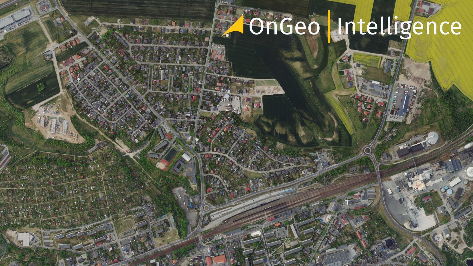
Essential Tips for Interpreting Satellite Imagery Like a Pro
2025-03-06
(Article updated:
2025-03-06
)
~ 8 min
Satellite images are incredible tools, offering a bird’s-eye view of our planet. Like maps, they’re packed with valuable insights—whether it’s tracking urban growth, monitoring crops, spotting wildfires, or predicting storms. But to unlock their full potential, you need toknow how to read them correctly. This guide will walk you through five essential steps to interpret satellite images like a pro. Ready to dive in?Let’s get started.
High-Quality Satellite Imagery, Hassle-Free
Explore any location on Earth with precision. Order a detailed Satellite Imagery Report—no sign-ups, no contracts. Delivered in a clear PDF for instant insights.
Before we jump into the how-to, let’s talk about why this skill matters. Satellite imagery isn’t just for scientists-it’s a window into understanding the world around us. Want to see how a city has expanded over time? Check a satellite image. Curious about the health of farmland or the path of a hurricane? Satellite data has you covered. By mastering interpretation, you can turn raw visuals into actionable information. Let’s break it down.
1. Understand the Image Scale
The first step to decoding a satellite image is figuring out its scale. Scale dictates what you can see and how much detail is available. Are you looking at a close-up of a neighborhood or a broad view of an entire region? The resolution of a satellite image determines the level of detail visible.
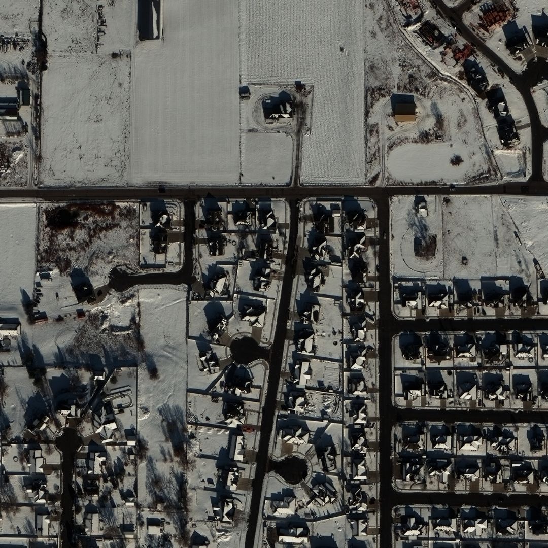
High-Resolution Images: Commercial satellites like WorldView-3 and Pléiades Neo offer incredible detail—down to 30 centimeters per pixel. You might spot individual houses or cars.
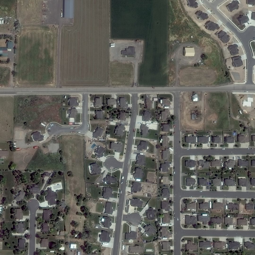
Medium-Resolution Images: Sentinel-2, with 10 meters per pixel, gives a city-wide perspective—great for broader context.
Low-Resolution Images: Geostationary weather satellites cover whole hemispheres but only resolve 1-4 kilometers per pixel, ideal for tracking massive weather systems.
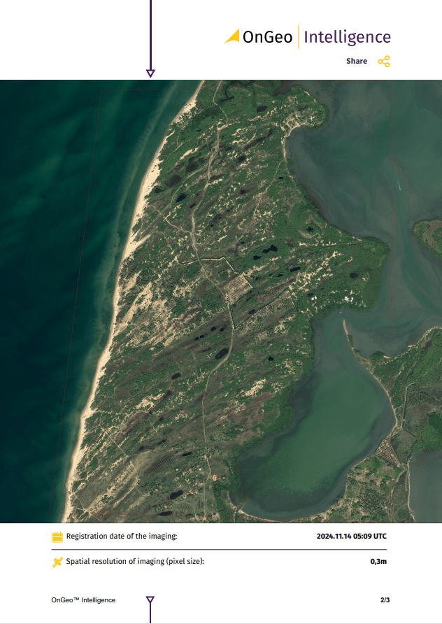
Examples of OnGeo Intelligence satellite imagery of the same area at spatial resolution of imaging (pixel size) 0,3m
Examples of OnGeo Intelligence satellite imagery of the same area at spatial resolution of imaging (pixel size)10m
Pro Tip: Check the image’s spatial resolution. For example, a high-res image might reveal flooded streets, while a wider view shows the river system feeding the flood.
2. Look for Patterns, Shapes, and Textures
Humans are wired to spot patterns, and this skill shines when interpreting satellite images. Features like rivers, forests, and cities often have distinct shapes or textures that make them stand out.
Water: Rivers twist, lakes form irregular blobs, and oceans stretch wide. These are easy to match with maps.
Human Influence: Farms show up as neat circles or rectangles, while roads and canals cut straight lines.
Geology: Volcanoes form circles, mountain ranges ripple in wavy lines, and canyons carve squiggly paths with shadows.
Cloud Clues: Mountains and islands shape clouds—think swirling vortices or linear formations—hinting at the terrain below.
Watch Out: Shadows can trick you. A phenomenon called relief inversion (when lighting flips mountains into valleys) can confuse interpretation. Rotate the image so light seems to come from the top to fix this.
Examples of OnGeo Intelligence satellite imagery of the same area in winter in January and in spring in May.
3. The Significance of Colors in Satellite Imagery
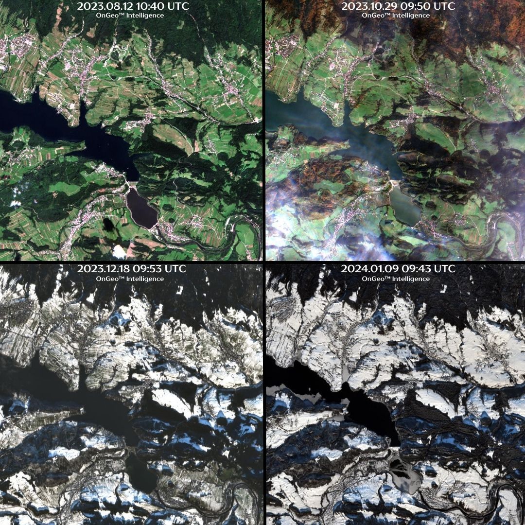
The colors in a satellite image vary depending on the type of light the satellite sensor captures. True-color images resemble what the human eye would see, while false-color images incorporate infrared or other wavelengths to highlight specific features. Understanding color representation in satellite imagery is essential for accurate interpretation:
Water: Typically appears dark blue or black, but can take on a brownish hue when carrying heavy sediment loads. Sunglint, caused by sunlight reflecting off water surfaces, can make areas appear silver or white.
Vegetation: Displays various shades of green. Grasslands appear light green, while dense forests show darker shades. Infrared images often highlight vegetation in bright red, helping scientists assess plant health.
Bare ground: Can range from tan and brown to reddish hues, depending on mineral composition. Salt flats or desert regions often appear white due to high salt content.
Urban areas: Usually appear gray or silver, reflecting the density of buildings and infrastructure.
Snow and ice: White to light blue, but may contain gray or tan hues due to impurities such as dirt or volcanic ash.
Clouds, smoke, and haze: White and gray tones, with smooth textures for smoke and haze, while clouds often have more defined edges.
Understanding color variations helps in distinguishing between water pollution, vegetation health, and geological formations.
Examples of OnGeo Intelligence satellite images showing the variability of the seasons
4. Finding North: Orientation in Satellite Images
Properly orienting a satellite image is crucial for accurate interpretation. Most satellite images align with north at the top, but this is not always the case. Checking for a north arrow or overlaying the image with a map can help confirm orientation. Identifying familiar landmarks, such as coastlines, rivers, or mountain ranges, can also aid in aligning the image correctly.
5. The Importance of Context and Local Knowledge
Local knowledge significantly enhances the interpretation of satellite images. Understanding regional climate, land use, and recent events allows analysts to make more accurate assessments. For instance, if an image shows a dark brown patch within a forest, knowledge of recent wildfires in the area can confirm that the patch represents a burn scar rather than a shadow or volcanic flow.
Maps and historical satellite images also provide context, allowing analysts to compare changes over time. For example, urban expansion, deforestation, and river course alterations become evident when comparing satellite images taken years apart.
Applications of Satellite Imagery
Satellite imagery has numerous applications across various industries and scientific fields, including:
Environmental Monitoring - Satellite images help track deforestation, desertification, glacier melting, and pollution levels. Remote sensing technology enables scientists to monitor climate change effects and natural resource depletion.
Disaster Management - Authorities use satellite imagery to detect wildfires, floods, hurricanes, and earthquakes. Rapid-response imaging helps emergency services assess damage and plan relief efforts effectively.
Agriculture and Food Security - Farmers and researchers utilize satellite data to monitor crop health, detect pest infestations, and optimize irrigation strategies. Remote sensing helps improve agricultural yields and sustainability.
Urban Planning and Infrastructure Development - Governments and urban planners analyze satellite images to monitor city growth, traffic patterns, and land-use changes. This information aids in designing efficient transportation systems and managing urban sprawl.
Climate and Weather Prediction - Meteorologists rely on satellite images to track storm formations, analyze cloud patterns, and predict severe weather conditions. Geostationary satellites provide real-time data for weather forecasting.
Military and Intelligence - Satellite imagery plays a critical role in national security and defense. Governments use high-resolution images for surveillance, border monitoring, and strategic planning.
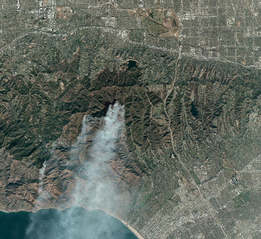
A good example is satellite imagery of the Los Angeles fire, taken from a considerable distance, which allowed us to capture the full extent of the fire.
Satellite image of the LA area on January 10, 2025. Smoke plumes are visible rising from the still-burning green areas.
This is an example of using satellite imagery by a Canadian forestry company.
When a forestry company in Canada suspected illegal logging on its remote lands, they turned to OnGeo Intelligence for a solution. By analyzing high-resolution satellite images over time, our team detected unauthorized deforestation patterns that had gone unnoticed from the ground. The company used this data to alert authorities and implement stricter monitoring, preventing further losses and protecting valuable natural resources. Thanks to OnGeo Intelligence’s satellite imagery, they not only stopped illegal activity but also strengthened their commitment to sustainable forestry management.
Conclusion
Satellite imagery is an invaluable tool for understanding our planet. By learning how to interpret images using scale, patterns, colors, orientation, and context, anyone can unlock the rich information hidden within these stunning visuals. Whether used for scientific research, disaster response, or urban planning, satellite images continue to shape the way we interact with and manage the world around us.
For those looking to dive deeper into satellite imagery analysis, resources such as online mapping platforms provide a wealth of data to explore. As technology advances, the capabilities of satellite imaging will continue to expand, offering even more precise and insightful perspectives on Earth’s dynamic systems.
Ready to explore satellite imagery with OnGeo Intelligence?
Satellite images are more than pretty pictures—they’re stories waiting to be told. Whether you’re a hobbyist, student, or professional, these five steps will help you unlock their secrets. Try it out with a local image—can you spot your neighborhood or a nearby river?
With OnGeo Intelligence, accessing satellite imagery has never been easier. The user-friendly Satellite Imagery Report offers high-quality data in a streamlined PDF format, eliminating the need for registration or long-term commitments. Users worldwide can obtain detailed imagery and actionable insights tailored to their area of interest. This report simplifies the process of utilizing satellite data for accurate analysis and effective strategy development.
We use cookies to run our website, analyze your use of our services, manage your online preferences & personalize ad content. By accepting our cookies, you'll get relevant content and social media features, personalized ads, and an enhanced browsing experience. To manage your choices, click "Cookie Settings." Necessary cookies are required for the core website functionality and cannot be rejected. For more information, see our Cookie Policy.
About cookies on this site
Cookies used on the site are categorized. Below you can allow or deny some or all of them, except for Necessary Cookies which are required to provide core website functionality. When categories that have been previously allowed are disabled, all cookies assigned to that category will be removed from your browser.
Some cookies are required to provide core functionality. The website won't function properly without these cookies and they are enabled by default and cannot be disabled.
Preference cookies enables the web site to remember information to customize how the web site looks or behaves for each user. This may include storing selected currency, region, language or color theme.
Analytical cookies help us improve our website by collecting and reporting information on its usage.
Marketing cookies are used to track visitors across websites to allow publishers to display relevant and engaging advertisements. By enabling marketing cookies, you grant permission for personalized advertising across various platforms.
The cookies in this category have not yet been categorized and the purpose may be unknown at this time.