🌍 Capture the world at 100% OFF! Use code ongeo100on 10 meters satellite image resolutions – limited time only! Higher resolution satellite images remain subject to payment.
🌍 Capture the world at 100% OFF! Use code ongeo100on 10 meters satellite image resolutions – limited time only! Higher resolution satellite images remain subject to payment.
Dual-Satellite Earth Observation: The Power of Combining SAR and Optical Imaging
2025-03-19
(Article updated:
2025-03-19
)
~ 4 min
Earth observation has reached new heights with the concept of dual-satellite formations, where a Synthetic Aperture Radar (SAR) satellite is followed by a high-resolution optical satellite in the same orbit. This innovative approach maximizes data accuracy and reliability, overcoming the limitations of each sensor type. Two prominent concepts—OptiSAR by UrtheCast and Tandem4EO by ICEYE & SATLANTIS—aimed to implement this strategy, but only one is on track for realization.
High-Quality Satellite Imagery, Hassle-Free
Explore any location on Earth with precision. Order a detailed Satellite Imagery Report—no sign-ups, no contracts. Delivered in a clear PDF for instant insights.
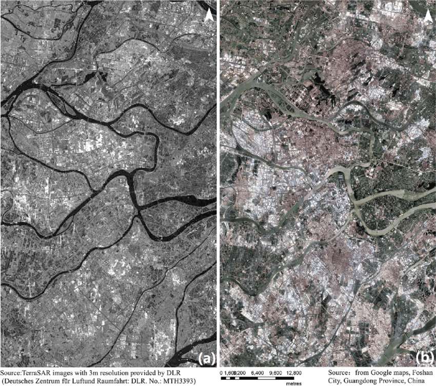
Optical satellites capture images in visible and infrared wavelengths, providing high-resolution, photo-like imagery. However, they are limited by weather and lighting conditions – clouds, smoke and darkness can render them ineffective. SAR satellites, on the other hand, actively emit microwave signals, creating high-contrast images regardless of time or weather. By pairing these technologies in a coordinated formation the two satellites can provide:
Uninterrupted Observation – SAR operates 24/7, while optical satellites capture fine details when conditions allow.
Enhanced Disaster Monitoring – SAR detects changes in flooded, burned or damaged areas, while optical satellites provide confirmation and context.
Improved Object Identification – SAR can detect structures and terrain changes, while optical imagery helps classify and analyze objects.
Now, let’s dive into two major SAR-optical dual-satellite constellation concepts
1. OptiSAR by UrtheCast – A vision that never took off
OptiSAR was conceived by UrtheCast, a Canadian company specializing in Earth observation. The company aimed to deploy a revolutionary constellation combining SAR and optical imaging on a global scale.
Basics of the solution
Orbit: Sun-synchronous low Earth orbit (LEO)
Satellites: 16 in total (8 optical, 8 SAR)
Formation: Each SAR satellite was to be paired with an optical satellite in a tandem configuration.
The idea behind the formation
OptiSAR was designed to enhance real-time Earth Observation. The SAR satellite would first capture an image, and the optical satellite, trailing behind, would capture a corresponding high-resolution optical image when conditions allowed. This setup would enable advanced applications such as AI-driven rapid response for disaster monitoring, high-precision mapping and defense reconnaissance.
Implementation status – why it never launched
Despite its ambitious vision, OptiSAR was never implemented. In 2021, UrtheCast declared bankruptcy, citing financial difficulties and an inability to secure sufficient investment. As a result, OptiSAR was officially canceled and its assets were acquired by EarthDaily Analytics, which shifted focus to purely optical satellite missions.
2. Tandem4EO – A New Hope for SAR-Optical cooperation
Engaged parties
Tandem4EO is a collaboration between ICEYE, a leader in SAR satellite technology, and SATLANTIS, a specialist in high-resolution optical imaging.
Basics of the solution
Orbit: Sun-synchronous low Earth orbit (LEO)
Satellites: 4 in total (2 SAR, 2 optical)
Formation Flying: The two ICEYE SAR satellites are designed to fly in a bistatic formation, meaning they will work in tandem to enhance radar imaging capabilities. Trailing behind these are the two SATLANTIS optical satellites, which will capture high-resolution optical imagery. This coordinated formation allows for near-simultaneous acquisition of radar and optical data over the same geographical areas.
The idea behind the formation
The formation is designed to provide near-instantaneous SAR-optical data fusion. By flying in tandem, the SAR satellites capture radar images first, and the optical satellites, following the same ground track, provide a visual confirmation whenever possible. This approach significantly reduces cloud-based data loss and improves change detection for applications such as:
Flood and disaster monitoring – SAR detects affected areas even in bad weather, while optical images provide human-readable context.
Security and defense – SAR can penetrate camouflage, and optical satellites can confirm object details.
Infrastructure assessment – Combining SAR’s structural analysis with optical imagery ensures a complete understanding of buildings, roads and construction sites.
Implementation Status – A Work in Progress
Unlike OptiSAR, Tandem4EO is actively being developed. ICEYE and SATLANTIS announced the project in 2022, with plans to launch the first satellites soon. If successful, it will be one of the first commercial constellations utilizing a SAR-optical tandem concept.
Source: researchgate.net
Why the SAR-optical satellite pairing concept matters?
The idea of flying SAR and optical satellites in tandem is a game-changer for Earth Observation. Here’s why:
Unmatched Versatility – The combination ensures continuous monitoring, regardless of weather or daylight conditions.
High-Accuracy Data Fusion – Integrating SAR’s structural mapping with optical imagery enhances object detection, classification and interpretation.
Improved Crisis Response – From natural disastersto military intelligence, the ability to cross-verify SAR and optical data in real-time is invaluable.
Better AI Integration – Advanced AI models can use both radar and optical inputs to provide more precise automated analysis.
While OptiSAR failed due to financial struggles, Tandem4EO represents a promising future for this innovative approach to Earth observation. The combination of SAR and optical imaging in the same orbit is not just a great concept – it’s a necessity for modern geospatial intelligence, environmental monitoring and disaster response.
Conclusion
With the increasing demand for reliable, all-weather Earth Observation, SAR-optical dual satellite formations are set to revolutionize the industry. While OptiSAR never made it to orbit, Tandem4EO is on track to become a pioneering constellation in this field. As technology advances, we can expect even more sophisticated multi-satellite formations to provide unparalleled insights into our planet.
We use cookies to run our website, analyze your use of our services, manage your online preferences & personalize ad content. By accepting our cookies, you'll get relevant content and social media features, personalized ads, and an enhanced browsing experience. To manage your choices, click "Cookie Settings." Necessary cookies are required for the core website functionality and cannot be rejected. For more information, see our Cookie Policy.
About cookies on this site
Cookies used on the site are categorized. Below you can allow or deny some or all of them, except for Necessary Cookies which are required to provide core website functionality. When categories that have been previously allowed are disabled, all cookies assigned to that category will be removed from your browser.
Some cookies are required to provide core functionality. The website won't function properly without these cookies and they are enabled by default and cannot be disabled.
Preference cookies enables the web site to remember information to customize how the web site looks or behaves for each user. This may include storing selected currency, region, language or color theme.
Analytical cookies help us improve our website by collecting and reporting information on its usage.
Marketing cookies are used to track visitors across websites to allow publishers to display relevant and engaging advertisements. By enabling marketing cookies, you grant permission for personalized advertising across various platforms.
The cookies in this category have not yet been categorized and the purpose may be unknown at this time.