Artemis II Mission: NASA Photos from the Historic Crewed Lunar Flyby
NASA’s Artemis II mission, the first crewed flight of the Orion spacecraft beyond low Earth orbit in over 50 years, has successfully concluded. Four astronauts Reid Wiseman, Victor Glover, Christina Koch, and Jeremy Hansen completed a landmark ~10-day journey around the Moon, marking a major step toward future lunar landings.
For space enthusiasts, researchers, and imaging professionals, one of the most valuable outcomes is the massive collection of imagery captured during the mission. NASA has made available every single Artemis II photo a total of 12,217 separate images offering an unprecedented, raw look at the Moon, Earth, and the human experience inside the Orion capsule.
Artemis II Mission Overview
The crew launched on April 1 at 18:35 EDT from Launch Pad 39B at Kennedy Space Center, Florida. Over the course of the mission, the Orion spacecraft traveled a total distance of 695,081 miles, reaching a maximum distance from Earth of 252,760 miles roughly 4,105 miles farther than Apollo 13. At its closest approach, Orion passed approximately 4,070 miles from the lunar surface.
The primary objectives included testing Orion’s life support systems, navigation, and thermal protection in deep space, as well as gathering data for future Artemis missions. The crew conducted live broadcasts and captured extensive imagery using the spacecraft’s sophisticated camera suite.
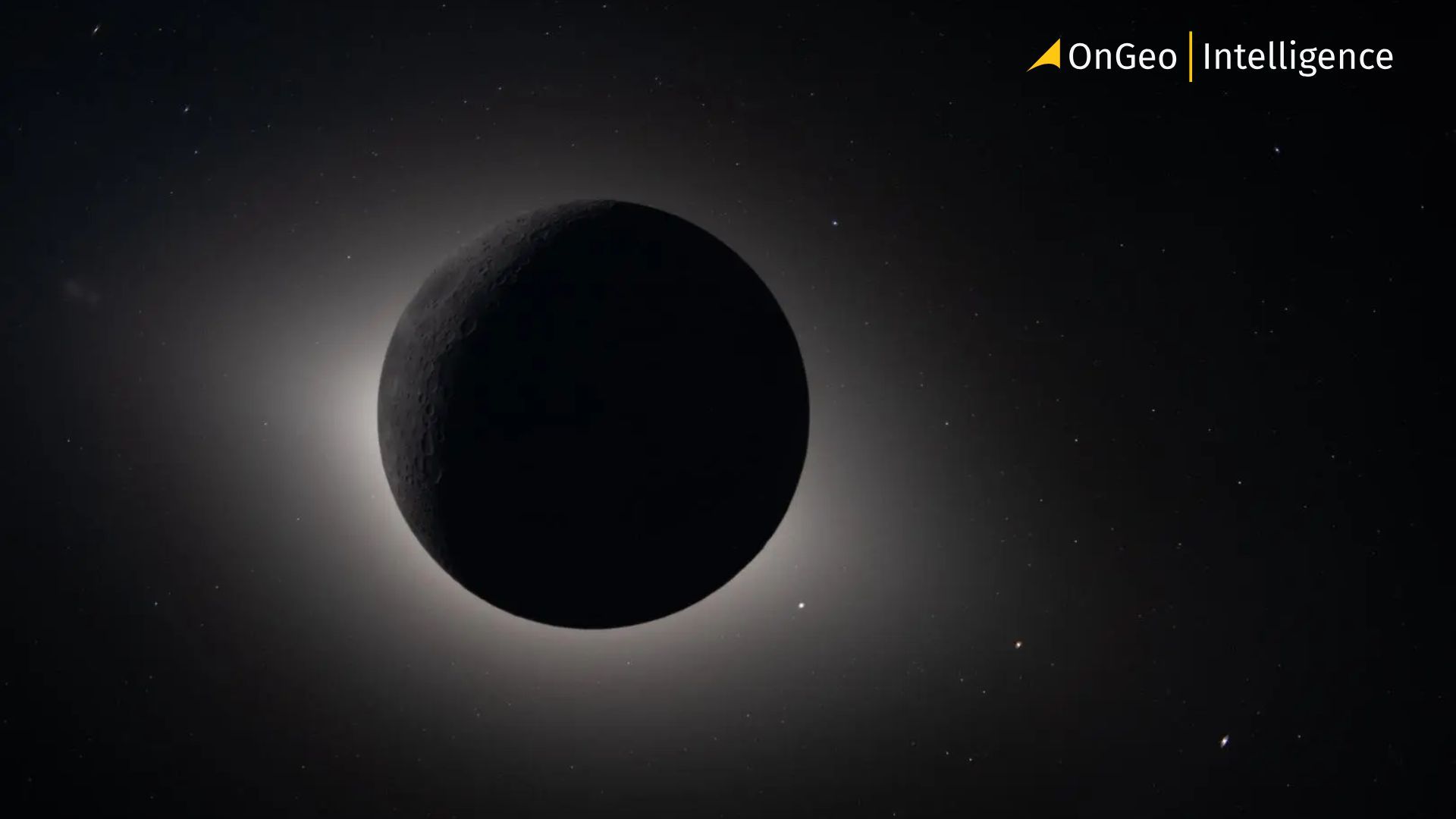
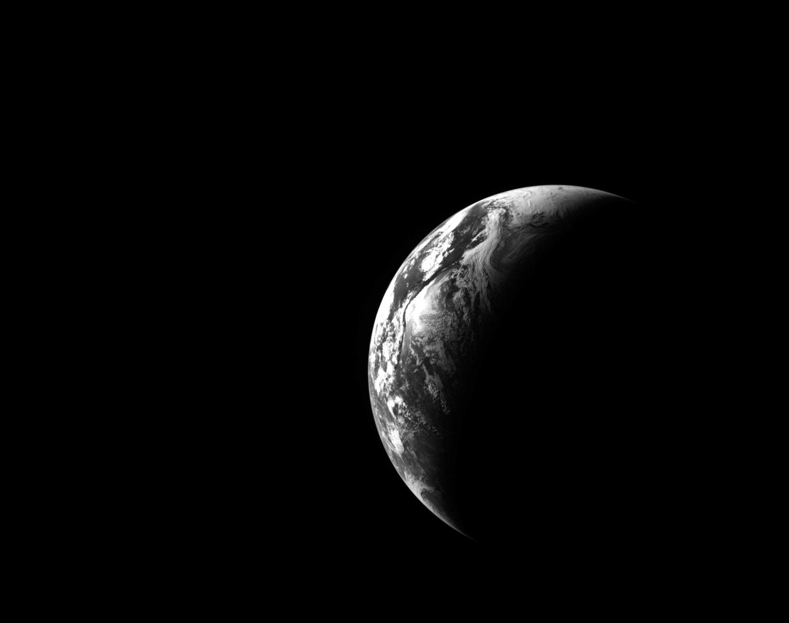
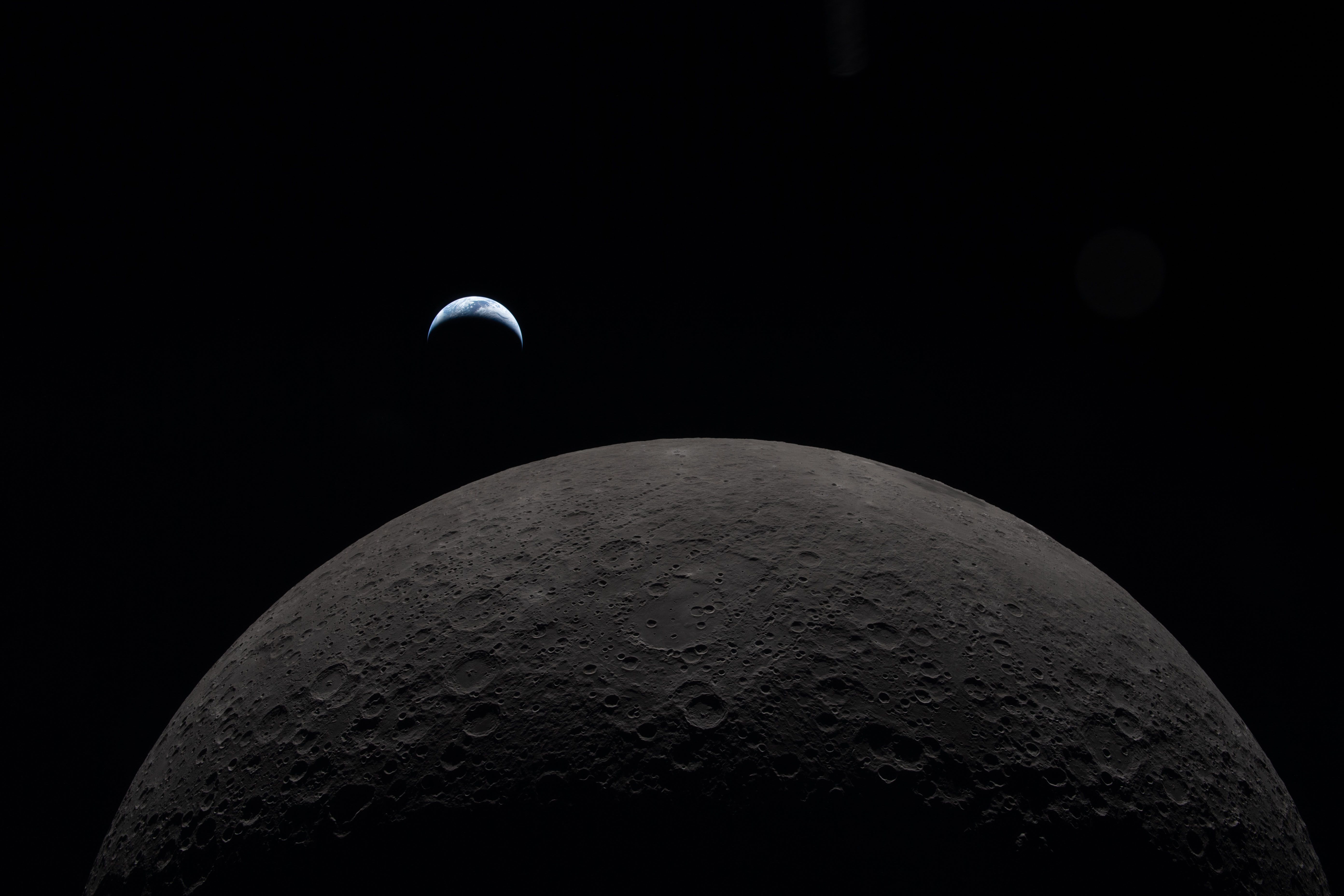
Why These Photos Matter: The Human Perspective from Deep Space
While robotic probes deliver outstanding data, human observers bring unique value. Astronaut eyes and brains excel at detecting subtle variations in color, texture, and lighting on the lunar surface that automated systems might miss. The Artemis II images reflect this advantage, featuring everything from dramatic Earthrise views to intimate “through-the-window” shots showing reflections of hands, the spacecraft interior, and even smudges on the windows offering a deeply human connection to the voyage.
These photographs serve dual purposes:
- Scientific value - Detailed documentation of the Moon and Earth from cislunar space.
- Public engagement - Raw, uncurated views that make deep-space exploration feel accessible.
How to Access Every Artemis II Photo (12,217 Images)
NASA has released the full collection through the Gateway to Astronaut Photography of Earth. While curated galleries on the main Artemis site feature only a few hundred selected images, the complete archive is available via this specialized database.
Direct link to the full image table
This archive stands as one of the most comprehensive releases from any recent crewed mission, giving researchers, educators, and enthusiasts direct access to the raw dataset.
Camera Systems on Orion
Orion was equipped with 32 cameras and imaging devices 15 mounted externally or structurally on the spacecraft and 17 handheld cameras operated by the crew. These systems supported engineering diagnostics, navigation, crew monitoring, scientific observation, and public outreach.
Post-Mission Operations and Path to Artemis III
Following the successful splashdown off San Diego, ground teams at Kennedy Space Center shifted focus to Artemis III preparations. The Mobile Launcher was transported back to the Vehicle Assembly Building for inspections, repairs, and stacking operations ahead of the next mission, currently targeted for the following year.
Lessons from Artemis II, building on Artemis I, continue to refine ground infrastructure and spacecraft performance for sustained lunar exploration.
Why This Image Archive Is a Geospatial Treasure
From a geospatial intelligence perspective, these images provide high-value context for Earth observation from deep space. Views of our planet against the lunar horizon and deep-space backdrop offer unique calibration opportunities and visual data for climate, atmospheric, and geographic studies. The raw, high-volume nature of the collection allows for detailed analysis beyond what curated selections can provide.
Explore the full Artemis II photo archive and experience the mission through the astronauts’ own lenses. Whether you’re studying lunar geology, Earth science, or simply inspired by humanity’s return to deep space, this collection represents one of the most significant public imagery releases in modern space exploration.
Stay tuned to OnGeo Intelligence for more updates on Earth observation, space-based geospatial data, and the latest developments in the Artemis program.
Related articles
- The ISS as a Flexible Eye on Our Changing Planet
- How to Get Live Satellite Images: Real-Time Options
- How to Download High-Resolution Satellite Images
- Sentinel-6B Launched: New Climate Sentinel Takes Orbit to Track Accelerating Sea-Level Rise
- Where to Find Satellite Imagery from a Specific Period? Explore OnGeo Intelligence Archives!