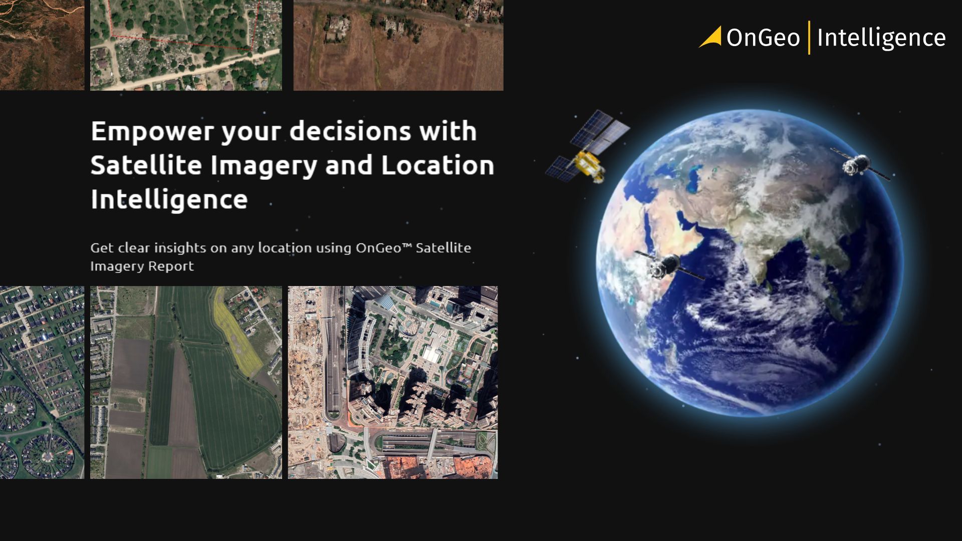
How to Download High-Resolution Satellite Images
High-resolution satellite imagery is no longer limited to governments, military agencies, or large corporations. Today, anyone can access detailed images of the Earth that reveal buildings, roads, land-use changes, and environmental activity with remarkable clarity.
But while access has improved, knowing where to find high-resolution imagery, what resolution you actually need, and how to download it legally and efficiently is still confusing for many users. This guide breaks down the process step by step - explaining what high-resolution satellite imagery is, where to download it, and how platforms like OnGeo simplify access without requiring specialist knowledge.
Whether you’re conducting research, monitoring land use, or exploring satellite data for the first time, this article will help you get started with confidence.
What Is Considered “High-Resolution” Satellite Imagery?
Satellite image resolution describes how much detail an image can capture on the ground. It is usually measured as spatial resolution, which refers to the size of the area represented by a single pixel.
The smaller the pixel size, the higher the resolution - and the more detail you can see.
In general, satellite imagery is grouped into the following categories:
- Low resolution (100 m and above)
Suitable for global and regional monitoring, such as weather patterns and large-scale environmental trends. - Medium resolution (10–30 m)
Commonly used for land cover mapping, agriculture, forestry, and environmental analysis. Satellites like Sentinel-2 and Landsat fall into this category. - High resolution (1–5 m)
Enables clear identification of roads, buildings, and infrastructure. Often used in urban planning, disaster assessment, and mapping. - Very high resolution (below 1 m)
Allows recognition of individual vehicles, small structures, and fine urban details. This level of resolution is typically provided by commercial satellites.
It’s important to note that higher resolution is not always better. High-resolution imagery produces larger files, may cost more, and is not always necessary for broad-area analysis. Choosing the right resolution depends on your project’s goals, scale, and required level of detail.
Free vs Paid High-Resolution Satellite Data
High-resolution satellite imagery is available through both free and paid sources, but the level of detail, update frequency, and usage rights can vary significantly between the two. Understanding these differences helps users choose the most appropriate option for their needs.
Free Satellite Data
Free satellite imagery is typically provided through public Earth observation programs such as Copernicus and NASA. These datasets are open, reliable, and widely used for scientific and environmental applications.
Common characteristics of free imagery include:
- Medium to high-medium resolution (typically 10–30 meters)
- Regular global coverage
- Open licensing for research and public use
- Limited ability to see fine urban or structural details
Examples include Sentinel-2 and Landsat, which are ideal for monitoring vegetation, land use, water bodies, and large-scale environmental change.
Paid High-Resolution Satellite Data
Paid imagery is supplied by commercial satellite operators and offers significantly higher spatial detail often down to sub-meter resolution.
Key features of paid imagery:
- High to very high resolution (1 meter or better)
- Ability to identify individual buildings, vehicles, and infrastructure
- Higher acquisition flexibility and tasking options
- Licensing restrictions depending on provider and use case
Paid high-resolution imagery is commonly used for urban planning, infrastructure monitoring, journalism, insurance analysis, and detailed site assessments.
Choosing Between Free and Paid Data
Free satellite data is often sufficient for regional analysis and environmental monitoring. Paid imagery becomes necessary when precise detail, visual evidence, or fine-scale measurements are required.
The right choice depends on:
- The size of the area being analyzed
- The level of detail needed
- Budget and licensing requirements
- How frequently updated imagery is required
By understanding the strengths and limitations of each option, users can make informed decisions and avoid unnecessary costs.
Where to Download High-Resolution Satellite Images
Once you understand the difference between free and paid imagery, the next step is knowing where to actually access and download high-resolution satellite data. Several platforms exist, each suited to different experience levels and use cases.
Public Data Platforms (Free Access)
Government and international space agencies provide open access to satellite imagery through official portals.
Common options include:
Copernicus Data Space – Access to Sentinel-1 and Sentinel-2 imagery, including 10 m optical data and radar imagery.
USGS EarthExplorer – Landsat imagery and historical satellite archives.
These platforms are reliable and free but often require:
- Account creation
- Understanding of data formats
- Manual processing in GIS software
They are best suited for users with some technical or GIS background.
Commercial Satellite Providers (Paid Access)
Commercial operators provide high to very high resolution imagery, often down to sub-meter detail.
Typical characteristics:
- Advanced ordering interfaces or APIs
- Licensing and usage restrictions
- Higher costs depending on resolution and area size
These platforms are commonly used by professionals who need precise detail and can manage technical workflows.
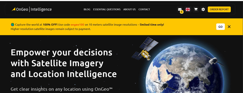
Simplified Access via OnGeo Intelligence
OnGeo Intelligence offers a more accessible way to obtain satellite imagery without navigating complex data portals.
With OnGeo Intelligence:
- No subscription or account creation is required
- No specialist knowledge is needed
- Users receive results as clear, readable PDF reports
- Sentinel-2 imagery can be accessed for free using the code ongeo100
- High-resolution satellite data becomes accessible to a broader audience
This approach is particularly useful for users who want insight rather than raw data files, or who need satellite information quickly for reporting, planning, or decision-making.
Step-by-Step: How to Download High-Resolution Satellite Imagery (Conceptual)
Downloading high-resolution satellite imagery generally follows the same workflow across most platforms, whether you’re using public data portals, commercial providers, or simplified services. Understanding this process helps you choose the right tool and avoid common pitfalls.
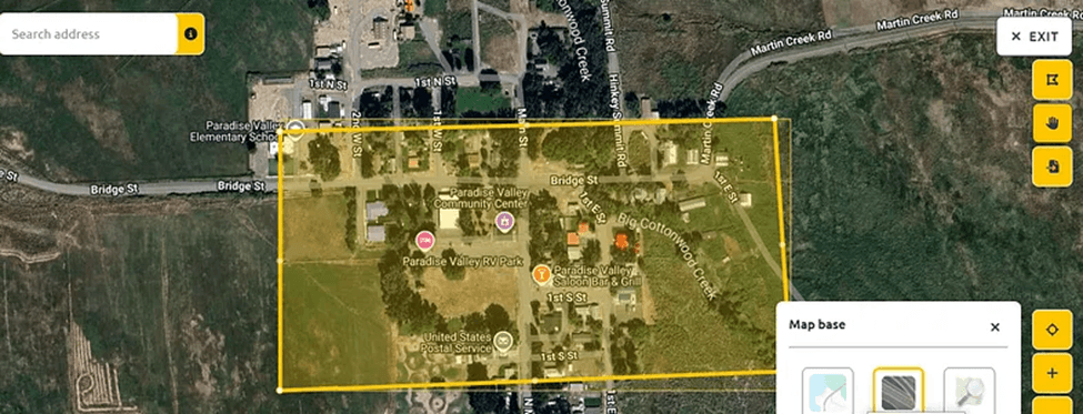
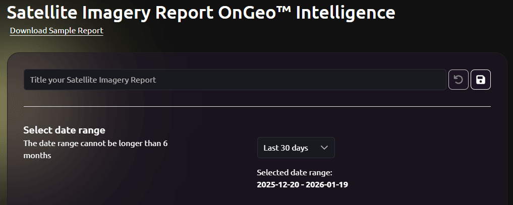
Step 1: Define Your Area of Interest (AOI)
Start by identifying the exact location you need imagery for.
This is usually done by:
- Searching for a place name or coordinates
- Drawing a polygon or rectangle on an interactive map
- Uploading a boundary file (e.g., GeoJSON or shapefile)
A smaller, well-defined AOI reduces data size, cost, and processing time.
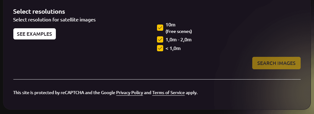
Step 2: Choose the Required Resolution
Select imagery resolution based on your use case:
- 10–30 m → Environmental monitoring, agriculture, land cover
- 3–5 m → Regional planning and infrastructure analysis
- <1 m → Urban analysis, construction, detailed inspections
Higher resolution means more detail but usually higher cost and larger files.
Step 3: Select Date or Time Range
Satellite imagery is captured at different intervals depending on the satellite.
You’ll typically:
- Choose a specific date
- Or define a date range to find the clearest image
Cloud cover filters are especially important for optical imagery.
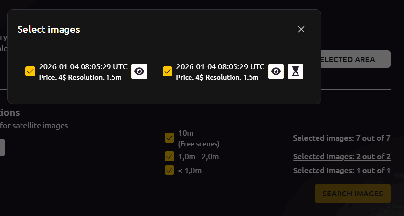
Step 4: Review Available Scenes
Most platforms show multiple available scenes for the same area.
At this stage:
- Compare cloud cover percentages
- Check acquisition dates
- Review preview thumbnails
Selecting the right scene is often more important than simply choosing the highest resolution.
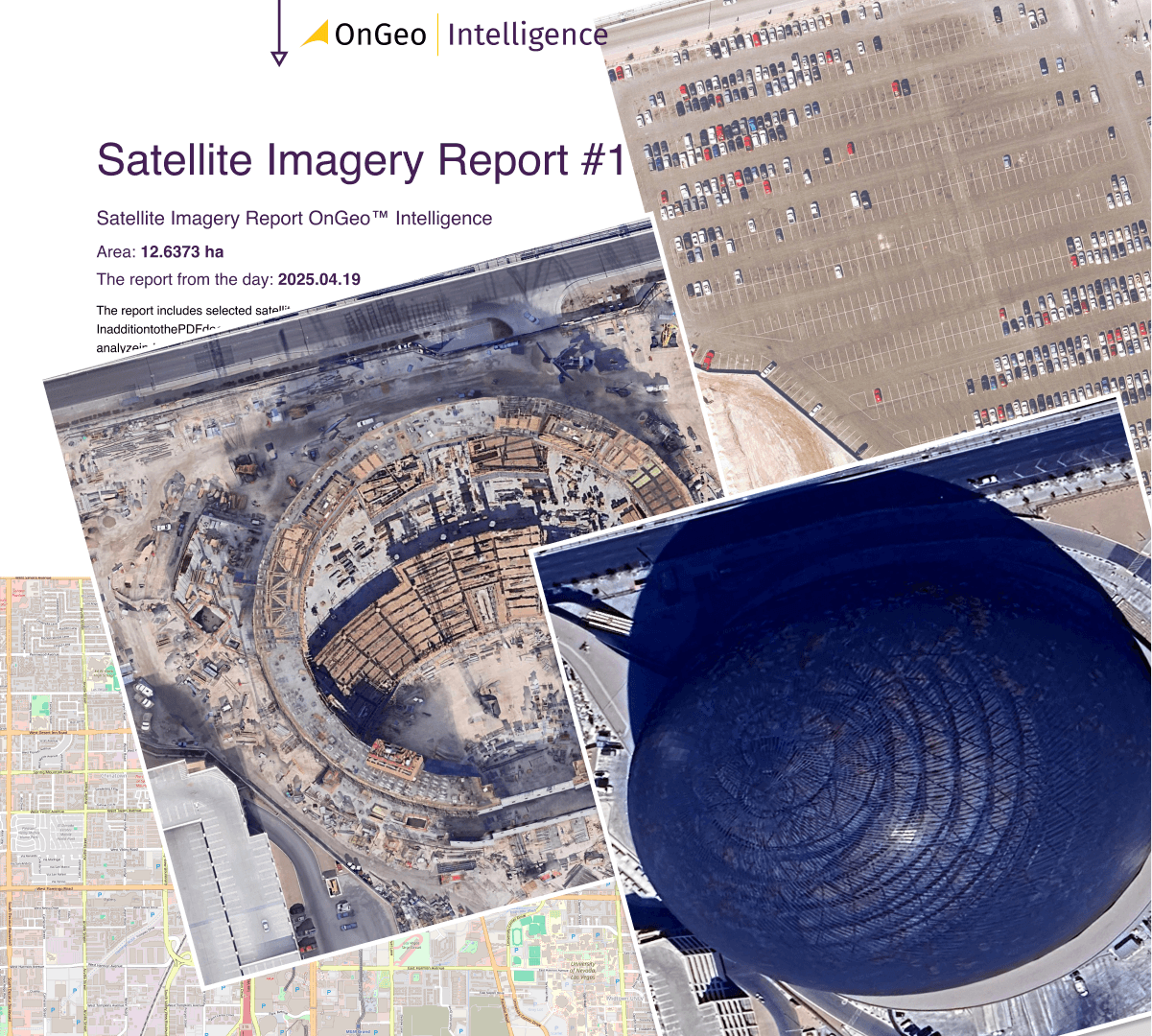
Step 5: Download or Generate the Data
Once selections are confirmed:
- Public platforms generate a download link
- Commercial providers may process the order
- Simplified tools generate a report or ready-to-use output
Processing time can range from seconds to hours.
Step 6: Use the Imagery
After download, imagery can be:
- Opened in GIS software like QGIS
- Embedded in reports or presentations
- Compared with older imagery for change detection
See sample Satellite Imagery Report
Read More Here: Satellite Imagery Report
When Do You Actually Need High-Resolution Imagery? (And Why It Matters)
High-resolution satellite imagery should be used when detailed visibility, reliable visual evidence, or precise detection of small-scale changes is essential. It is particularly valuable in urban and densely built environments, infrastructure and construction monitoring, property and land-use analysis, and legal, insurance, or investigative applications where sub-meter detail strengthens accuracy and credibility. However, for large-area environmental monitoring, climate studies, regional agriculture, or broad land-cover analysis, medium-resolution imagery is more efficient and appropriate. Selecting the right resolution reduces costs, accelerates processing, and ensures imagery is aligned with real project requirements, because the right level of detail matters more than maximum detail.
Final Thoughts - High-resolution satellite imagery
High-resolution satellite imagery has become far more accessible than it was just a few years ago. What was once limited to governments and large institutions is now available to researchers, businesses, journalists, planners, and individuals who need accurate, visual insight into the world.
The key is understanding when high-resolution imagery is truly necessary. For detailed analysis, urban environments, visual evidence, and monitoring small-scale change, high-resolution data offers clarity that lower-resolution imagery cannot match. At the same time, choosing the right resolution for each task ensures efficiency, cost control, and better outcomes.
Platforms like OnGeo Intelligence help lower the barrier to entry by simplifying access to satellite data and presenting it in an easy-to-understand format. This shift toward usability ensures that satellite imagery is no longer just about technology, but about practical insight and real-world impact.
Ultimately, the value of high-resolution satellite imagery lies not in its sharpness alone, but in how effectively it is used to understand change, support decisions, and reveal what cannot be seen from the ground.
Related articles
- From Space to Shore: How Earth Observation Satellites Help Monitor Water Quality
- How to Download Free Sentinel Data: A Step-by-Step Guide
- Real-Time Satellite Imagery
- How to Add Satellite Imagery to QGIS: Step-by-Step Tutorial
- What Is Satellite Imagery? A Complete Beginner’s Guide
- Satellite Imagery vs Aerial Photography: Key Differences Explained
- Construction Site Monitoring with Satellite Images