How Satellite Imagery Improves Crisis Management and Disaster Response
Satellite imagery has become an indispensable tool in crisis management and disaster response, offering critical insights that save lives, assess damages, and enhance preparedness. By leveraging both optical and Synthetic Aperture Radar (SAR) imagery, responders can predict, monitor, and recover from crises with unprecedented efficiency. We explore how satellite imagery transforms disaster management across all stages—before, during, and after a crisis. This article highlights its advantages over traditional methods, real-world examples.
Satellite Imagery Across the Disaster Management Cycle
Remote sensing plays a pivotal role throughout the disaster management cycle: prevention, response, and recovery. Below, we break down its applications at each stage.
1. Predict and Prevent
Understanding risks enables the prediction and mitigation of certain disasters. Satellite imagery provides critical data for proactive measures:
Flood Risk Management: Multispectral imagery analyzes soil moisture, texture, and other properties affecting water infiltration and runoff. 3D terrain models derived from satellite data identify flood-prone areas, enabling better planning and infrastructure design.
Landslide Prediction: By combining satellite imagery with in-situ data, responders can identify steep slopes, erosion-prone areas, and vegetation health—key factors in landslide risk assessment.
Wildfire Prevention: In forestry, satellite imagery maps vegetation density, vitality, and deadwood (e.g., from beetle infestations), pinpointing high-risk fire zones. This informs firebreak placement and early warning systems.
2. During a Crisis
When disasters strike, rapid access to accurate imagery is critical. Satellite data supports humanitarian organizations by enabling:
Resource Allocation: Imagery helps determine the number of responders needed in specific areas.
Evacuation Planning: Identifying blocked roads or suitable helicopter landing zones.
Real-Time Monitoring: Tracking wildfire progression, hazardous material spills, or water supply disruptions.
Infrastructure Assessment: Evaluating damage to power lines, roads, or other critical infrastructure.
By comparing pre- and post-event imagery from archives, responders can quickly assess the scope of destruction and prioritize actions.
3. Post-Crisis Recovery
After a disaster, satellite imagery monitors recovery efforts, tracking rebuilding progress and environmental impacts. High-resolution images provide a clear picture of restored infrastructure and ecosystems, ensuring long-term resilience.
Advantages of Satellite Imagery Over Other Methods
Satellite imagery offers unique benefits that make it superior to traditional methods like ground surveys or aerial photography:
Rapid Delivery: Satellites capture and deliver data from vast areas within minutes, enabling swift decision-making critical for saving lives.
High Resolution: Very High Resolution (VHR) imagery (30–50 cm) reveals fine details like individual plants, vehicles, or power lines, far surpassing the capabilities of lower-resolution sources like Sentinel.
Global Accessibility: Satellites access remote, rugged, or disaster-affected areas where ground-based methods are impractical or impossible.
Beyond Visible Spectrum: SAR imagery penetrates clouds and smoke, providing data in adverse conditions where optical imagery or human observation fails.
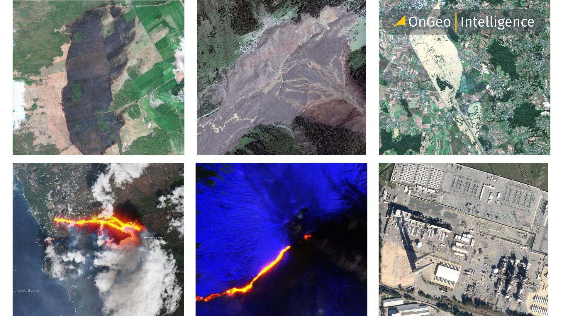
Real-World Examples of Satellite Imagery in Action
Blatten Landslide, Switzerland (2025)
In the Swiss Lötschental Valley, the village of Blatten was devastated by a landslide triggered by the collapse of the Birch Glacier. High-resolution satellite imagery captured the before-and-after.
These images guided damage assessments, evacuation planning, and recovery efforts while highlighting the need for enhanced monitoring to prevent future tragedies.
Biebrza National Park Fire, Poland (April 2025)
A devastating wildfire consumed 200 hectares of Poland’s largest national park. Satellite imagery revealed the extent of the damage, guiding firefighting efforts and sparing the ecologically critical Czerwone Bagno reserve. Multispectral data helped assess vegetation loss and plan restoration.
South Korea Wildfires (March 2025)
Catastrophic wildfires ravaged 170,000 hectares, destroying homes and landmarks. Sentinel-2 imagery, using SWIR, NIR, and RGB bands, mapped burned areas with precision, aiding resource allocation and recovery planning.
Mount Etna Eruption, Italy (February 2025)
Satellite imagery captured the dramatic eruption of Mount Etna, providing responders with real-time data on lava flows and ash dispersion, critical for evacuation and safety measures.
Los Angeles Wildfires, USA (2024)
The Palisades and Eaton fires scorched nearly 15,500 hectares, killing 24 people. High-resolution satellite imagery documented the destruction, supporting damage assessments and highlighting the fires’ environmental impact.
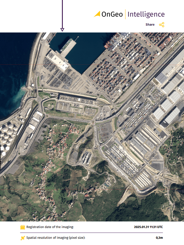
OnGeo Intelligence: Satellite Imagery for Crisis Management
The OnGeo Intelligence platform revolutionizes access to high-resolution satellite imagery, making it a powerful tool for crisis management. Designed for diverse users—from individuals to professionals across industries—this service delivers clear, reliable, and up-to-date imagery directly to users. In crisis scenarios, OnGeo Intelligence enables responders to track environmental changes, plan evacuations, or assess damages with precision. Its flexibility empowers users to make informed decisions, whether monitoring flood risks, wildfire spread, or infrastructure recovery. Unlike traditional methods restricted to large organizations, OnGeo Intelligence democratizes satellite data, allowing anyone to leverage its insights for effective crisis response and preparedness.
Satellite Imagery in Humanitarian Efforts
Beyond natural disasters, satellite imagery supports humanitarian crises, such as conflict-driven displacement. For example:
Refugee Camp Monitoring: Imagery tracks camp growth and environmental changes, aiding resource allocation.
Urban Destruction: Satellite data assesses damage in conflict zones, guiding humanitarian aid.
Early Warning Systems: Real-time monitoring enhances preparedness for socio-natural disasters.
Key Takeaways
Versatility: Satellite imagery supports all phases of disaster management—prevention, response, and recovery.
Speed and Scale: Rapid delivery of high-resolution data covers vast areas, even in remote or hazardous regions.
Superior Insights: SAR and multispectral imagery provide details unattainable by ground-based methods.
Global Impact: Initiatives like OnGeo Intelligence democratize access to critical data, enhancing disaster resilience worldwide.
Humanitarian Value: From natural disasters to conflict zones, satellite imagery saves lives and supports recovery.
By harnessing the power of satellite imagery, crisis management and disaster response have entered a new era of precision, speed, and effectiveness, ensuring better outcomes for communities worldwide.
Related articles
- How to Acquire Free Satellite Imagery for Your Investigations
- Test Our Satellite Data with a Free Satellite Imagery Report
- Myanmar Earthquake: Damage Revealed by Maxar Satellite Images
- Using Satellite Imagery As Evidence In Judicial Proceedings
- War in Sudan: How Satellite Imagery Reveals Hidden Atrocities