Understanding Satellite Imagery Resolution: Spatial Tiers, Market Dynamics, and Licensing Realities
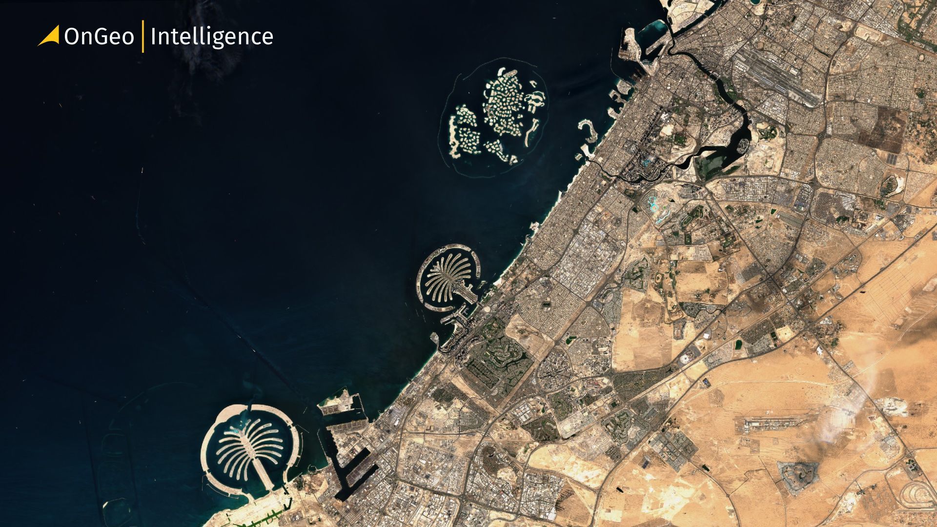
The term "high resolution" is ubiquitous in Earth observation (EO) marketing, yet its technical meaning spans a vast continuum. In practice, satellite data ranges from freely accessible public imagery, where a single pixel encompasses a 10 x10 meter footprint, to ultra-high-resolution commercial collects capable of isolating structural elements, vehicle profiles, and fine-grained infrastructure.
For GIS professionals, data scientists, and enterprise decision-makers evaluating spatial intelligence platforms like OnGeo Intelligence, selecting the correct imagery tier requires a precise understanding of spatial, temporal, and radiometric parameters alongside the regulatory and licensing frameworks that govern them.

What "Resolution" Means in Earth Observation: Ground Sample Distance (GSD)
Unlike consumer digital imaging, where resolution is defined by total camera megapixels, satellite imagery performance is measured by Ground Sample Distance (GSD). GSD represents the distance between the centers of two adjacent pixels measured on the ground.
- A 30 cm GSD image means each pixel corresponds to a 30 x 30 cm square on the Earth's surface.
- Lower numerical values indicate finer spatial detail (higher resolution), while higher values denote coarser imagery covering broader geographic areas.
| Resolution Tier | Spatial GSD Range | Primary Identification Thresholds |
| Public / Open | 10 m – 30 m | Forests, water bodies, urban boundaries |
| Mid-Tier Const. | 3 m – 5 m | Major road networks, large structures |
| High-End Comm. | 15 cm – 30 cm | Vehicles, surface markings, equipment |
Spatial resolution dictates the Level of Detail (LoD) for object detection. A 30 cm image allows an analyst or computer vision model to detect a vehicle and determine its general envelope, but identifying exact makes or sub-models typically crosses into the sub 15 cm processing threshold.
The Commercial Market Spectrum: Three Operational Tiers
1. The Open & Public Tier (10 m - 30 m GSD)
Operated primarily by government space agencies, this tier provides open-access data under permissive licenses:
- Landsat Program (NASA/USGS): Offers a continuous historical archive dating back to 1972 at 30 m multispectral resolution.
- Copernicus Sentinel-2 (ESA): Delivers 10 m spatial resolution across visible and near-infrared bands with a global revisit frequency of roughly 5 days.Best suited for: Regional land-cover classification, broad agricultural monitoring, deforestation tracking, and long-term climate analytics.
2. The Persistence & Change-Detection Tier (3 m - 5 m GSD)
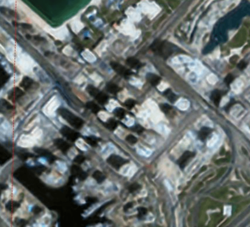
Pioneered by providers operating large constellations of CubeSats (such as Planet Labs), this mid-tier prioritizes temporal resolution (revisit rate) over spatial detail. Rather than capturing occasional targeted snapshots, these constellations image the entire terrestrial landmass on a near-daily cadence.
Best suited for: Daily crop health updates, supply chain monitoring, automated change detection, and disaster response alerting.
3. The Ultra-High Resolution Tier (15 cm - 30 cm GSD)
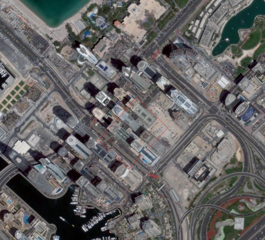
Dominated by commercial industry leaders such as Maxar Technologies and Airbus Defense and Space, this tier provides optical data at native ground sampling around 30 cm, with proprietary super-resolution and HD processing algorithms deriving outputs down to 15 cm. Best suited for: Infrastructure inspection, urban planning, defense intelligence, precision asset management, and high-accuracy geospatial mapping.
The Regulatory Evolution of the 25 - 30 cm
For years, commercial resolution faced a artificial cap dictated by U.S. national security policy rather than sensor engineering limitations. Commercial remote sensing satellites operated by U.S. entities are licensed by the National Oceanic and Atmospheric Administration (NOAA) under the Land Remote Sensing Policy Act.
1990s-2000s: 50 cm Commercial Cap
▼
2014: NOAA Lowers Cap to 25 cm (Accommodating Maxar WorldView-3)
▼
2020: Regulatory Shift to Dynamic Licensing (Focus on Foreign Competition)
▼
2023: Declassification of Tier 3 Limits (Unlocking Sub-20 cm SAR & Optical Sales)
- The Historical Restriction: Initially capped at 50 cm, NOAA lowered the commercial threshold to 25 cm in 2014 to accommodate the advanced sensor capabilities of Maxar's WorldView-3 satellite.
- The 2020 Reforms: Recognizing that foreign competitors (unbound by U.S. regulations) were marketing sub 30 cm imagery, NOAA modernized its framework. The agency shifted from permanent capability caps to temporary restrictions lasting a maximum of three years for truly novel capabilities.
- The 2023 Deregulation: In August 2023, NOAA removed lingering "Tier 3" restrictions. This regulatory shift enabled Synthetic Aperture Radar (SAR) providers like Umbra to commercially market high-resolution radar data down to 16 cm a technical capability that was previously constrained by licensing laws.
Sensor Physics: Optical vs. Synthetic Aperture Radar (SAR)
When selecting data sources for enterprise geospatial workflows, understanding the operational differences between sensor modalities is essential:
- Passive Optical Sensors: Capture reflected sunlight across visible and infrared spectrums. They yield intuitive, photograph-like images but are entirely obstructed by cloud cover, atmospheric haze, and nighttime conditions.
- Active SAR Sensors: Emit active microwave pulses and measure the signal backscatter. SAR pierces through cloud cover, smoke, and total darkness, while also measuring surface roughness, soil moisture, and micro-scale ground deformation down to millimeter tolerances via interferometry (InSAR).
Streamlining Earth Observation with OnGeo Intelligence
OnGeo Intelligence makes satellite-based without the need for specialized software or subscriptions. Key features include:
- No subscription or account needed. Reports can be ordered in just a few simple steps.
- Accessible data. High-resolution imagery are delivered in a readable .pdf format, ready for interpretation.
- Free Sentinel-2 reports. Using the code ongeo100, users can generate a report with Sentinel-2 scenes at no cost.
- Ease of use. No specialist knowledge is required
- Time efficiency. Access to satellite-based insights in hours rather than days, supporting timely interventions and improved decision-making.
Commercial Imagery Licensing: Avoiding Legal Pitfalls
A common pitfall in spatial data integration is mistaking a data license for property acquisition. Purchasing commercial satellite imagery grants an End-User License Agreement (EULA), not underlying copyright.
Single-User vs. Enterprise Licenses:
Standard commercial licenses restrict data usage to a specified number of seats or a single legal entity. Sharing raw GeoTIFF files across subsidiaries or partner networks typically requires multi-user or enterprise-tier licensing.
Derived Works & Derivative Data:
Most commercial contracts allow organizations to publish vector features, analytics, or raster maps derived from the source imagery, but strictly prohibit public redistribution of the unrendered raw sensor data.
Tile Services vs. Source Delivery:
Platforms such as Google Maps aggregate imagery from diverse vendors, compressing and stitching raster tiles for web rendering. Consequently, display imagery on web maps rarely offers the radiometric depth, positional accuracy, or spatial precision of direct commercial satellite feeds.
Integrating Spatial Intelligence into Your Workflow
Selecting satellite imagery requires balancing spatial resolution, temporal frequency, spectral bands, and project budgets. While public datasets like Sentinel-2 remain invaluable for baseline environmental monitoring, specialized commercial sensors provide the precision necessary for site-level decisions.
To explore how advanced geospatial data, automated property analytics, and spatial intelligence can optimize your business operations, explore our platform resources at OnGeo Intelligence.
Related articles
- GEO vs LEO Satellite Orbits, Altitude, Latency and Applications
- Free Satellite Imagery Sources: A Complete Comparison
- How to Get Live Satellite Images: Real-Time Options
- Satellite Imagery: Definition and Applications in 2026
- What is GEOINT? The Power and Limits of Geospatial Intelligence in the Modern World
- Why Metadata Is Essential in Satellite Earth Observation