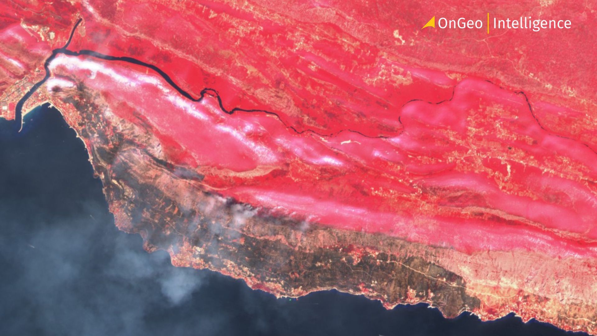
Croatia Wildfire Devastates Omiš Area: Around 200 Fire Hotspots
A major wildfire that swept through the Omiš area in Croatia’s Split-Dalmatia County has caused extensive damage, injured dozens of people and forced residents and tourists to flee their homes. The blaze, which broke out near Lokva Rogoznica on Thursday evening, spread rapidly through dry, forested hills toward Omiš and nearby coastal settlements.
According to the latest reports, 36 people have received medical assistance, while 14 have been hospitalized. Seven patients are reported to be in life-threatening condition. The fire also prompted a major emergency response involving hundreds of firefighters, dozens of vehicles and four firefighting aircraft. Reuters reported that the fire affected more than 1,000 hectares and led to the evacuation of around 1,000 residents and tourists.

Fire spread at extraordinary speed
The first flames were detected in the Lokva Rogoznica area on Thursday evening. Within a few hours, the fire had spread across a huge area, driven by strong winds and extremely dry vegetation.
Local firefighters described the scale of the fire as exceptional. Head of the Omiš firefighting service, told Croatian media that the destruction was enormous.
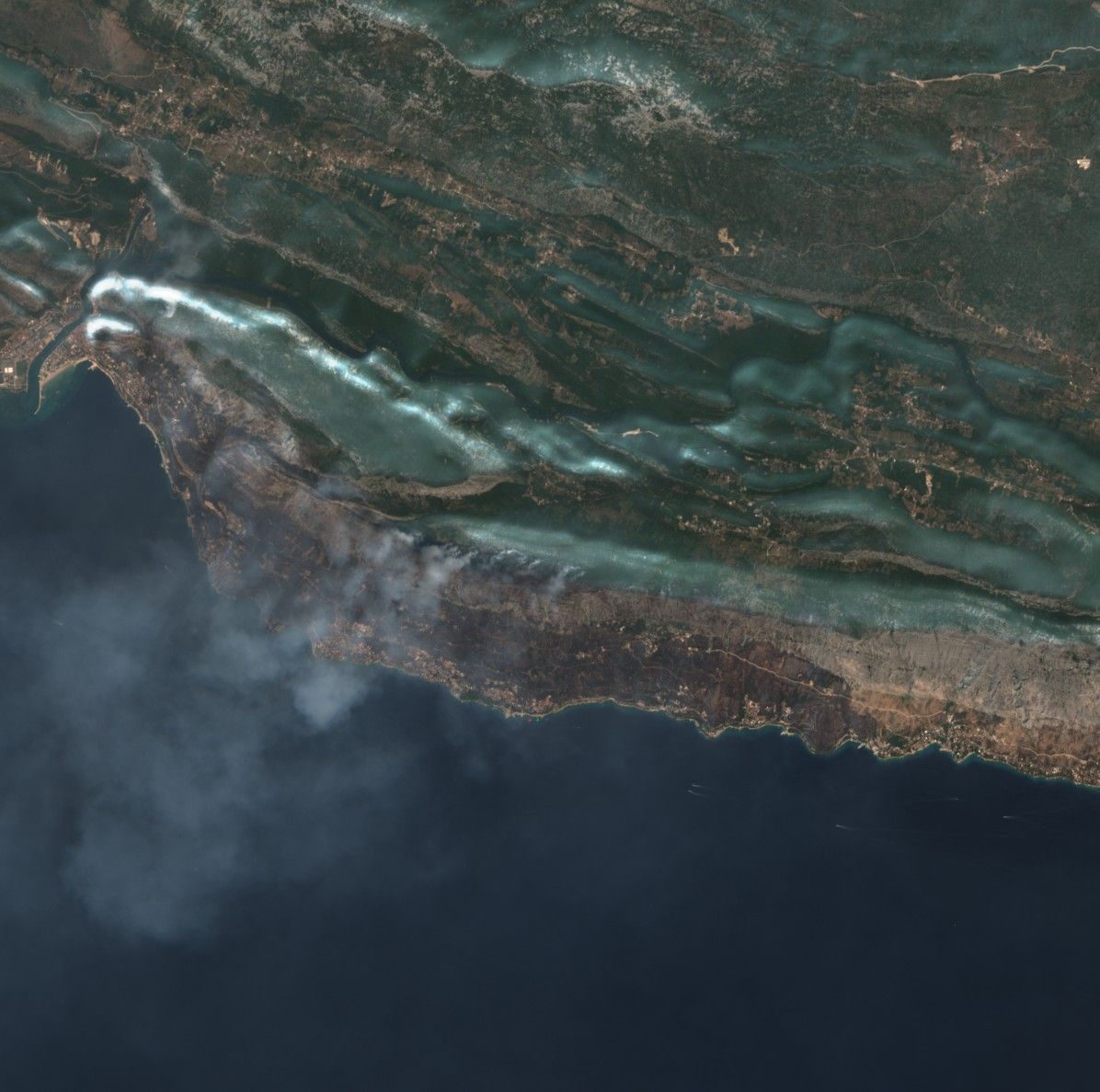
Satellite observations also illustrate how quickly the situation deteriorated. Reports from the scene indicated that around 200 fire hotspots were detected in the wider Lokva Rogoznica–Omiš area during the night. Such observations are particularly valuable during rapidly developing wildfires because they can provide a broad view of the affected area when smoke, darkness and difficult terrain make ground assessment much harder.
By Friday morning, firefighters said there was no longer an open fire front around Lokva Rogoznica and Omiš, although the operation was far from over. Hotspots and smouldering areas still require extensive firefighting and monitoring.
Several people injured
The human cost of the disaster has also become clearer as emergency services treated a growing number of casualties.
A total of 36 people have been assisted, mainly because of burns and breathing difficulties. Fourteen were transported to hospital, with seven described as being in critical condition. Three other patients were being treated in intensive care in serious but more stable condition.
The scale of the emergency forced KBC Split hospital to call medical staff back from vacation. The hospital said it immediately activated all available teams to ensure timely treatment as the number of injured people increased.
The response highlights the pressure placed on the local emergency and healthcare systems during the peak summer tourist season, when Omiš and the surrounding Dalmatian coast are crowded with visitors.
Homes, cars and boats destroyed
The full extent of the material damage became visible only after daylight.
Reports indicate that houses were damaged or destroyed in several settlements, including Ivašnjak, Staro Selo, Pod Vajle, Nemira, Stanići and Medići. Numerous cars and boats were also destroyed.
The Adriatic coastal highway was closed in the affected area while firefighting operations continued, with traffic redirected. Many tourists and residents left the danger zone by road or by sea.
The situation was particularly significant for foreign visitors because Omiš is one of Croatia's popular holiday destinations and the surrounding coastline is heavily visited during August. Reuters reported that about 1,000 people, including residents and tourists, were evacuated or sought emergency shelter.
Nearly 300 firefighters and aircraft involved
The firefighting operation has been conducted on a very large scale. Almost 300 firefighters were involved, supported by around 90 firefighting vehicles and four aircraft.
Although the disappearance of the open flames represents a major step forward, firefighters still face the difficult task of extinguishing hidden hotspots and preventing the fire from reigniting. In steep, forested terrain, this phase can be particularly challenging.
Croatia's firefighting authorities have repeatedly emphasized the increased danger of wildfires during periods of high temperatures and dry weather. The Croatian Firefighting Association has also documented extensive firefighting activity in Split-Dalmatia County during the current fire season.
Satellite imagery: a powerful tool for monitoring disasters
The Omiš and Lokva Rogoznica wildfire is also a good example of why satellite imagery has become an important tool for monitoring natural disasters.
Ground teams provide the most detailed information about conditions at individual locations, but satellite imagery offers something different: a rapid, large-scale view of changes across an entire region. In the case of a wildfire, successive images can help show the extent of burned areas, changes in vegetation and the development of the affected landscape.
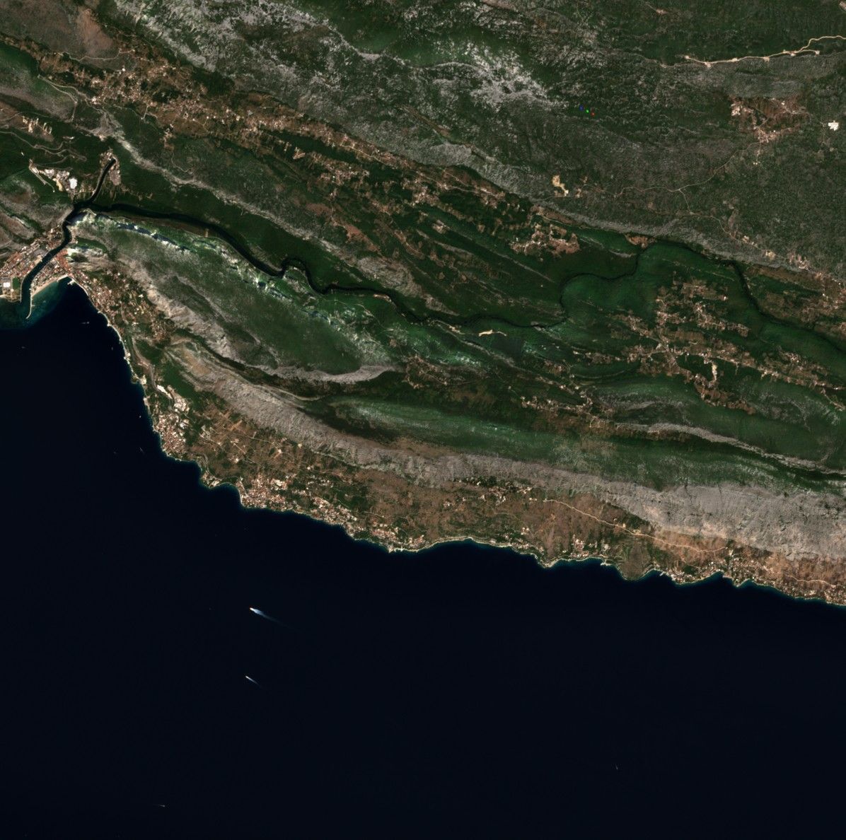
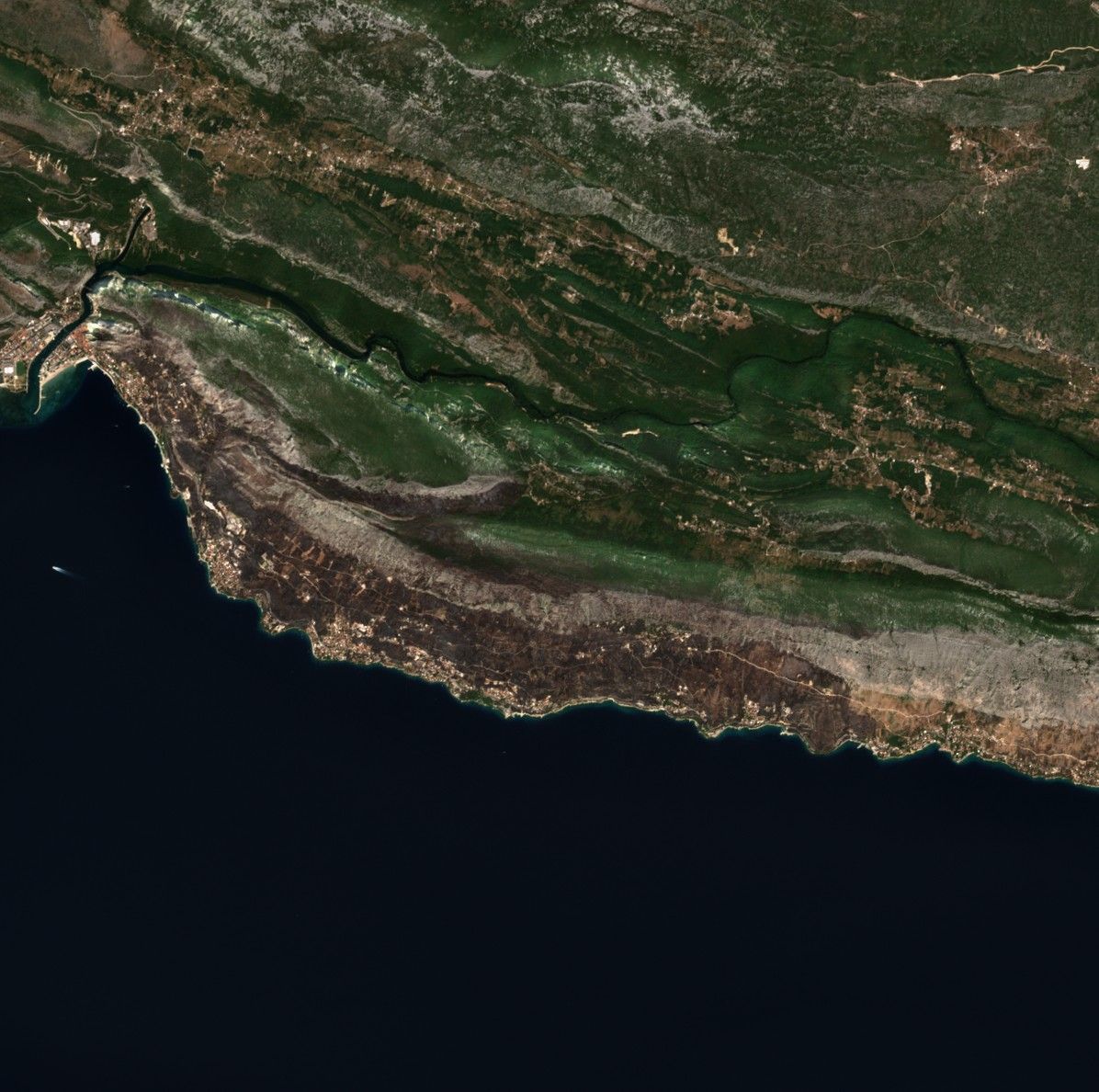
Before and after the fire Devastates Omiš Area
Services such as OnGeo Intelligence make it possible to search satellite archives for specific locations and dates and obtain imagery for comparison. The platform provides access to imagery from multiple satellite constellations, including Sentinel-2 and high-resolution commercial sources. Depending on the available imagery, resolutions can range from about 10 metres for Sentinel-2 data to approximately 0.3 metres for very-high-resolution imagery.
This is particularly useful when analysing the consequences of a disaster. Satellite images should not be treated as a replacement for live emergency information, but they can complement reports from firefighters, authorities and other services. Comparing images from before and after an event can provide a clear visual record of how the landscape has changed.
OnGeo Intelligence also allows users to search available satellite archives by location and date and obtain a report containing chronologically arranged imagery. Low-resolution imagery can typically be delivered within minutes, while high-resolution imagery may take longer depending on the satellite operator and availability.
For events such as the Omiš wildfire, this type of technology can therefore be useful not only for documenting destruction after the flames have been extinguished, but also for understanding the geographical scale of a rapidly changing emergency.
View the full satellite imagery report in Croatia
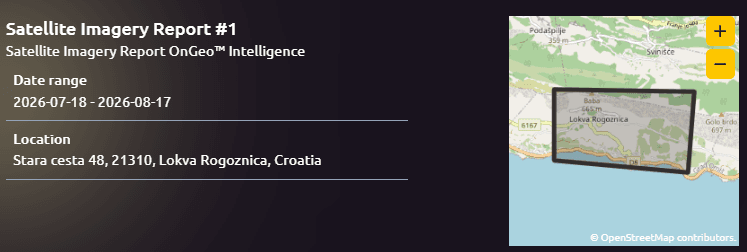
Free access with code ongeo100: Generate reports at no cost featuring 10-meter resolution
A disaster whose full cost is still unknown
The immediate priority remains the safety of residents, tourists and emergency personnel. While the main fire front around Omiš has been brought under control, the authorities still have to deal with hotspots, damaged infrastructure and the possibility of renewed fires.
Only after firefighting operations are completed will authorities be able to calculate the full financial cost of the disaster.
For now, the figures already available show the scale of the emergency: 36 people injured, 14 hospitalized, seven in life-threatening condition, around 1,000 people evacuated or seeking shelter, hundreds of firefighters deployed and more than 1,000 hectares affected by the flames.
The Omiš wildfire is another stark reminder of how quickly extreme heat, dry vegetation and strong winds can turn a relatively localized fire into a major threat to an entire coastal community.
Related articles
- Environmental Monitoring Using Satellite Data
- Satellite Imagery Reveals the Full Scale of Western Europe’s Most Destructive Wildfires in Decades
- How to Find Current Satellite Images
- Satellite Images Reveal the Devastating Scale of Venezuela’s Twin Earthquakes
- Satellite Imagery for Disaster Response and Recovery
- Satellite Forest Monitoring from Space: Global Tree Mapping with Satellite Earth Observation