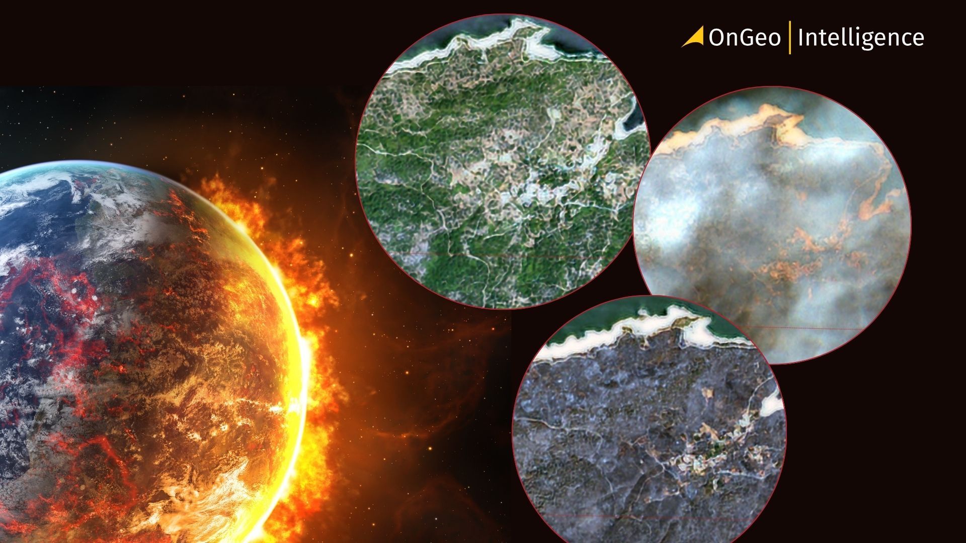
Satellite Imagery Reveals the Full Scale of Western Europe’s Most Destructive Wildfires in Decades
July 2026 fires in Spain and France force mass evacuations, destroy infrastructure, and underscore the indispensable role of Earth observation data in crisis response.
Wildfires are a familiar summer hazard across southern and western Europe, yet the blazes that erupted in Spain and France in July 2026 stand out as among the largest and most severe the region has faced in decades. Intense fires swept through France’s Gironde department and Spain’s Ávila and Madrid provinces, forcing hundreds of thousands of residents to flee, destroying hundreds of homes, and leaving vast landscapes charred. Satellite imagery has provided an unparalleled view of the destruction, enabling rapid assessment of burned areas, infrastructure damage, and fire behavior that ground observations alone could never match.

The Historic Fire in Ávila and Central Spain
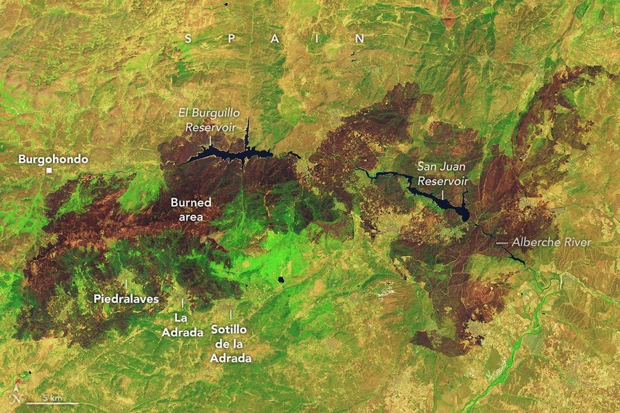
Spanish authorities have confirmed that the fire that began near Burgohondo in the province of Ávila has become the largest recorded in the country’s history. The blaze consumed approximately 50,000 hectares, surpassing the major 2025 fire that affected Larouco, Quiroga, and Oencia across the provinces of Ourense, Lugo, and León.
Satellites first detected the initial smoke and heat signatures of the Ávila fire on 22 and 23 July. Within days it merged with neighboring fires, expanding the total burned area across Ávila, Madrid, and Toledo to roughly 77,000 hectares an expanse comparable to the size of New York City. Of that total, more than 25,000 hectares burned in the Madrid region and over 2,000 hectares in Toledo.
Third Deputy Prime Minister Sara Aagesen described the 2026 fire season as “extremely complicated.” By early August, Spain had already recorded 32 large forest fires, with approximately 153,000 hectares burned nationwide since 1 January six times the area affected in the same period of the previous year. Around 90,000 people were evacuated or confined in the Ávila-Madrid-Toledo emergency zone, with another 16,000 evacuated in Castellón. In the three main provinces under emergency status, 59,896 people were evacuated and 29,867 were housed in temporary centers.
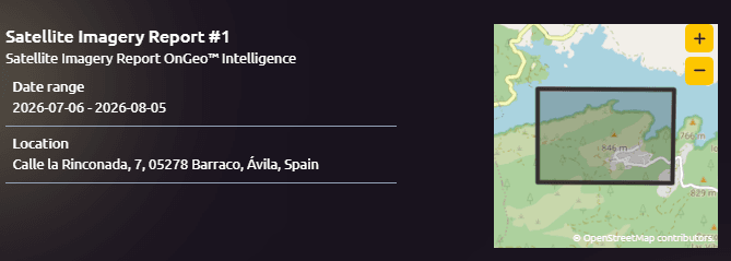
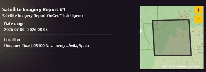
View the full satellite imagery report in Spain
Devastation West of Bordeaux in France
A parallel catastrophe unfolded in southwestern France, west of Bordeaux. One of the largest fires of the decade scorched more than 42,000 hectares and largely destroyed the village of Le Porge. According to the European Forest Fire Information System, fires across France had burned more than 90,000 hectares by the end of July the highest total in decades.
French President Emmanuel Macron called the fires “unprecedented”. At least three people died, including two firefighters, and many homes were lost. Residents of towns such as Cotignac watched rapidly intensifying flames approach their communities. Beachgoers at Lake Lacanau observed thick plumes of smoke rising from the Gironde fire, a visible reminder of the air-quality threat posed by the blazes.
Three of the 15 largest wildfires recorded by the European Union in the past 20 years occurred during the preceding month. Satellite measurements of fire energy output over France in July reached double the previous record for that month, placing the country on track for its worst fire season since satellite records began in the early 2000s.
Befor and after Wildland fire Saumon, France
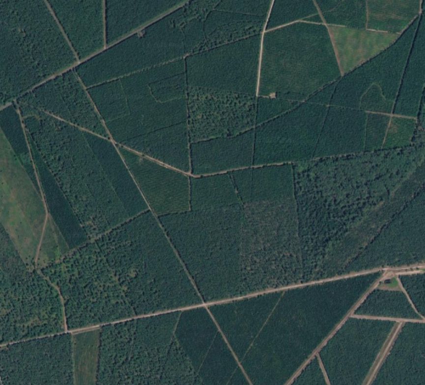
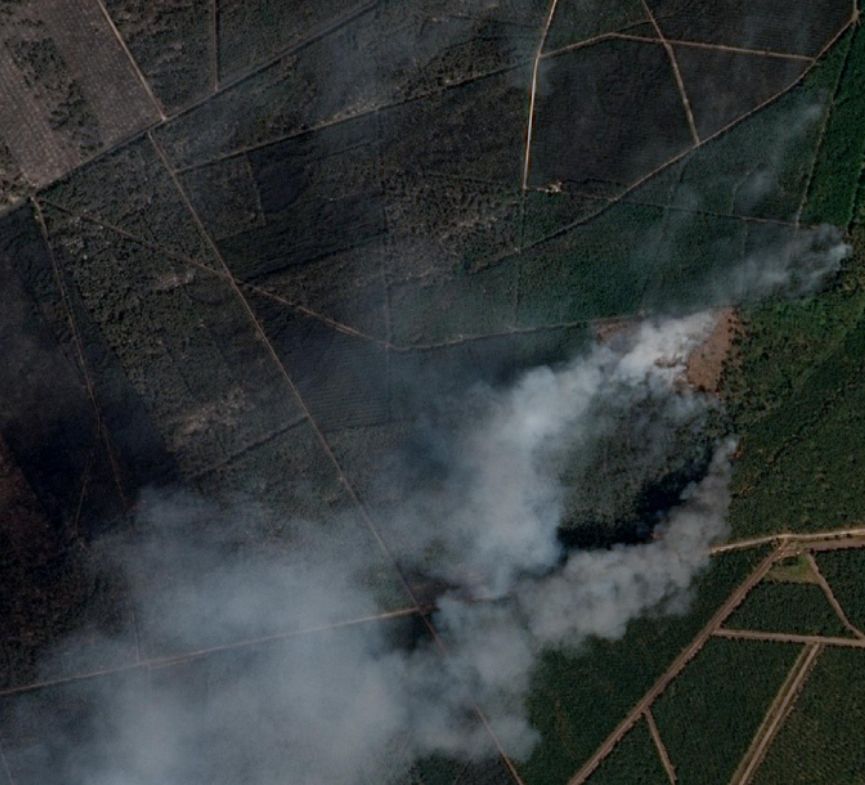
View the full satellite imagery report wildland fire in France
Satellite Imagery Saumos, France
Environmental Conditions That Fueled the Crisis
Scientists from The State of Wildfires Project and other research groups have identified a clear sequence of environmental drivers. An unusually wet winter encouraged vigorous growth of grasses, shrubs, and understory vegetation. Subsequent heatwaves and prolonged drought then dried this fuel load to critical levels. June temperatures across Spain and France ran 4–5°C above the long-term average conditions consistent with ongoing climate change.
The final trigger came from strong winds that reached speeds of 65 km/h (40 mph) for several days, fanning the flames and enabling rapid spread. On 25 July, conditions in southwestern France became so extreme that firefighters reported the formation of a pyrocumulonimbus, or “fire cloud.” This powerful convective column draws energy from the heat of the fire itself. Atmospheric scientists who track these rare phenomena note that while pyrocumulonimbus clouds have been documented over fires in Spain and Portugal in recent decades, this appears to be the first recorded instance linked to a wildfire in France.
The Critical Contribution of Satellite Imagery
Throughout the crisis, satellite imagery has delivered information that no other source can provide at the same speed, scale, and objectivity. Government satellite systems form part of a global observation network used to track fire behavior, map burned area, monitor smoke plumes, and detect emerging trends.
Satellites also measure the energy released by active fires, providing an independent metric of intensity. Satellite data revealed that the energy output from French fires in July was twice the previous record. This quantitative evidence helps scientists place the 2026 events in historical context and supports comparisons across regions and years.
Beyond immediate response, satellite data enable longer-term analysis. They reveal how fire patterns are shifting under a changing climate, document the conversion of forests from carbon sinks to carbon sources, and help authorities evaluate the effectiveness of fuel-management strategies such as prescribed burning and forest thinning.
OnGeo Intelligence: Open Access to Real-Time Fire Monitoring
Among the tools that make satellite-derived fire information widely available is the OnGeo Intelligence platform. It provides real-time wildfire monitoring data to anyone without requiring a subscription. Users can access up-to-date satellite observations that track active fires, map burned areas, and support situational awareness for emergency services, researchers, journalists, and the public.
In rapidly evolving disasters such as the 2026 Spanish and French wildfires, platforms like OnGeo Intelligence democratize access to critical Earth-observation data. They allow decision-makers to see the full geographic extent of a fire within hours, identify threatened communities, and prioritize resources more effectively. The same imagery later supports damage assessment, insurance claims, ecological recovery planning, and scientific research into fire-climate interactions.
How to find satellite images?
- Access the OnGeo Intelligence Platform: visit the website.
- Define the Location and timeframe of interest: specify the geographic area and timeframe of interest.
- Automatic Archive Search: the system identifies and retrieves all available satellite imagery matching the selected criteria.
- Select and Order the Report: review the images and proceed to place an order for the most relevant data.
- Receive the Results: a PDF report is delivered via email within 5 minutes, while high-resolution images are provided within 48 hours.
Free access with code ongeo100: Generate reports at no cost featuring 10-meter resolution
Human and Climate Consequences
The human toll has been severe. Hundreds of thousands of people were forced from their homes. Millions more were exposed to harmful wildfire smoke, which is known to increase hospital visits for respiratory and cardiovascular problems and to produce a measurable rise in mortality. Structures left undefended during evacuations faced a higher risk of destruction.
On the climate front, the fires released large quantities of carbon stored in vegetation, contributing to a temporary spike in greenhouse-gas emissions. Across the Northern Hemisphere, intense forest fires are becoming more frequent. Similar events have recently affected Canada, the United States, and even unexpected locations such as Scotland and Greenland. Scientists warn that if forests continue to shift from net carbon sinks to net sources, a dangerous feedback loop could further accelerate climate change.
Looking Ahead
By late July, firefighters had gained the upper hand in many areas, allowing authorities to begin lifting evacuation orders. Yet meteorologists caution that elevated fire risk will persist as heat and drought continue. Additional heatwaves are forecast for the remainder of the European summer, raising the possibility that 2026 will stand as an outlier year for extreme heat in western Europe.
The events of July 2026 demonstrate both the growing intensity of wildfires under climate change and the indispensable value of satellite imagery in understanding and responding to them. From the first detection of smoke near Burgohondo to the detailed false-color maps of charred landscapes weeks later, Earth-observation data have provided clarity amid chaos. Open platforms such as OnGeo Intelligence ensure that this information reaches those who need it most quickly, transparently, and without barriers. As Europe confronts a future of more frequent and severe fire seasons, the ability to see the crisis from space will remain one of the most powerful tools available.
Related articles
- How Satellite Imagery Improves Crisis Management and Disaster Response
- Etna's Eruption Seen from Space: What Satellite Images Reveal
- Amazon Deforestation: What Satellite Reports Reveal
- From Space to Shore: How Earth Observation Satellites Help Monitor Water Quality
- How to Find Current Satellite Images
- Satellite Images Reveal the Devastating Scale of Venezuela’s Twin Earthquakes
- Massive Oil Spill Off Kharg Island, Iran: Satellite Imagery Reveals Environmental Crisis in the Persian Gulf