How to Find Current Satellite Images
Recent satellite images have become an essential source of up-to-date information for monitoring land, infrastructure, agriculture, and environmental change. Whether you need imagery for professional analysis or personal use, finding the latest available data quickly is key.
This guide explains how to find recent satellite images efficiently using OnGeo Intelligence. You'll learn how to search by location and date, compare available resolutions, and identify the most suitable imagery before ordering all without requiring technical expertise.

The Growing Importance of Recent Satellite Imagery
Satellite technology has evolved dramatically. Modern constellations capture the Earth with increasing frequency and detail. Recent images (typically from the last few days to several weeks) captures current conditions, enabling you to:
- Detect new constructions or unauthorized changes
- Monitor environmental impacts like drought, flooding, or vegetation health
- Support legal proceedings with timestamped evidence
- Plan developments or investments based on real-time land status
OnGeo Intelligence aggregates data from leading sources including offering resolutions from 10 meters down to an impressive 0.3 meters.
Step-by-Step Guide: How to Search for Recent Satellite Images on OnGeo Intelligence
OnGeo Intelligence interface is designed for speed and simplicity. Here’s the complete process:
Access the Platform
Head to the Satellite Imagery Report tool. The clean dashboard loads quickly even on mobile devices.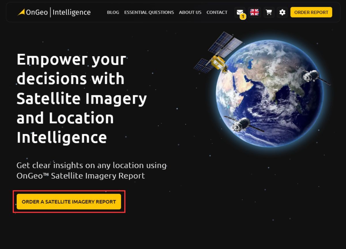
Order a Satellite Imagery Report Define the Timeframe for Recent Data
Select a custom date range or use convenient presets such as “Last 30 days,” “Last 60 days,” “Current month,” or “Previous month.” The system supports ranges up to 6 months, focusing searches on the most relevant recent archives. This filtering is key to finding the latest available satellite images without sifting through years of data.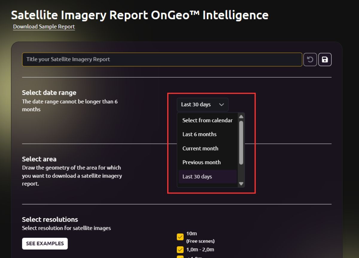
Define the Timeframe for Recent Data Draw or Search Your Area of Interest (AOI)
Zoom into the interactive map and draw a precise polygon around your target whether it’s a single residential plot, a farm field, a construction site, or an entire city district. The tool supports address search for faster navigation.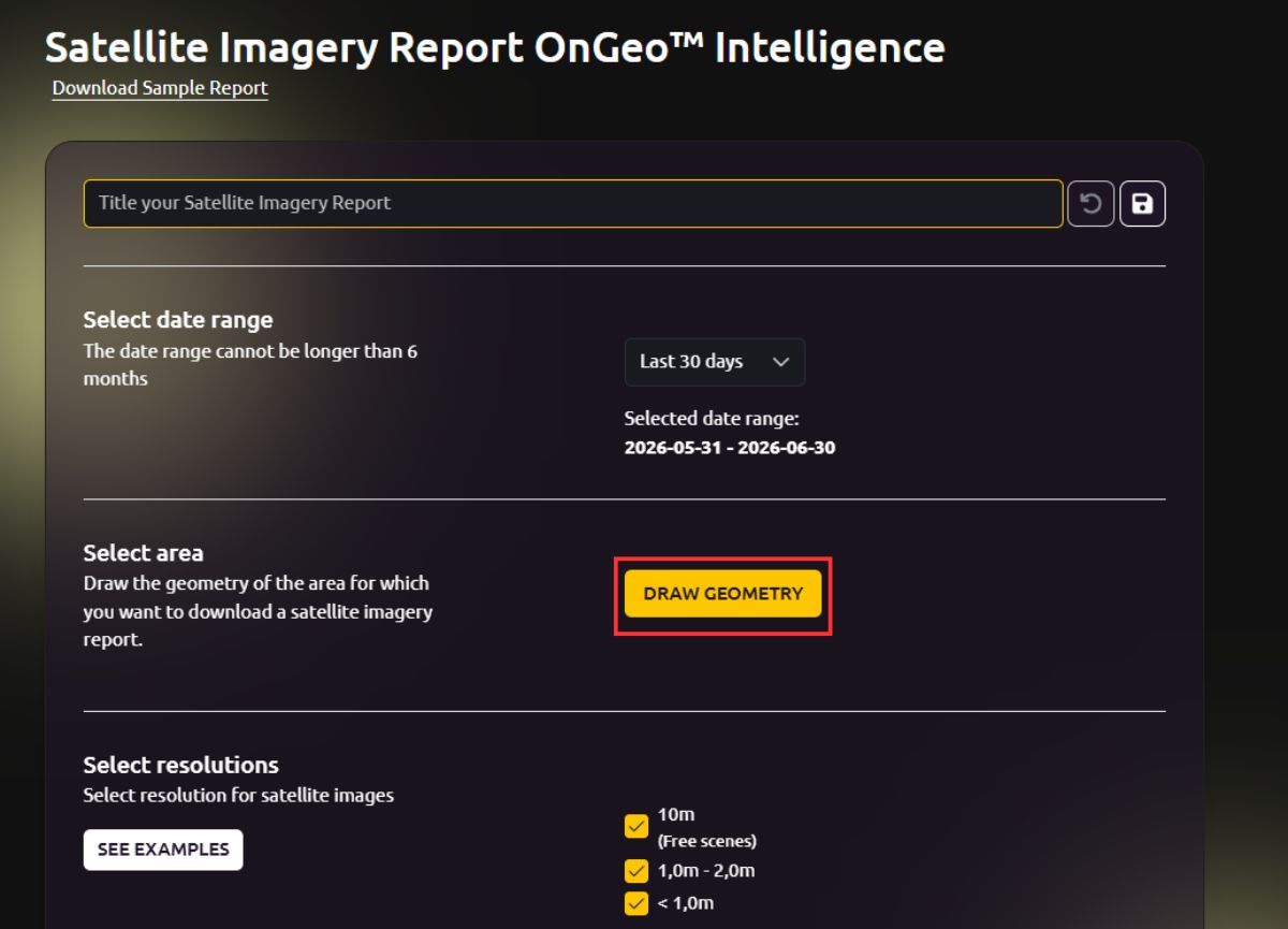
Draw or Search Your Area of Interest (AOI) 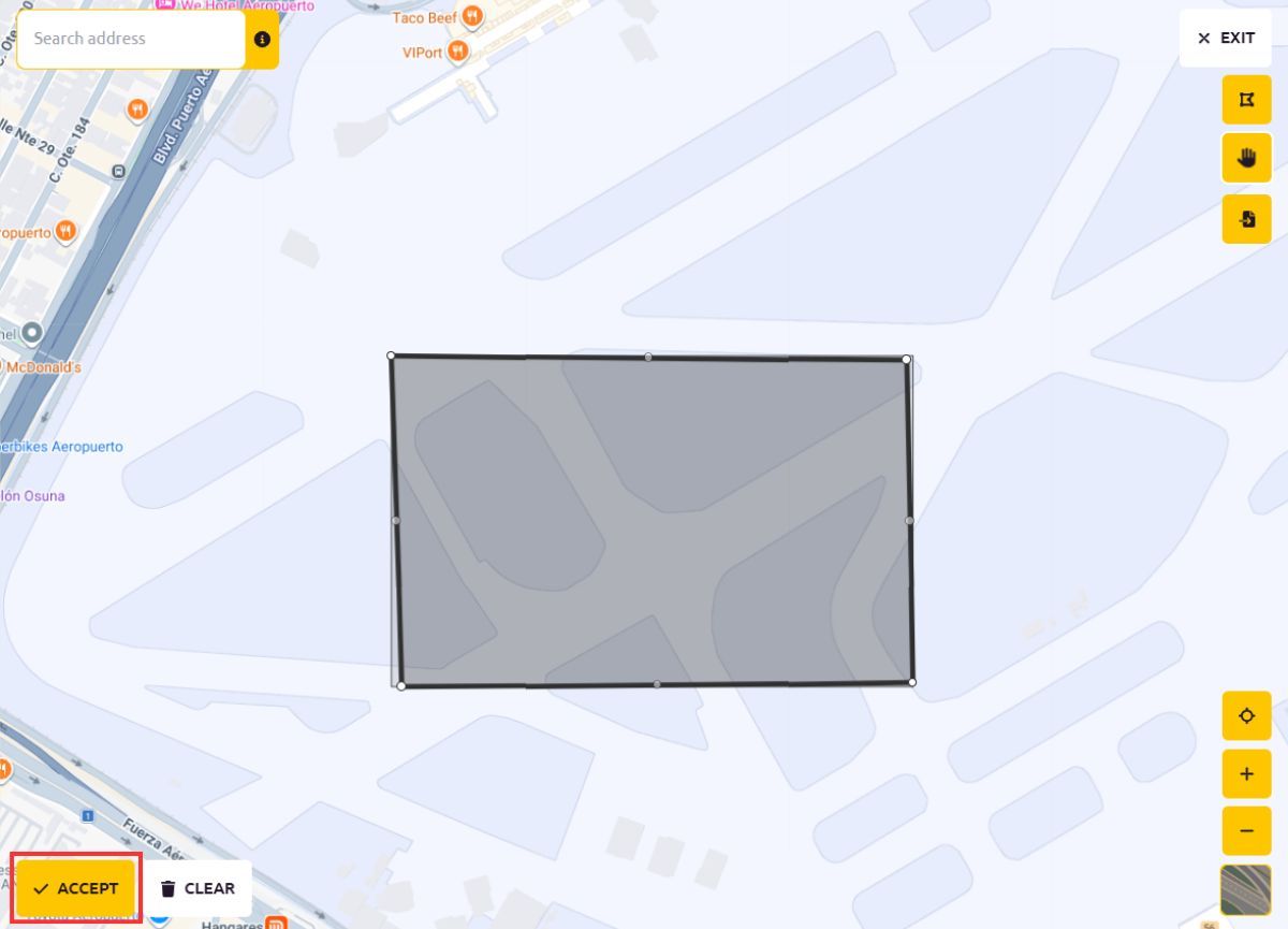
Draw Your Area of Interest (AOI) Select Desired Resolutions
Tailor results to your needs:- 10 m resolution Excellent for regional monitoring and vegetation indices.
- 1.0–2.0 m resolution Balanced detail for identifying larger structures and land-use patterns.
- Sub-meter (<1 m, down to 0.3 m) Ultra-sharp imagery perfect for detecting individual objects, roof details, vehicles, or small changes.
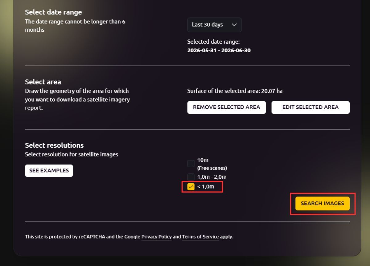
Select resolutions - Run the Automatic Archive Search
Click “Search images.” Within seconds, the platform scans vast archives and displays all matching cloud-free (or low-cloud) scenes. Results include:- Exact capture date and time
- Resolution
- Cloud cover
- Clickable thumbnails for quick visual inspection
After all this, you can click on the ADD TO CART or BUY AND PAY button.
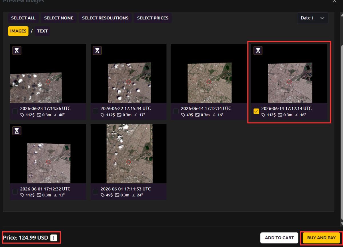
Archive Search and ADD TO CART or BUY AND PAY Enter your email address to which the report will be sent, place your order and make payment.
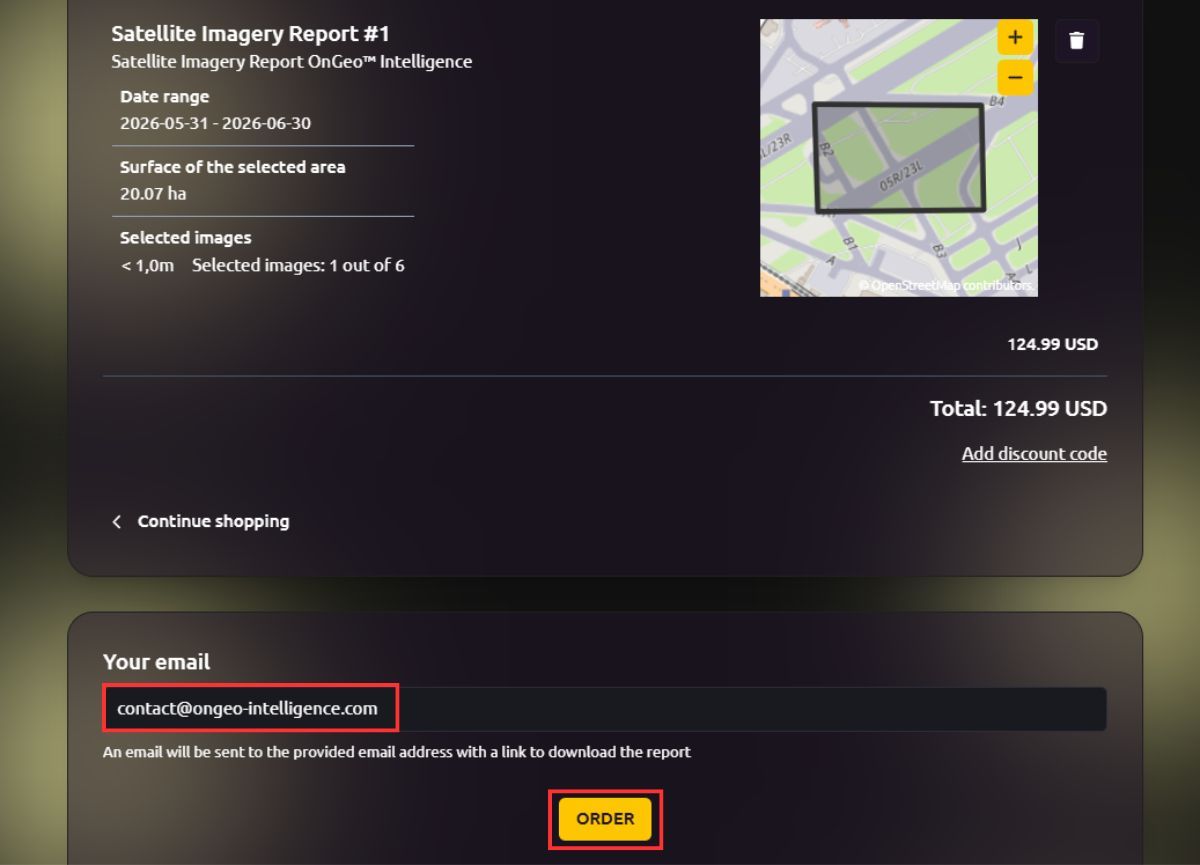
Place your order and make payment How to Generate Satellite Imagery Using OnGeo Intelligence | Step-by-Step Tutorial
Available Resolutions What You Really See
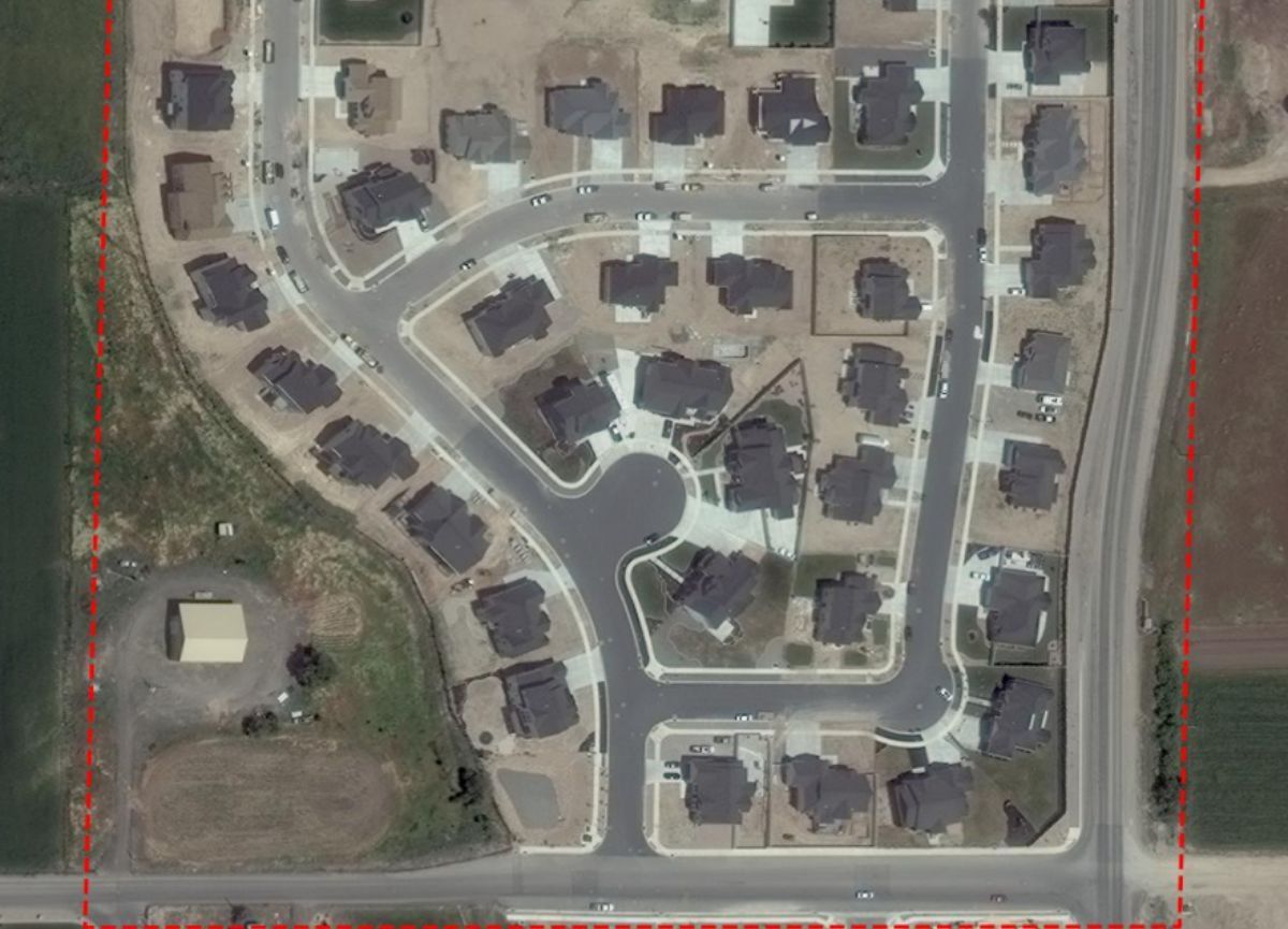
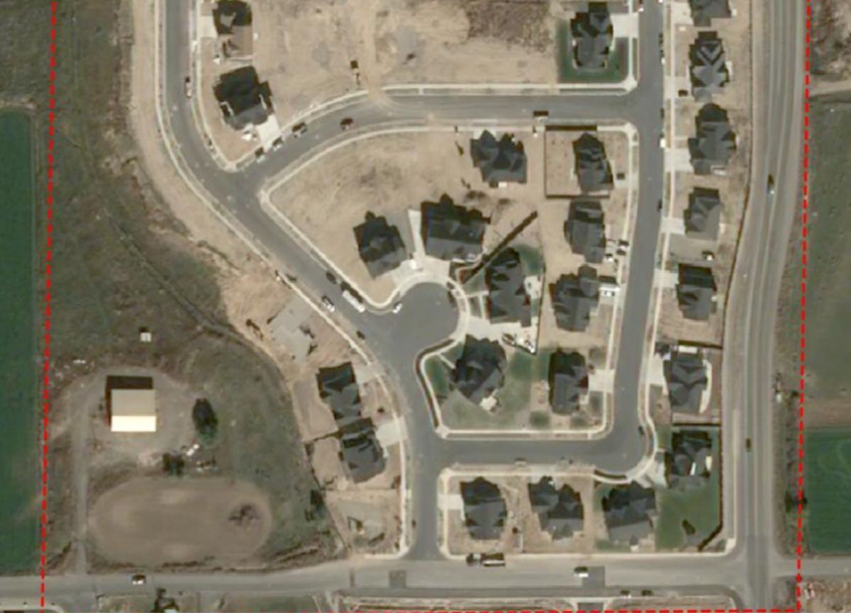
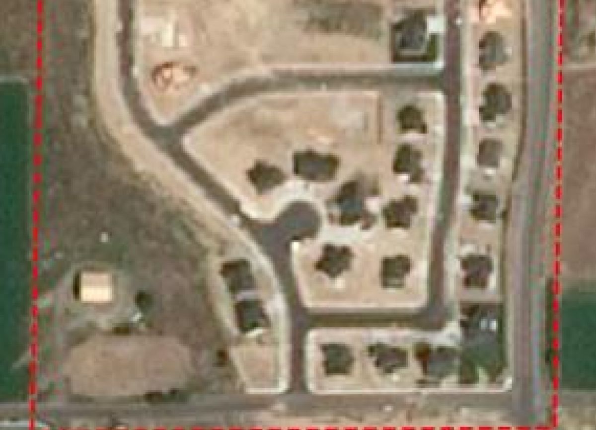
OnGeo Intelligence provides several resolution options, clearly demonstrated in the sample report. The differences are significant:
- 0.3 m: Extremely detailed you can identify individual vehicles, roof features, fences, and small structures. Perfect for precise property analysis and legal evidence.
- 0.5 m: Excellent for spotting buildings, construction details, and larger objects.
- 1.5 m: Good for identifying major structures and land-use changes, though finer details become less visible.
- 10 m: Best for broad overviews, vegetation monitoring, and large-area analysis using spectral indices like NDVI.
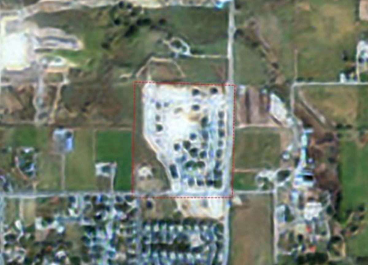
The comparison below shows how the same location appears at 0.3 m, 0.5 m, 1.5 m, and 10 m resolutions, making it easy to understand how image quality improves as the pixel size decreases.
What’s Included in Your OnGeo Intelligence Satellite Imagery Report?
After selecting preferred scenes and ordering, you receive a professional, ready-to-use PDF report via email:
- Chronologically ordered high-resolution imagery (newest first).
- Natural color (RGB) composites.
- Optional full Sentinel-2 multispectral package (visible + NIR + SWIR bands) for GIS software import.
- Graphs of key remote sensing indices (NDVI, NDWI, NDMI) tracking changes in vegetation, water, and soil moisture.
- Metadata for every image (date, resolution).
Turnaround: Low-resolution reports arrive in minutes; highest-resolution scenes within 48 hours maximum.
Sample Satellite Imagery Report
Ready to explore?
Use promotional code ongeo100 for free reports and start discovering the world from above.
Understanding Update Frequency and Data Availability
Satellite revisit times vary:
- Sentinel-2: Approximately every 5 days globally, with cloud-free usable images every 7–30 days on average.
- Commercial high-res satellites (Maxar/Airbus): More frequent passes over populated or high-interest areas, often delivering new scenes weekly or bi-weekly.
OnGeo’s intelligent filtering prioritizes the most recent imagery, ensuring you get actionable recent data. Archives extend back to 2008 for historical comparisons, but the tool excels at surfacing the newest captures.
Factors affecting availability include weather (cloud cover), geographic location, and satellite tasking priorities. The platform clearly indicates these details so you can make informed choices.
Practical Applications of Recent Satellite Images
- Real Estate & Investment: Verify property conditions, construction timelines, or neighborhood changes.
- Agriculture: Monitor crop growth, detect stress or drought early.
- Insurance & Claims: Document damage from storms, floods, or fires with before/after evidence.
- Legal & Administrative: Provide timestamped proof in boundary disputes, inheritance cases, or violation proceedings.
- Urban Planning & Construction: Track project progress remotely.
- Environmental Monitoring: Identify erosion, deforestation, or pollution impacts.
- Journalism & Crisis Response: Capture unfolding events with visual context.
Conclusion: Unlock the Power of Recent Satellite Imagery Today
How to find recent satellite images no longer requires complex tools or expert knowledge. Platforms like OnGeo Intelligence democratize this technology, letting you search archives, preview results, and receive high-quality reports in minutes.
Whether for personal curiosity or professional needs, recent satellite imagery provides a unique perspective that informs smarter decisions.
Related articles
- How to Get Live Satellite Images: Real-Time Options
- How Often Do satelites Take Pictures? Satellite Imagery Frequency
- What Is Satellite Imagery? A Complete Beginner’s Guide
- Where to Find Satellite Imagery from a Specific Period? Explore OnGeo Intelligence Archives!
- Free Satellite Imagery Sources: A Complete Comparison
- How Satellite Imagery Supports Forest Management