Satellite Map: What It Is & How It Works – Your Guide to Orthophotomaps
Ever wondered what satellite imagery is all about? Discover how advanced satellite data helps simplify spatial management, investment planning, and agricultural development, and how OnGeo Intelligence can provide you with the insights you need.
In today's world, where precision and access to up-to-date data are incredibly valuable, a satellite map has become an essential tool. From urban planning and crop monitoring to analyzing climate change - its uses are almost endless. But what exactly is a satellite map, and more specifically, what sets a satellite orthophotomap apart? In this article, we'll break down these advanced technologies, show you their practical applications, and explain how the OnGeo Intelligence platform makes accessing this crucial data easy.
What is a Satellite Map?
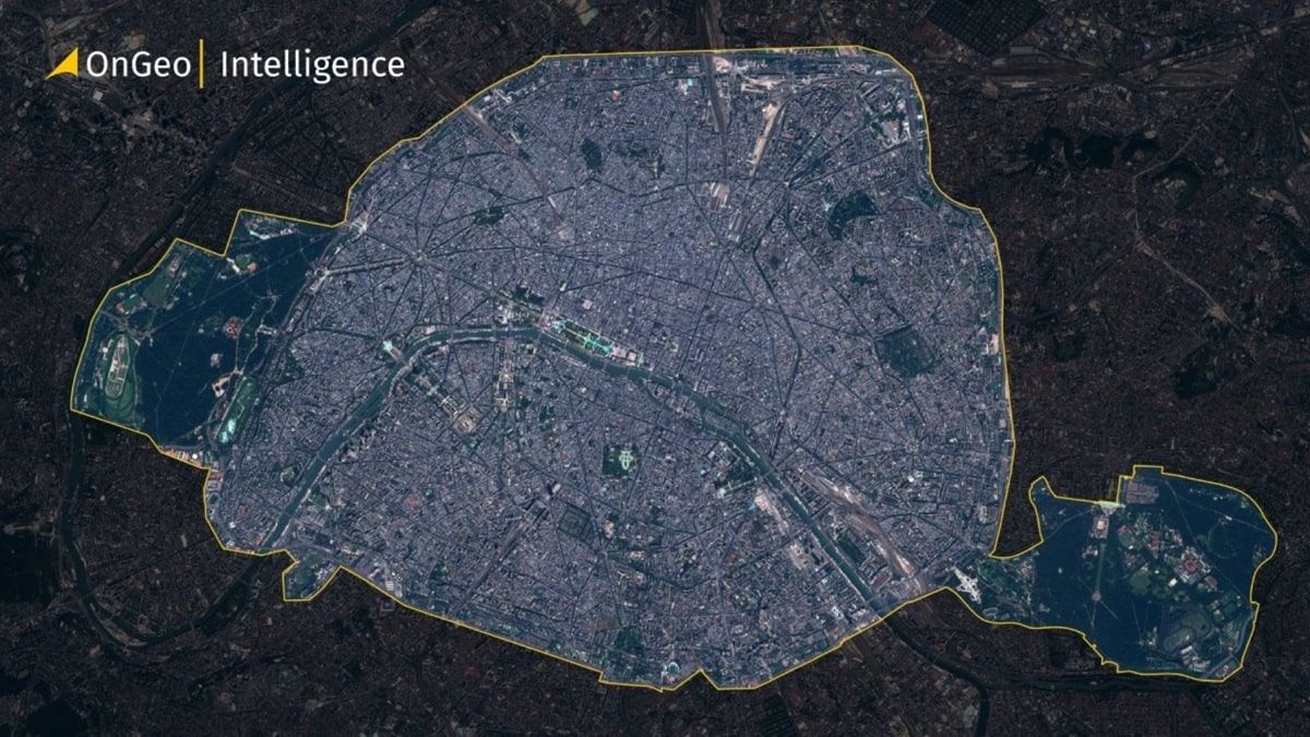
A satellite map is simply an image of the Earth's surface, created from photos taken by satellites orbiting our planet. These satellites are equipped to record light and other types of radiation reflected from the surface, and then this data is processed by computers. The result is vibrant images that let us view the world from space - often in high zoom and surprising detail.
Satellite Photo vs. Satellite Map - What's the Difference?
A regular photo, whether taken from a plane or a drone, can be very detailed, but it has a common flaw - objects at the edges often look distorted or shifted. This is a perspective effect. The same applies to a raw satellite image - by itself, it doesn't always show the world exactly as it truly appears on a map. It's only after computer processing that a satellite map is created, providing an image of the terrain where all elements are "in their correct place."
Orthophotomap - The Satellite Map Without Distortions
If you need even greater precision, that's where an orthophotomap comes in. This is a specially corrected satellite image that has been straightened and adjusted through a process called orthorectification. It removes errors caused by terrain elevation, the angle at which the satellite viewed the area, or even the Earth's curvature. Because of this, every point on an orthophotomap corresponds to precise geographical coordinates. In practice, this means that houses, roads, or fields appear in their true position and size on the map. That's why orthophotomaps are so valuable wherever accuracy matters - from urban planning to construction and scientific research.
What Information Can You Find on a Satellite Map and Satellite Orthophotomap?
Thanks to satellite technology, a satellite map and satellite orthophotomap can show a wide range of information. This includes:
- Terrain Features: Mountains, valleys, rivers, lakes.
- Vegetation: Forests, farmlands, green areas, with the ability to assess their health and growth.
- Infrastructure: Cities, roads, buildings, bridges, energy infrastructure.
- Changes Over Time: Monitoring urban expansion, processes like deforestation, coastline shifts, or construction progress.
This versatility makes a satellite map a powerful tool for analysts, planners, and businesses.
Practical Applications of Satellite Maps and Satellite Orthophotomaps
The uses for satellite maps and satellite orthophotomaps are incredibly broad, covering many sectors of the economy and daily life.
For Governments and Local Authorities
- Spatial Planning
City and local government offices use satellite maps to create and update spatial development plans. This helps them monitor the growth of green areas, new housing estates, and infrastructure. A satellite orthophotomap provides the precision needed for these tasks, allowing for accurate demarcation of property boundaries or protected zones.
- Environmental Monitoring
Satellite images help track environmental changes such as deforestation, soil erosion, or monitoring water quality in lakes and rivers. This aids in nature conservation and managing natural resources.
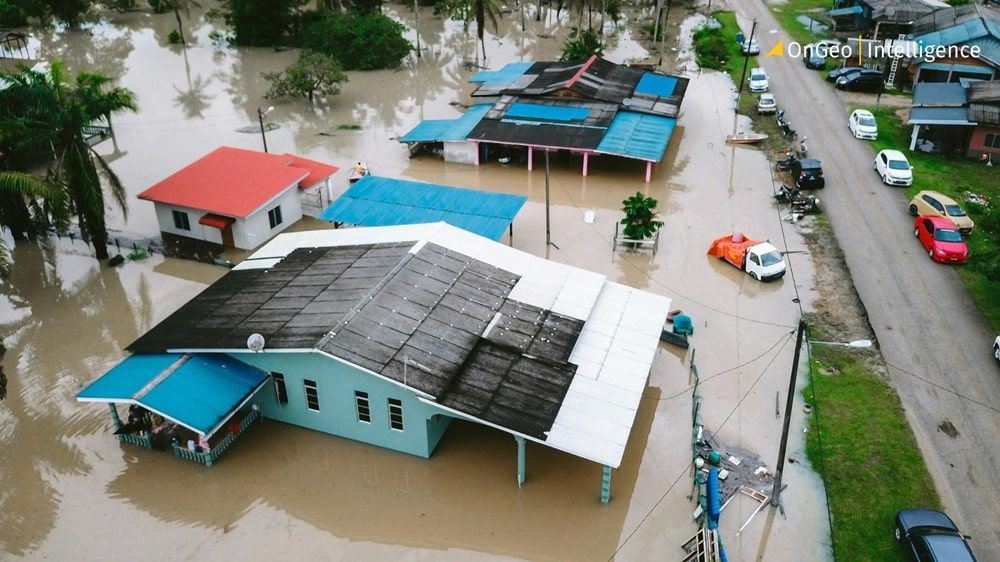
- Crisis Management
Quick access to current satellite imagery is vital during natural disasters like floods, forest fires, or earthquakes. A satellite map helps assess the scale of damage, locate people in need, and plan rescue routes or aid delivery. For instance, after a flood, flooded areas can be identified, and after a fire, burned territories can be mapped.
In Politics, Economy, and Business
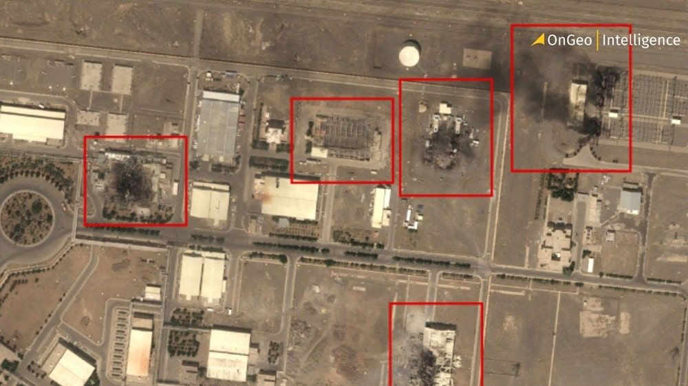
- Geopolitical Analysis and Security
Satellite maps are invaluable for analyzing situations in conflict zones. They allow for monitoring troop movements, locating strategic objectives, and assessing war damage. During military operations, satellite images can provide information on enemy positions, the state of critical infrastructure, or humanitarian needs.
- Monitoring Infrastructure Projects
Large construction projects, like highways, airports, or pipelines, can be monitored using satellite images. This helps track work progress, verify schedules, and manage logistics.
- Investment and Development
Companies can use satellite maps to evaluate potential locations for new factories, warehouses, or shopping centers. They help analyze access to roads, proximity to cities, or utility availability. A satellite orthophotomap provides the data needed for precise planning, for example, choosing the optimal route for a new power line.
For Investors and Developers
- Location Assessment
Investors use satellite maps to evaluate land for investments, analyzing infrastructure access, building density, and the surrounding environment. Satellite orthophotomaps provide precise data for planning, such as sun exposure or access to green areas.
- Property Valuation & Market Analysis
Satellite maps offer vital data for property valuation, assessing proximity to services, development, and green spaces. Investors use them to track area growth, identifying prime districts for informed investment and market trend analysis.
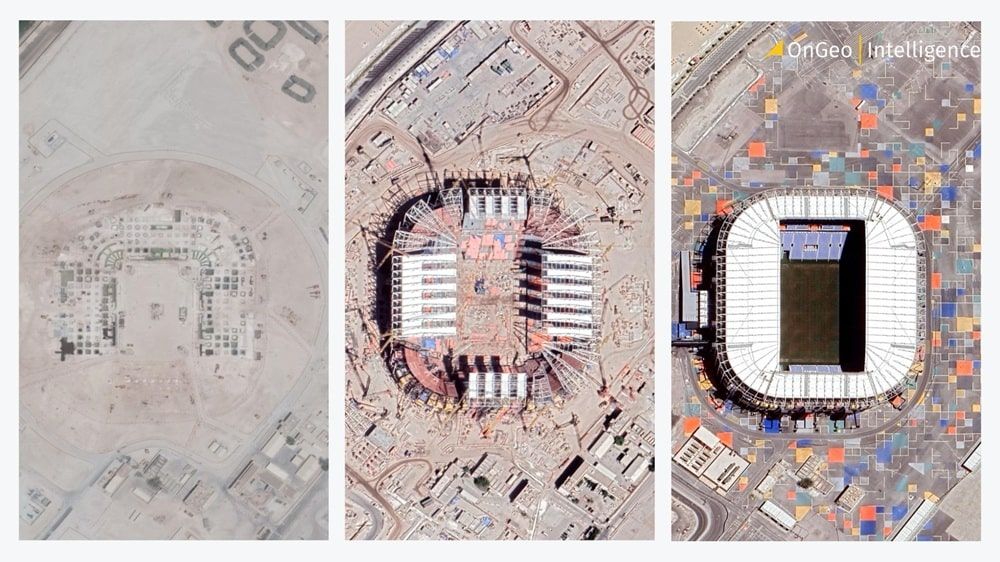
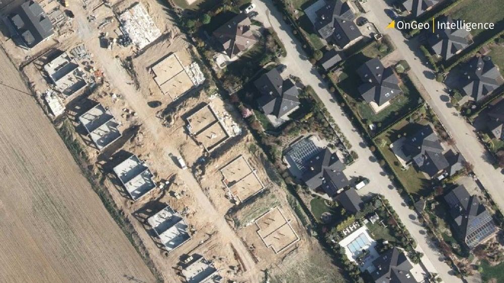
- Construction Monitoring
Regular satellite imagery precisely tracks construction progress, helping verify schedules, manage material deliveries efficiently, and react quickly to potential delays.
In Agriculture
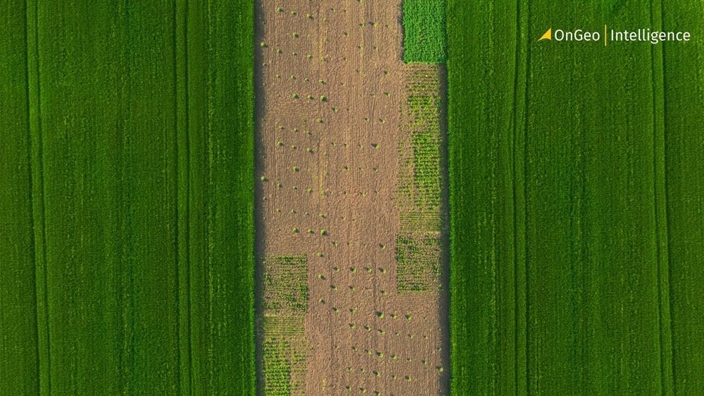
- Precision Agriculture
Farmers monitor crop conditions, detecting issues like drought, disease, or nutrient deficiencies. Satellite maps and orthophotomaps enable precise planning of fertilization, irrigation, or spraying, minimizing costs and increasing yields.
- Water Resource Management
Satellite maps enable farmers to manage water resources more efficiently. They can identify areas needing irrigation and monitor soil moisture levels over large areas, optimizing water use and preventing droughts.
- Damage Assessment
After adverse weather (e.g., hailstorms, strong winds), satellite images help estimate crop losses, crucial for insurance claims and future planting plans.
For Individuals
- Legal Evidence in Court
A satellite map or ortofotomapa satelitarna can be strong evidence in legal cases. They're useful for documenting property boundaries, proving unauthorized construction or changes in land use, and showing environmental damage or the extent of damage for insurance claims after events like floods or fires.
- Memories of Places
The ability to track changes in places that are important to us over the years, for example, observing the expansion of your hometown.
- Property Monitoring
Assess changes on your own property, plan garden layouts, or locate specific objects. It's also possible for legalization of unauthorized buildings using satellite images in some situations.
OnGeo Intelligence - Your Gateway to the World of Satellite Maps and Orthophotomaps
The OnGeo Intelligence platform offers innovative tools and services that make accessing advanced data from satellite maps and satellite orthophotomaps simple and intuitive. Whether you're an investor, farmer, public official, or a private individual, OnGeo Intelligence provides the precise information you need.
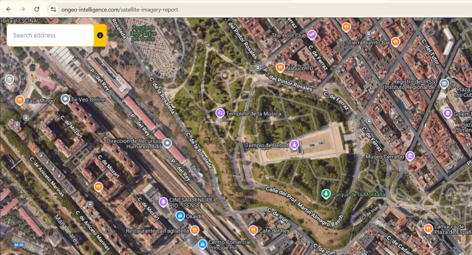
Satellite Imagery Report - Your Key to Information
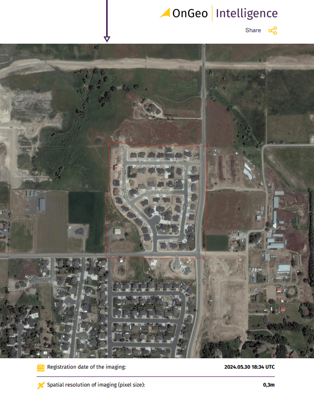
One of OnGeo Intelligence's flagship services is the Satellite Imagery Report.
This comprehensive data summary, based on a satellite map and satellite orthophotomap, provides detailed information about your chosen area.
You can see an example report here:
The OnGeo Intelligence Satellite Report service isn't just about current images; it also allows for historical data analysis, letting you monitor changes over time.
Free Image Archive and Search Engine
OnGeo Intelligence goes a step further by offering free access to it's satellite image archive! You can freely explore the search engine, check the available time periods for images, and even preview them. It's a great opportunity to see whether your area of interest is available in high or low resolution.
For high-resolution satellite images, ordering a report involves a fee, which ensures the highest precision and detail. However, if you need low-resolution satellite images (10-meter resolution), we have a special offer for you! Use the discount code ongeo100 to get 100% off and access this data for free! This offer is for a limited time, so don't miss out!
In Summary
Satellite maps and satellite orthophotomaps are powerful tools. They're changing how we see and manage our world. From large-scale government planning to small-scale crop monitoring, and even personal uses - their capabilities are immense. Thanks to OnGeo Intelligence, accessing this data is now easier than ever. Take advantage of the Satellite Imgery Report and discover what a satellite orthophotomap can offer in your work and daily life.
Related articles
- Satellite Imagery Pricing: A Comprehensive Guide to Costs and Value
- How to Obtain Satellite Imagery of Your Plot? OnGeo Intelligence Guide
- How To Choose The Satellite Imagery For Your Needs?
- How to Acquire Free Satellite Imagery for Your Investigations
- How Free Satellite Imagery Can Help Farmers Optimize Crop Management
- Satellite Imagery vs Aerial Photography: Key Differences Explained