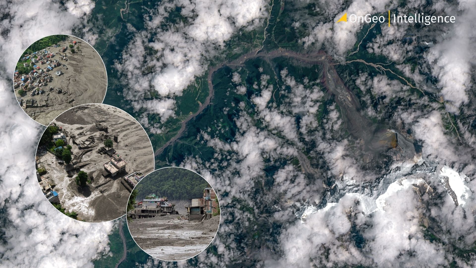
Shocking Satellite Images from Nepal Deadly Flash Flood
Satellite imagery has played a decisive role in clarifying the cause of one of the most destructive flash floods to strike the Himalayan border region in recent years. On the morning of 26 August 2026, a sudden surge of water, ice, rock and sediment tore through valleys along the Nepal–Tibet frontier, primarily affecting Nepal’s Rasuwa district and adjacent areas of China’s Gyirong County in Tibet. Within hours of the disaster, before-and-after images from commercial constellations and national space agencies enabled geologists and remote-sensing specialists to reconstruct the sequence of events with remarkable speed and precision demonstrating once again the unique value of Earth observation data in remote, high-altitude hazard zones.

The Scale of the Tragedy Deadly Flash Flood
The flood originated high in the mountains and raced downstream along the Lhende Khola (a tributary), the Bhote Koshi and the Trishuli river systems. It swept away bridges, sections of road, hydropower infrastructure, customs facilities and entire settlements. Confirmed fatalities stand at approximately 165 in Nepal and three in Tibet as of 27 August, though officials repeatedly warn that the death toll will rise as search operations continue. Nearly 1,500 people remain unaccounted for across both sides of the border. In Nepal alone, authorities report around 826 missing, including almost 500–600 foreign nationals from more than two dozen countries. Among the largest groups are Indian pilgrims (approximately 177), followed by citizens of the United States (around 63), Australia (34), the United Kingdom (33) and Canada (25). On the Tibetan side, Chinese state media reported 558 missing in Gyirong County, including roughly 260 foreign nationals. Many of those affected were travellers and pilgrims heading toward the sacred Mount Kailash region.
Rescue efforts involving helicopters, ground teams, sniffer dogs and international coordination remain underway. Damaged roads and bridges have severely hampered access, forcing reliance on aerial assets to deliver supplies and evacuate survivors. Videos circulating online captured the terrifying moment when a wall of muddy water and debris overwhelmed border infrastructure and riverside communities in seconds.
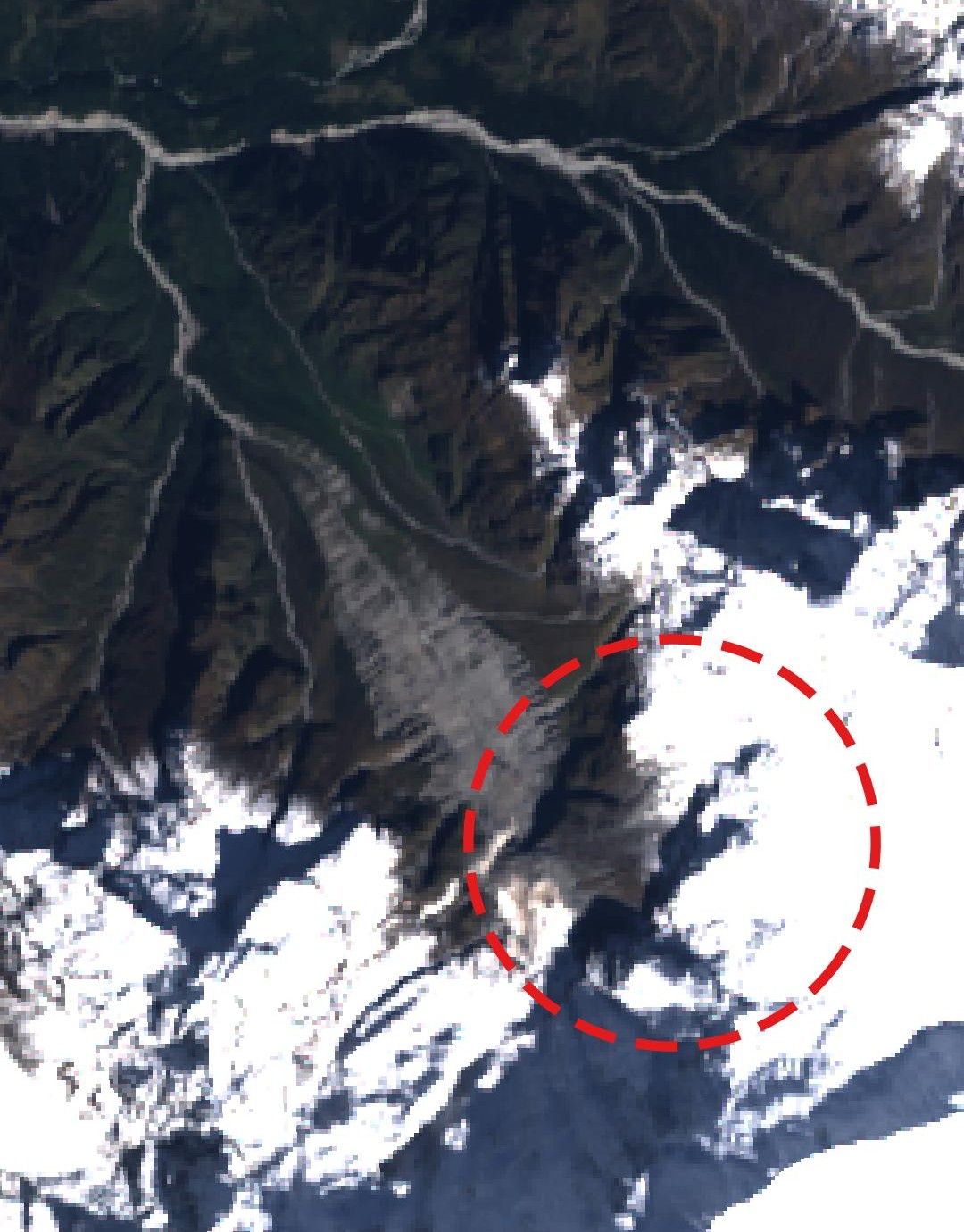
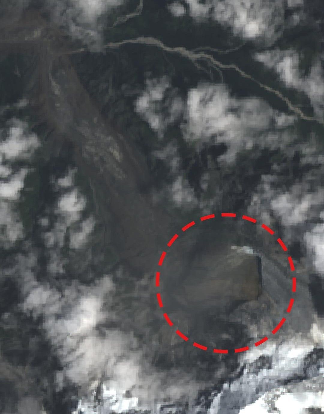
Before and after photo of the landslide, Source: Landsat
From Suspected Earthquake to Confirmed Glacial Collapse
Early statements from Nepalese officials, including Foreign Minister Shisir Khanal, suggested that a magnitude 4.4 earthquake detected by the US Geological Survey (USGS) might have triggered an avalanche that in turn caused the flood. Subsequent analysis by the USGS, incorporating long-period seismic waves, nearby station data and satellite imagery, revised the interpretation: no tectonic earthquake had occurred. The recorded seismic signal (reassessed near magnitude 5.2) was generated by the mass movement itself a glacial collapse and associated debris flow.
What the Satellite Record Reveals
Commercial imagery acquired on consecutive days bracketing the event (notably 25 and 26 August), provided the first clear visual evidence. Before-and-after pairs show a previously vegetated, green mountainside near the Nepal–China border transformed into a broad brown field of debris and sediment. Experts examining these scenes identified the failure of the lower portion (snout) of a glacier located at approximately 5,200 metres elevation. A substantial mass of ice broke away and plunged roughly 1,200 metres onto the valley floor, entraining rock and sediment as it fell.
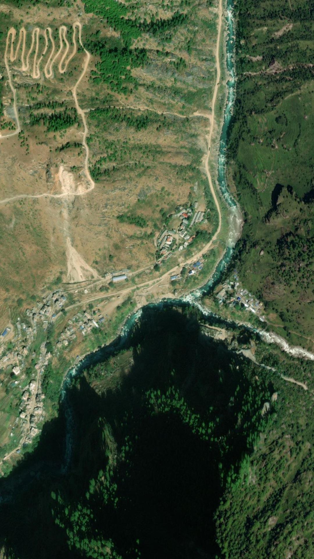
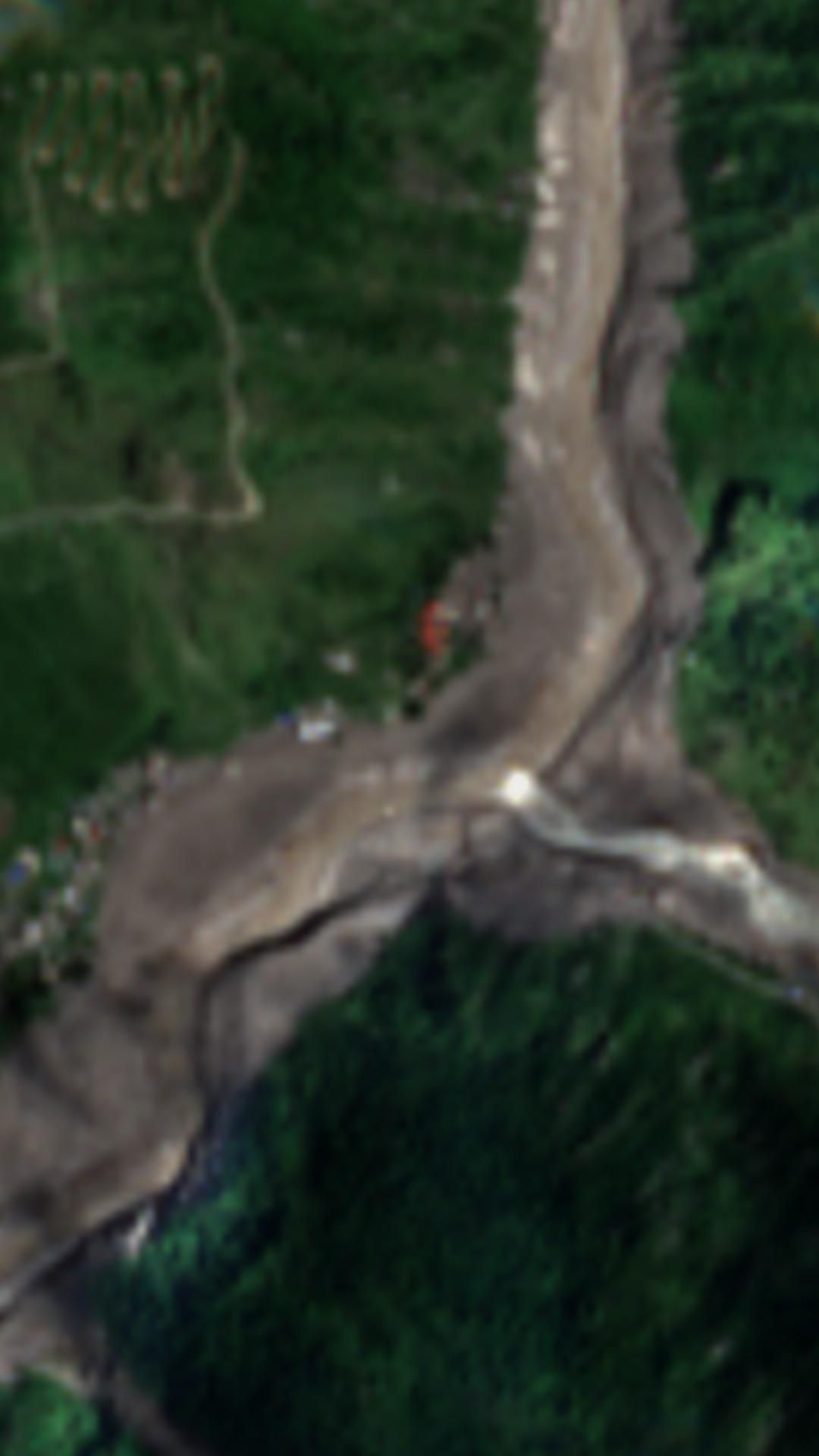
Before and after photo river valley, Source: Sentinel
Nepal’s National Disaster Risk Reduction and Management Authority (NDRRMA) and scientists from the International Centre for Integrated Mountain Development (ICIMOD) independently reviewed the same Planet Labs and other satellite datasets, describing the event as a “glacier-inclusive flood” or ice-rock avalanche originating roughly 20 kilometres northeast of the Rasuwagadhi border crossing.
View the full satellite imagery report in Nepal
The Critical Role of Satellite Imagery in Nepal Disasters
This event underscores several operational strengths of modern Earth observation systems in cryospheric and mountain environments:
- Rapid change detection: Near-daily revisits from commercial constellations allow precise bracketing of sudden-onset events, revealing morphological changes that would otherwise remain inaccessible for days or weeks.
- Multi-sensor synergy: Optical data from Sentinel-2, Landsat provide multispectral context for identifying ice, snow, water and sediment; when combined with higher-resolution commercial imagery, they support both scientific reconstruction and operational mapping of flooded extents and infrastructure damage.
- Remote access advantage: In steep, high-altitude terrain where roads are destroyed and weather can ground helicopters, satellites deliver an immediate synoptic view essential for prioritising rescue zones, assessing secondary hazards (further collapses, temporary lakes) and coordinating cross-border response.
- Objective documentation: Independent satellite records help resolve competing early hypotheses (earthquake versus glacial process) and create an authoritative baseline for longer-term scientific investigation and risk assessment of neighbouring glaciers.
The Himalayan region contains thousands of glaciers, many of which are thinning and retreating under rising temperatures. Events involving ice-rock avalanches, glacial lake outburst floods (GLOFs) or sudden collapses are recognised hazards. Continuous satellite monitoring both for early-warning indicators such as accelerating surface lowering, crevasse development or rapid snowmelt, and for post-event forensics has become indispensable for disaster risk reduction strategies in the Hindu Kush Himalaya.
How to find satellite images?
- Access the OnGeo Intelligence Platform: visit the website.
- Define the Location and timeframe of interest: specify the geographic area and timeframe of interest.
- Automatic Archive Search: the system identifies and retrieves all available satellite imagery matching the selected criteria.
- Select and Order the Report: review the images and proceed to place an order for the most relevant data.
- Receive the Results: a PDF report is delivered via email within 5 minutes, while high-resolution images are provided within 48 hours.
Looking Ahead Nepal
Detailed multi-temporal and higher-resolution analysis is still underway. Researchers will examine the precise volume of ice and debris involved, the possible contribution of prior snowmelt or englacial water, any role of temporary river damming, and whether the collapse was influenced by longer-term climatic trends or local factors. Agencies including NRSC/ISRO, ICIMOD and international partners are expected to release further assessments.
In the meantime, the satellite record of this tragedy already stands as a powerful illustration of how geospatial intelligence can accelerate understanding, support life-saving operations and inform future resilience measures in one of the world’s most dynamic and hazardous mountain landscapes. The images themselves stark contrasts of green slopes turned to barren debris fields and once-narrow river corridors transformed into wide, sediment-choked channels convey both the violence of the event and the quiet power of remote sensing to reveal what happened when ground access was impossible.
Related articles
- Satellite Imagery Reveals the Full Scale of Western Europe’s Most Destructive Wildfires in Decades
- Water Resource Management via Satellite Monitoring
- Satellite images reveal devastating floods in Poland
- How Satellite Imagery Supports Forest Management
- Satellite Imagery for Insurance Claims Assessment
- How to Download High-Resolution Satellite Images