Water Resource Management via Satellite Monitoring
More than 2 billion people still lack access to safely managed drinking water, while global demand continues to grow. Water resources constantly change due to droughts, fluctuating reservoirs, and shifting river systems, making traditional monitoring methods insufficient at large scales.
Satellite monitoring provides consistent, large-scale data on surface water, soil moisture, vegetation health, and groundwater changes. This helps governments and water managers detect risks early and make better-informed decisions.
In this article, we explore how satellite data is transforming modern water resource management.
Surface Water Monitoring
Surface water bodies such as rivers, lakes, reservoirs, wetlands, and coastal zones are among the most visible and measurable components of the hydrological cycle. Satellite imagery plays a central role in tracking their extent, variability, and long-term trends.
1. Mapping Water Extent and Seasonal Changes
Optical satellite imagery (e.g., Sentinel-2, Landsat) allows analysts to map the spatial extent of surface water using spectral indices such as:
NDWI (Normalized Difference Water Index):
Water absorbs strongly in the near-infrared (NIR) band and reflects more in the green band, making it distinguishable from vegetation and soil. By applying NDWI across time-series imagery, water managers can:
- Monitor seasonal reservoir fluctuations
- Track river widening during floods
- Identify shrinking lakes during droughts
- Detect newly formed water bodies
This is especially valuable in regions where in-situ gauges are sparse.
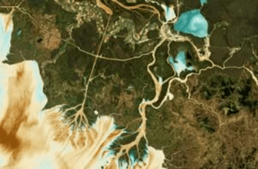
2. Flood Extent and Inundation Mapping
During heavy rainfall or river overflow, satellite imagery can quickly map flooded areas. Radar imagery (e.g., Sentinel-1 SAR) is particularly useful because it penetrates cloud cover and operates day and night.
Flood monitoring supports:
- Emergency response planning
- Infrastructure risk assessment
- Agricultural loss estimation
- Post-event recovery planning
By comparing pre- and post-event imagery, analysts can quantify inundated areas and identify affected settlements or transport networks.
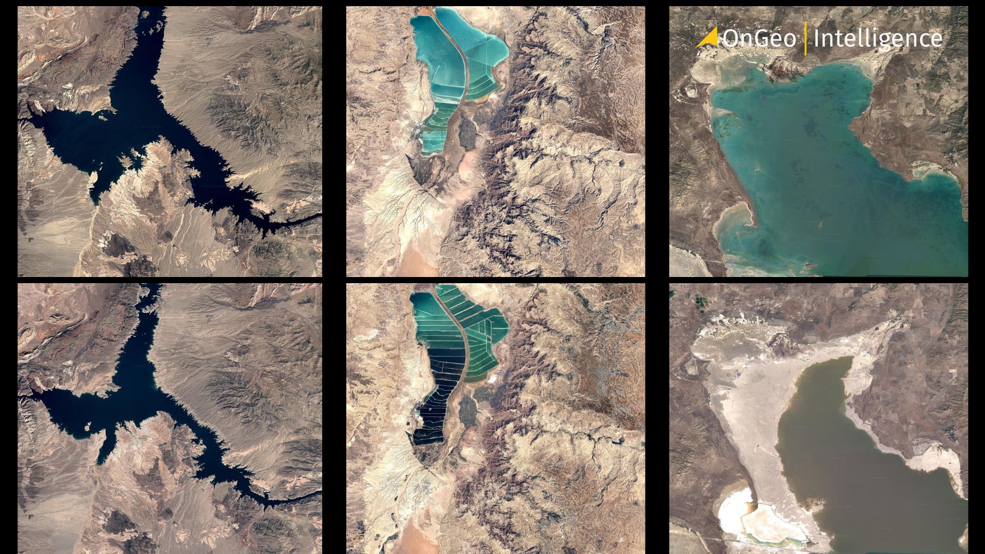
Lake Mead, the largest U.S. reservoir, is disappearing
3. Reservoir and Dam Monitoring
Reservoir levels fluctuate due to rainfall, irrigation demand, and energy production. Satellite-based monitoring enables:
- Tracking reservoir surface area changes
- Estimating relative storage trends over time
- Monitoring water availability for agriculture and hydropower
- Supporting transboundary water management
Time-series analysis can reveal long-term decline patterns or abnormal fluctuations that may indicate water stress.
Satellite imagery of a water body wetlands
4. Wetland and Coastal Monitoring
Wetlands are highly dynamic ecosystems that are often vulnerable to urban expansion and climate variability. Satellite monitoring helps:
- Detect wetland degradation
- Track shoreline movement
- Monitor tidal changes
- Assess coastal flooding risks
This information supports conservation efforts and sustainable land-use planning.
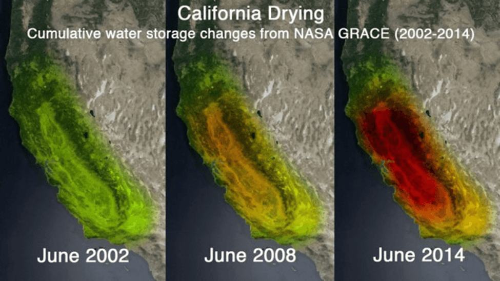
Drought and Soil Moisture Monitoring
Droughts are one of the most significant threats to water security, agriculture, and ecosystems worldwide. Detecting drought early and monitoring its severity is crucial for minimizing economic losses, managing water resources, and planning relief efforts. Satellite data plays a key role in providing consistent, large-scale drought monitoring.
The Great Salt Lake in Utah has lost over 50% of its surface area
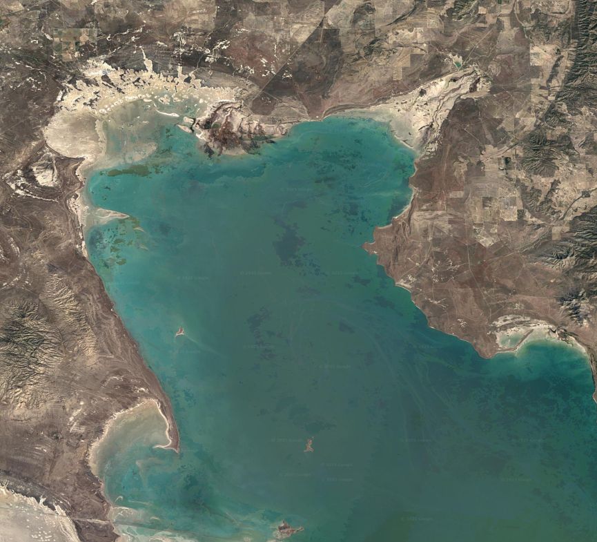
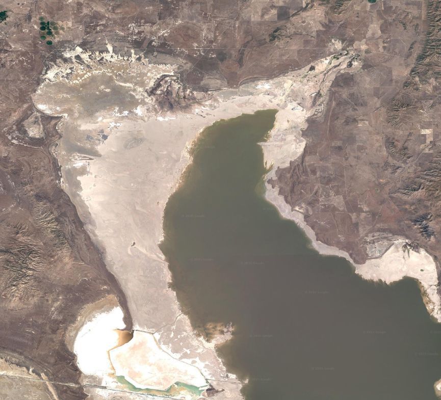
1. Soil Moisture Assessment
Microwave and radar satellites, such as SMAP (Soil Moisture Active Passive) and Sentinel-1, can measure soil moisture across vast areas. These observations help identify:
- Areas experiencing low soil moisture
- Regions where crops are under water stress
- Zones at risk of desertification or reduced vegetation growth
By combining soil moisture data with precipitation and temperature records, managers can monitor emerging drought conditions before they manifest visibly on the ground.
2. Vegetation Stress Detection
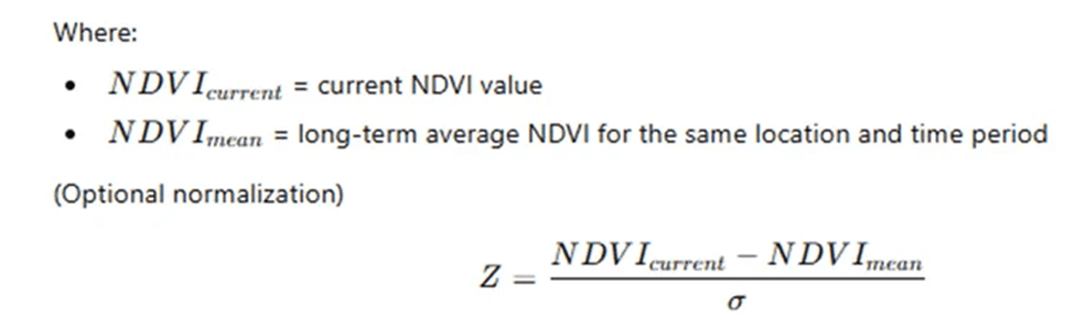
Drought impacts plant health long before soil visibly dries. Vegetation indices, such as NDVI and EVI, derived from optical satellite imagery, allow analysts to detect stress caused by insufficient water availability:
Declining NDVI values over time can indicate early signs of crop or forest stress, enabling targeted interventions such as irrigation adjustments or water allocation planning.
3. Drought Severity and Early Warning
By analyzing time-series data, satellite platforms can quantify drought severity and monitor how it evolves spatially and temporally. Metrics like Standardized Precipitation Index (SPI) or Vegetation Condition Index (VCI) can be derived from satellite observations to support early warning systems and inform policy decisions.
4. Supporting Agriculture and Water Management
Timely satellite-based drought monitoring allows:
- Governments and utilities to prioritize water distribution
- Farmers to adjust planting schedules or irrigation strategies
- Aid agencies to target food and water assistance efficiently
Platforms like OnGeo Intelligence simplify access to soil moisture maps, vegetation indices, and time-series data, transforming complex satellite information into actionable insights for decision-makers.
Water Quality Monitoring Using Satellites
Satellite sensors assess water quality by analyzing changes in water color and spectral signatures. Optical satellites such as Sentinel-2 and Landsat detect suspended sediments, allowing managers to identify erosion-prone areas, track sedimentation in reservoirs, and evaluate the impact of construction, mining, and agricultural runoff.
Satellite-derived indices like NDCI enable early detection of harmful algal blooms caused by excess nutrients. This provides timely warnings for drinking water suppliers and fisheries, helps assess eutrophication risks, and supports efforts to reduce nutrient pollution.
By observing anomalies in water reflectance, satellites also help detect potential pollution events such as oil spills, chemical discharges, and urban wastewater. The data facilitates rapid response, regulatory enforcement, and long-term pollution trend analysis.
Time-series satellite data further reveals gradual changes in water clarity, sedimentation rates, and bloom frequency. These insights are essential for sustainable watershed management, remediation planning, and environmental compliance.
Platforms like OnGeo Intelligence make this satellite-derived information easily accessible, enabling decision-makers to combine it with ground measurements and hydrological models for a comprehensive view of regional water conditions.
Related articles
- Monitoring air quality from space: Sentinel-4 Satellite Delivers First Data on NO2, SO2, and Ozone Levels in Europe
- From Space to Shore: How Earth Observation Satellites Help Monitor Water Quality
- Spectral Bands: A Guide to Popular Index Formulas
- Satellites spot plastic waste on beaches: A new era in remote sensing for marine cleanup
- Satellite Forest Monitoring from Space: Global Tree Mapping with Satellite Earth Observation
- Satellite Imagery Reveals M23’s Environmental Destruction in Eastern DRC
- Environmental Monitoring Using Satellite Data
- How Satellite Imagery Supports Forest Management